

“What the F is that?” I exclaimed.
A creature the size of a hummingbird was flying near our heads, buzzing, orange wings whirring.
“Tarantula hawk,” said my husband.
This giant wasp is the state insect of New Mexico, so named because it is a predator of tarantulas.
I’d never seen one. Before the hike was over, we’d see two more.
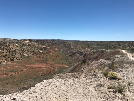
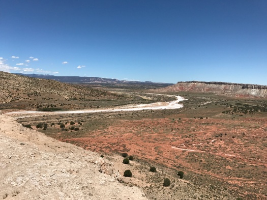
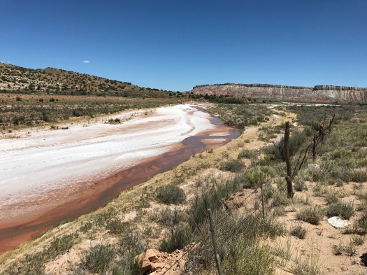
When we saw that first one, we were standing above what looked like the frozen River Styx. Below us, water flowed over reddish-brown ground, and the river appeared to be surrounded by ice. It was actually surrounded by massive salt blooms.
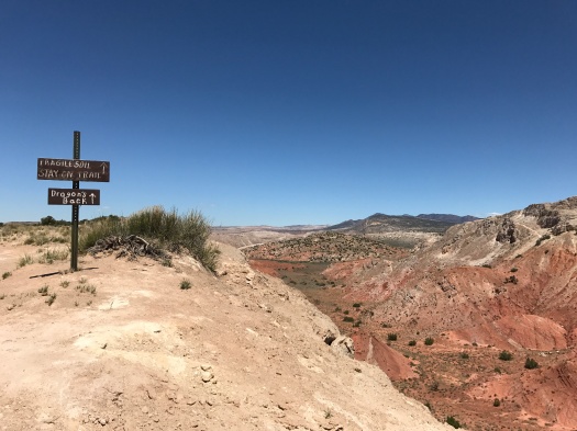
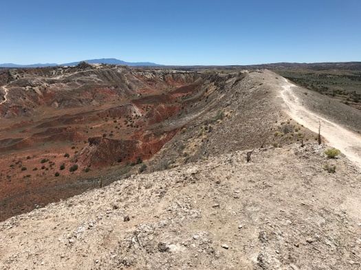
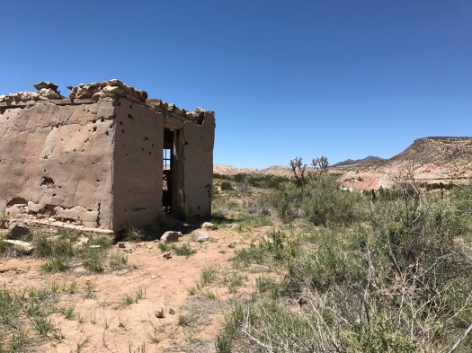
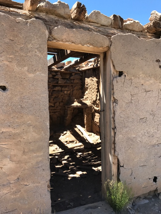
By that time, we’d already traversed a narrow three-mile ridge called the Dragon’s Back, climbed down to view the ruins of an old wood and stone dwelling, and learned we were sharing the space with dozens of college geology students from at least three states.
This is White Mesa.
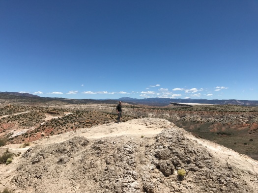
What brought the geology students out there was the same thing that makes it such an incredible place to hike (or bike – it’s actually a bike trail site and Dragon’s Back is primarily used by mountain bikers.) White Mesa is an anticline, a fold of stratified rock shaped like a ridge in which the stratifications slope down from the crest.
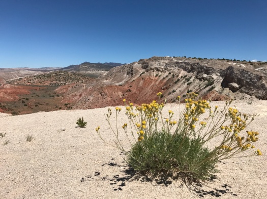
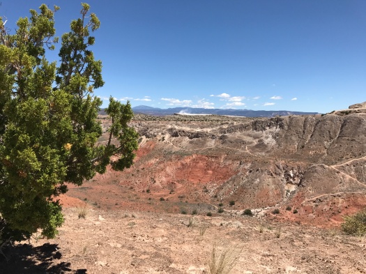
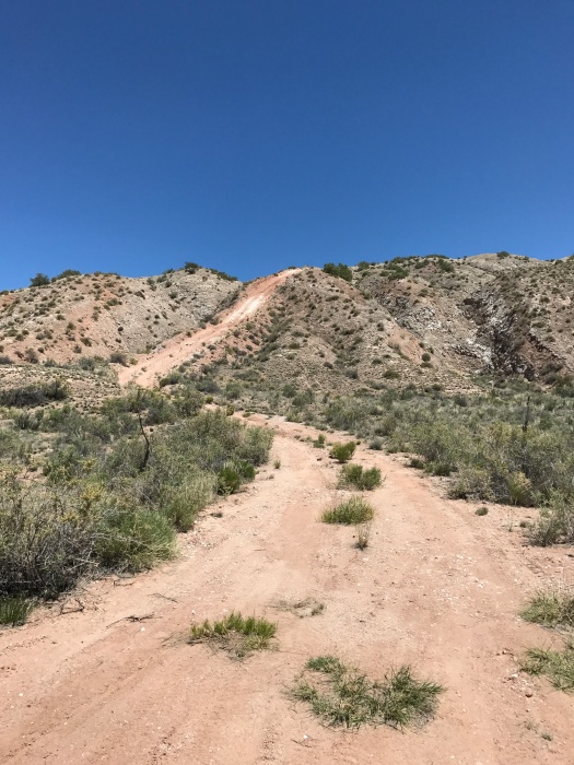
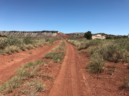
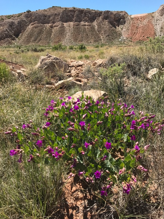
The cliffs beneath the Dragon’s Back slope down to a valley filled with deep red soil, which in places has formed into mounds. On the other side of the valley is a steep ridge much shorter than Dragon’s Back.
I’d only seen White Mesa in winter. It’s a no-shade hike and a temperamental place – the leader of one of the geology groups told us it had snowed the day before, and the day before that, the wind was howling at 50 miles an hour.
But we woke up to one of those brilliant, relatively cool days we’ve had all spring following cold snaps, so White Mesa it was.
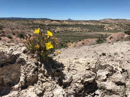
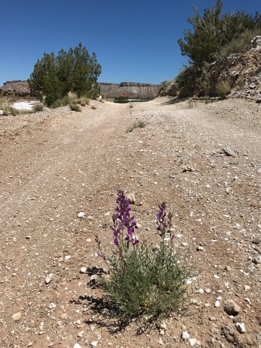
The red soil and blue sky I remembered from White Mesa in winter were set off by the deep, rich green of the valley. Yellow bell-shaped wildflowers sprouted from the Dragon’s Back, and plants with vibrant purple flowers grew on the valley floor.
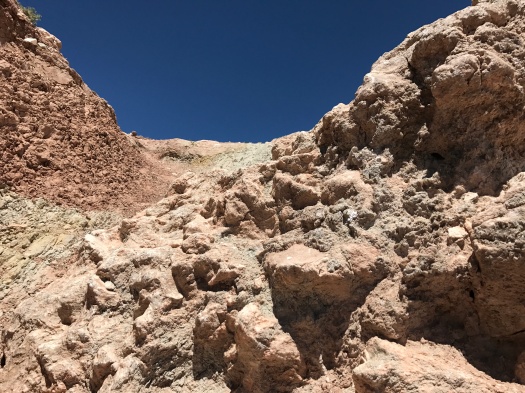
The first time we came out here was the longest hike I’d done at that point, 5.1 miles, and by far the most demanding. The route we took then, from our trusty “60 Hikes within 60 Miles of Albuquerque” guidebook, began with a 400-foot descent down the ridge opposite Dragon’s Back. Patches of the steep trail were icy and muddy. I was terrified. By the time we made it to the valley floor, my legs were trembling, and we had another three miles to hike, part of it a climb. I wasn’t sure I could do it, but I knew I couldn’t climb back up that slippery 400-foot trail, so I went forward.
This experience was similar. After the Dragon’s Back came an insanely steep climb down to the ruins. A spell of nice flat doubletrack led to a climb up a dome in the middle of the valley. And after climbing down that, to get out of the valley and back to our car, I had to climb…the 400-foot trail that I thought might kill me on my first visit here. While the temperature was balmy and there was a gorgeous cool breeze, doing all that in full sun was taxing.
This was my toughest hike in six months, and one of my best hikes ever. The route, and especially the season, made it a completely different experience than our previous hikes here.
That’s when you know you’ve found a great hike – when you do it again and again and it’s truly different every time.
Hike length: About 7.5 miles
Difficulty: On the high side of moderate
Trail traffic: Lots of people, but there’s so much space it didn’t feel crowded.
Wildlife spotted: butterflies, turkey vulture, tarantula hawks, chipmunk, lizard, crow

This place is a visual feast. The hike must have been STRENUOUS. I wish you could have caught in a pic the tarantula hawk. The pictures are fantastic!
Love, Ur Daddie
LikeLike