Of all the hikes, this one smells the best

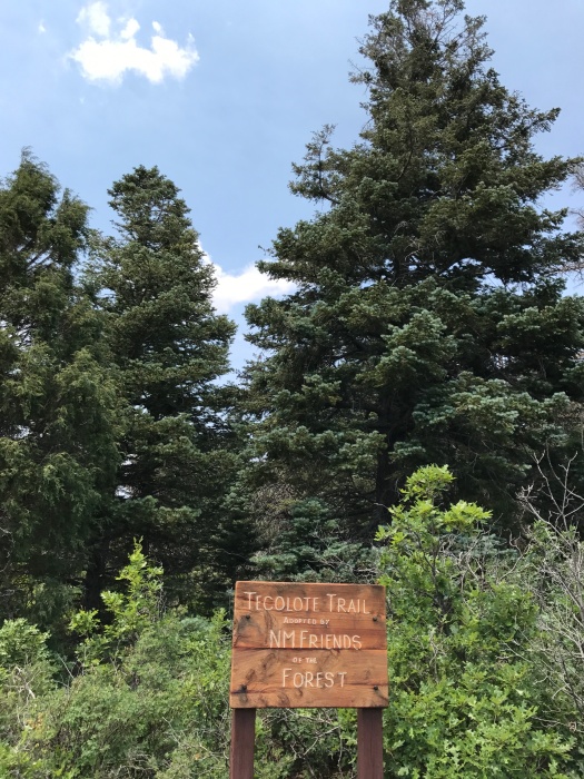
As soon as I stepped out of the car at the Tecolote Trail in the Sandia Mountains, I recognized the scent. It smelled like the Christmas tree farm where my family got our trees when I was growing up.
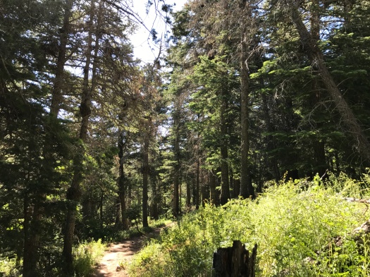
Unlike many New Mexico mountain hikes where the vanilla-tinged smell of ponderosa pine hits you periodically, this trail smells like straight-up pine and fir pretty much the whole time. Like Christmas, in other words.
Besides the smell, the other thing I noticed right away was the breeze. A heat wave of endless 100-degree days had broken and the temperature was in the low 80s, with 40 percent humidity. That meant more sweating on the trail, but also more coolness in the wind.
Then we heard a clear, musical bird call neither my husband nor I could identify. We later spotted a Western tanager high in a tree, and suspected the call was theirs.
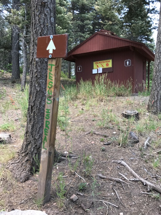
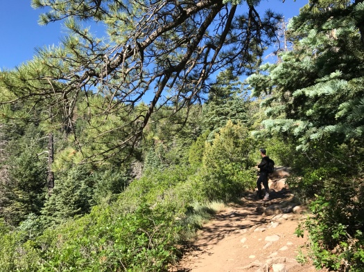
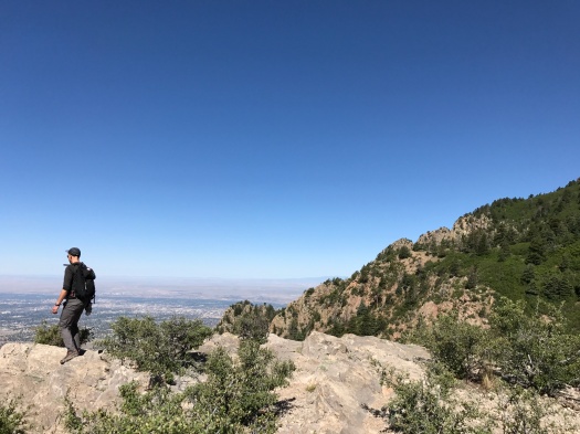
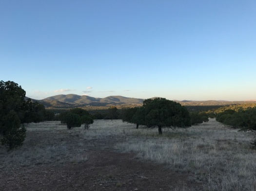
We had two hours before a hefty chance of thunderstorms, so we’d chosen the less-than-three-mile Tecolote Trail, at 8,200 feet in the Sandias. It was just half a mile up the road from the hike we did last weekend, but significantly less difficult, and with views of  different mountain ranges. This hike’s accessible enough that everyone from the young to the old can enjoy it, and we saw multiple generations of families tackling it together.
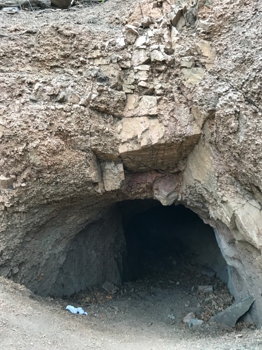
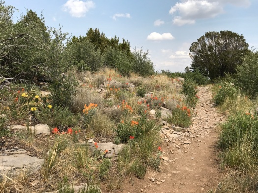
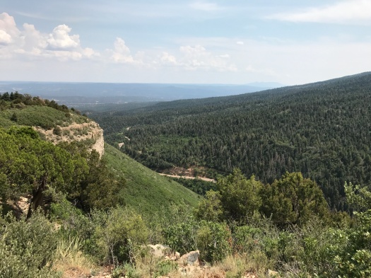
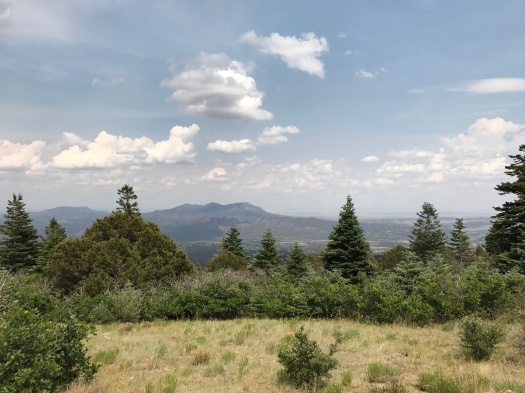
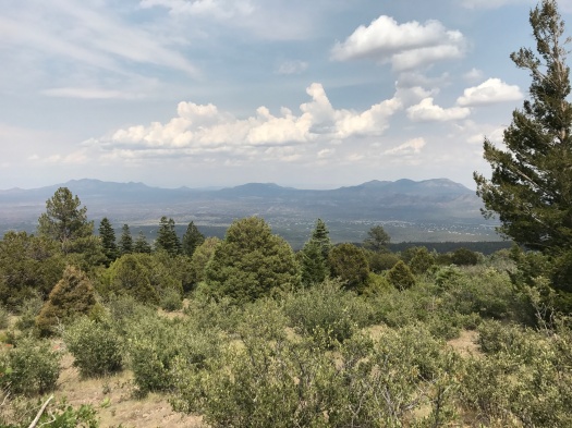
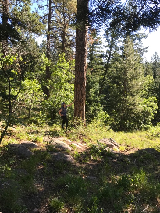
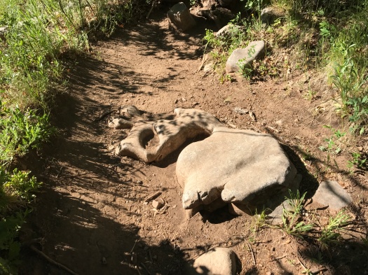
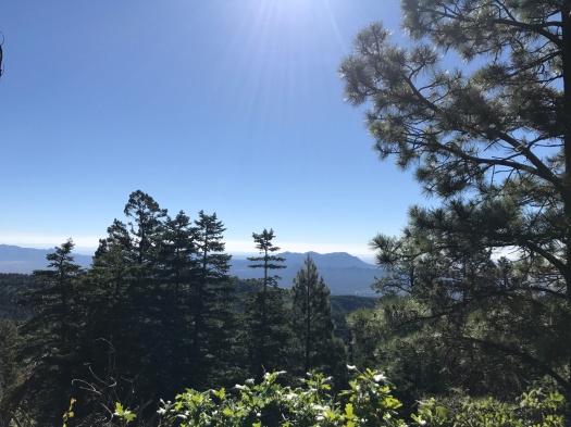
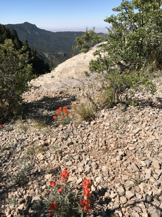
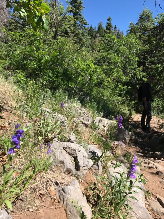
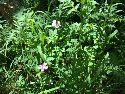
The trail is much gentler than nearby Tree Springs, ascending steadily but gradually. One of the first things you spot is an old mine shaft carved into the rock. Along the trail grow both mountain wildflowers and cacti with chartreuse flowers. It doesn’t take long to reach killer views, including one of a rock dome with a huge grassy slope rolling away from it – the biggest area I’ve seen in the Sandias covered with something other than evergreens.
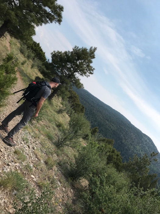
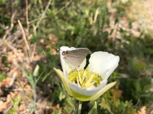
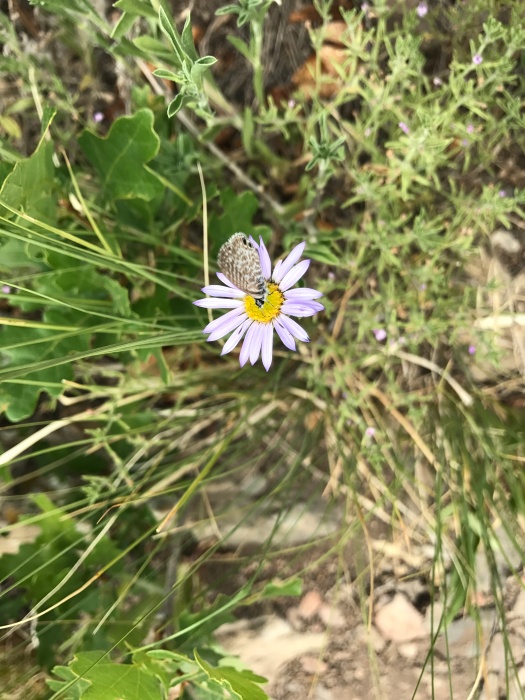
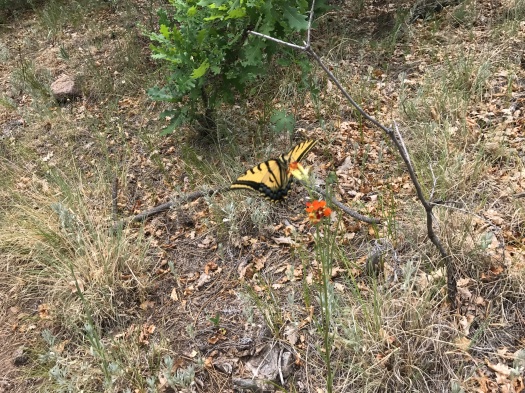
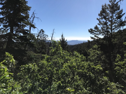
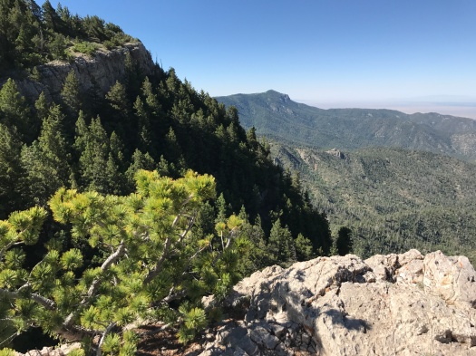
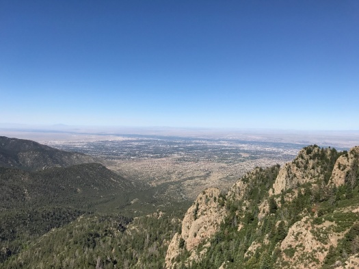
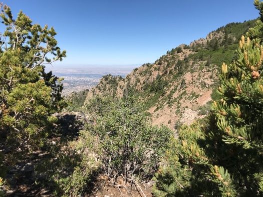
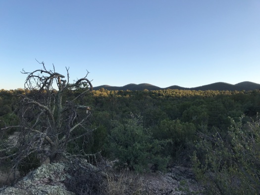
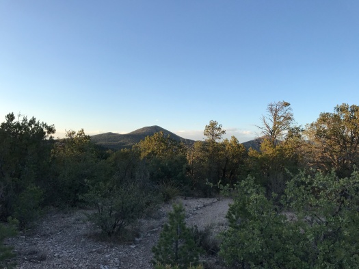
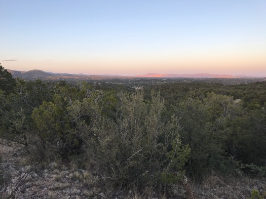
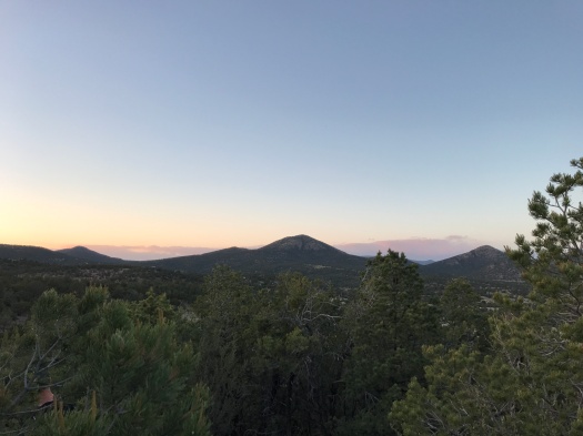
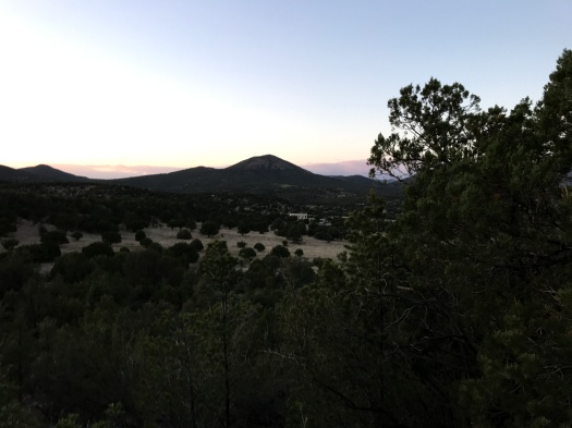
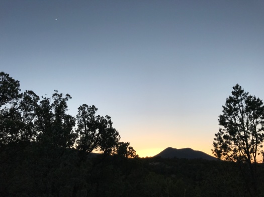
At the top, a quarter-mile loop leads to fantastic views of the Ortiz and San Pedro Mountains. We did some serious butterfly chasing, and even spotted – a first for me – two butterflies mating on a flower.
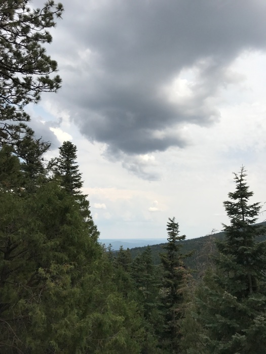
When we started the hike, I thought the soft, blurry quality to the air might be a heat haze. But it was clear right away, given how fragrant and moist the air was, it had to be water vapor – the most humidity we’ve encountered on a New Mexico hike in a long time.
The clouds began to close in just as we headed back down. When the sky turned gray, all the shades of green along the trail began to look really saturated.
It was the best-smelling 90 minutes I’ve spent in a long time – and there was plenty to see, too.
Length: 2.8 miles
Trail traffic: moderate
Difficulty: easy
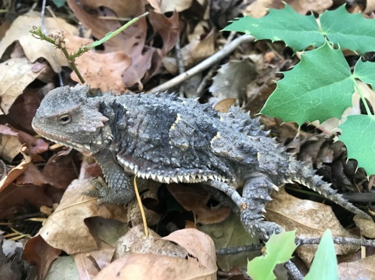
Wildlife spotted: butterflies (including swallowtail, and some caterpillars), tanager, enormous vulture, grasshoppers, rabbit
IMG_7975
Jesus is real, but these restrooms are not. They are permanently closed for “unsafe conditions.” Husband’s theory: black widow farm.
IMG_7983
Mine shaft

IMG_7993IMG_7996

IMG_8002
Indian paintbrush and cacti
IMG_8003
Lizard chillaxin

IMG_8006

IMG_8014
Below, the Sandia Crest Highway and the trailhead for last week’s hike

IMG_8016IMG_8025IMG_8030

IMG_8037
Annnnnd that is what two butterflies getting it on looks like.

IMG_8044IMG_8047

IMG_8050
That’s our cue!

If you can’t take the heat, get on Tree Springs Trail

I’ve only been on Tree Springs Trail when it’s 100 degrees in Albuquerque. The trailhead is at 8,500 feet elevation. You step out of your car and instantly you’re in a mountain forest: evergreens soaring overhead, wildflowers at your feet, chipmunks scampering, sky an eye-popping blue. The elevation change alone is good for 10-15 degrees lower temperature than in the valley.
The first time we came out here, the mountain was shrouded in mist and fog. I needed extra layers. We hiked all the way to the Sandia Peak Tram terminal, over seven miles roundtrip.
I was hoping for that same cool mist today, but the only clouds to be seen appeared to be far-off smoke from a fire in the Jemez Mountains. No moisture there.
A thing I cannot overstate about hiking in New Mexico: it’s usually solitary, rarely crowded, and never, ever really crowded. It was a prime, if hot, summer Saturday on a popular trail 30 minutes from downtown, but after saying hello to a few folks at the trailhead, we didn’t see anyone but black-and-white Abert’s squirrels for most of the first hour of our hike.
Much of Tree Springs Trail is deeply shaded. The sections on mountain bends in the sun were already baking at 8 a.m. The trail is a gradual but constant 1,000-foot climb over two miles. Much of the trail is limestone rock, and as you ascend, more and more fossils from when this trail was at the bottom of an ocean appear in the rocks. My husband kept seeing animal shapes in the limestone rock formations, and after he pointed them out, I did too.
Amid the canopy of massive evergreens and sprinklings of wildflowers, some great views over the surrounding mountains and small-town valleys appear. We followed a couple of huge yellow and blue swallowtail butterflies, hoping they’d settle on a flower long enough for us to snap a photo, but couldn’t quite catch them.
It’s been many months since I did a real mountain climb. My calves and ankles felt it, and the low humidity had me guzzling twice as much water as usual (and usual is a lot). As the morning kept warming up, I began to wonder if they’d moved the spectacular overlook at the top of Tree Springs Trail further away. Finally, we passed the wilderness boundary sign and took the path to the overlook. We waited in a shaded glen while a loud couple took overlook selfies. I spotted something moving on the ground. It was the biggest horny toad I’d ever seen, gray and black. We watched him, snapping a few photos, until he disappeared in the brush.
Then we climbed around the enormous overlook, with its panoramic view of dusty, hazy Albuquerque below, faraway mesas and the arrowhead-shaped Sierra Ladrones range 60 miles to the south.
On my previous two visits to this overlook, the winds were so strong it was hard to stand. I understood for the first time why it’s always so bumpy when you’re flying over the Sandias. Today, a cool, gentle breeze offset the baking sun.
There would be no trip up the Crest Trail to the tram today; after the hot climb to the overlook, I had enough energy to make it back down the trail, and that was all. We enjoyed that breeze on the way down, passing panting but happy dogs and their owners as the trail came to life for the day.
Will we have the good fortune of hiking this trail in a gentle mist on a blazing day again? Stay tuned. The current forecast for next Saturday: 103 degrees.
Length: 4 miles
Difficulty: moderate
Trail traffic: moderate
Wildlife spotted: many kinds of butterflies, chipmunks, rabbits, Abert’s squirrels, bluebird, towhees, ginormous horny toad
IMG_7927
Pondering bigly.
IMG_7930
Husband pondering bigly.
IMG_7933
That rock looks like a rabbit! Right?

IMG_7936IMG_7938IMG_7940

IMG_7947
I SAID NO PAPARRAZI, DAMMIT

IMG_7955IMG_7958

IMG_7959
Hot, hazy ABQ below. Sierra Ladrones range at 10 o’clock.
IMG_7960
Indian paintbrush at overlook

IMG_7961

IMG_7966
Husband patiently waiting out wildflower photo-taking

IMG_7969

I didn’t want to take this hike, but I’m grateful for it

I knew the day was coming when I would need to go to Chattanooga for my grandmother’s funeral.
Last week, the news came, and the waiting for the arrangements to be determined, and the frantic flurry of preparations when they were.
The night before I left, with the trip I’d been dreading almost here, the flight and hotel and rental car booked, I did a quick Web search.
My sister and I were staying a half-day longer than everyone else, flying out later to save a little money. I quickly learned that during that half-day, 150 miles of hiking trails awaited us within 15 minutes of downtown Chattanooga. I just had to pick one.
After the service, and the reception, and the meals with family, and the chess squares and pound cake, and the goodbyes, my sister and I got up early and drove through rolling hills and rural neighborhoods to Audubon Acres nature sanctuary.
Our goal: Little Owl Village, the site of a Native village hundreds of years ago. I’d chosen a two-mile roundtrip hike because it was hot, it was my sister’s first hike and we had a plane to catch. We arrived just after Audubon Acres opened for the day and had the place to ourselves for almost the entire time we were there.
The path began as packed dirt carpeted with pine needles – the softest trail I’d ever felt under my feet. Sweetgums and water oaks towered above us, vines twining around them, creating a canopy of almost complete shade.
In half a mile we came to a swinging bridge over fast-flowing South Chickamauga Creek. The thought of a swinging bridge had made me a little nervous, but it felt buoyant yet sturdy under our feet. The path tracked the creek, winding through trumpet vines and yellow and purple wildflowers I didn’t recognize. Birdcalls and the ripples of fish moving through the water occasionally broke the silence. And the constant buzzing of flies – we spent the whole hike waving our hands in front of our faces to keep them off.
We detoured to check out the Ford of Youth, the spot where those with swinging bridge phobias can ford the creek. It was twice as deep and three times as wide as any spot I’d forded on my trip to the Middle Fork of the Gila River.
As we stared across the water, imagining how challenging it would be to ford, an enormous blue bird swooped down right in front of us, wings outstretched, gliding over the water. I’m going with a great blue heron; they hang out at Audubon Acres year-round.
When we emerged from the creek path, the Little Owl Village loop in front of us glowed in full sun and the grass was ankle-high. It was 10 am, it was already sweltering and our relatives’ efforts to put the fear of God into us regarding ticks in the Chattanooga area had worked. The return trip along the shady creek beckoned.
As we drove away from Audubon Acres, a huge turkey ran across the road in front of our rental car. While he ran back and forth and we gawked, another turkey appeared.
My grandmother’s death, and this trip to Chattanooga, were certain to come, though I didn’t know when.
That being the case, I’m glad I got to see a great blue heron, and a swinging bridge, and those turkeys.
Length: 2 miles roundtrip
Difficulty: easy
Wildlife spotted: great blue heron, butterflies, moths, dragonflies, squirrels, wild turkeys
Trail traffic: almost none
IMG_7877
My sister tackles the swinging bridge.
IMG_7883
Swinging bridge
IMG_7879
South Chickamauga Creek
IMG_7888
The trail above the creek
IMG_7892
Would you ford here?
IMG_7894
Cabin at Audubon Acres
IMG_7896
Why did the turkey cross the road? To avoid being on a hiking blog.

If the valley is glowing, you’re probably on a bonus night hike

Spoiler alert: You won’t find many sunrise or sunset hikes on this blog.
I’m not a camper (too many visions of stuff crawling on me while I sleep), and many of the places we hike are a little ways away, so I’m rarely on the trail at dawn or dusk. The tradeoff for that: missing some of the day’s best light and best opportunities to see wildlife.
So when we saw that the lodge where we were staying outside Silver City had hiking trails on the property (for lodge guests only), we knew it was a unique chance for us to see the day’s light begin to fade from on the trail.
From the start, the experience was different from our usual hiking pattern. We started at 7:30 PM, not 7:30 AM. Silver City’s temperatures went from blazing to cool around dinnertime, so I wore an extra layer. I’d had a beer with dinner, so I was slightly buzzed as we climbed the ridge – a first, since I don’t drink before setting out on five-or-six-mile desert jaunts.
The lodge was tucked into a valley on the edge of the Gila National Forest. We’d seen tons of deer along the road to the lodge and wondered if we might get a closer look on an evening hike. But we were in pinon-juniper hills, and they stayed in grassy areas close to the road, where they could munch on leaves.
The gravel trails were easier to follow and better maintained than many we’ve hiked. The cool evening air, bearing slightly more moisture than the bone-dry afternoons, released the evergreens’ scent. Rabbits scampered.
After a few minutes at the rocky overlook atop the ridge, we headed back down to catch the last of the evening’s light.  Clouds pulsed with the sunset’s muted color. The Chino Mine, one of the world’s largest open-pit copper mines, glowed pink across the valley. A crescent moon winked into view high above a distant peak.
Hiking is what I do on Saturdays. Usually, because of the length of the hike, challenging terrain, the area’s remoteness, or a combination of the three, the experience takes up much of the day. Our adventure on the Middle Fork of the Gila River was that kind of hike.
The next day’s hike was right outside our lodge door, took less than an hour, capped off a day of sightseeing in town and gave us a totally different look at the beautiful place where we spent the long weekend.
Now that I’ve experienced a bonus night hike, it won’t be my last.
Hike length: 1.5 miles
Difficulty: moderate
Trail traffic: just us – the lodge’s trails are for guests only
Wildlife spotted: jackrabbits, cottontail
IMG_7829IMG_7831IMG_7832

IMG_7835
The Chino Mine, one of the world’s biggest open-pit copper mines, is the thing glowing pinkest across the valley.
IMG_7841
Can you spot my husband’s head? It looks slightly disembodied, but it’s there.
IMG_7843
The lodge is in the center of this image. I was amazed how tiny it looked from less than a mile away.
IMG_7847