This hike ended at just the right time

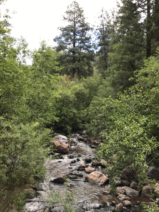
Until today, I had only seen the Winsor Trail along Tesuque Creek buried in snow.
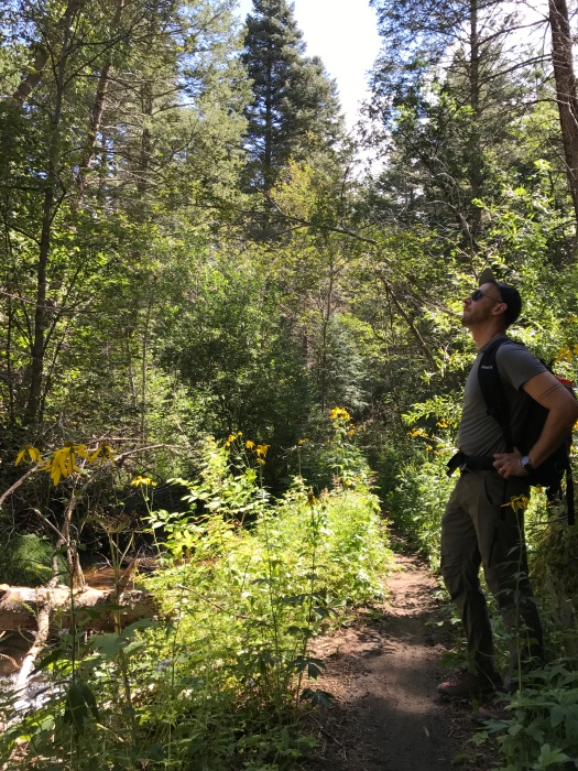
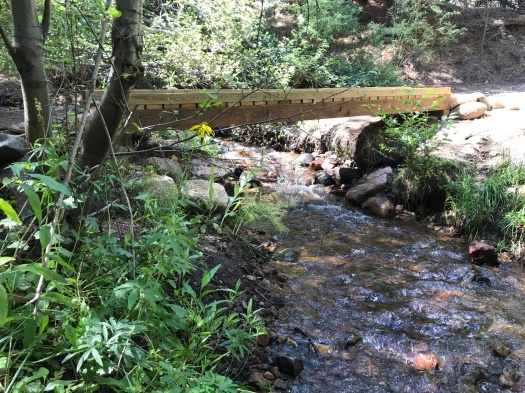
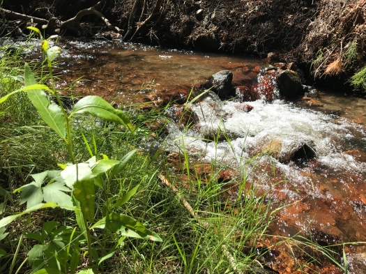
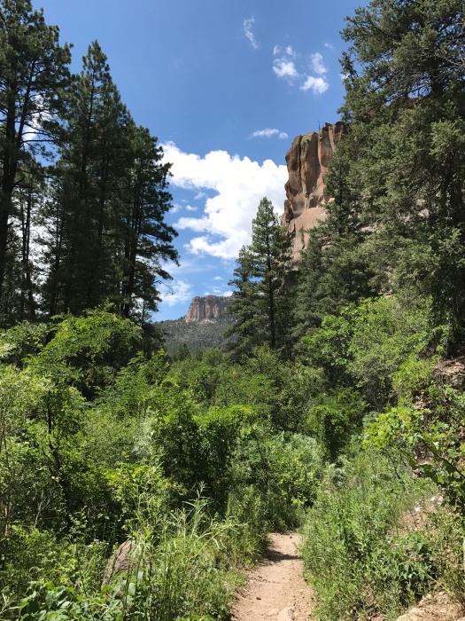
Today, Tesuque Creek was flowing fast along the Winsor, surrounded by lush foliage and wildflowers. A sign on the approach to the trail noted that about 100 dogs travel on it with their owners each day. We didn’t see all 100 – maybe a fifth of that.
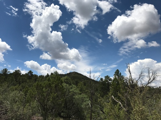
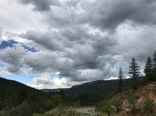
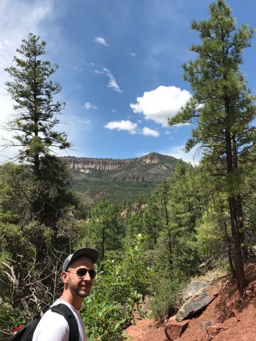
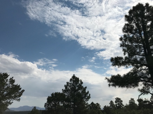
When we began the hike, it was a perfect 71 degrees. It’s actually been raining in Santa Fe, so the humidity quickly worked us into a swelter when we were in the sun, and sometimes when we weren’t. The sky was vivid blue; fluffy, towering monsoon-season clouds built in the distance.
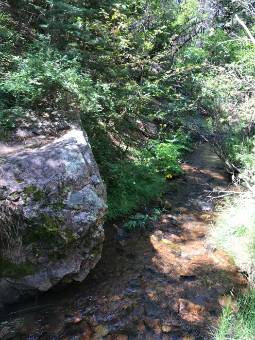
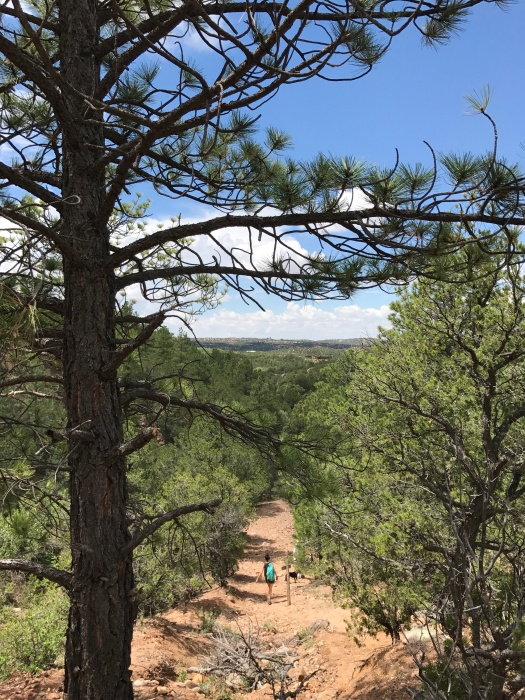
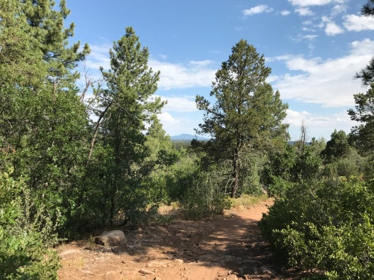
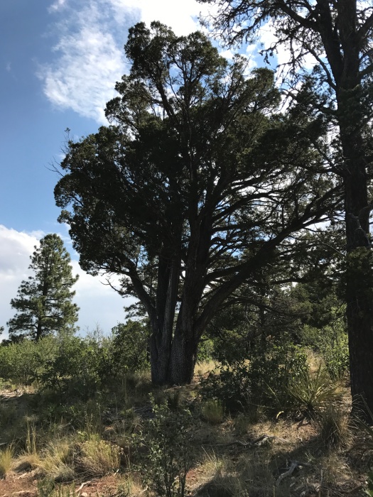
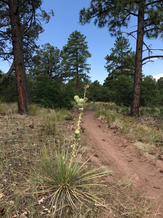
The hike begins along the creek, climbs above it, then meets it anew further up the trail.
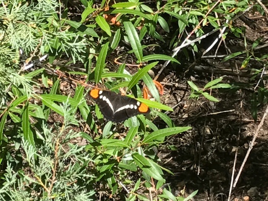
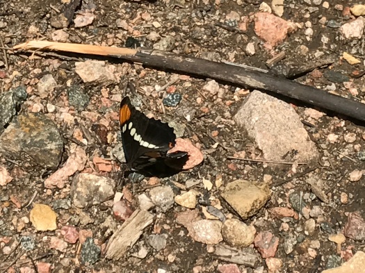
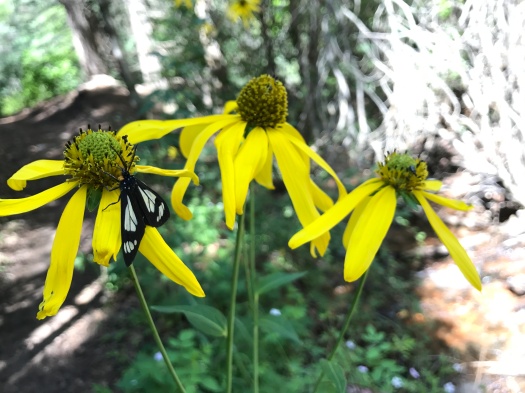
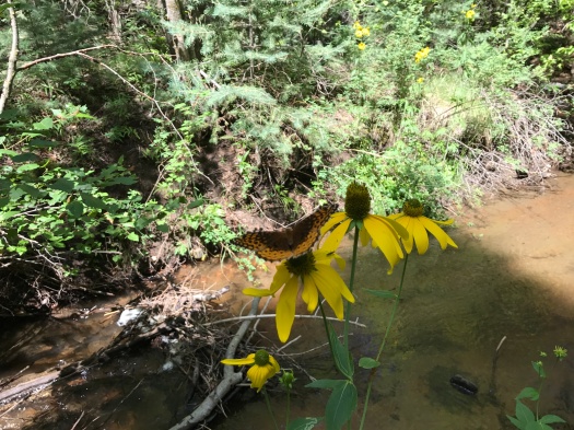
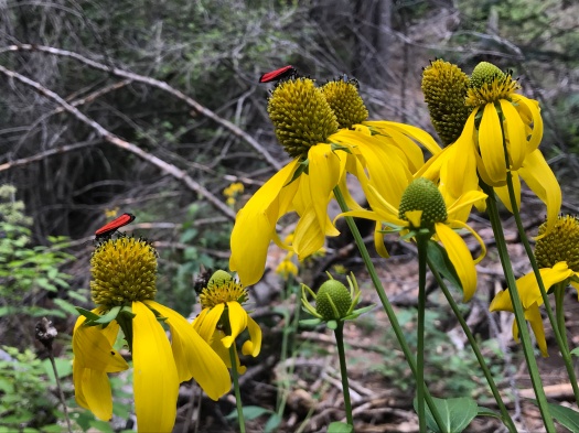
We began to see sunflowers as we climbed, first a couple at a time, then in clusters along the creek. We passed through a section of the trail with rows of sunflowers on each side. Several kinds of butterflies fluttered among them, along with some bee-like red insects we couldn’t identify.
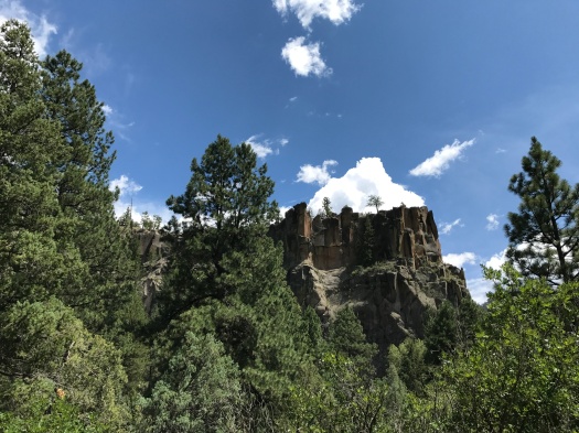
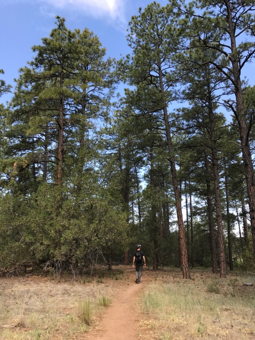
The Winsor Trail goes all the way from Tesuque to Ski Santa Fe. You can use it to get up to Lake Katherine, one of the hardest hikes in New Mexico.
We weren’t going to get anywhere near that far this day.
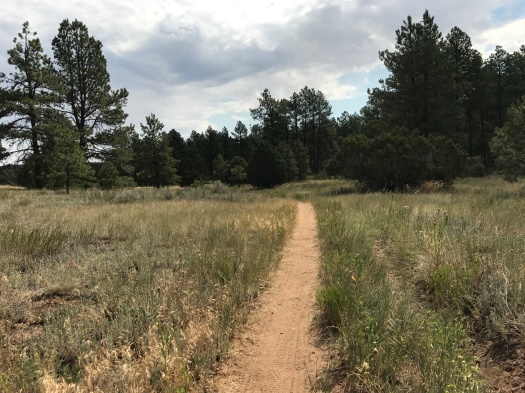
We’d hoped to see more of the higher section of the trail, but after two and a half to three miles, we reluctantly decided to head back. I’ve been having some high desert summer nosebleeds and my allergies were starting to kick up, so I decided not to push my luck.
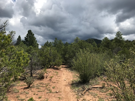
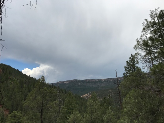
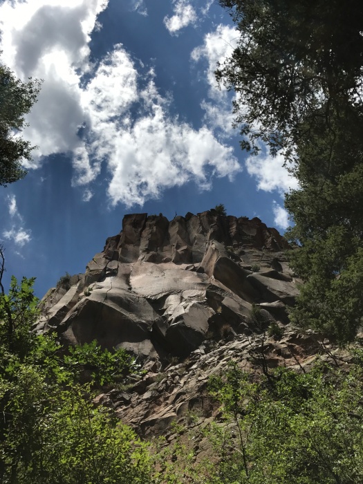
The sky above was inviting, beckoning us higher, just one single dark cloud among the fluffy white ones.
But we turned and headed back. Somehow, on the way down, my husband managed to spot a tiny horny toad, not much bigger than the tip of a finger, camouflaged perfectly among the beige and pink rocks.
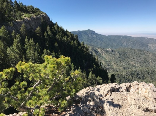
We stopped at a ridgeline to take one last look behind us – and the entire sky was grayish-black. That one cloud had managed, before noon, to bloom into something much bigger.
As we walked out of the Winsor and into the surrounding neighborhood, thunder began to crackle.
I’ve seen my fair share of New Mexico monsoons, and my husband has seen them all his life. Neither of us would have turned back solely for that one cloud.
I’d like to thank my nose for perfect timing.
And perfect performance. It didn’t even bleed.
Hike length: 5.5 miles
Difficulty: moderate
Trail traffic: busy, though less so the higher you climb
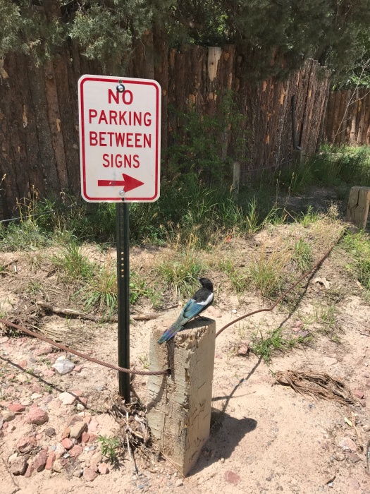
Wildlife spotted: butterflies, Abert’s squirrel, dragonflies, tiny horny toad, magpies, crows
IMG_8246IMG_8227IMG_8236IMG_8237IMG_8243

IMG_8244
Perfect lunch-eating boulder above the creek.

IMG_8250IMG_8255

IMG_8263
We saw several insects we couldn’t identify, including these red and black butterflylet-esque things.
IMG_8264
That escalated quickly.
IMG_8265
Meanwhile, on this ridgeline, all is fluffy.

IMG_8267

IMG_8272
Magpie looking out for the neighborhood where you park at the base of the Winsor Trail

The Jemez is beautiful this summer – even minus the parts you can’t get to

I was really looking forward to hiking at Paliza Canyon Goblin Colony this weekend.
It’s a crazy conglomeration of hoodoos tucked into a beautiful canyon near Ponderosa Valley Vineyards. It’s cool and shaded – perfect for summer.
As our truck dipped through a fertile valley and climbed the forest road into Paliza Canyon, a chipmunk skittered across the road, and birds and butterflies darted by.
But when we got to the trail, just a few hundred feet down the path, we met a locked gate and caution tape. The area was closed until July 31 due to fire hazards. The posted sign said it was because of the Cajete Fire earlier in the summer, which puzzled me greatly, since that fire was a good 30 miles away.
We weighed our other options. Stable Mesa, about 20 miles away, was another well-shaded summer hike. But when we’d stopped in the Walatowa Visitor Center at Jemez Pueblo, we’d seen a notice that the road to Stable Mesa was closed for rockfall mitigation. And our favorite hike in the Jemez, the Las Conchas Trail, was right next to the Cajete Fire site, so we thought it was probably closed.
We decided to drive further into the Jemez and pull over at the first campground we could be sure had a hiking trail.
That turned out to be Battleship Rock, a few miles past Jemez Springs. We’d seen that rock formation towering over Highway 4 many times but never stopped.
The campground was mobbed, as we’d known it would be on a summer Saturday. The East Fork of the Jemez River was flowing well. I’d forgotten to bring my hiking poles and I was nervous about fording without them, but we crossed at a narrow, shallow spot and made it across without incident. Then we thought about the gray clouds threatening overhead and about being cut off if a downpour made the river too dangerous to ford. So we crossed back over and found a path along the base of Battleship Rock.
It was gray and humid and smelled like campfires and pit toilets. The trees and vines pushing in on both sides of the trail felt oppressive. We saw a trail heading upward and took it, thinking it was a back approach to Battleship Rock.
It wasn’t, at least not in the direction we headed. But it took us away from the crowds and up a ridge strewn with the shiniest black boulders we’d ever seen – probably basalt, although there are other lava forms in the area.
Incredible views of mesas edged with fingers of rock, deeply forested slopes and Highway 4 below came into view. The dark clouds slowly lifted and the sun came out – just as I’d hoped – and it was instantly really, really hot. Lizards scampered over the boulders as they heated up in the sun.
The climb was challenging without my poles, and the descent more so.
The way down brought even more amazing views, now that the clouds had cleared. When we came within earshot of the East Fork again, it was a welcome sound. And with the sun shining down on the riverbank, the plants and flowers at the base of looming Battleship Rock seemed to glow.
The sun was still beating down when we left, but more storm clouds were gathering.
I would love to hike up Battleship Rock itself one day.
Maybe that day will come soon, if everything else is closed.
Hike length: 3 miles
Difficulty: Moderate
Trail traffic: lots along the East Fork, less on the climb
Wildlife spotted: lizards, vultures, crows
IMG_8176
Paliza Canyon wasn’t happening this day.
IMG_8179
Arrival at Battleship Rock under threatening skies.
IMG_8180
The East Fork of the Jemez River, looking good.
IMG_8184
Battleship Rock
IMG_8189
Respect the boulder.

IMG_8192IMG_8195

IMG_8212
Battleship Rock in foreground

IMG_8218

IMG_8221
Our final glimpse of Battleship Rock

One summer night in the Mississippi Delta

When my sister asked, “You gonna hike?” I was like, “Are you crazy?”
We were home visiting my parents in the Mississippi Delta, where I grew up. Just walking from the house to the car in the heat of summer in the Delta is enough to give you the vapors. Most days, with the heat index, it feels like at least 100.
But on our third night home, a rainstorm washed everything clean and wiped the temperature down to 76.
The Delta is flat. I did not hike in it growing up. No one did.
I was also too busy hating it to really look at it. I saw and heard so many racist things growing up. I defined myself in opposition to a place where so much ugliness had happened and was still happening.
So when I went up in a hot-air balloon at age 13, I was shocked to love what I saw: a tapestry of green in shades I’d never seen outside a Crayola box, ribbons of rivers snaking through black soil.
In summer, in full-on primordial swamp mode, the Delta is freaking gorgeous.
This night in July, the light was soft, the air almost totally saturated with moisture, the neighborhood a tangle of trees and vines, flowers and grass.
My husband, my sister and I walked up Grand Boulevard and crossed the Tallahatchie Bridge (yes, that one) onto Money Road.
Yes, that Money, Mississippi. The place where 14-year-old Emmitt Till was brutally murdered in 1955 in an act of racial hate.
The historical marker of Till’s death was vandalized just last month. Again.
Money Road is not a place to travel on foot, so we immediately turned onto a dirt road that parallels the Tallahatchie River. Cotton and soybean fields stretched away into the unseeable distance. Despite all the cotton fields I’d seen in my life, it was the first time I’d actually seen cotton plants flowering.
We passed a parked tractor, the glowing sun behind it. A deer bounded along the riverbank, leaping over tangles of brush.
We rounded a bend in the road, tried to remember where it led, and headed back so as not to be wandering around Money Road after dark.
That walk through fields in a Delta pulsing with life and light was one of the highlights of our visit home.
There are many myths about the Delta. Inevitably, they all ignore one of two things.
All of the hate and injustice and poverty and ugliness here was – and is – real.
So is the beauty.
Hike length: 1.6 miles
Difficulty: easy
Traffic: some in neighborhoods, none on the bridge or dirt road
Wildlife spotted: deer, red-headed woodpecker, squirrels
IMG_8127IMG_8129IMG_8137IMG_8139IMG_8143IMG_8145

Some who wander in the Manzanitas are lost

“If they don’t have to send out search and rescue, you weren’t lost.” -my husband
Mmm-hmm.
After our latest hike in the Manzanita Mountains just south of Tijeras, I took score.
Of the six hikes we’ve taken in the area, two were completed without any wrong turns. One required retracing our steps back to the car when we couldn’t find the trail that was supposed to lead us out. And one took us on an unintended three-and-a-half-mile detour.
It’s a lovely landscape to hike in – deeply forested, a couple thousand feet above Albuquerque, with winding rock-lined canyons. But the trail system is primarily used by mountain bikers, and it’s a tangle, with informal trails cut between the official paths. It’s also a foothills area, with fewer distinctive landmarks visible from a distance than higher in the mountains.
Hence, directional challenges.
We were there for a short loop hike at Juan Tomas Open Space, which is City of Albuquerque property. We were the only hikers on Juan Tomas this morning, with plenty of mountain bikers, some of whom we saw multiple times as they made a circuit.
The area’s gently rolling terrain allows you a better grasp of just how towering ponderosa pines are than you get high in the mountains. This spot has some sweet alligator junipers, too.
Most of this hike is trees and meadows, but there’s a vista of Sandia Peak near the beginning of this loop. We could see the smoke from a small fire burning on the Sandia crest.
This is a beautiful hike during the period when the monsoon season is flirting but not committing. Clouds frequently slid by above, and when they did, a breeze rose that was just humid enough, without making you sweat buckets. The downside of summer hiking here: in some spots, there are lots of flies.
A black-and-white Abert’s squirrel darted across the path, then scampered up a massive ponderosa and looked down at us from high above. Birds chirped and called all around us.
Our guidebook refers to a spot toward the end of the loop where the trail splits four ways. We found two places where the trail split three ways, but never found the four-way split (something similar happened on our first hike here, a year and a half ago.) We took our best guess, but it quickly became clear it wasn’t leading us back to where we started.
We could see the road we drove in on through the trees, so we headed toward that and, about a third of a mile up the road, we found our car. (Oddly, the part of this hike that had the most flies was the part we hiked on the road.)
Our first hike here was in winter, with snow on the ground. Our second was in sweltering pre-monsoon summer. Both were worth taking.
But I’m beginning to think no matter how many times we hike this loop, we’ll never find the end.
Hike length: 3.2 miles
Difficulty: On the easy side of moderate
Trail traffic: A healthy dose o’mountain bikes
Wildlife spotted: coyote (on the drive in), crow, vulture, nuthatches (heard but not seen), Abert’s squirrel, lizard, juniper titmouse (I think) and many flies

IMG_8103IMG_8108

IMG_8106
Alligator juniper
IMG_8109
Yucca gone to seed

IMG_8111IMG_8112

The mountain does not care about you

IMG_7958

You’re getting close to 40. Things hurt that never hurt before, in your body and in your heart. You worry.

You worry when you’re on the mountain: is whatever body part’s talking to you today up to the task? Do you have enough strength and balance and patience for what’s in front of you, which often feels different from what your reference material described?

The mountain does not care.

The mountain never had a guidebook, nor needed one.

For millennia, the mountain has been whatever it had to be.

When there was water everywhere, the mountain was a ridge at the bottom of the sea.

When the ocean receded, the mountain was an arrowhead sticking up from the desert.

When the rock couldn’t hold it together anymore, it fell. It didn’t care who or what was under it.

The mountain doesn’t care who got hurt, or who died.

The mountain doesn’t care how much being there means to you.

That is why it means everything.