

I was really looking forward to hiking at Paliza Canyon Goblin Colony this weekend.
It’s a crazy conglomeration of hoodoos tucked into a beautiful canyon near Ponderosa Valley Vineyards. It’s cool and shaded – perfect for summer.
As our truck dipped through a fertile valley and climbed the forest road into Paliza Canyon, a chipmunk skittered across the road, and birds and butterflies darted by.
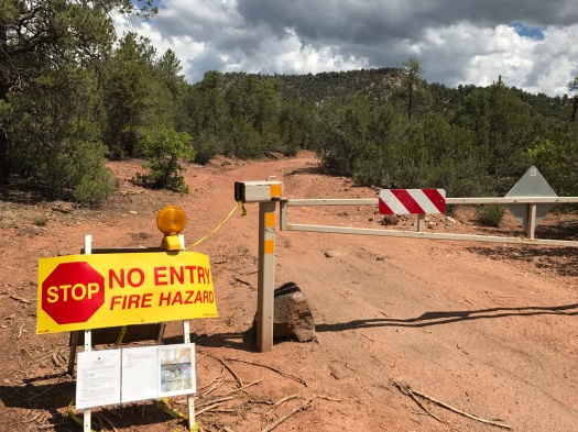
But when we got to the trail, just a few hundred feet down the path, we met a locked gate and caution tape. The area was closed until July 31 due to fire hazards. The posted sign said it was because of the Cajete Fire earlier in the summer, which puzzled me greatly, since that fire was a good 30 miles away.
We weighed our other options. Stable Mesa, about 20 miles away, was another well-shaded summer hike. But when we’d stopped in the Walatowa Visitor Center at Jemez Pueblo, we’d seen a notice that the road to Stable Mesa was closed for rockfall mitigation. And our favorite hike in the Jemez, the Las Conchas Trail, was right next to the Cajete Fire site, so we thought it was probably closed.
We decided to drive further into the Jemez and pull over at the first campground we could be sure had a hiking trail.
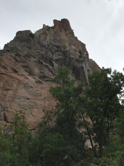
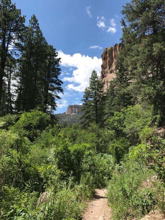
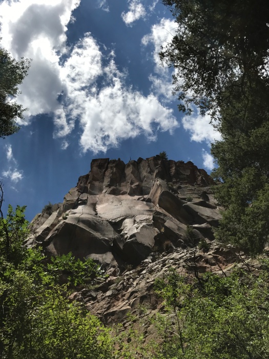
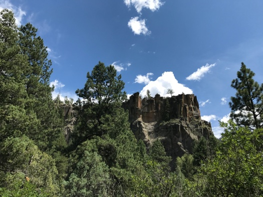
That turned out to be Battleship Rock, a few miles past Jemez Springs. We’d seen that rock formation towering over Highway 4 many times but never stopped.
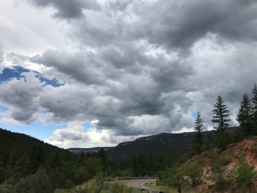
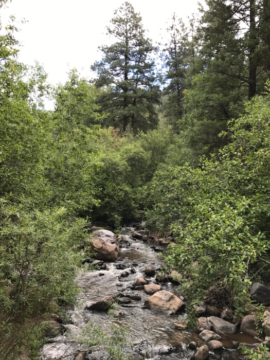
The campground was mobbed, as we’d known it would be on a summer Saturday. The East Fork of the Jemez River was flowing well. I’d forgotten to bring my hiking poles and I was nervous about fording without them, but we crossed at a narrow, shallow spot and made it across without incident. Then we thought about the gray clouds threatening overhead and about being cut off if a downpour made the river too dangerous to ford. So we crossed back over and found a path along the base of Battleship Rock.
It was gray and humid and smelled like campfires and pit toilets. The trees and vines pushing in on both sides of the trail felt oppressive. We saw a trail heading upward and took it, thinking it was a back approach to Battleship Rock.
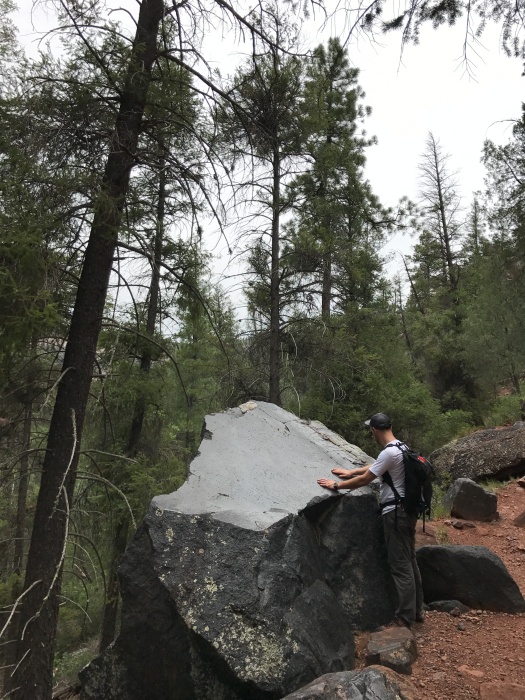
It wasn’t, at least not in the direction we headed. But it took us away from the crowds and up a ridge strewn with the shiniest black boulders we’d ever seen – probably basalt, although there are other lava forms in the area.
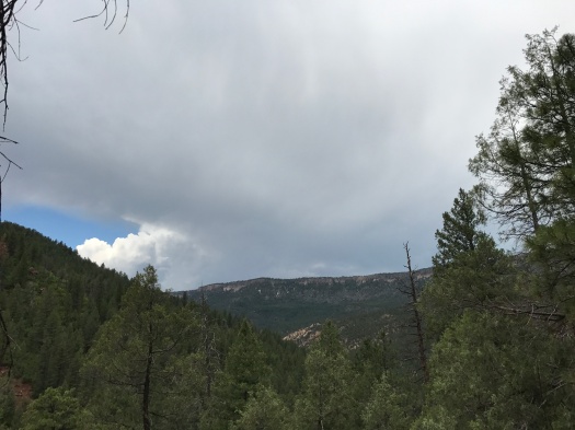
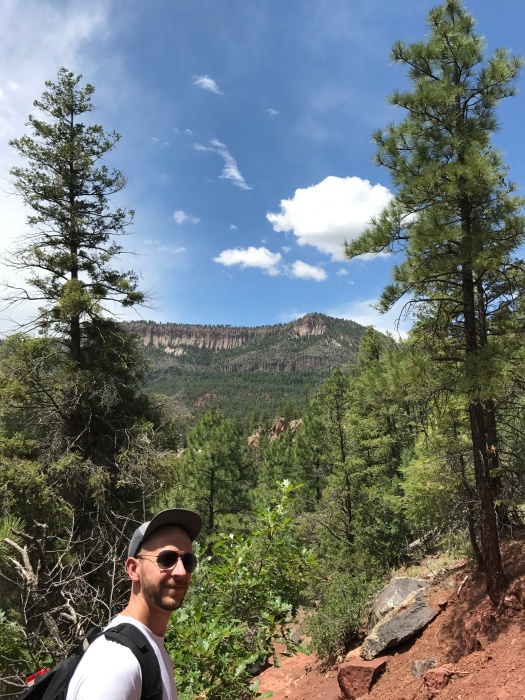
Incredible views of mesas edged with fingers of rock, deeply forested slopes and Highway 4 below came into view. The dark clouds slowly lifted and the sun came out – just as I’d hoped – and it was instantly really, really hot. Lizards scampered over the boulders as they heated up in the sun.
The climb was challenging without my poles, and the descent more so.
The way down brought even more amazing views, now that the clouds had cleared. When we came within earshot of the East Fork again, it was a welcome sound. And with the sun shining down on the riverbank, the plants and flowers at the base of looming Battleship Rock seemed to glow.
The sun was still beating down when we left, but more storm clouds were gathering.
I would love to hike up Battleship Rock itself one day.
Maybe that day will come soon, if everything else is closed.
Hike length: 3 miles
Difficulty: Moderate
Trail traffic: lots along the East Fork, less on the climb
Wildlife spotted: lizards, vultures, crows

2 Replies to “The Jemez is beautiful this summer – even minus the parts you can’t get to”