

I.
It was because I was going slow that I saw her.
It was a steep section of trail and I was huffing and puffing, lifting one foot in front of the other. I looked to my right and saw something tawny above a rock outcropping fifty feet away. My first thought was “oh shit, bobcat.” Fear began.
Then I looked into gentle eyes and saw a doe, staring right back at me.
We stared for what felt like several minutes, but probably wasn’t. She also looked at my husband, who was about five feet ahead of me on the trail. She slowly began chewing, as if she’d frozen midbite when she saw us. I saw her blink several times.
Then she turned and walked calmly away into the forest.
II.
“These are the mountains everyone knows about and few people really know.”
The New Mexico Wilderness Alliance’s Wild Guide entry for these mountains is mournful, lamenting how far away they are from Albuquerque and how much effort it takes to get to them.
Those are the exact things I love most about them.
I will tell you how to get there.
Get off I-40 at the Tijeras exit and drive south on Highway 337. Squeeze and wind your way up through narrow canyon walls, passing bicycles on your right. It’s dramatic and lovely, but also familiar. You’ve done this before, maybe for a picnic, maybe to reach trailheads in the Manzanitas. Maybe you’ve gotten lost on the trails in the Manzanitas. A lot.
Once the road’s steep climb levels out, you leave behind all that is familiar.
You are in a place densely forested with evergreens, but it is also a high, rolling green valley. Its settlements are named Yrisarri, Escobosa and Chilili.
No one hikes here. Signs along the road say things like “Land Grant Hiers’ Property! Not For Sale!” and “There is nothing beyond this fence worth risking your life for.”
You pass burn scars from the Dog Head Fire last year. Officials came to Chilili to evacuate it. But many people stayed. Those residents of this two-centuries-old land grant would rather risk fire than leave.
This morning, the entire populace of Chilili stands under the back awning of a small church, where the dance of Los Matachines is taking place. The dancers wear tall, dark headdresses and scarves.
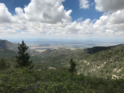
South of the villages, the salt lakes in the Estancia Basin glimmer into view on the horizon. White wind turbines turn on a faraway mesa as you turn onto NM 55. You’re almost there.
If you had land here, you’d face off with a fire to keep it, too.
III.
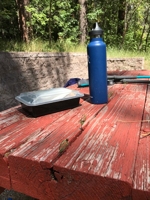
The last time our car climbed the seven-mile dirt road to the trailhead, it was one of a line of dozens of cars doing so. The overflow from the hiker parking lot at the campground spilled onto the road.
As soon as we arrived, it was obvious that it was worth it.
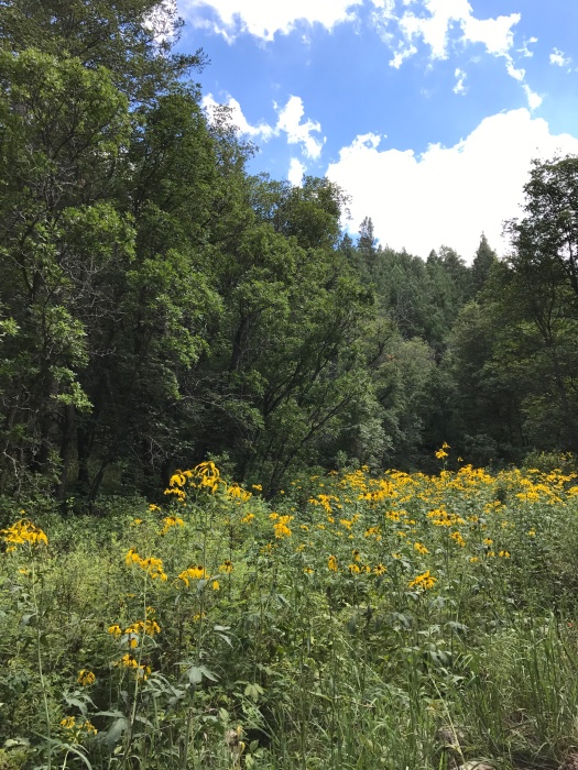
Fourth of July Canyon in the Manzano Mountains is the site of New Mexico’s most spectacular display of fall foliage. We were there several days past its peak, and it was still astonishing. We hiked seven miles and every step was a fresh riot of reds, yellows and oranges.
We didn’t mind the crowds; all the people were happy, nice New Mexican leaf-peeping families, and the crowd thinned after about a mile and a half.
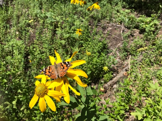
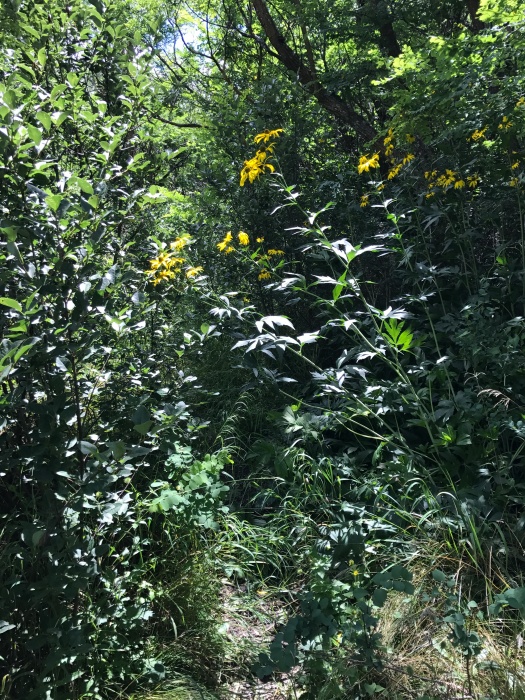
But to be there today, the forest a riot of sunflowers and wildflowers and foliage, and have it all to ourselves was exquisite.
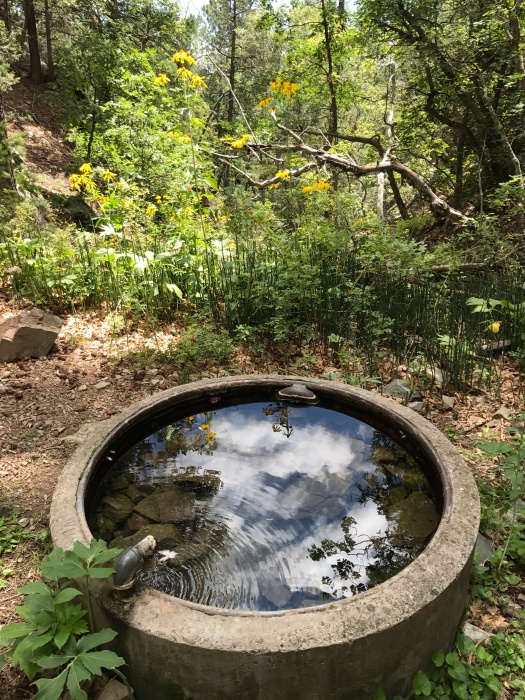
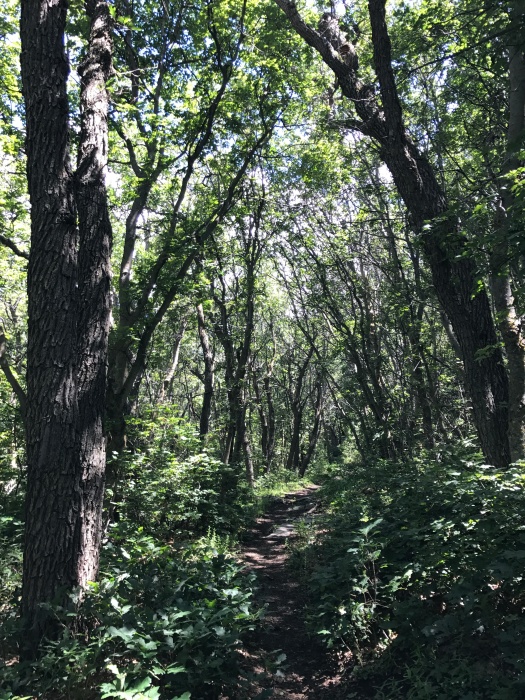
The campgrounds were nearly deserted. My husband said it looked like someone had sent out a memo and we were the only ones that hadn’t gotten it. In four hours of hiking, we didn’t see another soul on the trail. The silence was a living thing. Even with a trickling spring, and later a creek, and pines sighing, and birds and squirrels chirping, the silence was a sound right there among the rest.
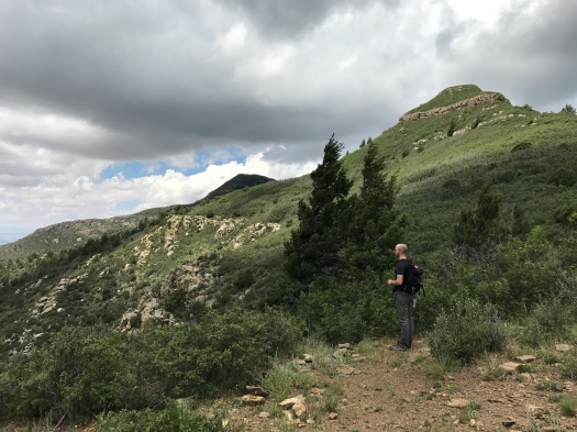
The forest is so lush – especially today, fresh off a rain last night, parts of the trail still damp – that at times it’s like you’re in the jungle, and daylight is far away. At one point, near the top, the trail is so overgrown with spiky honey locust that you can’t see your feet beneath you as you push through it.
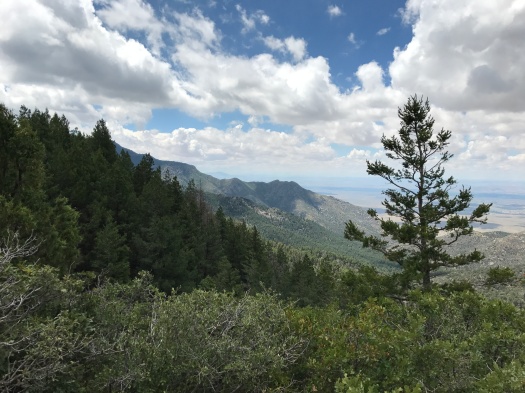
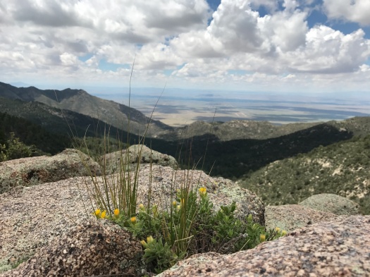
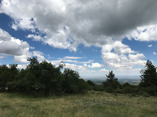
Then glimpses of the very tops of the peaks above, or the brilliant blue sky, or the fluffy clouds, or the salt lakes, or the rolling valleys, remind you where you are and how you got there.
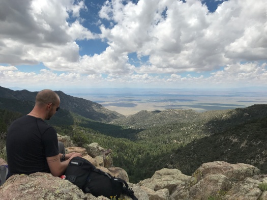
At the overlook at the top, a cool wind blew with ferocity and the clouds scuttled by fast, their shadows dotting the plain of Los Lunas and Belen far below.
A thousand feet below that, we closed the loop of this hike by walking along the forest road we drove in on. That’s where my husband spotted another deer and pointed. He was an adolescent, with small antlers, still growing. He watched us for a moment from a ridge across the creek.
We’d never been that close to a deer on the trail. The solitude of Fourth of July Canyon in August allowed us to experience it – twice.
All this hike has to offer could be yours and yours alone, for the day, or the night, if you go in the summer.
Do it.
Hike length: 6.5 miles (this spectacular route, and the tip to do it in summer, came from “60 Hikes Within 60 Miles of Albuquerque” by Stephen Ausherman)
Difficulty: moderate
Trail traffic: none
Wildlife spotted: doe and buck, woodpecker, jay, bluebird, vulture, crow, eagle (we think), squirrels, prairie dog (we think)


10 Replies to “You have probably never been here in the summer. But you should.”