A watched-for hawk never flies

The Buddha advises letting go of expectation.

But when you are hiking a trail called Hawk Watch, it is human nature to expect hawks.

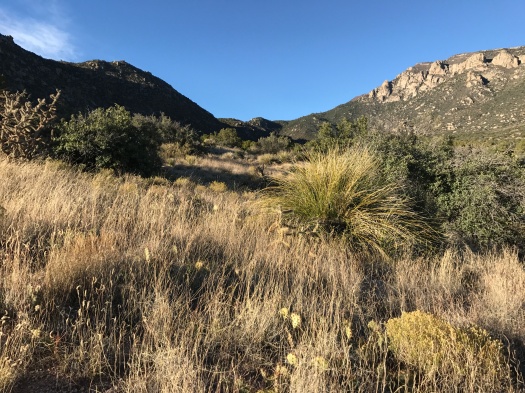
So my eyes were glued to the sky as we climbed out of an arroyo in Tijeras Canyon.

The day was warm and brilliant blue, with a stiff and surprisingly cool wind blowing – sometimes hard – from the southwest.

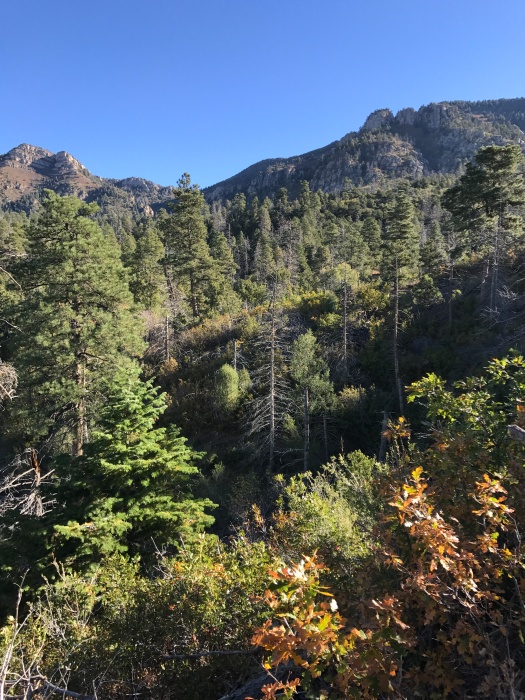
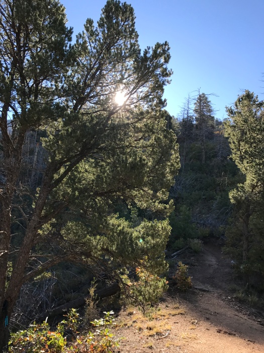
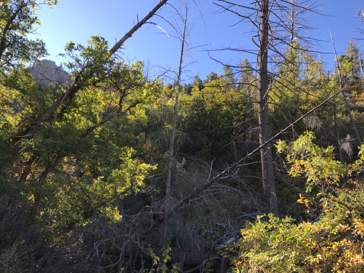
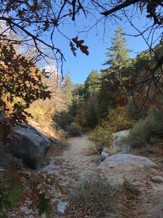
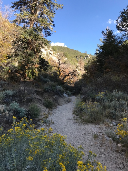
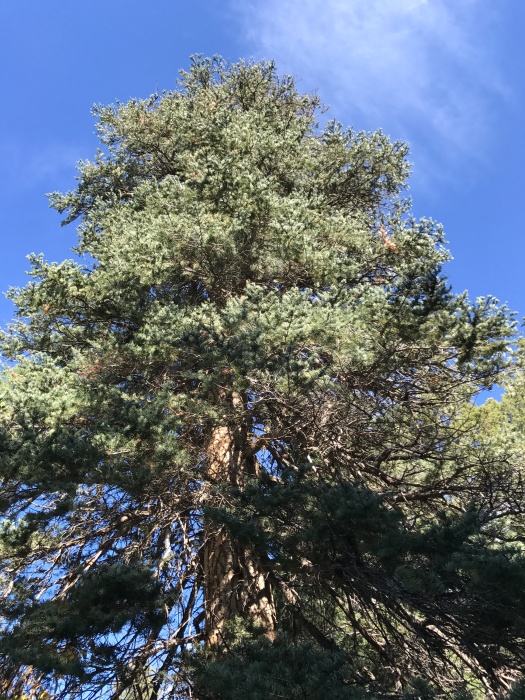
Cactus, cedar, juniper and desert shrubs crowded in on the sun-baked trail. Herbaceous smells I didn’t recognize occasionally drifted my way.

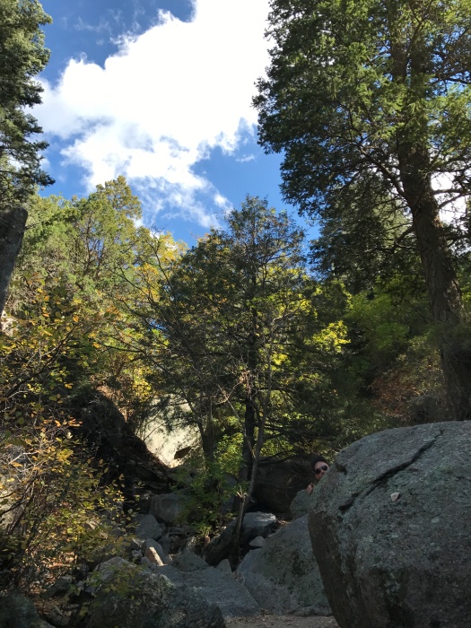
Seemingly every rock on the trail displayed what looked to us like deposits of bear scat.

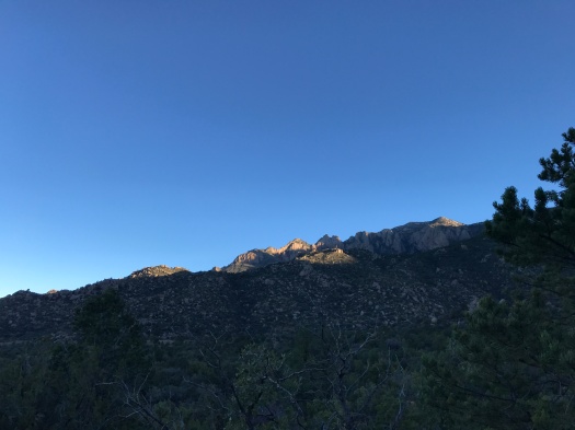
I salute any bear that could navigate this trail. It is wildly steep. It corkscrews, rather than switchbacks; when you come to a rare switchback, it feels like a break. No two websites agree on this hike, but a pretty authoritative one says it gains 1,500 feet in two miles.

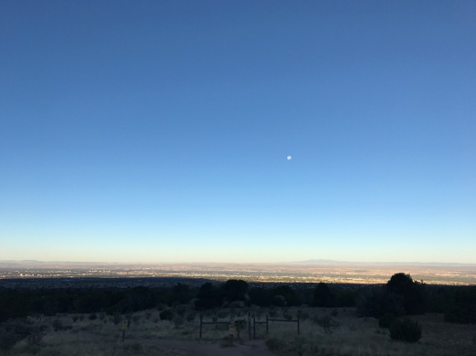
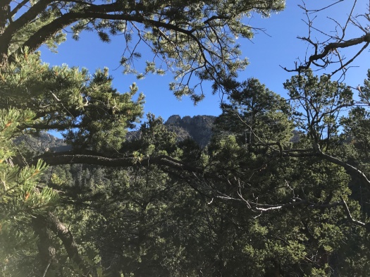
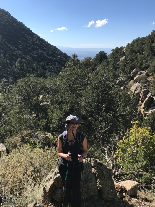
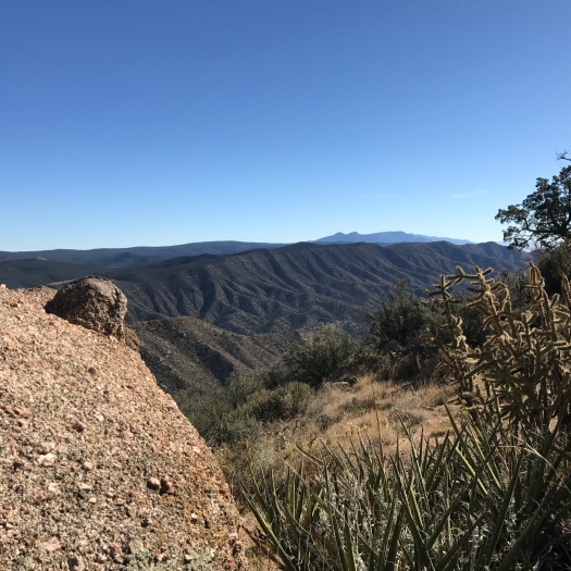
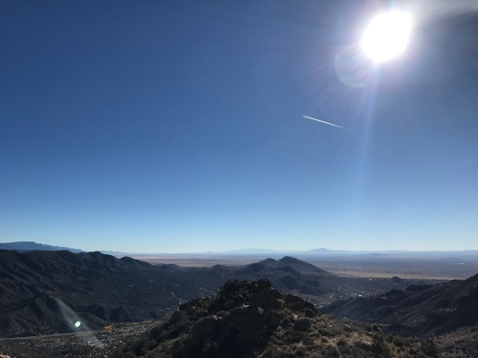
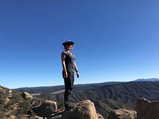
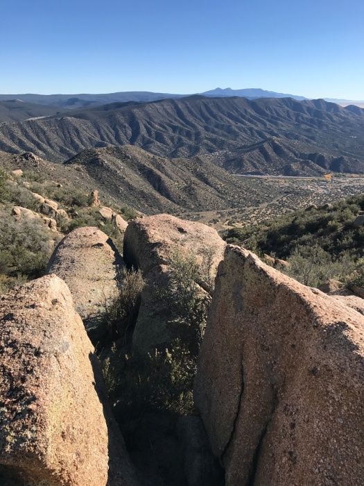
We rapidly acquired the best views in existence of Tijeras Canyon, a ridge of rumpled foothills stretching to our south.

IMG_8977

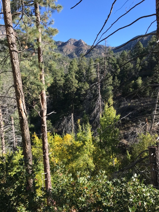
Cottonwoods turning yellow in the valley. A few peaks of the Manzanitas jutted up beyond the valley, and further still, a glimpse of the Manzano crest.

Far below, the UNM golf course and the airport control tower. Way across the Rio Grande Valley to the west, the arrowhead range – the Sierra Ladrones – and the distant Magdalena and San Mateo ranges blending into one.

IMG_8990

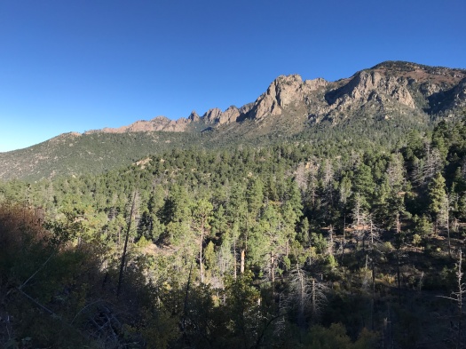
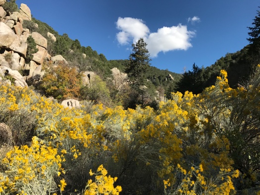
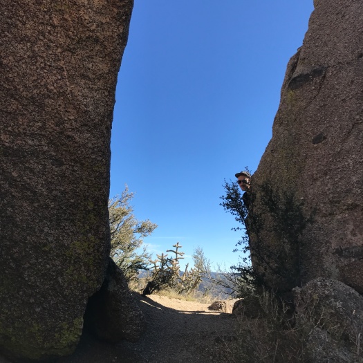
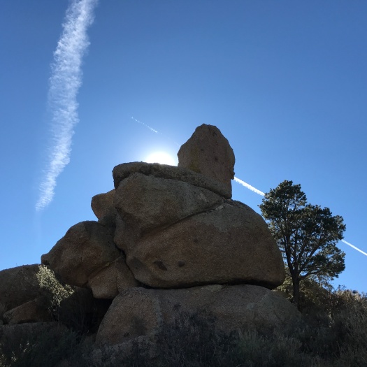
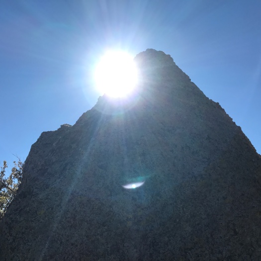
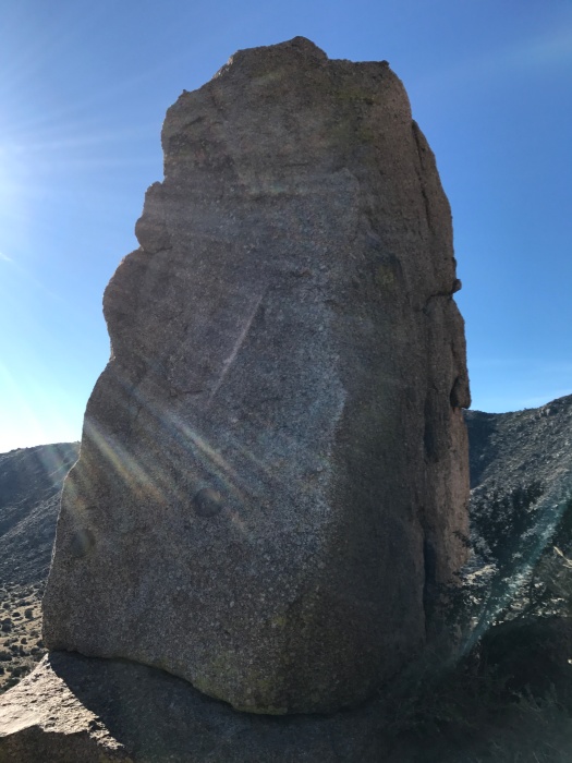
In front of us, increasingly, were boulders. Pink and gray granite boulders with sprinklings of green, orange and pale blue moss. Balanced rocks. Flat boulders turned on their side, perfect for standing on. Kingly thrones.

IMG_9012


IMG_8968

IMG_8973

IMG_8980

IMG_9010

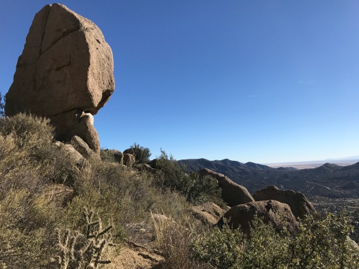
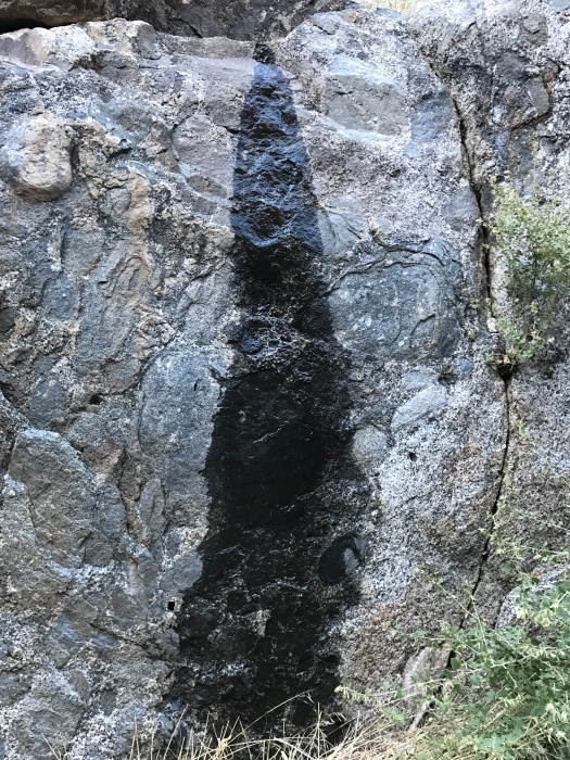
We climbed on them. We repeatedly crossed a seam of hollow-sounding black rock that felt almost like pavement.

One more push, gusts of wind lifting us up the mountain in the empty stretches between clusters of rock.

The trail turned, and we found a perfect group of flat boulders for sitting.

IMG_8998

IMG_9002

Bluejays flew overhead. A wren sang sweetly. We consulted our guide to Rocky Mountain animal scat (this is a thing – jealous?), which neither confirmed nor denied our scat identifications as bear and bobcat.

We could’ve kept going. Some friends of mine did when they hiked Hawk Watch, pushing all the way up the ridge to South Sandia Peak and back.

They must have bionic knees.

On many hikes, I put my exertion into the climb and coast on the way down, soaking up the scenery.

If there was anything different to see on the way down, I didn’t see it. I was focusing on keeping my feet under me on the steep and rocky grade. My lower body slowly composed a symphony of aches. My right knee was the tuba, blurting its presence regularly. The ball of my left foot, my right big toe and my hip flexors occasionally contributed a phrase.

I walked sideways or stagger-stepped to keep my balance. I fell on my arse (and was unharmed; God bless sturdy hiking pants.) Twice we found ourselves at the end of an arroyo because we’d missed a bend in the trail, eyes glued to our feet.

The half-mile of Three Gun Springs trail we borrowed to get back to the car was wide and gentle. The ache symphony quieted. Late-afternoon sun slanted through the canyon, wind sailing through the wild grasses, butterflies and birds making their late-day rounds.

IMG_9020

Hawks?

Not a one to be seen.

Hike length: 5 miles

Trail traffic: moderate

Difficulty: difficult

Wildlife spotted: butterflies, skinny and fat lizards, bluejays, wrens


When everything else in Burque is falling apart, you can still walk along a ditch

These are tough times in our beautiful city.

Violent crime is rising, and Burquenos are worried about it. They have reason to be. Our state already ranks among the worst in the nation on crime, domestic violence and drug addiction.

Then, this week came the news that a major mental health provider – an organization that treated thousands of people in Albuquerque, many of them low-income – would close its doors.

Another gaping hole in our city’s safety net.

Too often, our coffers are empty, our resources overstretched, when it comes to helping the neediest among us.

But there is one resource we have in abundance, one that studies have found could help reduce the risk of depression: our beautiful natural environment, with 310 days of sunshine a year.

It is no replacement for food, shelter, medical treatment, counseling, drug treatment, policies or laws addressing public health needs. We are going to have to find ways to make more of all those things accessible to our residents, or stay at the bottom of every list forever.

But being in the natural world more is one thing that could help many people in Albuquerque, at least a little, at least for a moment. Maybe that little boost could help more people continue the endless search for the more elusive resources they need.

The wilderness is as near and accessible here as it is almost anywhere in the country, but it is still not accessible to all.

Walking through a gate into the wilderness is usually free, or cheap. But you typically need a car to get there, and gasoline, and some basic gear for when you arrive (proper outdoor footwear, compass, map, extra food and water.) You also need time. If you’re juggling multiple jobs, working every day, a full-time caregiver, a hike can quickly edge out of the realm of possibility.

But there is one natural resource within immediate walking distance of virtually every person in Albuquerque.

Ditches.

IMG_8935

There are 1,200 miles of irrigation ditches and acequias carrying water throughout the Middle Rio Grande Valley, according to the Middle Rio Grande Conservancy District. Some were first used by Native Americans 500 years ago. Others were built by Spanish settlers in the 1600s.

In a land where water was extremely scarce, people found ways to get the most precious of resources to people who need it.

If you have half an hour, you can spend time walking alongside a ditch. If you have more time and access to a bicycle, your options for exploring the paths along the city’s ditch network multiply. (To state the obvious: stay away from ditches and out of arroyos after we’ve been blessed with abundant rain, and respect the water’s power always.)

All ditch paths are not created equal. In Albuquerque’s agricultural valleys, you’ll walk under massive cottonwoods and see birds and ducks frolicking.

IMG_8936

IMG_8923IMG_8924

IMG_8927

I saw more wildlife on a five-mile ditch path walk Saturday than I usually see in a day in the mountains or the open desert. Plus goats. And reading material.

IMG_8910

IMG_8937

In some neighborhoods, the closest ditch might be accompanied by a concrete path under the baking sun.

All ditch paths provide direct access to sunlight and fresh air, for free, in a matter of moments.

Our coffers may too often be empty, but, this year at least, our ditches are full.

May we find solace in walking alongside them, and may this abundant resource inspire us to build a network of resources where all the people of Albuquerque can get the help they need.

IMG_8942

This trail sucks for watching balloons. Good thing it’s great for hiking.

The sun hit our faces just before 9 a.m.

We’d been hiking for two hours.

We got an early start because I had the idea to watch a Balloon Fiesta mass ascension from the mountains. Brilliant as that idea seemed, it didn’t really work.

I had picked the Pino Trail in the Sandia foothills because it was far enough north and low enough elevation that I thought we’d get a good view of the field. I was right: we could see the field. We could even see some balloons hovering over it, floating along like chess pieces moved by an unseen hand. But they were tiny from where we stood, and as soon as we started ascending the trail, they became impossible to make out.

IMG_8840
There are balloons out there. Really.

So we focused on the hike.

I have history with the Pino Trail. When I first got interested in hiking and was looking to build stamina, I’d hike on this trail every weekend, going a little further each time. It was many months before I realized it was nearly 10 miles roundtrip and rated difficult by the Forest Service. I tried to do the whole thing last year but fell a mile short (the end of the trail is the toughest.)

The trail is steep and well-shaded after the first mile, with enormous boulders scattered along its lower half. On the upper half, a narrow trail climbs along the canyon wall, with steep dropoffs on the other side.

The sun comes slowly into this canyon. In the cold early morning, it touched two rocky peaks.

IMG_8844IMG_8850

Half an hour later, the top of a ridge. Half an hour after that, most of the ridge was bathed in sun, but we were still in layers and gloves in the shade.

By the time we finally caught up to the sun, our legs and lungs were pounding. We might have tried for the top again, since we’d gotten such an early start, but I had a midday commitment. So at a dark, cold spring seeping from the canyon wall, we turned and headed back down.

The light on the way back was spectacular, shimmering through pine needles, dancing on leaves, warming our backs and faces.

IMG_8861IMG_8871IMG_8872IMG_8877IMG_8882

The humans and dogs who’d been mostly absent from the trail on our early climb poured up as we moved down.

Birds and butterflies flittered past us into the light. As we finished the last open, unshaded section of trail, I spotted a tarantula hawk crawling on the ground and called to my husband. A man heading up with his family saw us looking at it and gaped.

“We don’t have anything like that in Montana!” he exclaimed.

“Do you know what it is?” I asked, ready to blow his mind.

But he was talking with his companions and didn’t hear me.

It’s for the best. Knowing the full beauty and horror of the tarantula hawk might have sent him packing back to Montana early.

Hike length: 6.5 miles

Difficulty: difficult

Trail traffic: moderate

Wildlife spotted: cottontail, jays, robin, sparrows, butterflies, tarantula hawk


Before I knew it, this hike had seeped into my heart

I doubt we would have seen the seeps if we’d gone on a different day.

Today’s hike followed five consecutive days of rain, the first time I’ve seen that in eight years of living here. The total haul at our house was over two inches.

So when we headed into Embudito Canyon, we knew we were likely to see some sights we wouldn’t get on another day. And almost immediately, we noticed the seeps.

IMG_8824

Trickles of water cascaded out of stacked rocks, coursed over the ground under us, pooled in depressions in smooth granite.

It was an amazing sight, and made for slippery going on said granite.

This is a tough hike. There’s a lot of clambering up and over giant rocks. It’s a hike you want to take with someone you’re comfortable giving a butt-boost up to the next level of the trail, or vice versa.

It is also spectacular.

The canyon walls are the tallest I’ve seen in the Sandias. They’re stone dominoes at first, transforming to forested coves as you ascend.

IMG_8807IMG_8813

Fall had already announced itself, chamisa blazing yellow, leaves shading through orange and brown, Virginia creeper bleeding deep red (how is there Virginia creeper in this canyon? If that wasn’t it, it was some fine mimicry.)

IMG_8819

I would be remiss if I did not note that this canyon also boasts an embarrassment of big flat rocks perfect for a rest.

IMG_8788

I found a boulder twice as long as I am where I could catch the breeze under a tree and practice my new hobby – photographing whatever I can see while lying on my back at the halfway point of a hike.

IMG_8794

But it wasn’t quite halfway. We scrambled on up a game path in search of a sweeping view. There wasn’t one, but we had no complaints about what we could see.

IMG_8802

The Sandia Mountain Hiking Guide promises even more delights if you keep going. The trail will take you to “one of the most secluded and prettiest spots in the Sandia Mountains,” it says.

I find it hard to believe the first two miles of Embudito Canyon could be improved upon, but I look forward to finding out whether they can.

Hike length: 4 miles

Difficulty: difficult

Trail traffic: light

Wildlife spotted: Gambel’s quail, finches, robins, bluejays, butterflies, cottontail, lizard, millipede, red beetles