To share or not to share your favorite hiking spots? That is the question

An acquaintance posted a gorgeous image from a recent hike on social media.

I commented, asking if he was willing to share the location of this beautiful spot.

He wouldn’t share exactly where it was.

He’s not the only one.

It doesn’t make me angry when someone won’t disclose a favorite hiking spot to me – that’s a personal choice.

But, in New Mexico at least, it bewilders me.

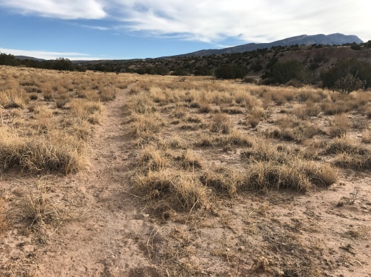
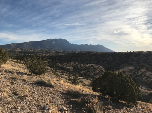
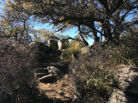
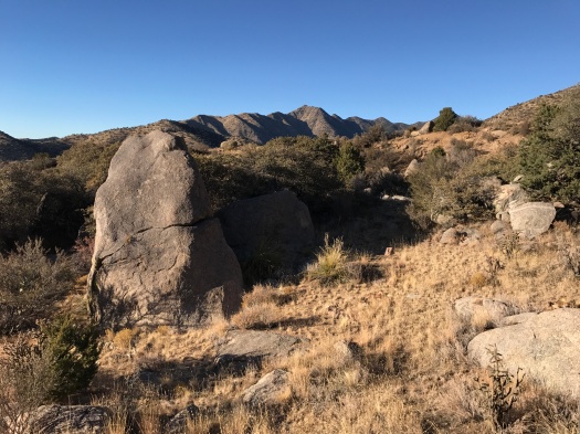
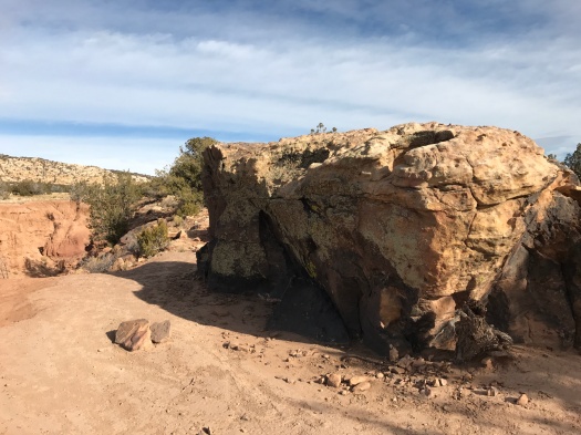
Take a place like Herrera Mesa, a silent, sun-swept, eroded landscape next to the To’hajiilee reservation.

I’ve posted about it and told several people about it in person. Of the people who’ve read or heard what I’ve said about it, maybe one will ever visit it.

That would be one more human than I’ve ever encountered there, and it would have no impact at all on my enjoyment of the place.

In 5280 Magazine’s wonderful package on how Colorado’s wild places are being loved to death, one photographer said he doesn’t reveal the exact locations where his images were taken if they’re not on official trails. He doesn’t want to be responsible for hordes trampling those beautiful places, disturbing the habitat, leaving human waste behind.

I understand that.

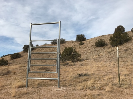
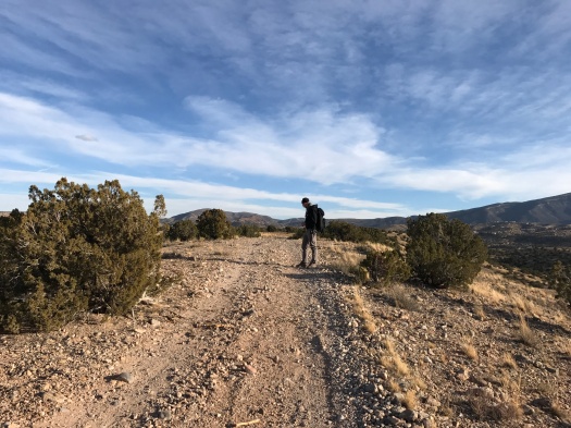
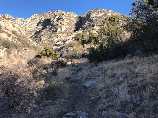
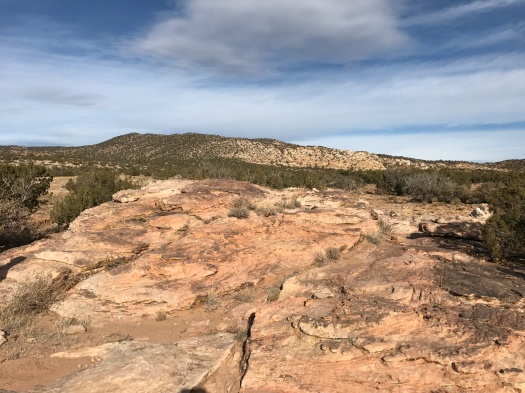
But I have never encountered a mobbed hiking spot in New Mexico. I’ve encountered some that have a steady flow of hiker traffic. More of my hiking stories include the words “We didn’t see another soul.”

Those experiences are incredibly special. But at most of New Mexico’s wild places, there’s room for more people to enjoy them without ruining the experience.

I don’t know where the tipping point is. Maybe hikers in and around Colorado’s Front Range enjoyed solitude once too, before the booming economy drew people there in droves.

Maybe, at some point, one too many people told one too many people.

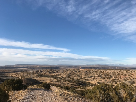
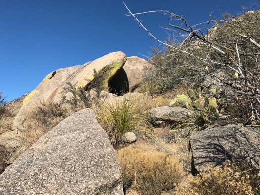
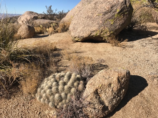
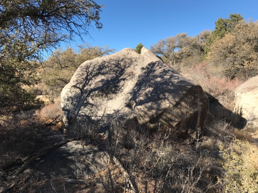
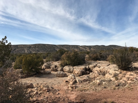
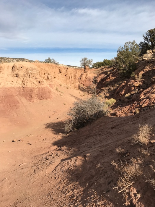
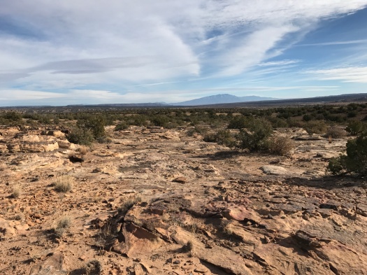
New Mexico is full of incredible lands far beyond its few famous tourist spots. I love to share the unusual sights I see in those places. It’s never even occurred to me to keep them secret. They don’t belong to me. They aren’t my secret to keep. Every one of them is open for the public to enjoy.

It’s also not my place to judge the fellow who wouldn’t tell me where to find that quiet spot near a popular tourist attraction.

But I would like to understand that impulse better.

Do you share your favorite hiking spots, or keep them close?

Why is that your choice?

P.S. Any guesses where I took the photo above? It’s not a secret.

The calm before the storm in Placitas

We could see it in the distance, over the Jemez Mountains: small clouds forming in a pale sky. White on white.

A winter storm rolls in tonight. In Albuquerque, it’ll rain a little and the wind will heave a lot of dust around.

But it will snow somewhere in those mountain ranges that surrounded us today in Placitas, which is all we can ask.

This hike is a combination of Albuquerque Open Space and BLM land. The route’s from Stephen Ausherman’s “60 Hikes Within 60 Miles of Albuquerque.”

When we arrived at the trailhead, we found the parking lot empty. We’d passed the trailhead for the beautiful hike we did a few weeks ago in Placitas, just a few miles from I-25, and it was full.

This hike winds through juniper-dotted hills to the Las Huertas creek bed, where there’s no sign of water.

IMG_9667

When we did this hike two years ago, on Easter Sunday, we hiked up the creekbed for two miles, navigating ankle-twisting rocks. The rocks were stunning; one was brick-red with big powder-blue polka dots. Today, we stuck to the path along the bank. That brought some unusual sights of its own.

IMG_9670
Well, that’s one way to do it.

As we walked east along the creek bed, the green-topped mesas of Santa Ana Pueblo came into view, the Jemez looming beyond. We found an array of shotgun shells; as we finished the hike later, we’d hear shooting.

We crossed under humming power lines, headed into a wash, then up an arroyo for 0.7 miles.

IMG_9679

That slog up the arroyo as it gradually gained elevation qualifies as one of those hiking times when you’re just ready for that part to end. Going uphill in sand is hard, my right hip throbbed from the repetitive motion, and the beautiful juniper lining the arroyo clogged and stung my nose.

All that seemed easy when we arrived at the next leg of the journey: a quarter mile of a 45-degree grade.

The prize: an outstanding view of those green mesa tops on the pueblo, and an excellent perspective on just how massive the Jemez range is.

IMG_9685

The path from there was blessedly flat. As we walked across the parking lot, I looked over and saw one mesa glowing in the setting sun, Cabezon Peak rising dark and foreboding behind it. It was too far away for my camera to capture, so my eyes just drank it in.

With any luck, those hills we climbed will get dusted with snow tonight.

IMG_9688IMG_9690

Hike length: 4 miles

Difficulty: On the easy side of moderate

Trail traffic: none

Wildlife spotted: mystery bird of prey

Why I’m doing the #52HikeChallenge

Because I want to do the thing that makes me so happy as often as I can.

Because I have a hiking blog, and more hikes means more writing, another thing that makes me really happy.

Because I want one more reason to overcome excuses.

Because it’s possible, but not easy. I didn’t do 52 hikes in 2017.

Because it could spark creativity. I’ve talked about how easy it would be to hike Carlito Springs after work for months, but I’ve never done it. If I miss a weekend hike on this challenge, I might just do it.

Because I made a list of a bunch of special places I wanted to go in 2017 and only made it to one of them. I wasn’t going to set any hiking goals for 2018 at all. But with this one, the possibilities are wide open as long as you’re doing the thing.

Because, as this article by Gabriella Marks aptly puts it, hiking isn’t all summits and sweeping views. It’s tedium and blisters and repetition and turning around a half mile short because that’s the safest choice for you that day. The more of those dues you pay, the more summits and sweeping views you might reap.

Because it brings me closer to the only goal I did set for myself in 2018 – to spend more time with humans in real life, especially my life partner, who is also my hiking partner.

For the record: Nobody’s paying me to do this challenge or write about it, I’m doing it because I want to.

There’s a boulder wonderland beneath one of ABQ’s biggest tourist attractions

This hike began with the hum of gears turning.

It’s the sound of the Sandia Peak Tram moving up or down the mountain on its pulley. The sound is equally audible whether there’s a tram car in sight or not.

We were on the Tramway Trail, and while there are many excellent places in the Sandias to see boulders, this one may take the cake.

Gray granite boulders. Lichen-covered boulders. Boulders ribbed with stripes or veins of quartz. Boulders stacked atop one another. Boulders leaning against other boulders. Boulder-edged meadows. Boulders separated by slick granite faces like the one that stymied me on the Whitewash Trail.

IMG_9624
Nature’s Earthship, boulder edition.
IMG_9626
Boulders with barrel cactus.
IMG_9628
Stairway to boulders.

IMG_9630IMG_9634

IMG_9640

IMG_9650
Shot while standing on a boulder

IMG_9652

IMG_9660

In some places, the boulders were the trail.

This is the trail you take if the line for the tram is too long. (So I’m told; I’ve never ridden the tram – I prefer to traverse mountains with my feet on the ground.) This trail connects to the La Luz Trail, with its legendary 3,800-foot elevation gain to the top of the mountain.

One day.

Today, we were just there to soak up sun and sky, to climb high enough to feel sore but not so much that we can’t move tomorrow.

As we returned to the trailhead, we explored the empty space between two giant boulders, the sound of the tram humming in our ears.

Hike 1 of the #52HikeChallenge

Length: 5 miles

Difficulty: moderate

Trail traffic: moderate

Wildlife spotted: bluebird, jay, crow

We still haven’t found what we’re looking for

For C.Z.

My husband pours a few drops of water into a small burrow next to two intact dead tarantulas and a few more dismembered ones.

“What the heck is IN there?!”

Tarantula hawk?” I suggest. “Do they burrow?”*

He sticks a blade of grass into the hole.

We don’t know where we are, but we can see the road and know how to get back to it. So we aren’t lost, navigationally.

But we are a bit adrift.

We’re in the San Ysidro Trials Area, a chunk of public land with amazing sandstone canyons that’s mostly used by motorcyclists doing stunts. Today, there’s not another soul here.

We’re here to hike an amazing loop found in Stephen Ausherman’s “60 Hikes Within 60 Miles of Albuquerque.” It traverses a sandstone canyon full of natural pools, squeaks through a wild section of land where the soil is red and purple, and brings you back over more trippy rocks.

But even though we’ve done this hike before, we cannot find that loop. We can’t even find a single one of the three sections that make it up.

We find a natural rock mini-amphitheater.

IMG_9592

We wander through a wash and find a side canyon of brick-red soil that narrows to a slot too small to walk in.

IMG_9601

We scramble up to the rim in search of our route, but while we see lots of volcanic-looking mini-domes and the hometown Sandia Mountains beyond, nothing looks familiar.

IMG_9602

IMG_9603

IMG_9605

We climb back down and head up a rocky canyon. This looks familiar. The spots that look like they could hold natural pools are dry, but that could just be because it hasn’t rained in Albuquerque in nearly 100 days.

But when the canyon ends, we’re facing a fence that we know marks the Jemez Reservation boundary, as far as we can see. We turn around and head back.

Even without the desired route, there’s plenty to see and feel; warm sun, crisp breeze, the play of colors in the slanting light.

We’ll have hiked five miles by the end. We’ll have spotted petrified wood. Our feet will hurt, our shoulders will be sore from backpack straps.

But something’s off today.

We’re out here two days after the death of a family member, which came just a week after he unexpectedly went into the hospital.

We’re out here looking, but not quite finding.

It’s not the first time I’ve gone on a hike in response to the death of a loved one and it won’t be the last. I have a Big Birthday this year. The number of people I love who will die does not get smaller from here.

As we walk the road back to our car and look across the valley, a wash of red and purple soil comes into view. The canyon. We were so close to it, but we couldn’t quite get there.

IMG_9612
Our shadows are unintentionally in this photo.

It’s sad to look back at it.

But we have to keep going.

*Turns out tarantula hawks do burrow.

Hike length: 5 miles

Difficulty: moderate

Trail traffic: none

Wildlife spotted: dozens of bluebirds in trees along the road, two dead tarantulas