How to have a staring contest with nine deer on one of the most popular trails in the Sandias

Do deer charge? I wondered.

I’d just taken one small step toward a group of five mule deer standing on a ridge about 20 yards away.

The deer in front took one small step in my direction, eyes on me.

I’m not sure what I was expecting, but it definitely wasn’t that.

I recalled some advice about cows from my hiking guidebook: If it doesn’t run away, steer clear.

She didn’t come any closer, though. The group milled around, seeming not to notice the people talking loudly on the trail behind us. Then the deer walked single file along the ridge.

They stopped for a minute. I took one step in their direction, to see around a branch.

Again, the deer in front took one small step toward me. She craned her neck forward. Two deer behind her inclined their heads toward each other, as if to say, “What the hell?”

That’s when we realized there were more than five.

“Eight,” my husband whispered. “No. Nine.”

We watched them until they turned and walked away.

IMG_9878
I don’t have a picture that shows all nine; you’ll just have to believe me.


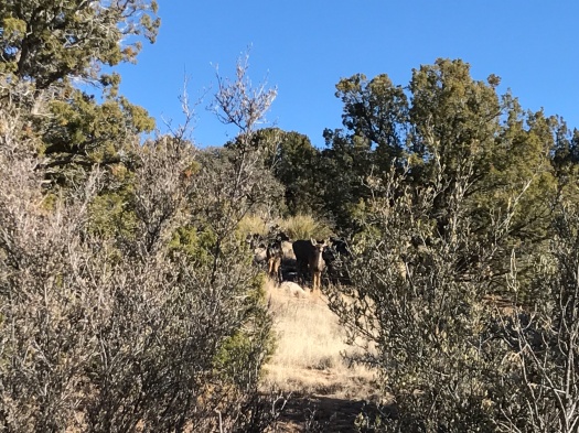
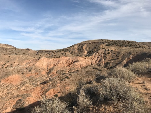
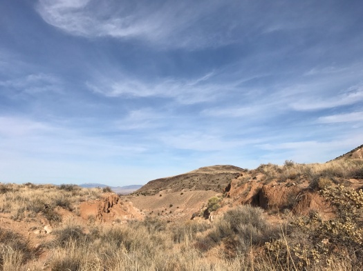
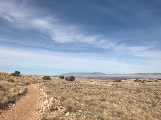
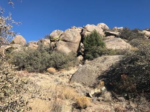
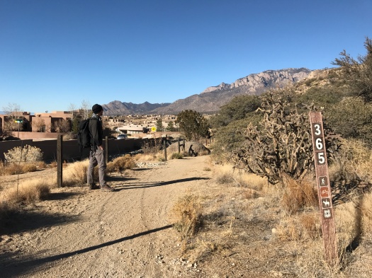
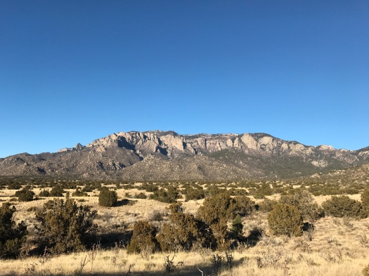
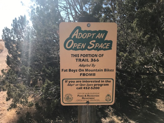
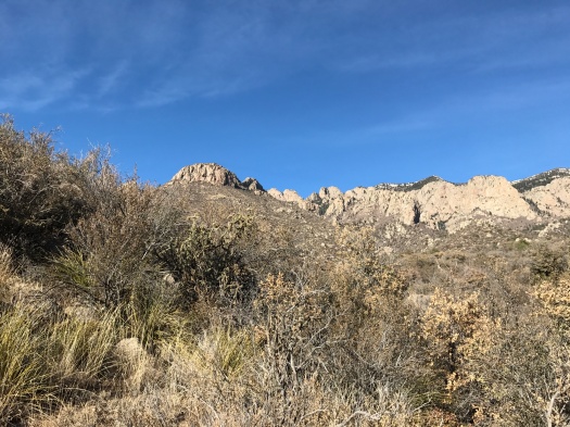
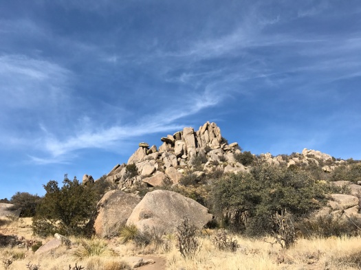
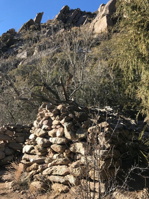
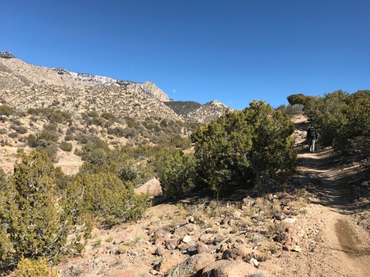
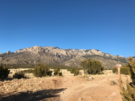
We saw nine deer on the Foothills Trail, one of the most popular trails in the Sandias, just north of the Elena Gallegos Open Space.

We saw nine deer within shouting distance of a warren of cul-de-sacs.

I believe we saw nine deer because the Foothills Trail had probably a third of its normal traffic today.

IMG_9851

IMG_9855

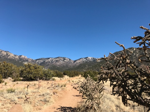
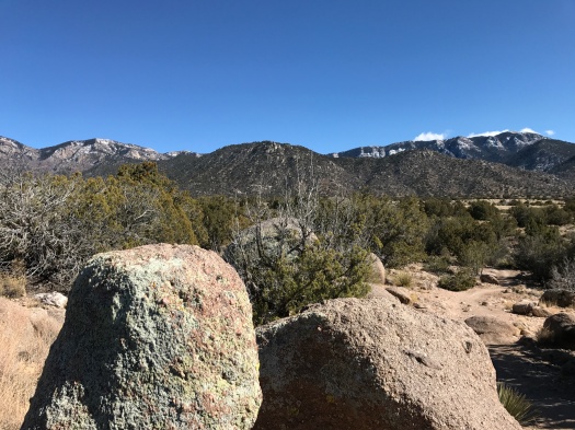
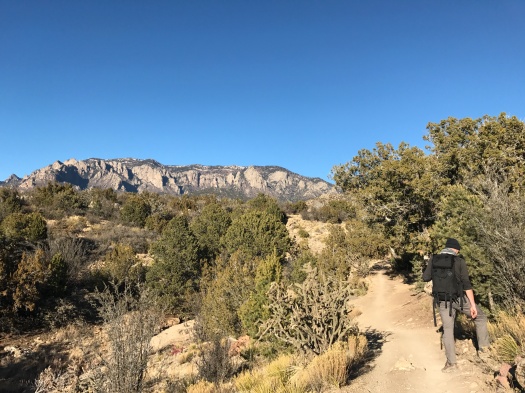
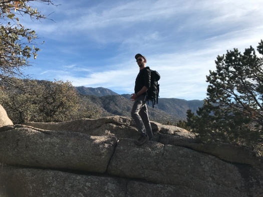
The day was brilliantly blue, but the temperature was only in the low 40s, and a brisk wind howling out of the northwest made it feel 10 degrees cooler. I layered up and put on my winter hat and gloves for the first time since a 7 a.m. hike at high elevation in October.

We still had to leap off the trail for our fair share of mountain bikes, but there was a trickle of them today, not a flood.

IMG_9864IMG_9870IMG_9888

I believe we saw nine deer because the more things you see in the outdoors, the more things you notice. The people behind us walked right past the deer. We could have, too. We probably have walked right past wildlife dozens of times, and will dozens of times more.

If you want to see a bunch of wildlife, you can go to places where you know there’s a lot of wildlife.

Or you can just be outdoors a lot.

I’ve spent most weekends hiking for the past three years. Before today, my grand deer-sighting total was two, spotted separately on the same summer day in Fourth of July Canyon.

There can be long stretches of monotony and when-will-this-end-already in hiking. Like baseball. Or courtroom trials.

But the more you do any of those things, the more you increase your odds of witnessing something spectacular.

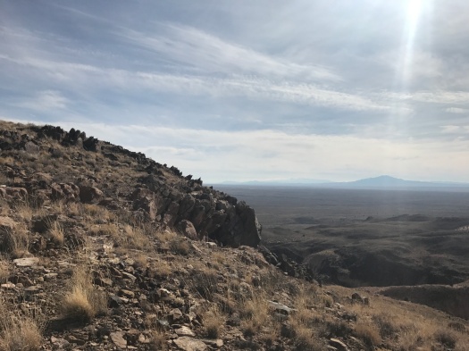
Hike length: 6 miles

Difficulty: moderate

Trail traffic: light

Wildlife spotted: mountain bluebirds, jays, mystery bird of prey (probably a hawk), group of deer

You know that giant hill in Los Lunas? You can hike it. It’s awesome.

We were on our way to a mysterious place a friend had told me about, a place in Los Lunas where you can hike for hours without seeing anyone.

I’d looked up maps and directions. But it wasn’t till I turned off the interstate and started driving toward it that I realized: Holy crap, I’m climbing THAT hill.

It’s the major feature of Los Lunas as you’re driving through on I-25: a long, wide, tall, shadowy hill. It’s enormous, and a little foreboding.

Our hiking destination’s name: El Cerro de Los Lunas. Translation, “the hill of Los Lunas.” Roger.

Let’s dispense with a few things: On the one-mile trail leading into the preserve (creatively named “Trail Head Trail”), you could be forgiven for thinking the only color in the world was beige. There’s no shade anywhere in the preserve. For a good five months a year, El Cerro de Los Lunas is undoubtedly the same temperature as the surface of the sun, its volcanic rock crawling with rattlesnakes.

IMG_9783
Reads like it’s telling the rattlesnakes to stay on the trail, doesn’t it?

That leaves you seven months of the year to enjoy its delights – and there are many.

We climbed onto the Overlook Trail, ascending steeply and gazing down into what appeared to be a giant scooped-out bowl of sherbet. Pale pink, orange, beige, white and gray striations stretched before us. An enormous bird, so large we thought it might be an eagle, swooped over a ridge, evading even our binoculars.

IMG_9785
We took the Stairmaster to the overlook.
IMG_9829
And what an overlook it was.
IMG_9828
Sherbet bowl
IMG_9826
Peeking through a crevasse into the sherbet bowl

As we meandered around the sherbet bowl, snow-capped Mount Taylor came into view, then the arrowhead range of the Sierra Ladrones. Behind the Ladrones was a cloud-covered range that I thought had to be the San Mateos or Magdalenas. High plains rolled away below.

IMG_9806

We watched a couple scramble up a 60-degree incline from the bottom of the sherbet bowl to the Overlook Trail. That made me really nervous, but they made it.

Crows wheeled above, calling to each other. Faraway train whistles echoed from the rail switching yard 10 miles south. We rounded the south end of the hill and the village of Los Lunas stretched below us. Though it only has 15,000 people, it looked enormous. A bend in the Rio Grande glimmered.

IMG_9803

At the top, we found an incredible view of four ranges to the east, from the Sandias back in Albuquerque to the Manzanitas, the snow-capped Manzanos and the Los Pinos Mountains.

IMG_9811
Manzanos
IMG_9815
Looking back at the Sandias

We hiked nearly seven miles and didn’t even cover half the marked trails. Among those we missed: the trail that explores the sherbet bowl (called – wait for it – “Bowl Trail.”)

Next time I drive through Los Lunas, I will look at that giant hill very differently, knowing there’s a whole world up there.

Hike length: 6.5 miles

Difficulty: moderate

Wildlife spotted: hawk or eagle, crows, sparrows, lizards, tiny dragonflies

Trail traffic: busy on Trail Head Trail, some traffic on lower section of Overlook Trail, none at the top

IMG_9781
Thank you, Huning family!

Welcome to the wildland-urban interface

We’re on a winding trail in the national forest.

We’re also, suddenly, staring into the floor-to-ceiling windows of a high-end home just a few feet away.

IMG_9761

On our right, more homes proliferate. Cul-de-sacs sprout. A new subdivision, foundations poured, rises from the earth.

IMG_9760

On our left, boulders upon boulders, rising to the mountain. A symphony of tweets rises from birds among the rocks, though we can’t see a single one.

IMG_9758

Today’s hike was the most blatant display we’ve ever seen of the “wildland-urban interface” – the increasing number of places where people have built homes and community centers amid wildlife habitats and wild forests. That zone is ground zero in wildfire science and much more.

We were on the Foothills Trail at the spot where the Sandia Mountains begin to rise from the earth. Pinon, juniper, dry arroyos, tons of mountain bikes.

The trail kept its form and style as it entered the housing zone, rising and falling, bending sharply. But at times, it looked like we were entering someone’s backyard. An enormous marker shouted out the trail number to reassure us that we really were on a hiking trail.

IMG_9762

The juxtaposition didn’t make the landscape any less beautiful. It was just surreal.

On the way back, we took a side trail that detoured into a canyon. It was the day after a huge windstorm, and while it didn’t bring any precipitation to Albuquerque, the sky and air were brighter and crisper than they’ve been in months. The thin film of dust that’s hung  in the air since November had disappeared. The intense green of densely forested canyon walls sloped into many shades of gray rock, then into a sky that seemed to pulse with blue.

IMG_9767

IMG_9768IMG_9770

We could see all the landmarks: Mount Taylor, White Mesa, Cabezon Peak, the arrowhead Sierra Ladrones ridge. Two balloons hovered over the West Mesa.

We saw a single house, barn and stock tank far away, deep in the canyon. They looked like they’d been there forever.

Or at least since the urban-wildland interface began.

Hike length: 5.7 miles

Difficulty: moderate

Trail traffic: moderate, lots of mountain bikes

Wildlife spotted: sparrows, jay

P.S. Thank you, Fat Boys on Mountain Bikes (FBOMB) for making today’s hike possible!

IMG_9749

Yes, Virginia, there is water in the desert. We found some.

I saw it before I heard it.

Water.

Cool, clear water, trickling over rocks, leaves and branches.

IMG_9734

Maybe I hadn’t heard it because I’d almost forgotten what it sounds like. It’s rained once in Albuquerque in the past 120 days.

Year-round streams in the Sandias are rare. But we’d stumbled upon one, about a mile up Domingo Baca Trail.

Truth be told, I wasn’t that excited to take this hike. I love the desert and its colors in all seasons. But with this brutally dry winter, there’s no getting around it: Everything just looks faded and dusty. It had begun to feel like we’d never see water and colors again.

But then we did.

We clambered over the little stream and over a ridge. Evergreens lined the north-facing wall of the canyon. Patches of snow nestled at the base of some. A red-tailed hawk swooped along the canyon wall and perched in a tree.

We lay in the sun on a boulder, soaking up the sight of blue sky and green trees.

IMG_9738
View 1 from our boulder resting spot: evergreens.
IMG_9737
View 2 from our boulder resting spot: mountain peaks.

IMG_9708

IMG_9713

IMG_9719
I menace you from atop a giant boulder

On the way down, we passed a ruin, a small stone structure.

IMG_9742

Near it is an unmarked trail to a site where a plane crashed in the 1950s. It’s said to be one of the most difficult and beautiful hikes in the Sandias, and the most haunting. It’s on my bucket list. That’s why we were scouting Domingo Baca Trail today.

I’m grateful that trail brought me exactly what I needed to see.

Hike length: 4.7 miles

Difficulty: moderate

Trail traffic: moderate

Wildlife spotted: red-tailed hawk, canyon wren, mountain chickadee, bluejay