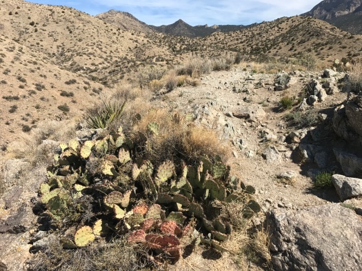
Trails hiked: Birdhouse Ridge-Tunnel Canyon loop, plus a little bit of West Ridge
Hike length: 6.4 miles
Difficulty: moderate
Trail traffic: moderate
Wildlife spotted: many kinds of butterflies, vulture, crow, lizard

The stories of what I've seen and experienced exploring New Mexico on foot.

Trails hiked: Birdhouse Ridge-Tunnel Canyon loop, plus a little bit of West Ridge
Hike length: 6.4 miles
Difficulty: moderate
Trail traffic: moderate
Wildlife spotted: many kinds of butterflies, vulture, crow, lizard

I wasn’t sure where to begin today.
Like all of Albuquerque, I was grieving the loss of a beloved woman, a mother, wife, businesswoman and community service leader, in an unspeakable accident. With my colleagues, I’d written an obituary and created a tribute to her this week.
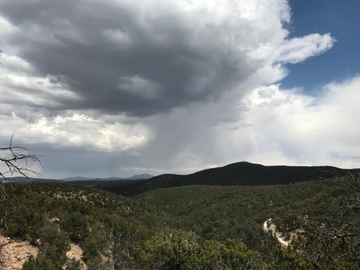
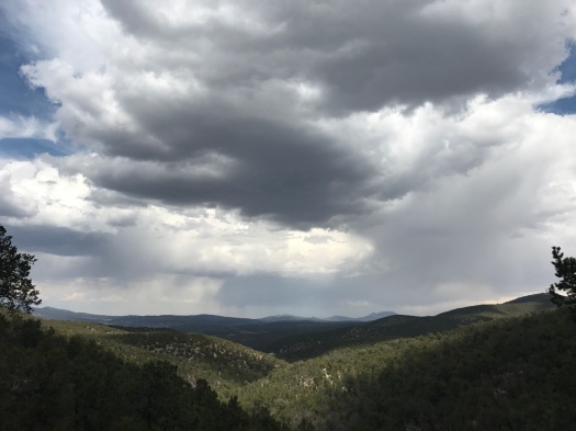
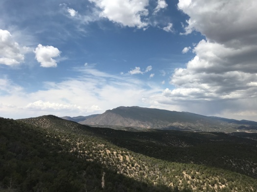
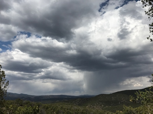
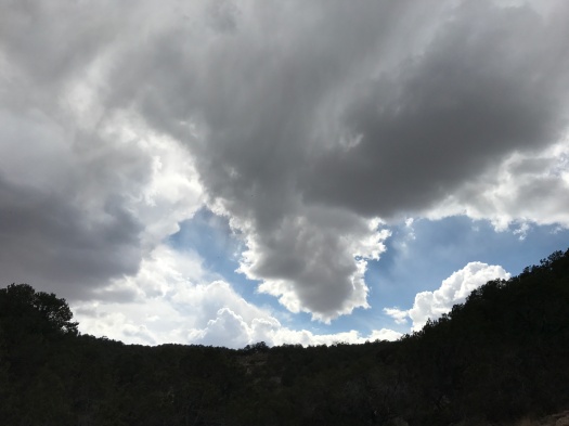
My spirits low, I dawdled getting to the trail. But when I got there, I could see that what this place had was good for me.
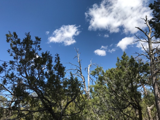
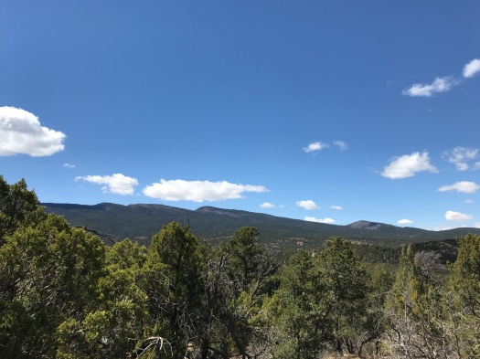
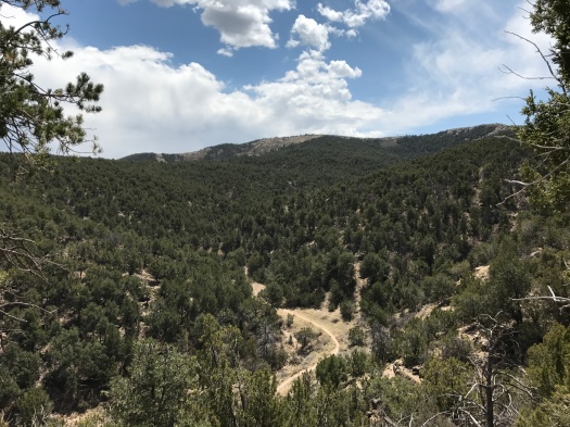
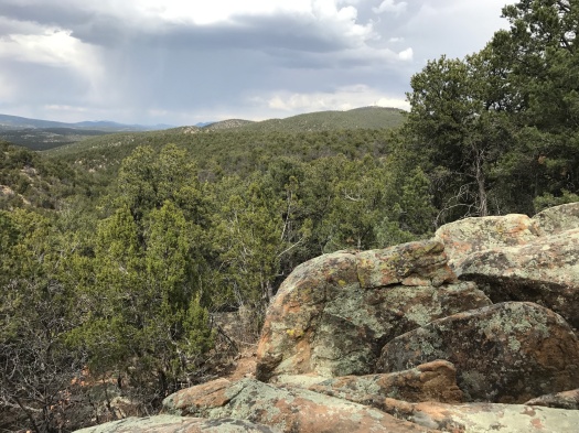
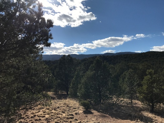
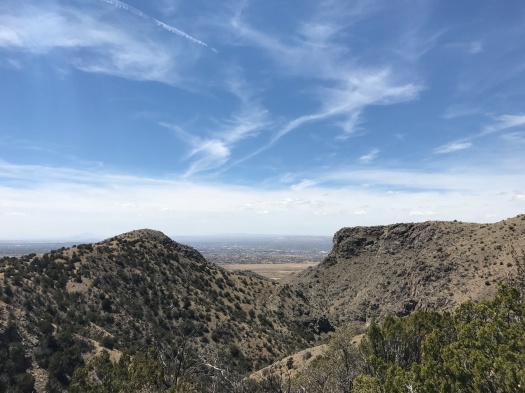
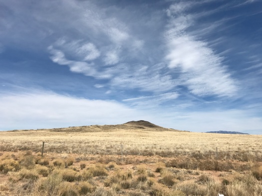
A fragrant green tangle of pinon and juniper. Blue sky and clouds sliding by. A gradual but steep climb to a rock shelf with a sweeping view of the deeply forested East Mountains and faraway Guadalupe and Mosca peaks.
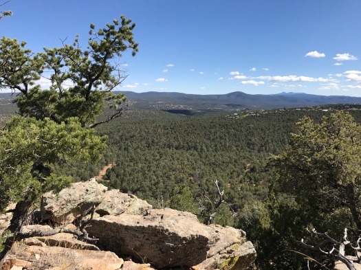
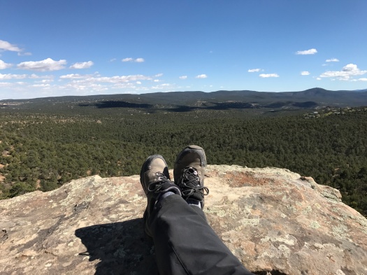
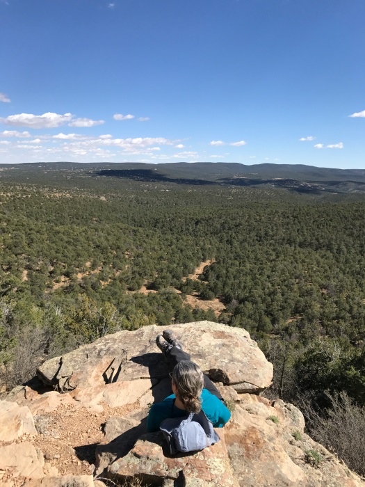
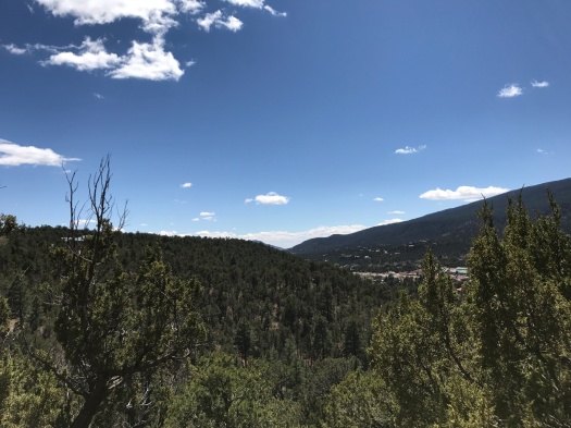
This place is the Milne/Gutierrez Canyon Open Space, accessed behind the Cedar Crest post office. It’s close enough to Highway 14 that you can hear some level of highway traffic throughout most of the space. But the higher you climb, the more that’s overtaken by bird song, the wind and the squeaking of branches. The trail network is well-marked and lightly traveled, especially on the upper trails. We found no map of the full trail network online or at the information board, but it was easy to choose your own adventure.
A little brewery sits right next to the open space entrance. And a barbecue joint is close enough that the smell of smoked meat tantalized us as the sun fell and we meandered along an arroyo. You could stop at either or both to cap off an afternoon spent wandering high above the valley.
Or you could just head back to reality, feet aching, fortified with sunlight and gratitude.
Hike length: 6.8 miles
Trail traffic: light
Difficulty: moderate
Wildlife spotted: jays, caterpillar, beetles, rabbit, hawk, lizard

Getting down that is going to suck.
I’d just scrambled up one level on the side of a cliff with the assistance of my husband and some rocks. I’d scrambled up worse, but never with such a steep dropoff on one side. I knew I could get back down it, but I also knew doing so would trigger my fear of heights.
Once I was up, looking down wasn’t easy, but it was productive.
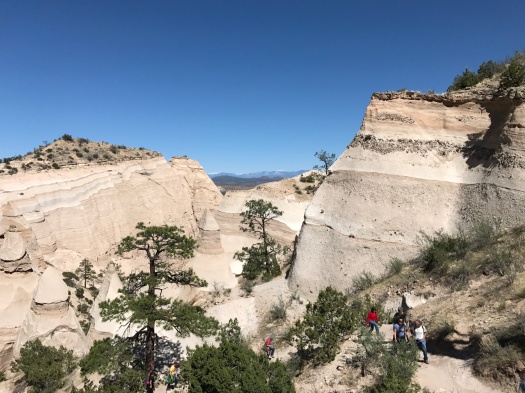
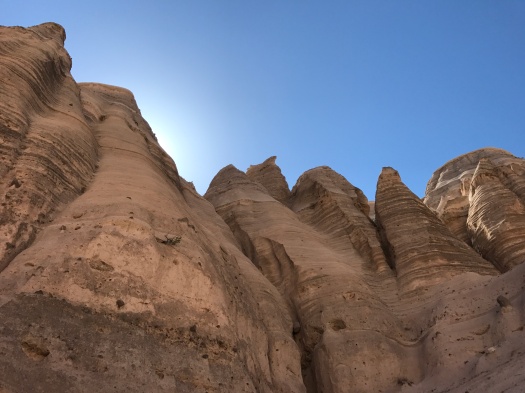
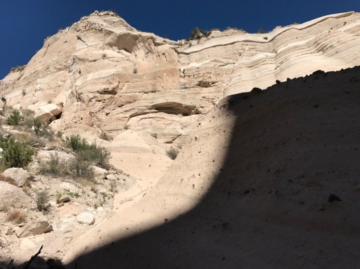
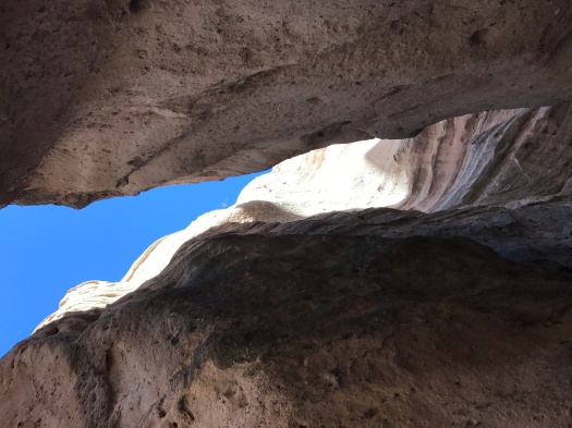
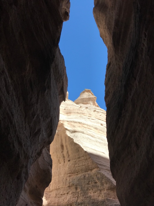
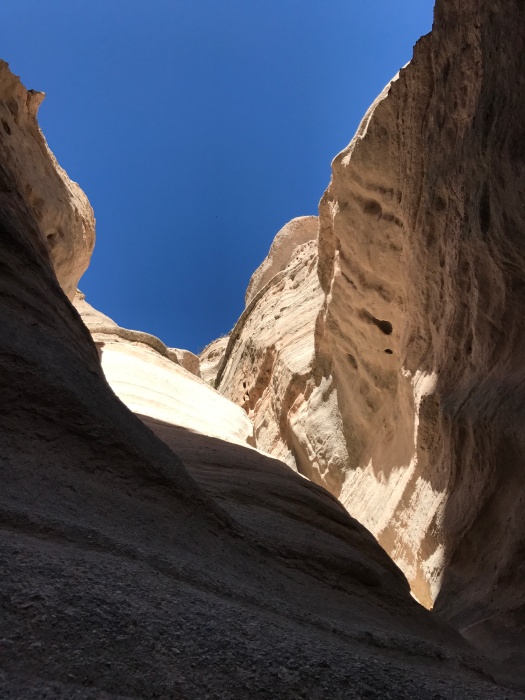
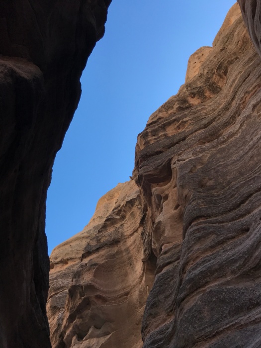
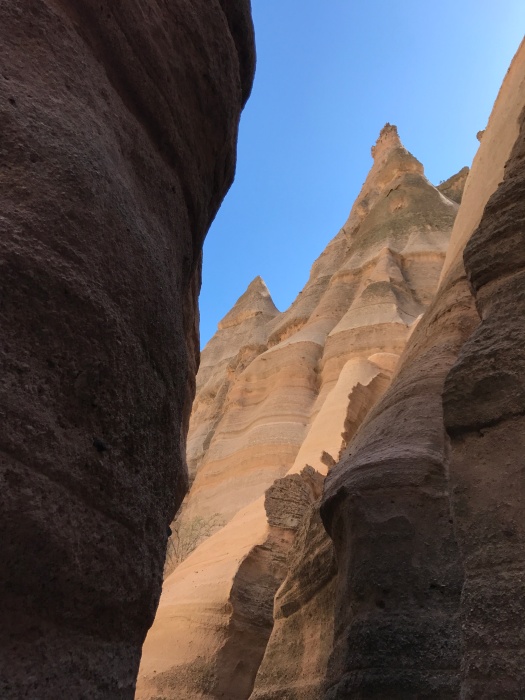
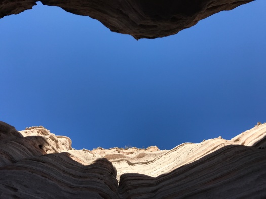
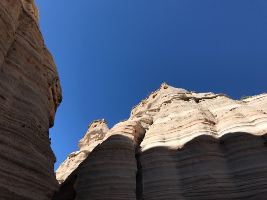
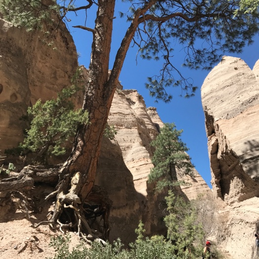
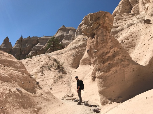
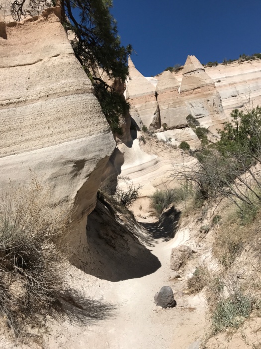
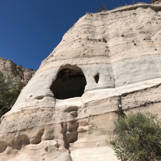
I was staring down at 90-foot-tall hoodoos sprinkled with ponderosa pines. We’d traveled through a 1,000-foot-long slot canyon before we began the climb.
My legs were rubbery, but as the trail switchbacked further up, the snowcapped Sangre de Cristo Mountains came into view behind the hoodoo field.
And at the top, I could see into the Jemez Mountains, the Dome Wilderness, Tetilla Peak and back to the Sandias, too.
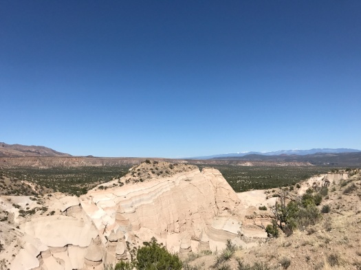
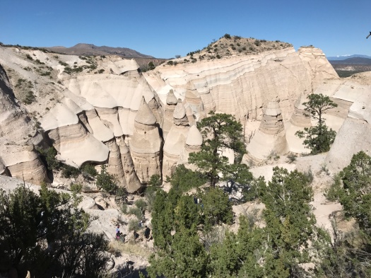
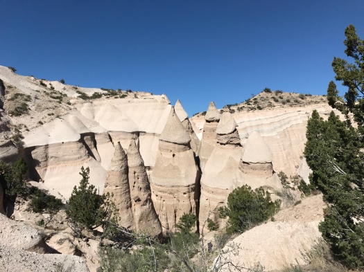
I was standing at the highest point of Tent Rocks National Monument (Kasha-Katuwe in the Keresan language, and a place of great significance to the people of Cochiti Pueblo). We have a six-million-year-old volcanic eruption in the Jemez to thank for the existence of the hoodoos, formed of soft volcanic tuff that’s eroded over millennia.
On a clear and brilliant blue day, Tent Rocks also provided a spectacle we rarely see while hiking in New Mexico: crowds. It’s one of the most-photographed destinations in the state, and over 130,000 people visit every year. On summer days, you might have to wait up to 90 minutes until a parking space opens up. We had no wait to get in, but at one point, we waited as a group of seven people squeezed through a particularly tight spot in the slot canyon one at a time.
Given how popular this hike is with tourists, I was surprised by how challenging it is in spots. The slot canyon and the path through the hoodoos rise gradually, but the trail up the cliff rises 200 feet in 0.3 mile.
Oh yeah, scrambling down that cliff. I tried to back down; I thought it would be physically easier, but I could not make myself do it. We regrouped and let some less acrophobic people by. When I saw one go down facing forward, I did the same, finding enough footholds and handholds to land solidly.
From there, a passage back down and through the slot canyon, all cool rock, light, shadow and sky.


Hike length: 4 miles (including the Cave Loop)
Difficulty: moderate
Trail traffic: busy
Wildlife spotted: bluejay, white-throated swift, crow, bald eagle?!? (sitting on a power line above the Rio Grande just outside the monument boundary)
Thanks: I’m grateful to the people of Cochiti Pueblo for allowing the public to use its land to access this amazing place.
Want more hoodoos? I got more hoodoos.
*Note: The Veterans’ Memorial Overlook loop, which we’d also hoped to hike today, is closed until Tent Rocks can hire another ranger to patrol it. There were only two working the busy park today.

“GAAAAAAAAHHHHHHH!”
Lift foot a little higher up the 50-degree slope. Brace pole. Push body up trail, husband assisting by pulling my arm upward.
Pant.
Make that noise again.
Repeat.
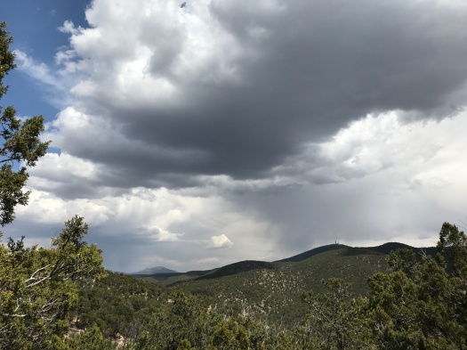
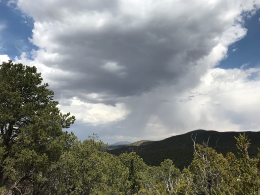
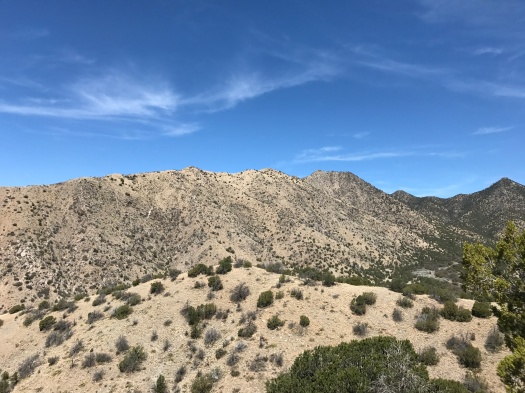
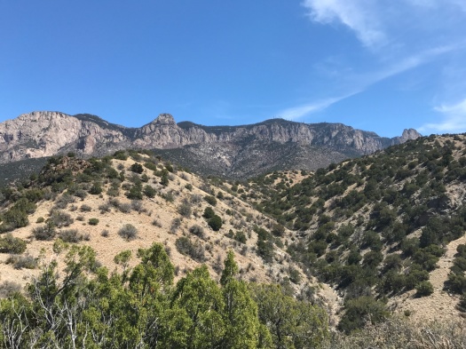
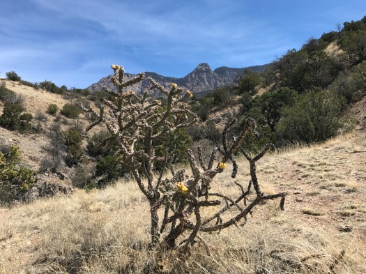
We’re on a side path of the Boundary Loop Trail in the Sandia foothills.
I use the term “path” in the loosest sense. There is one. But it’s insanely steep, and twisty, and rocky, and fades out a lot. Like a game path, better suited to light-footed deer than humans.
When we’d reached the far point of the loop we were familiar with, splinter trails branched off all around us, rising up to steep ridges and down into steeper canyons. I couldn’t resist exploring them, but I knew it would be hard.
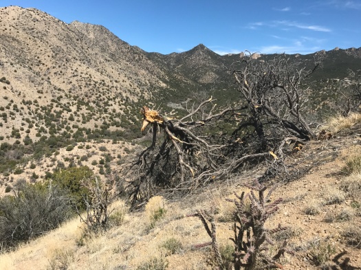
Even amid all the grunting, our rugged route provided stupendous views of the Sandias’ Shield, Prow and Needle and Juan Tabo Canyon. A notch in the canyon wall, from our steep angle on the trail, yielded a perfect view of Mount Taylor.
A few houses nestled low in the canyon.
“If I lived here,” my husband said, “I’d climb up to the top of that canyon wall every day.”
“No you wouldn’t,” I said. “That’s gotta be pueblo land.”
As we staggered down into the canyon, the pueblo fence came into view, stretching up toward the notch in the wall. I savored being right; it doesn’t happen often on the trail, since my husband’s been hiking New Mexico mountains and arroyos for decades longer than I have.
But being right didn’t make my legs any less shaky. It was 80 degrees, this hike had precious little shade, and the energy I’d expended climbing and descending repeatedly had heated me up further. I couldn’t wait for the moment when I’d get into the car and blast the air conditioner.
Luckily, we found a gentle, rolling path back to the trailhead that we’d missed our first time out here.
The car felt like heaven. As we drove away, all the things I’d experienced before the taxing climb came back to me: the cool breeze, the black and white and yellow butterflies darting around, the jay that flapped by squawking, the red-tailed hawk gliding high above a ridge.
The moments when I’d longed for the hike to be over swapped places with the beauty of it in my memory, and the wish that it was still happening.
I remembered the words of a yoga teacher, when we were all pretzeled into a thigh-burning, off-center shape: “What happens for you when things get challenging?”
And another yoga teacher: “If you practice struggle, struggle is what you’ll learn.”
What would a really rugged trail be like with just burning legs and lungs and feet scrabbling on rocks, minus the struggle?
I don’t think I know yet.
But I’d really like to.
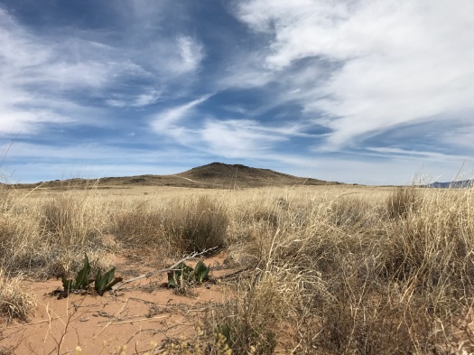
Hike length: 5 miles
Difficulty: moderate, strenuous beyond the end of the loop
Wildlife spotted: butterflies, caterpillar, Say’s phoebe, bluejay, red-tailed hawk, chipmunks
Trail traffic: moderate

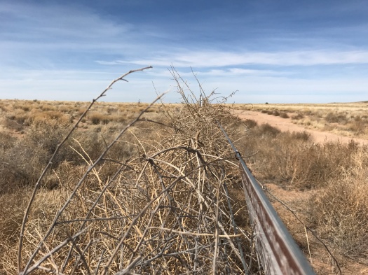
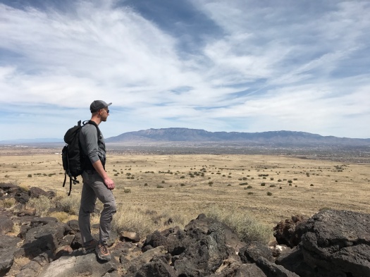
Everything is the sun.
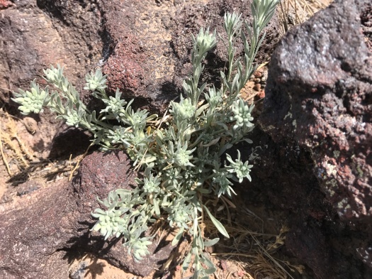
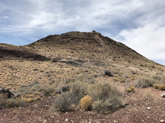
The sweet soaking rain that bathed the city last week must have stopped at the West Mesa escarpment. The prevailing colors are buff (the grasses), blue (the sky) and black (the hole-riddled chunks of basalt.)
Rocky paths circle the flanks of the volcanoes, climb to ridges. Calves burn. Feet seek stable purchase on the ever-changing terrain.
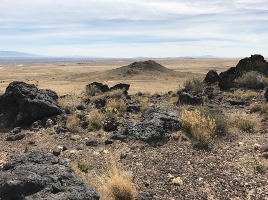
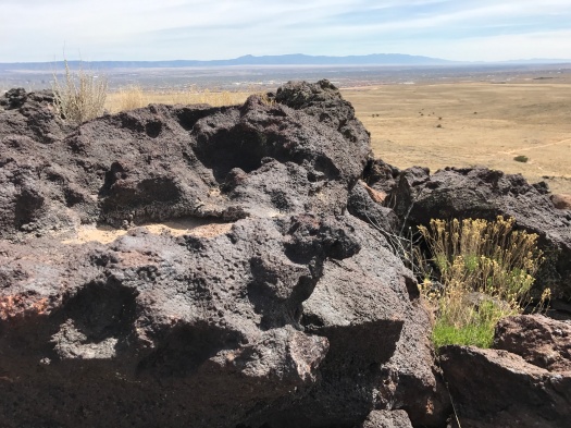
Red, gray and white pebbles surround an old quarry. I pull the brim of my hat to its rarely-used lowest setting.
The west wind blows, the only coolness to be found here. A crow rolls along buoyantly on it, cawing. We look down at small planes that lift off the runway at Double Eagle Airport and climb into the cloud bank.
A lizard’s yellow-and-white chevron stripes flash through the dry grass. He stops, does a few pushups, repeats and disappears under a bush.
A shade shelter we passed earlier looms before us on the return. All I can think about is how good it will feel to rest beneath it. But when we get there, the benches are baking in full sun. We keep walking and find another shelter, this one in actual shade.
It’s cool under the portal, staring out at one of the cinder cones.
I think of walking along the tumbleweed-lined jeep road now that I’ve had a chance to cool down.
But when we emerge again into the sunlight, it’s clear the trail will end just as we’ve received the maximum amount of sun possible before it becomes too much.
P.S. It was partly cloudy today.
Hike length: 4 miles
Difficulty: moderate
Trail traffic: low to moderate
Wildlife spotted: crow, lizard, grasshoppers, dark-eyed juncos