The clearing that gave me another view on the Manzanitas

DSC00440

Sometimes you find the spot, sometimes you don’t.

I wasn’t sure it was a clearing. It looked like one, but so often something does, through the trees, and isn’t.

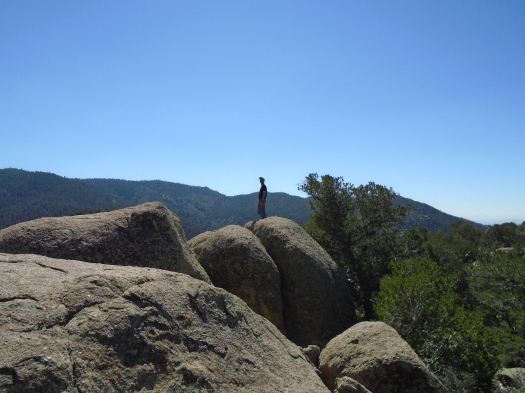
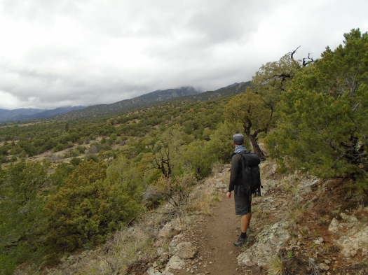
Before I realized it, my husband had scrambled off-trail to check it out.

“I think you’ll like it up here,” he said from above.

He was right.

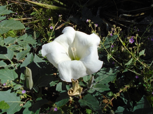
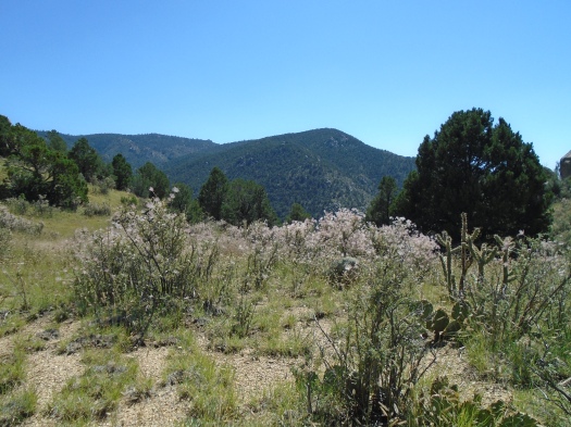
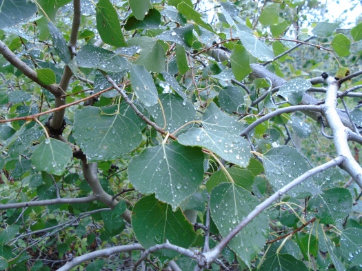
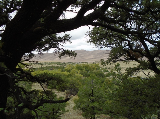
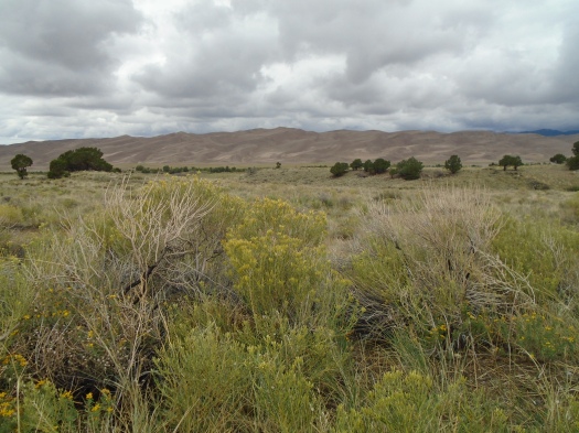
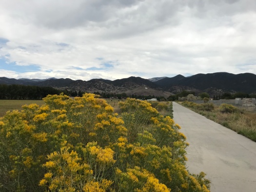
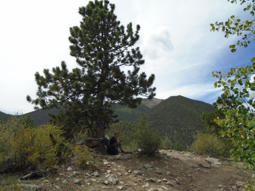
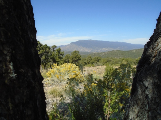
The first thing I saw when I emerged from the trees was a single aspen sapling, brilliant green and yellow, leaves tossing in the breeze.

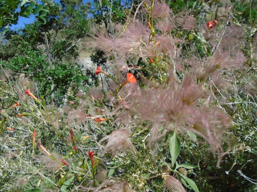
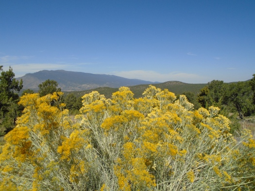
Next, a waist-high chamisa bush glowing yellow, butterflies and bees gamboling around it.

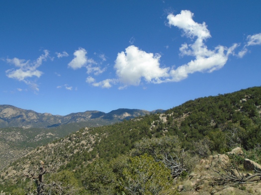
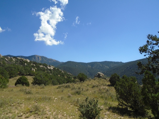
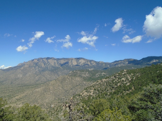
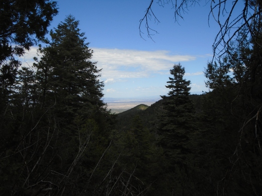
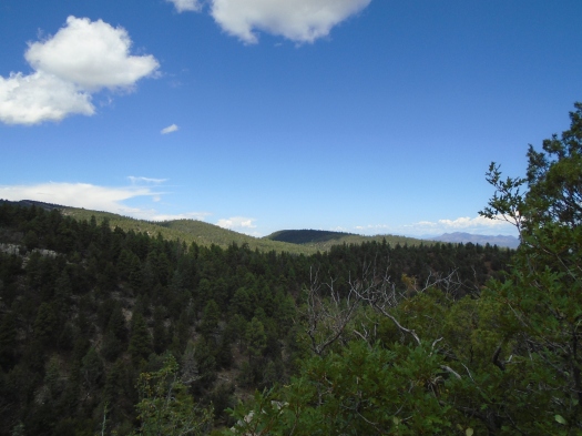
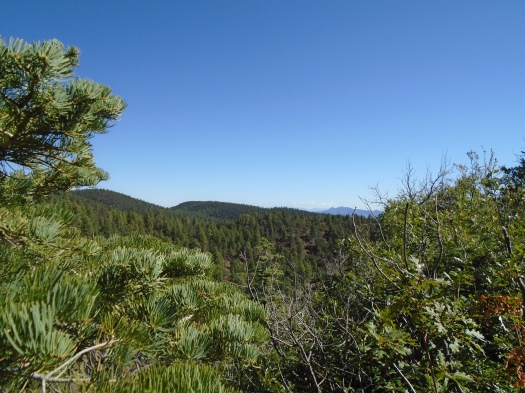
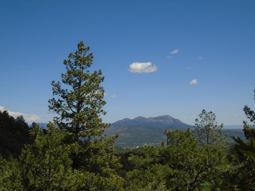
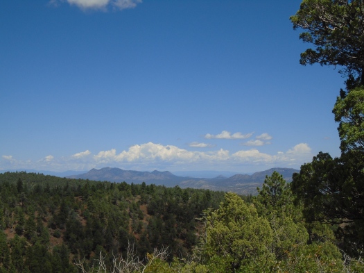
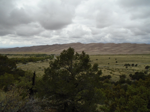
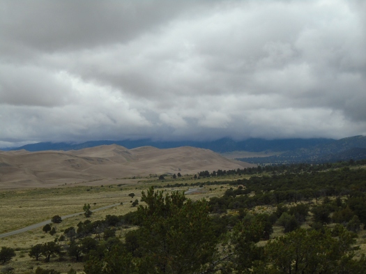
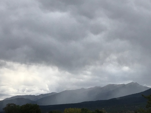
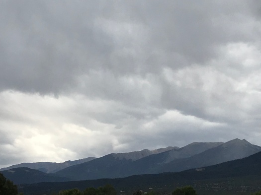
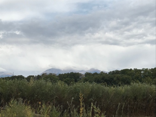
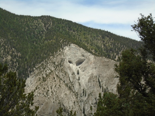
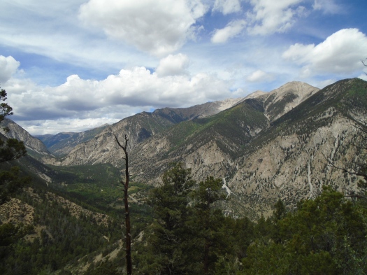
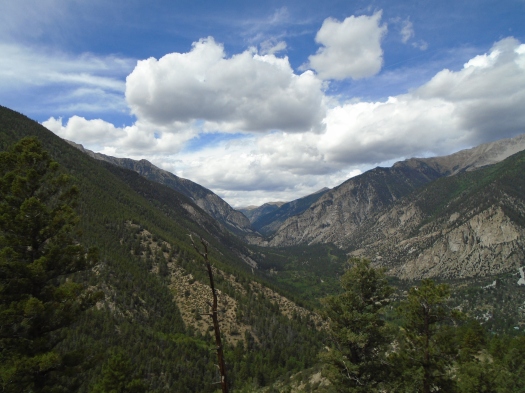
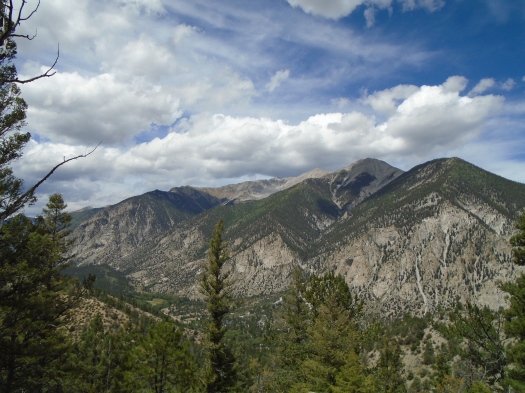
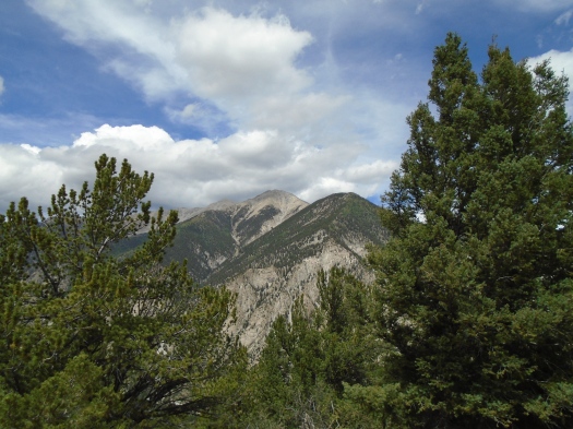
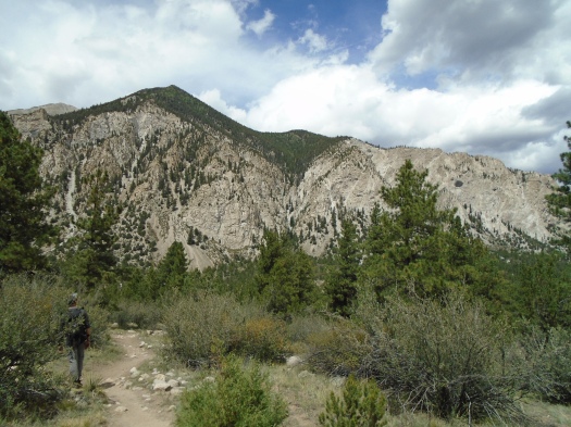
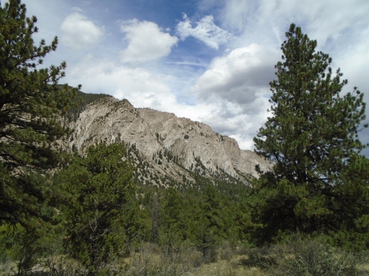
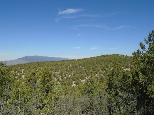
Then I turned around. The east side of the Sandias loomed blocklike in front of me, the ridges we’d just traversed rolling away before them.

DSC00442

DSC00437

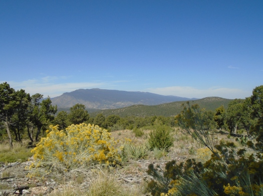
If you can find a high enough ridge in the Manzanita Mountains, you’ll see that view. But it’s rare to see as much of it as we did in that clearing, one of the most open and angled spots we’ve found in the range.


Before we reached that spot, we solved a mystery.

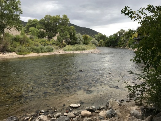
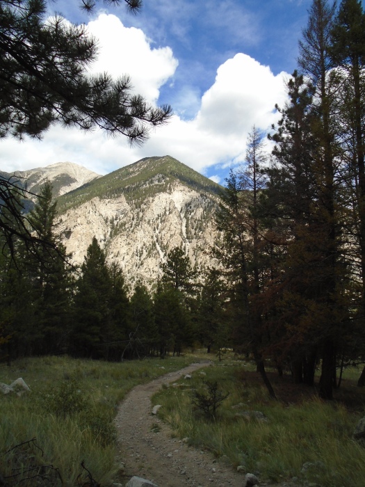
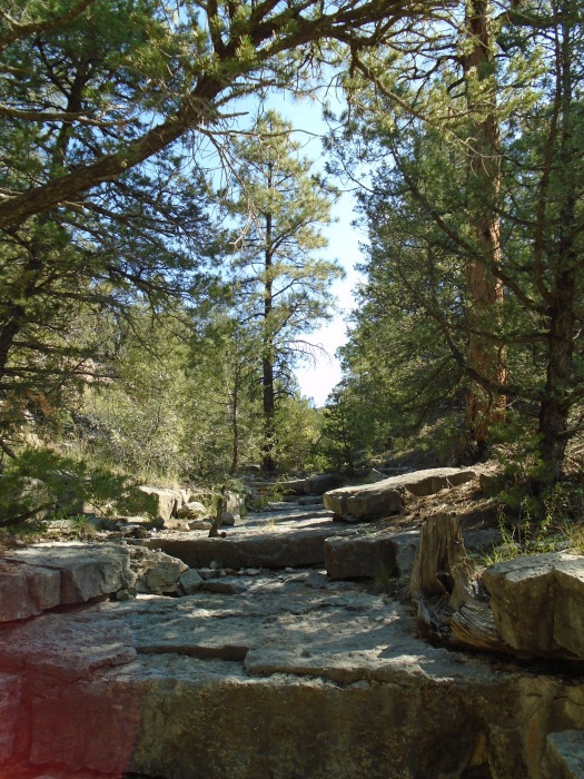
We’d started in the rock garden and mountain-bike haunt of Otero Canyon.

DSC00422

DSC00423

As before, we hit Department of Defense signs less than two miles in, warning us not to go any further.

This befuddled us, since the Forest Service labels that trail as nearly four miles in length. Then I realized the Forest Service mileage must reflect taking the trail out and back, though it isn’t marked that way.

There was only one thing to do: proceed up the trail called “Gnasty with a G.” It was the first time we’ve experienced this trail’s full steep and rugged length, and it lived up to its name.

A left turn on a sunbaked ridgetop put us on a loop back to our car via the Blue Ribbon Trail. The Blue Ribbon Trail is clearly one of the less-traveled in the Manzanitas; the frequent cyclist traffic stopped.

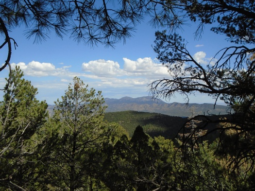
That’s where we found the clearing that gave us a new view on the Manzanitas.

DSC00433

Hike length: 6 miles

Difficulty: moderate

Trail traffic: moderate, none on Blue Ribbon Trail

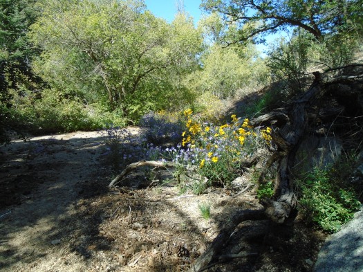
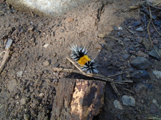
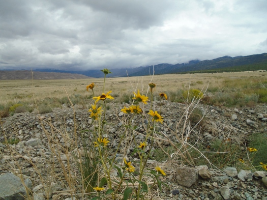
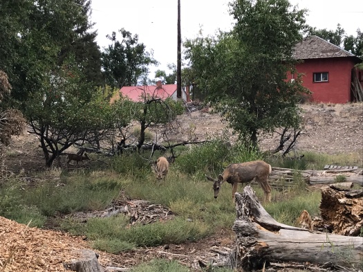
Wildlife spotted: hawk, crows, butterflies, dragonflies, jays, lizards

Embudito Canyon: Judgment Day

DSC00413

“SHE doesn’t have any kids!” the child across the parking lot exclaims.

Et tu, kiddo?

I’m judged daily by adults for my choice not to have kids, but this is the first time I’ve heard it from a 4-year-old.

“Maybe she has kids,” the child’s dad says. “Maybe they’re just not here.”

Um, I CAN HEAR YOU.

How would you feel, single dad, if I hollered “Maybe HE has a (husband/wife), THEY’RE just not HERE.”

We step onto Embudito Trail behind the family. The 4-year-old immediately begins yanking datura flowers off their vines.

I see teaching your children Leave No Trace ethics isn’t part of your repertoire, Pops.

DSC00394
Datura (before the kid got there)

We quickly pass the family as an illegal drone buzzes overhead. I can’t wait to leave the voices behind.

Of course I know the kid and the dad were just blurting out the first observations that came to mind, nothing more than that.

But the last place I want to hear a comment about my reproductive choices is on the trail.

That’s why I’m here. If I can go far enough up, or out, all the voices offering unsolicited comments about my being fall away.


Embudito Canyon begins wide and sunbaked, green ridges rising steeply away on either side, blue sky pulsing above.

Wildflowers riot: sunflowers, aster, Apache plume. All fed by Oso Spring, a trickle we cross over and over as we ascend the canyon’s throat.

DSC00400DSC00397

DSC00391
Apache plume+ trumpet vine (?)

Layers of limestone mount under our feet, pushing us up to the next ledge, the next sand landing. Lots of spots require some upper-body work or a lift from above. It’s a difficult hike.

As the canyon narrows, cool stone and vines surround us. Evergreens begin to appear. Boulders become more frequent.

We ascend a very long arroyo through thick pines. After what seems like forever, we spot endless blue sky through the branches ahead. A ridge.

As we eat lunch, two giant hawks cross overhead, keeping close to each other. The trail leads us higher on the ridge, opening up views of the Sandia Crest, where the aspens are beginning to turn yellow. We glimpse a perfect view of White Mesa across the Rio Grande Valley.

Enormous boulders abound. We detour off-trail for some bouldering. My husband’s more comfortable with that than I am, but I make it two-thirds of the way to the top of one boulder cluster.

DSC00406

When we rejoin the trail, we realize it’s heading down. We surmise that we accidentally left the trail when we climbed that arroyo, and rejoined it heading back the way we came, but on a side path, one of the many that crisscross the canyon walls.

Though we’re below 8,000 feet, it looks almost subalpine up here; high meadows of wildflowers surrounded by mountains, more boulder thickets.


DSC00421DSC00420

DSC00415

I’m enjoying the views when I notice that the tree cover has ended, the cacti have multiplied and the grade of the trail has tilted.

Rather than rejoining the canyon, we’ve ended up on a path that will take us down those steep, sunbaked ridges we saw from the canyon’s mouth.

It’s a long trip. The sun’s relentless. I stumble constantly. I fall several times. Once, when I get back up, I realize every careful step is causing me pain.

I have a cactus needle embedded in the back of my thigh.

I try to pull it out through the fabric of my pants. Not happening.

Looking around to make sure the coast is clear, I lower my pants just enough to reach for the needle. Still not happening.

As we carefully balance on the steep slope, me half-pantless, my husband pulls the needle, plus five more, out of my leg.

And there wasn’t a soul around to judge us.

Hike length: 6 miles

Difficulty: difficult

Trail traffic: moderate (light above midcanyon)

Wildlife spotted: lizards, butterflies, hawks, blue jays, Bewick’s wren, canyon wren, black-chinned hummingbird


The North Faulty Trail cairn fairy takes us on an unexpected detour

DSC00375

“There’s probably a witch at the end of this,” my husband said. “And she’s going to eat us.”

A maze of cairns had caught our eye and led us further into the forest, away from North Faulty Trail. We’d gone at least a quarter mile, following cairns placed every 50 feet or so. Spotting the cairns in the rocky terrain became a game. Someone had put a whole lot of effort into setting them up.

The cairns took us to an overlook with a good view of the San Pedro Mountains, where we sat on a boulder and plotted our next move.

DSC00379

The cairns continued. Another overlook? (I really wanted one.) A boiling cauldron? (Not so much.) We followed them a little longer, but grew worried that if we went any further, we’d end up lost, so we retraced our cairned steps back to the trail.

The little rock piles weren’t the only surprise on North Faulty. Yep, I said North Faulty, not Faulty, or Upper Faulty, or even Lower Faulty. North Faulty is an unofficial route that sine-waves along the 8,000-foot contour line north from the Sandia Crest Highway. It’s one of those ridgeline routes that constantly teases you with glimpses of mountains and valleys, then whisks you back into the forest.

DSC00370
It’s a three-mountain-range situation

DSC00364

Along with the cairns, we found three huge brown-and-white hawk feathers along the path, one stuck in a tree stump.

I wonder how many more surprises await those who go all the way to Palomas Peak, a good 10 miles roundtrip from the North Faulty trailhead.

DSC00381

Hike length: 5.5 miles

Difficulty: moderate

Trail traffic: light

Wildlife spotted/heard: horny toads, lizards, jays, butterflies, swift, gray catbird

Hot on the trail of two special springs in the Sandias

DSC00357

I was excited. I had realized that by hiking south on the Faulty Trail from the Sandia Crest Highway, I had a shot at seeing two springs.

Both were much-touted springs that I’d passed on separate hikes in the area, but couldn’t access, because they were closed for rehabilitation.

That was two years ago. It’s been monsooning. I thought I had a good shot.

It had rained on the trail overnight. Mud and wet pine permeated our nostrils.

At the junction of Armijo and Faulty Trails, a dogleg of Armijo once led to Torro Spring. Now, Armijo dead-ends at Faulty. A tiny spur trail leads to a”medallion tree,” which displays a medallion allegedly noting the age of the tree, but branches block any travel beyond it.

DSC00340

DSC00341

We persevered on Faulty. I’d forgotten our Sandias topo map, and we wandered around on an unmarked trail with a fallen sign nearby, thinking it might be Canoncito Trail, home of Canoncito Spring. Though the trail had great views of the San Pedro Mountains, it was springless. We retraced our steps and pressed south.

Canoncito! The maps had shown a flowing travertine spring just east of the trail’s junction with Faulty. We hiked down to a beautiful canyon lush with wildflowers. It looked just like a canyon fed by a flowing spring would look. But…nada.

Through this stretch Faulty Trail rises and descends through canyon after canyon. Many look like spring territory. But none are – at least not today, that I could see.

There’s no shortage of scenery, from an outstanding overlook of Cienega Canyon to little  horny toads scuttling among the red rock and limestone.

DSC00330

DSC00323
Very hairy caterpillar

DSC00345

DSC00348

DSC00353

At the trailhead, Cienega Spring gurgled past the parking lot.

But if you know what happened to the other two springs, for goodness’ sake, please tell me.

Hike length: 6.5 miles

Difficulty: moderate

Trail traffic: light

Wildlife spotted/heard: Abert’s squirrel, caterpillar, butterflies, crested jay, nuthatch


One hour at Great Sand Dunes National Park

The smell: damp earth and rock, wet pinon and juniper.

Above, jagged stone, overlaid with green, swallowed in cloud.

Below, massive sand dunes, people and trees dotting them like ants.

We cross a tiny creek amid the aspens. It gurgles over rocks with the gusto of a much bigger body of water.

DSC00291

We’re in the trees instead of on the dunes because I thought it would be the only comfortable place in the park at noon. Noon summer temperatures on the surface of the dunes can hit 150 degrees.

But a morning frontal system that’s still hanging around has the air temperature at 55 degrees at midday.

On any other day, we’d see 13,000-foot peaks soaring above us.

But on any other day, we wouldn’t see fog, wouldn’t see the muted tan of the dunes meet blue stone and green trees as if through a filter.

DSC00282

DSC00281

DSC00279

DSC00277

DSC00294

DSC00298

DSC00303

The light on the huge field of flowers at the highway wouldn’t be as dramatic.

DSC00321DSC00319

The weather is always in control, but Colorado’s swings in temperature and precipitation really bring that home.

Show up. Prepare for temperatures somewhere between freezing and boiling, and any or all levels of precipitation.

Let nature do the rest.

Hike length: 1.5 miles

Difficulty: easy

Trail traffic: light

Wildlife spotted: three hawks and a rabbit on the highway into the park

A lazy, rainy, mountain-town Sunday hike

The day started with a bolt of lightning splitting the air above the mountains.

The view definitely heightened the drama of the Salida Safeway parking lot.

A soft rain began. It didn’t look like it was falling nearly as softly on the peaks around us, where we’d planned to spend another day.

Plan B. Setting out from our Airbnb, we headed for the riverwalk along the Arkansas River.

IMG_1536

We shared the day with families and kayakers, tubers and stand-up paddleboarders (those did take five while it rained, mostly), and happy dogs playing fetch in the river.

We passed restaurants, a park, an amphitheater where a band was setting up for later.

As we crossed under a bridge, the rain began in earnest.

It was the second time I’d felt rain on a desert hike in three weeks. I was grateful, for the land and for me: the rain washed away enough pollen that the death-rattle chest cough I’d had for a day subsided.

Like the last time I’d been rained on, I was grouchy, too. It was chilly and the wind was picking up. But we sought out the Monarch Spur Trail, leading away from downtown along an old railroad corridor. The trail snaked among lumberyards and condos, fields and parks.

Five mule deer noshed along the trail, a frequent sight in a town that’s teeming with deer.

IMG_1546

As we walked, curtains of rain fell, intensified, then parted on the peaks all around us.

IMG_1557

IMG_1561

The trail opened up to cows and fields. The rain stopped. At Loyal Duke’s Dog Park, we turned around.

IMG_1559


IMG_1562

The sun returned to town, and we soaked it up on the patio of a restaurant overlooking the water.

We stopped to sit on river rocks on the walk back. As we neared the house, it warmed up enough to ditch the hoodies.

IMG_1565

But the low, bruise-gray sky over S Mountain promised more action ahead for this lazy mountain-town Sunday.

Hike length: 4 miles

Difficulty: easiest

Trail traffic: moderate

Wildlife spotted: deer, magpies, bluebird, vultures, dragonflies

TIP: The riverwalk and the entire 2.5-mile length of the Monarch Spur Trail are paved, making it accessible to those in wheelchairs.

I’ve now seen two miles of the 468-mile Colorado Trail. They were two of the best I’ve hiked.

When your hike begins at a creek – a rolling, tumbling creek – you know you are in for something good.

DSC00250

Bonus: Chalk Creek, where segment 14 of the Colorado Trail begins, is larger than any body of water I’ve encountered on a New Mexico Trail, excepting the Gila River.

Chalk Creek tumbles cold and clear through a grove of aspens. A few were already beginning to turn, and as we climbed, small patches of yellow dotted the hillside.

Behind us, the Chalk Cliffs soared white.

DSC00208

When we reached the highest point of the hike, we could see caves in the cliffs – even a pair of caves that looked like a face.

DSC00217
It always feels like…somebody’s watching me…

The task at hand, though: a parade of switchbacks rising 1,000 feet in a mile and change. I was panting the whole time. Impressively, a woman from sea level arrived at the top just after we did.

The most dramatic view I’ve seen on a hike awaited us there, at 9,500 feet. The Collegiate Peaks towered above, green and gray, sloping into a deep crevasse below. One level down from those peaks, the Chalk Cliffs. Behind us, blue and green rolling back to the Arkansas River Valley.

DSC00211

DSC00232

DSC00244

DSC00229

DSC00230

DSC00226

We lingered there for nearly an hour, then navigated the steep way down.

DSC00245

DSC00249

We relaxed at the creek for another 45 minutes, dipping sweaty hands and feet into its cool, mossy flow.

DSC00256

With the robust creek and commanding views, this was easily one of the most spectacular hikes I’ve taken so far. It’s challenging (I respectfully disagree with the Mellow Mountain Hikes guidebook’s “easy” rating), but it’s doable and enjoyable for a visitor to the area.

We left as faraway thunder echoed down the creek. Storms drenched the peaks above us as we drove back to Salida.

Hike length: 4 miles

Difficulty: a solid moderate in my book

Trail traffic: light

Wildlife spotted: Abert’s squirrels and black Abert’s squirrels on the road, chipmunks, vulture, nuthatch, bluebirds, Stellar’s jay, mockingbird

TIP: Mount Princeton Hot Springs is just a few miles from this hike. We passed it up on a hot day at high elevation, but it would sure feel good to soak after tackling those switchbacks.