Ocean Beach and Lands’ End: Where San Francisco meets the ocean


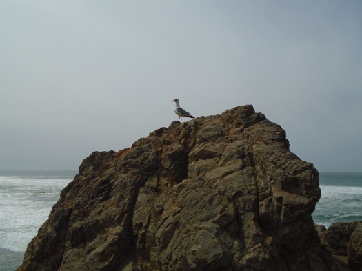
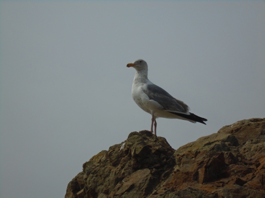
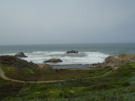
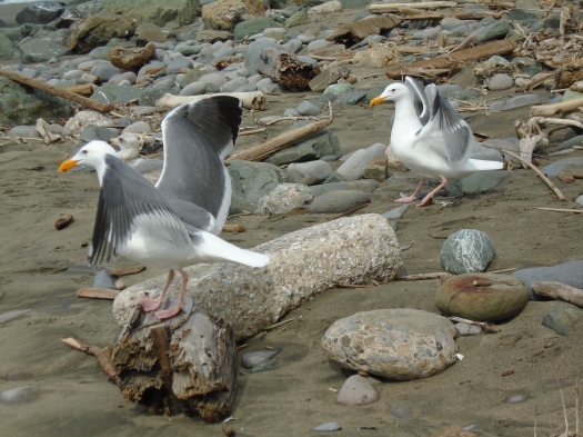
Waves crash over jagged cliffs. A gull perches on a rock, unfazed at my approach.

DSC01448

DSC01454

DSC01443

DSC01455

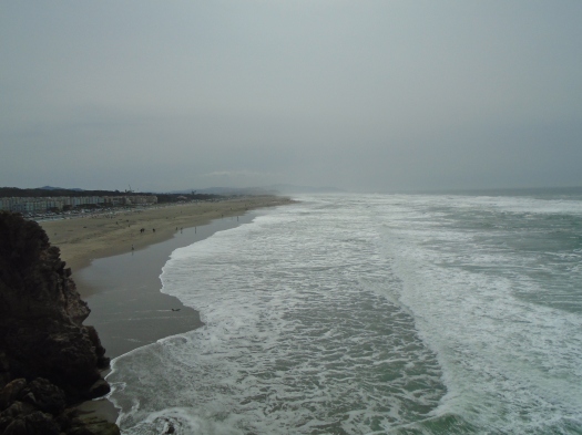
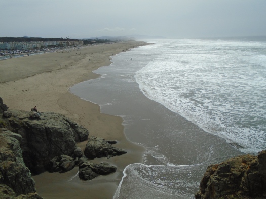
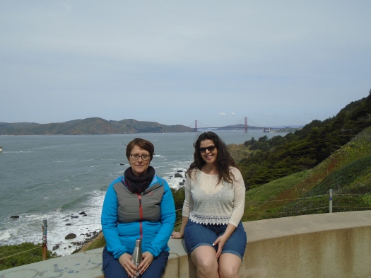
I’m at San Francisco’s Ocean Beach with two friends. Yesterday we spent 11 hours in a board meeting. We came together needing to put one foot in front of the other and repeat.

DSC01434

DSC01439

DSC01444

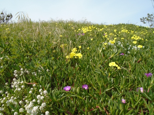
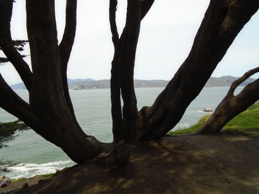
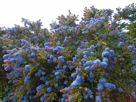
We leave the jagged shore at the Cliff House for the Lands’ End Coastal Trail. We enter green, gnarled cypress above, succulents and wildflowers sprouting from everything that isn’t rock. The sweet scent of abundant yellow sand verbena cuts the salt air’s bite.

DSC01430

DSC01460

DSC01461

This is part of Golden Gate National Recreation Area, and the trail’s busy. Each dog charms us more than the last: dachshunds, corgis, poodles, all wildly wiggly.

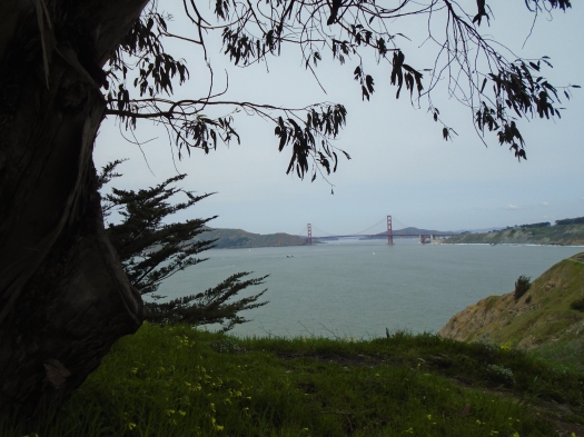
The bay peeks through the trees, then the mountains, then the Golden Gate Bridge.

DSC01466

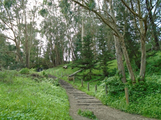
A long slope of wooden stairs burns hamstrings, thighs. We enter a eucalyptus grove, yellow and blue light filtering through the long leaves, and inhale deeply.

DSC01468

DSC01471

In front of us, a couple pulls their baby up the steps backwards in his stroller. He’s also wildly wiggly, his smile widening every time the stroller bounces.

The Coastal Trail ends, depositing us in a neighborhood of Mediterranean-style homes. They’re all lushly landscaped, but the ultimate landscaping comes from the surf pulsing against the cliffs that form their backyards.

DSC01508

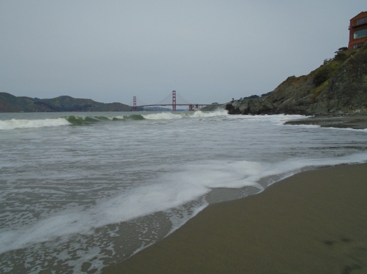
We pass the rickety lookout stands of China Beach. It’s a shabby shoreline, old firewood and detritus everywhere.

The dark sand turns nearly black where the tide washes it. Waves break tall and powerful off the beach, rip current warning signs everywhere. I put my hand in the cold foam the water leaves behind.

DSC01480

DSC01500

Most of this hike took place in a national monument. Sweaty runners on their afternoon break mingled with tourists speaking many languages. We saw jeans and sneakers, stockings and boots, couples with angular hair.

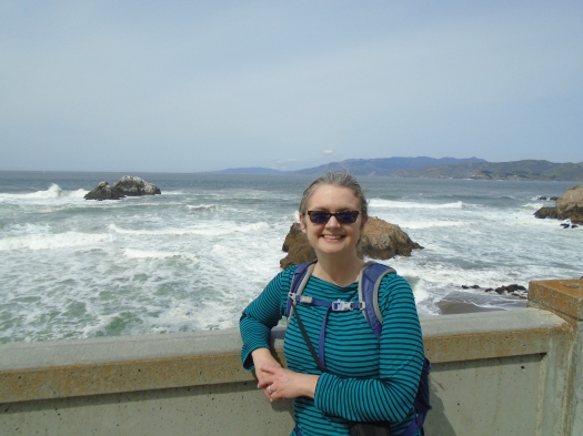
One of the women I was hiking with used to live in the Bay Area. She trained for marathons by running for miles on these beaches, then plunging her aching muscles into the cold water.

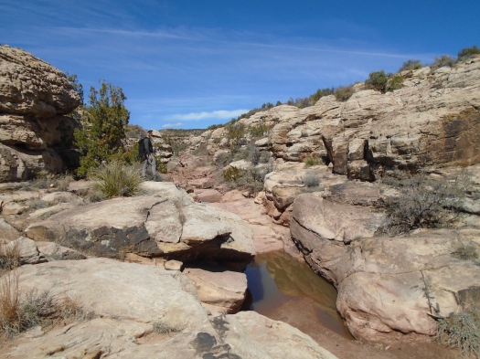
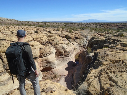
As a desert dweller who frequently sees no one on a hike, it was both strange and inviting to imagine this water-shaped landscape was your routine, its smells and sounds your everyday.

Hike length: 5 miles

Difficulty: easy

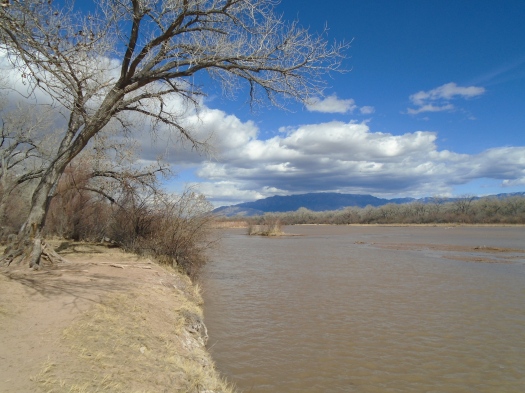
Wildlife spotted: crows, several kinds of gulls

Trail traffic: heavy

Sandstone and snowmelt at San Ysidro Trials Area

I place my feet carefully in the thin crescent of stone at the base of a narrow slot canyon.

The rock slopes down, deposits me on a landing. Red sediment ripples over the sandstone, shows the path water took down this canyon days ago. Everything around us curves.

DSC01414

DSC01417

Water still rests in the stone. Some of the pools stretch several feet across. We skirt some, step through others on rocks.

DSC01409

DSC01405

After half a mile, we reach a pool too wide to safely cross. We backtrack, covering the same ground in minutes that had taken us a half hour as we explored every detail.

DSC01404

DSC01400

DSC01393

DSC01386

We climb out of the canyon where we climbed in, a series of rock ledges guiding our way up.

DSC01380

On the rim above, the land is corrugated, tan rock oxidized, rust and brown and black. It perfectly suits what this place, the San Ysidro Trials Area, is primarily used for – motorcycle trials, bikes ripping turns and tricks on the rock. Yet we’ve never seen a bike here, except in the parking lot, and hardly any other hikers.

We gaze into the canyon’s womb far below. We see more and bigger pools. The storm that grazed the Jemez and Sierra Nacimiento mountains with fresh snow this week left its mark here too.

DSC01421

DSC01422

The floor of the canyon begins to rise, the rim to descend.

DSC01424

Where the rock ends, we follow a motorcycle path across red and purple dirt, occasionally marked with white, like chalk.

The meadow leads us to another wide swath of wavy rock, a few small pools dotting the sandstone. We look behind us at the Sandia Mountains. In Albuquerque they appear monolithic. From this angle, craggy and snow-covered, they look more like pictures of the Alps.

We found this strange and incredible loop hike in Stephen Ausherman’s “60 Hikes Within 60 Miles of Albuquerque.” This was our third try at it.

The first time, we accidentally did the whole thing backward and missed the slot canyon entirely, though we didn’t realize it. The wide swath of wavy rock itself is pretty rad, and we thought its little pools were the ones described in the book.

The second time, we went down the wrong wash entirely.

Today, we managed to find what we didn’t even know we’d been missing.

Hike length: 6.6 miles

Difficulty: moderate

Trail traffic: none

Wildlife spotted: lizards, blue and black moth

FOUND: One magical mystery slot canyon at Golden Open Space

This place showed me how many ways rock can be.

Wavy off-white shelves underfoot, a sloping funhouse floor.

DSC01376

Crumbly tan, stacked in blocks, weathered into small caves.

DSC01343

Swirled, like an ice cream cone, with dusty pink.

DSC01342

Tan and rust gnarled together, high into the sky.

DSC01373

DSC01366

Maroon-purple, sprinkled with white spots, making hollow sounds beneath my feet.

DSC01369

DSC01353

DSC01337

Branches and grass choked a bend in the canyon: a sign of the power that shaped this rock, and still does.

***

This canyon tempted us at the end of another arroyo hike here at Golden Open Space, a city-owned tangle of juniper hills and deep red drainages.

The day we spotted the magical mystery slot canyon, I was too worn out to explore it, but I knew we had to come back. We tried to find it another time, but failed.

This time I remembered the arroyo that led us there. The trail crossed it not long after dropping down from the juniper hills. The arroyo’s red dirt and pale blue stone guided us. In no time, it seemed, we were there.

The magical mystery canyon continued for more than half a mile, a feast for the eyes and the feet at every turn.

DSC01350

It ended at a junction with the big arroyo we’d wandered aimlessly on our last visit. From this end, the canyon had appeared so small, we never guessed it was the one. But today we identified landmarks at that junction that will help us find it from either direction.

Coming back through the canyon, we lay on a cool, sloping, sunwashed rock field. When the breeze blew down the canyon, it brought a chill. When the breeze stilled, it was completely quiet, warm as April. But the best feeling was when the sun warmed the canyon floor and the breeze moved just above us.

DSC01340

The spot where you leave the trail for the arroyo network is so subtle that we missed it on the way back, going half a mile past it before we realized our mistake.

Or maybe the rock garden was just too hard to leave.

Hike length: 7.3 miles

Difficulty: moderate

Trail traffic: none

Wildlife spotted: Western bluebird, bluejay, crows, butterflies

DSC01336

Gulls await at the bosque trail’s end

DSC01316

The trail deposited us at the Rio Grande’s edge, the channel to our south too wide to cross.

Gulls wheeled overhead, glints in the blue.

Gulls at 5,000 feet elevation in the high desert? Why not?

They’d come a lot further than we had to be here.

DSC01313

DSC01312

DSC01314
Robust ducks

We’d planned to hike on a mesa west of town. But when we got up there, high and exposed, I could barely open the car door against the fierce west wind.

Back down into the valley we went, into the bosque. The cottonwoods stood brown and gray and naked, but they provided some shelter from the wind. A few last dead leaves trickled to the ground.

We wandered two miles south of the Montano bridge on the river’s west bank. Trails  braided toward, then away from the river. An enormous flood control spillway stood empty and sunbaked, begging for skateboarders.

DSC01325
Alternate entrance/exit from the spillway.

Not far beyond it came the dead end at the river.

DSC01317

On our return, we walked out onto the Montano bridge. The river’s surface rippled in the wind. Miles away, clouds dripped a light rain onto the northern half of the Sandias.

May that riverbed fill, and fill, and fill.

Hike length: 4.6 miles

Difficulty: easy

Wildlife spotted: ducks, geese, ring-billed gulls, sparrows, sharp-shinned hawk

Trail traffic: moderate