Tunnel Spring will show you some of the Sandias’ most beautiful terrain – if you can get there

What this route lacks: a place to step off the trail and cry.

A single flat boulder about three-quarters of the way up could serve that purpose. By then, you can practically see the top of the trail, though you might cry over how far away it still is.

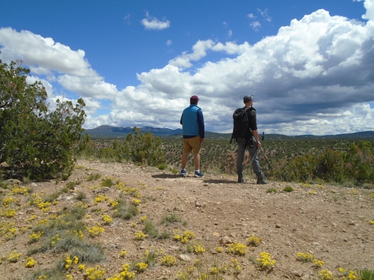
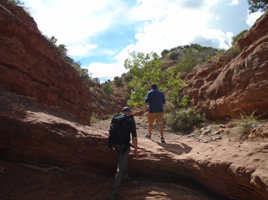
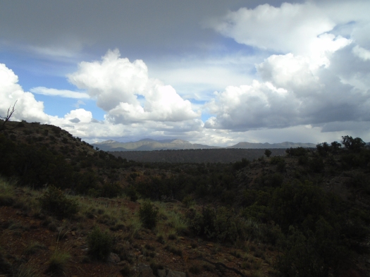
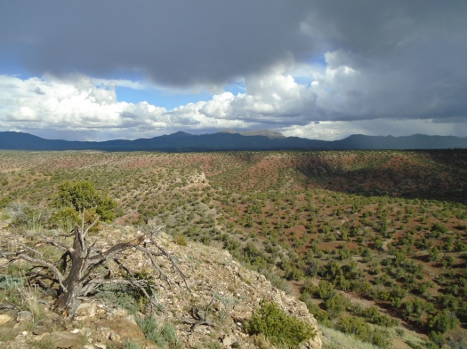
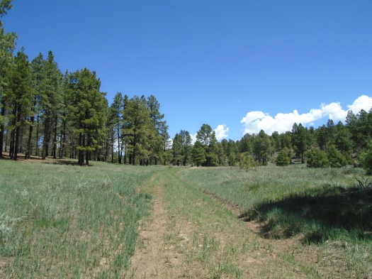
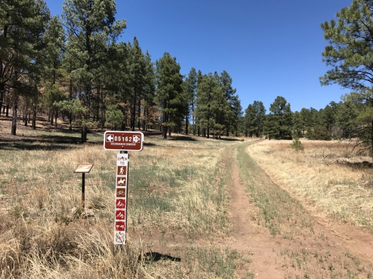
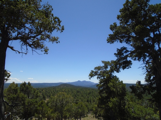
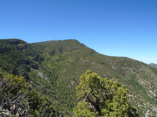
We’re on the Ojo del Orno Route in Placitas. This shortcut accesses a gorgeous ridgeline by bypassing the first 2.6 miles of the Sandia Crest Trail’s northern section.

Remember, though, Mama told you: there are no shortcuts.

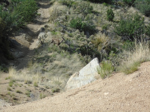
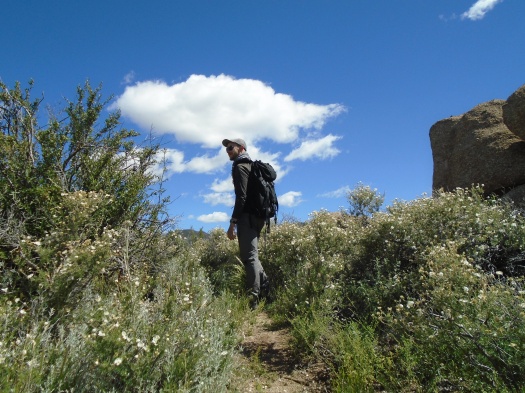
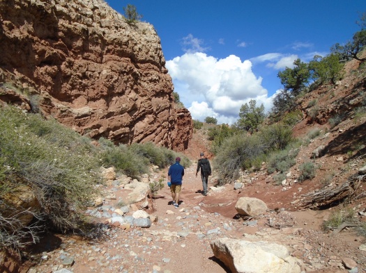
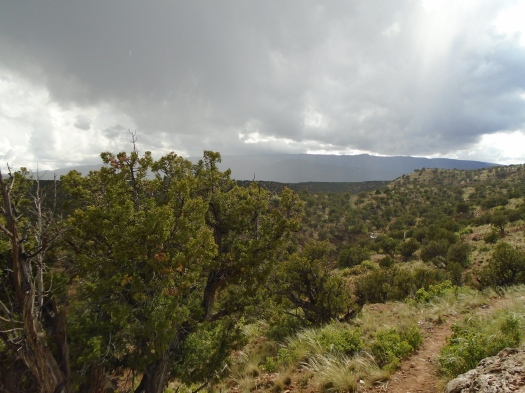
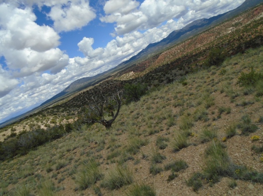
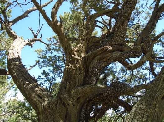
This trail maintains what feels like a 50-degree angle for its entire mile. It seems to switchback every few feet, instead of every few hundred feet. Its rocky surface means you often slip backward (ie down) when you brace to take the next giant step up. It’s hard to remove your eyes from your feet.

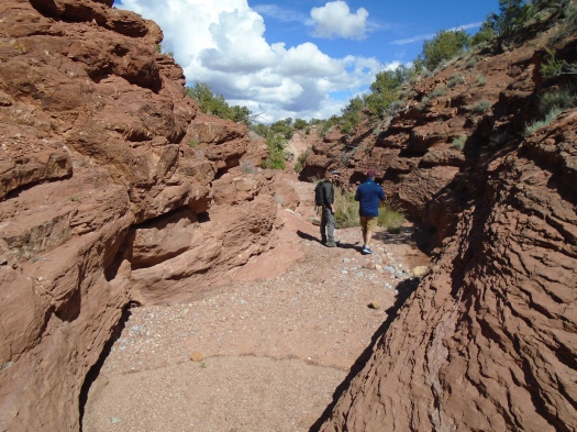
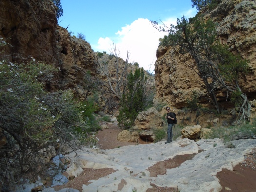
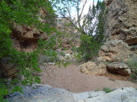
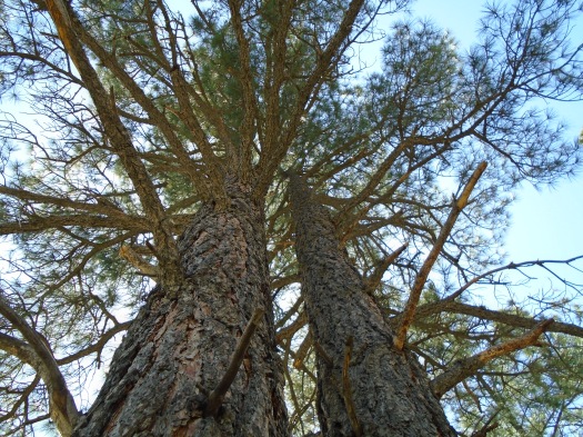
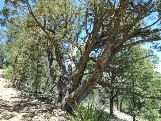
But when I managed to do so today, I saw shoulder-high wild rose. I saw deciduous trees glow in the sun. I saw enormous bulges of rock rise above us and, when I could look down, an amazing amount of canyon accumulate below us. Near the top of the arroyo, trees with sweet-smelling white blossoms lined the path.

DSC01827

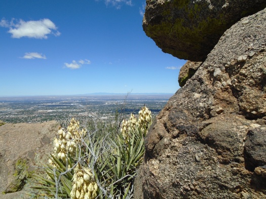
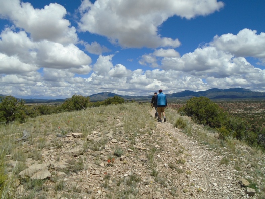
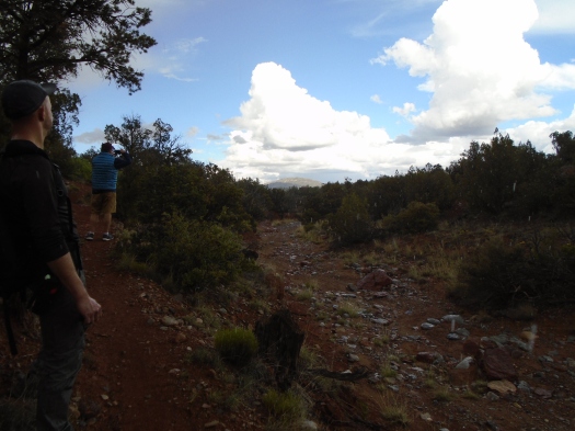
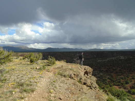
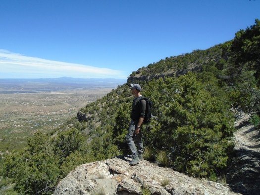
At last the ridgeline. A little further, a rock wall that overlooks Santa Ana Pueblo’s green-topped mesas.

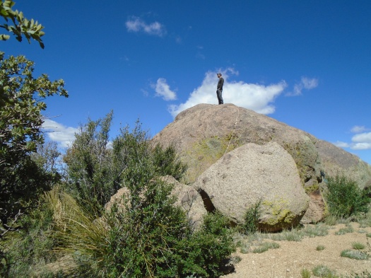
My husband stretched out on the rock wall in the sun. Twenty minutes later, he showed no signs of leaving.

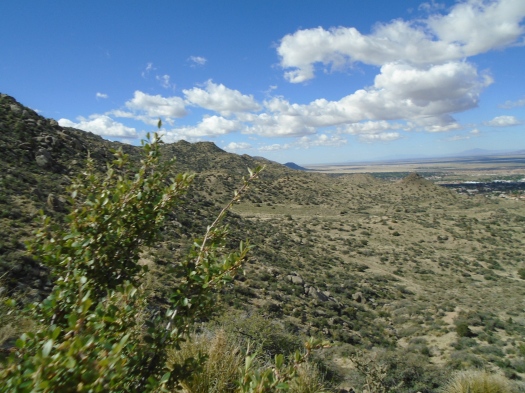
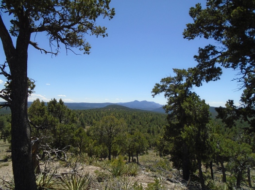
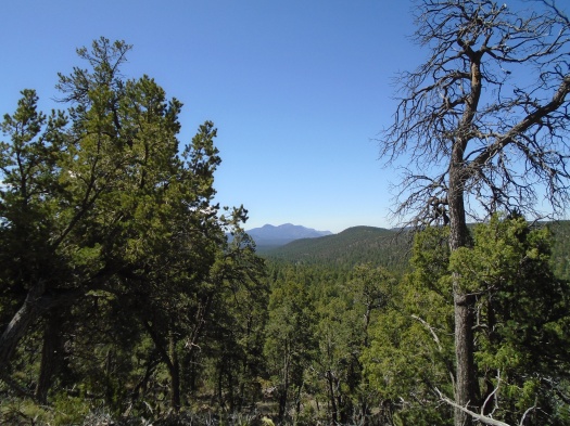
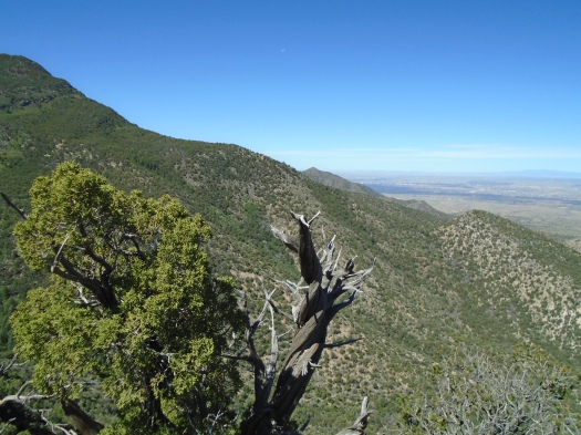
I could barely see the jagged Ortiz Mountains through the trees on the other side of the trail, though, and I wanted more.

I headed just a little further, then a little more, then a little more. The Ortiz popped into view, then the Sangre de Cristos another 30 miles away, dusted with fresh snow on May 25.

DSC01835

DSC01830

DSC01831

DSC01833

I went so far my husband came looking for me, thinking I might somehow have gotten off trail.

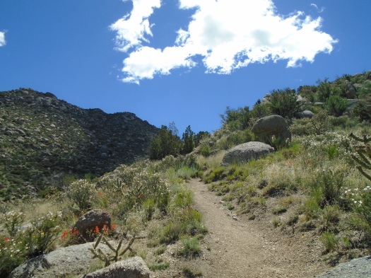
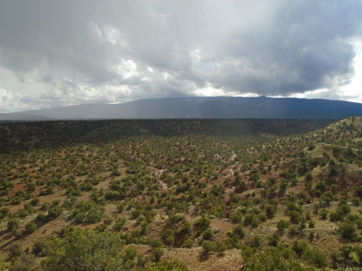
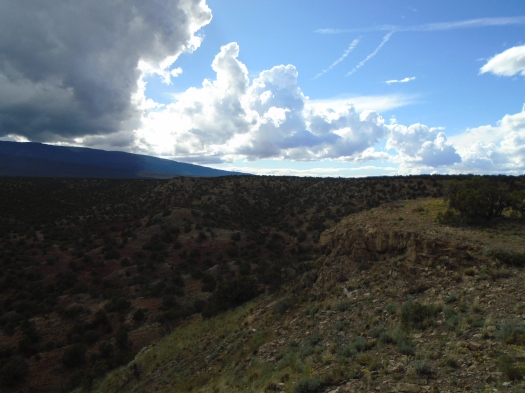
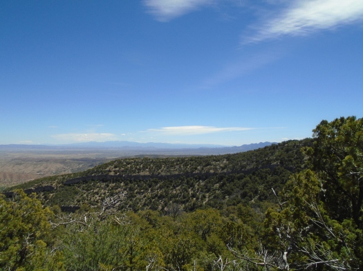
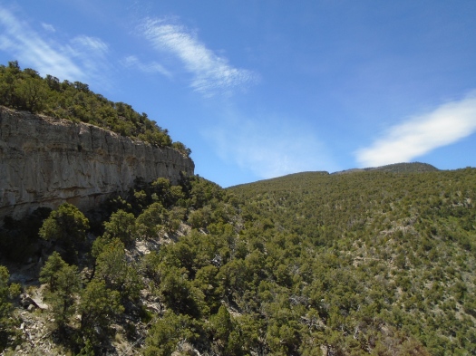
We retraced our steps, bypassing the Ojo del Orno, since descending it was unthinkable. The Crest Trail squeezed against a cool rock wall that rose high into the sky.

DSC01841

DSC01836

Our guidebook says many people find the first three and a half miles of the Crest Trail boring.

“It’s boring,” said the fellow we met in the parking lot.

This is false. What is true: the first part of the Crest Trail is incredibly hot. The rock wall provided the day’s last real shade. The air temperature was only around 72, but the trail was still blazing.

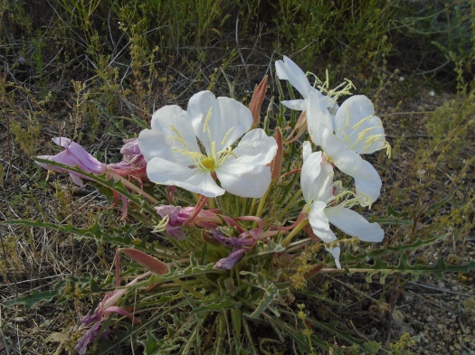
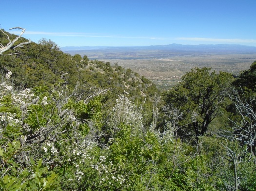
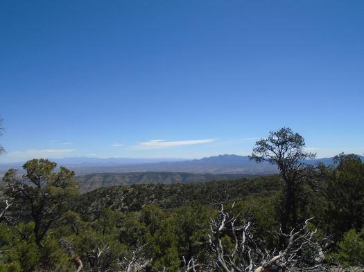
We saw the rumpled hills of Placitas, and a mystery black-capped red ridge further beyond. We saw tiny purple flowers with yellow centers blaze from the earth, electric-yellow cactus.

I have no pictures of any of it. I was hustling, desperate to get out of the sun. I privately cursed every sun-loving family we had to stop and let pass us on their way up. I wanted only one thing, and it was back at the trailhead.

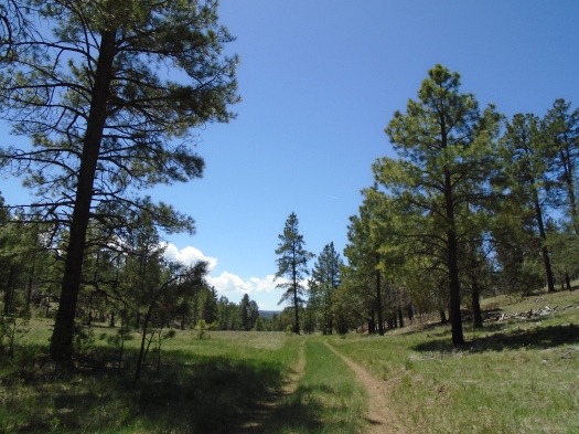
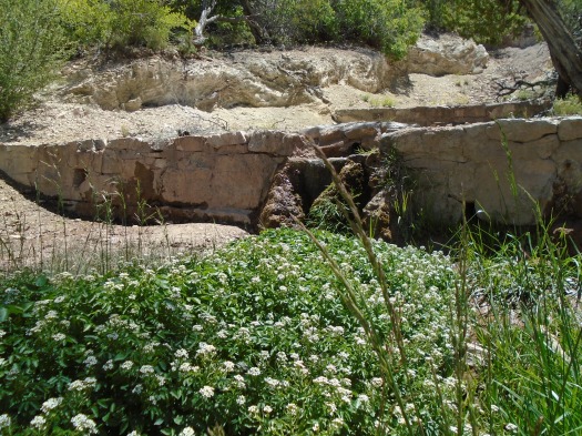
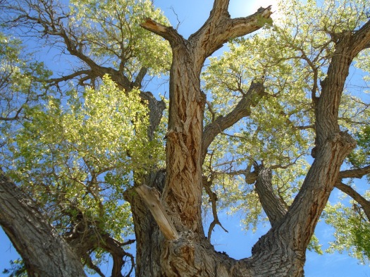
At last we reached it; a gargantuan cottonwood fed by Tunnel Spring. We crossed the road to put our sweaty hands into the cold water. The spring gurgled from a pipe that periodically croaked like a frog.

DSC01846
Tunnel Spring flows from a pipe in the rock.

DSC01845


I knew the canyon fed by this spring must be stunning right now. I’ve been there. Years ago, we went up Ojo del Orno, climbed another 1,500 feet to the top of the ridge, then came very slowly down through the outrageously steep, densely wooded Agua Sarca Canyon. I could barely use my legs for two days after that.

I’ll do it again.

When it’s 50 degrees.

Hike length: 6.5 miles

Difficulty: moderate

Trail traffic: moderate

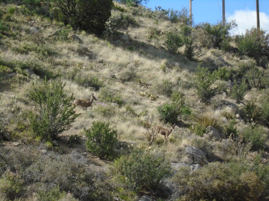
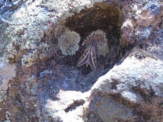
Wildlife spotted/heard: hawk, lizards, pinyon jays, bluejays, butterflies, cicadas, doves

THINGS YOU SHOULD KNOW IF YOU DO THIS HIKE:

-The dirt road from Placitas Highway 165 to the trailhead is only 1.4 miles. How bad can it be? TERRIBLE. It was already bad, and this year’s rain and snow have carved enormous chunks out of it. We took my little car up there. BAD MOVE. Take a high-clearance vehicle.

-The co-author of the new edition of “60 Hikes Within 60 Miles of Albuquerque” told me at a Q&A that he took Tunnel Spring out of the book because the first few miles of the Crest Trail have some very narrow ledges that he was uncomfortable on with his dogs.

-Speaking of narrow ledges, I would not go anywhere near this road or this area’s steep terrain in wet or icy weather.

-All of that said, this area has some of the most beautiful terrain in the entire Sandias. If it sounds like fun to you, you should go soon. Local homeowners are raising heck with the Forest Service and Sandoval County about the condition of the road-rightfully so. When that happens, it sometimes leads to road access to a trailhead being closed. I have no hard evidence that this will happen at Tunnel Spring, but I fear it could.

Deer pee, beetle sex and Apache plume: It’s springtime on the Mano Route

The deer paused on its way down the slope and looked around. It glanced at us; lifted a hind leg, still perfectly balanced; and – was it? Yes. Yes, it was peeing.

It’s springtime on the Mano Route.

The relieved-looking deer and its companion navigated a hillside, leapt a fence, glissaded another hillside and jumped an arroyo.

DSC01790

DSC01777

We did not have such grace as we clambered up the rough, rocky and steep trail – but then, the deer didn’t have to deal with backpacks.

The Mano Route’s northern half sprouts boulders and rock gardens, which truly were gardens today. Apache plume tossed in the wind. Asters danced. Orange, yellow and white butterflies flirted with flowers. Giant black beetles reproduced. (We saw not one but two pairs of these beetles getting it on today.)

DSC01766

DSC01797

DSC01809

DSC01818

DSC01807

I would not normally recommend the Mano Route in late spring. There’s no shade. But while this time a year ago it was 100 degrees, last night’s canyon winds blew in a cooler day. It was about 65 in these rocky hills at noon.

With such inviting conditions, when we reached the meadow at the top of our climb, we kept exploring. Then we clattered down the southern half of the Mano Route. It’s even steeper and rockier than the northern section, and slow going, but it overlooks Echo Canyon, El Cerro de Los Lunas and the Sierra Ladrones.

DSC01818

DSC01820

Though this trail runs at times just steps from busy streets and residential neighborhoods, it’s rugged, secluded and, this year, a wildflower wonderland.

As we made our way back to the car, my husband and I disagreed on which of many paths would get us there quicker. We were both wrong. A flock of violet-green swallows darted overhead as we consulted the map yet again.

Something moved on the hillside ahead.

A deer. Then two. The same two we’d seen earlier.

The sight reminded me: I needed to pee.

Hike length: 6.2 miles

Difficulty: moderate, with some strenuous climbs and descents

Trail traffic: none on the Mano Route

Wildlife spotted/heard: deer, butterflies, beetles, grasshoppers, mockingbird, hummingbird, crow, violet-green swallows

Golden Open Space, shapeshifter edition

One moment, sun and blue sky so intense the land’s vibrant colors must compete hard to be seen.

DSC01686

DSC01689

DSC01724

DSC01728

DSC01733

Clouds move over. The canyon’s deeper hues emerge, red and gold, pink and tan.

DSC01709

DSC01715

The Sandia Mountains loom beyond the canyon’s end, blurred by precipitation.

The flint-smell of rain. The first drops hit the red and blue rocks. Then fatter drops.

The curtain falls, and Golden Open Space transforms.

The place we knew before this is rocky juniper rim and wizened red canyons and sun, so much sun.

The steady rain and gray sky wash everything to rust and green. The forested hills all around the open space, usually unnoticed in the sun, emerge. Tiny clusters of wildflowers pulse yellow. Shrubs we’ve never seen in leaf here glow green.

DSC01743

DSC01744

Now it’s more than rain: tiny hail pellets, maybe, or graupel. It pings cool off my arms.

I’m both focused in the scene around me and in my head. Worried the mountain bike trail we’re walking on will turn to muck. Worried I’ll get too chilled with the temperature drop, which hit just after I ditched my hoodie for a light cotton T-shirt and copiously applied sunscreen.

But I see sun and some blue sky over the rim. The tiny hail abates. The rain slows to a light mist, droplets catching the light.

On the rim, bruise-gray clouds enter a dramatic duel with late-afternoon rays.

DSC01745

We scramble up a knoll to see the light and shadow on the mountains and plains. All three of us aim our cameras at once, even my husband, now wielding a smartphone after a lifetime of flip phone ownership.

DSC01748

DSC01750

DSC01755

DSC01759

We spot wildflowers as we walk back through the juniper hills: Indian paintbrush, Apache plume. Yellow and purple, red and white. We’re sure we hear thunder in the canyon behind us.

As the rain transformed the land, it transformed me. I’d clenched my teeth so much this week that my face throbbed. That pain began to abate, replaced by a throbbing in my feet that would remind me for hours to come: I’d had an experience.

Hike length: 7 miles

Difficulty: moderate

Trail traffic: none

Wildlife spotted: butterflies, crows, vulture, deer crossing the road as we drove away

DSC01700

This blessed year turned crispy David Canyon green

The meadow appears as we descend the steep trail. Grass dances in the breeze.

It’s green.

DSC01666

When we visited David Canyon one year ago, after the winter of no precipitation, we found a hotshot firefighter crew in the parking lot, babysitting the tinderbox. The meadow had parched to a washed-out beige.

But the wind never stopped sighing in the trees, and the canyon’s incredible bird lineup never stopped singing. Now, months of snow, more snow, rain and more rain have set the meadow’s colors free again.

DSC01670

IMG_0447
The same spot one year ago.

We hike up the other side of the canyon, traveling through a burn zone where embers still smoldered last year. The hillside remains naked in spots, but grass and little clusters of yellow wildflowers sprout along the path.

DSC01672

DSC01674
Alligator juniper

DSC01675

We reach the forest road that runs along the canyon’s rim. It’s still green up here, but more rocky than the meadow. From up here, the opposite wall of the canyon still looks dry and brown, fire-stripped trees visible in spots.

DSC01660
Can you see the horny toad? Every time I zoomed in I lost sight of him, he was so well camouflaged.
DSC01662
Arrowhead moth on a rock

Another steep forest road leads to the highest point of the hike. The ponderosa pines and grass yield to twisty junipers, yucca and rock, baking in the sun. It’s the point in the hike where the landscape makes me wonder, “Am I in Egypt?” We’ve already hiked close to five miles, and my feet protest.

But I know what’s coming next, and I know how close we are. I resist the temptation to look behind me until we reach a rocky landing. I turn for the full effect of what the climb gained us: a stunning view of the Manzanos’ Guadalupe and Mosca peaks above forested ridges.

DSC01677

DSC01678

A little more climbing and a steep descent over red and orange rock lead to the narrow, shady trail that will take us back. We pause to watch a group of seven or eight Abert’s squirrels scamper up trees and over hills. Two skirmish in a tree scramble, and squawking ensues. I try to get a picture, but they’re so fast. I zoom in on one only to watch it take a flying leap out of the camera’s field.

I relish that pause, because we’ve now hiked more than six miles and have two more to go. As we close back in on the trailhead, we get one last glimpse of the Manzano ridgeline, shaped from here like a pizza cutter.

DSC01656

We saw so much today, and a whole lot of it was green.

Hike length: 8.2 miles

Difficulty: moderate

Trail traffic: very light

Wildlife spotted: horny toad, lizards, nuthatches, grasshoppers, ravens, crows, Abert’s squirrels, brown creepers, bluejays, black-capped chickadee, sparrows, swallows