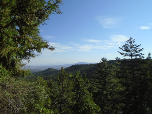
This is not the rim of a canyon, despite what it looks like.
To the east, volcanic humps everywhere, relentless sun. We head west, intersect trails, follow some with cautious hope.
Then we’re back at the parking lot where we started.
I sit under a rare and precious tree.
Hiking San Ysidro Trials Area can feel like staring down middle age. Your experience ceases to resemble what’s on the map. Things you know how to do, have done before, elude you.
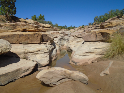
We do know this: Just to the east runs a smaller slot canyon, the one that would have completed our loop, if we’d made it.
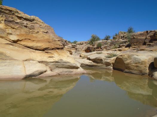
We find water there in rock pools, rippling blue-green. Six months ago, the slot canyon pools were deep reddish-brown, silt and clay stirred from snowmelt.
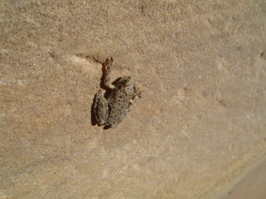
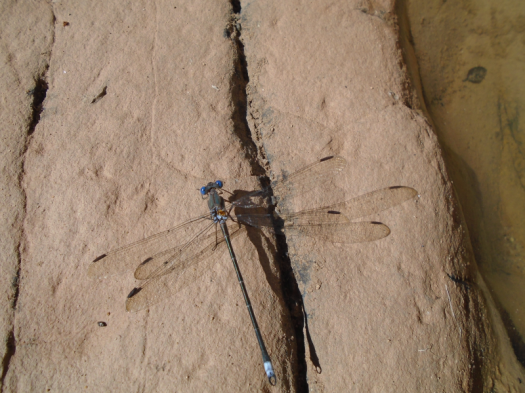
Tadpoles wiggle toward mosquito larvae. A small gray frog catapults himself into the curve of a slot. A blue-eyed dragonfly buzzes the water.
We clamber, photograph, watch creatures, reorient.
A high-pitched tone like a phone alarm, but less annoying, issues from the forest canopy.
Bird? Insect?
I can’t identify it, or much of anything else, in this unfamiliar watery environment.
A sharp call rises above the buzz. Osprey. This I know.
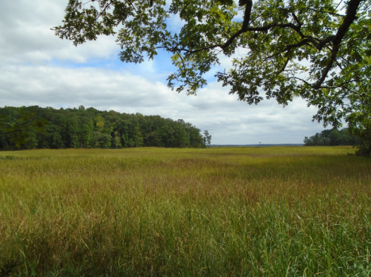
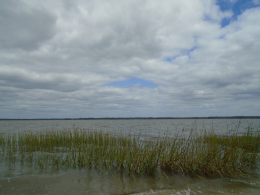
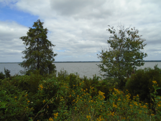
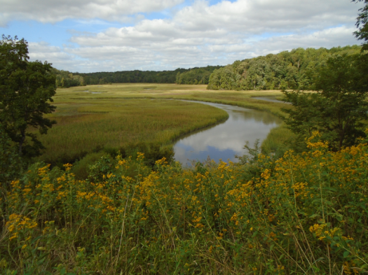
I emerge from the green and brown world at Bald Eagle Overlook. Taskinas Creek curves through marsh grass. A flare of deep brown, wings edged white, soars toward a stand of evergreens. Could it be?
The wingspan’s large, but nowhere near six feet. Must be another osprey.
A jumble of the birds swirls above the trees. Calls echo.
Back into the forest. The path flirts with the marsh. I smell the tang of low tide. Fall nudges in. Red leaves spotted black coat the path like ladybugs.
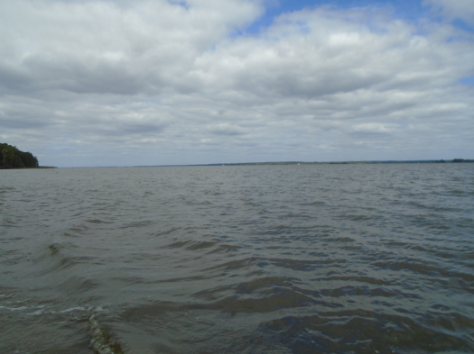
The trail ends and I walk down to the York River, wide enough to be a bay. Wind whips the water at Fossil Beach. The eternal wave sound lulls me. The only fossil I find: an orange and blue crab claw.
This is my first solo hike. If you don’t count the endless days of childhood wandering swampy paths along the Yazoo River. Or the short trail I walked along the Tombigbee River’s old channel at sunset.
I need lunch, and I have work to do before my conference starts.
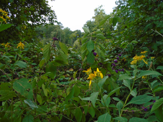
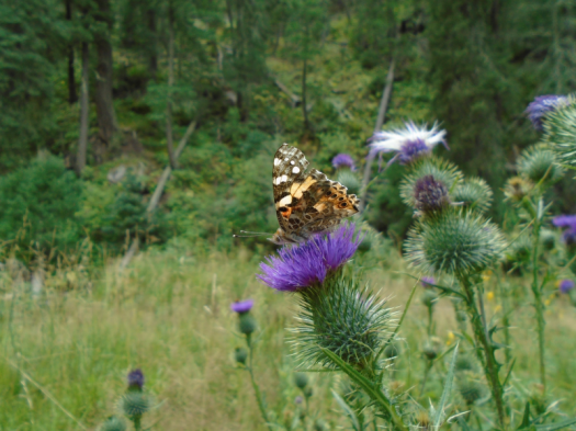
Still, I dawdle at the Taskinas Creek Overlook. A swallowtail butterfly swoops yellow and blue onto a flower. I watch it dine on blooms for several minutes. Maybe I’ll leave when it flies away.
But the butterfly settles in, right where it belongs.
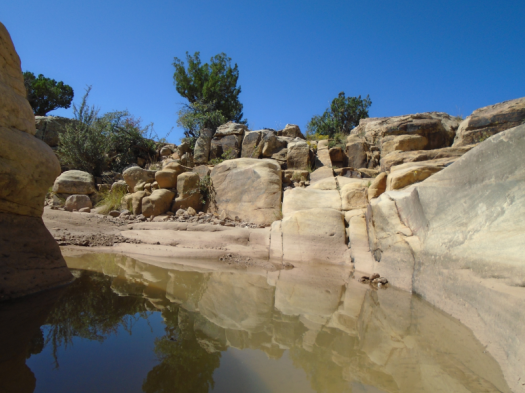
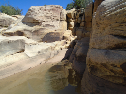
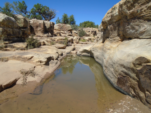
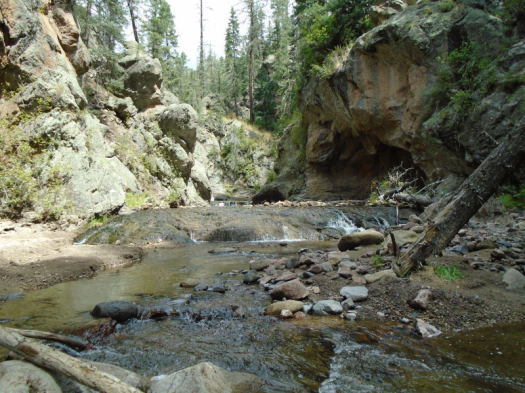
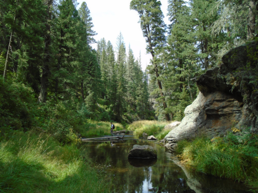
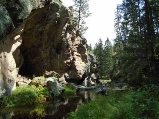
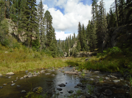
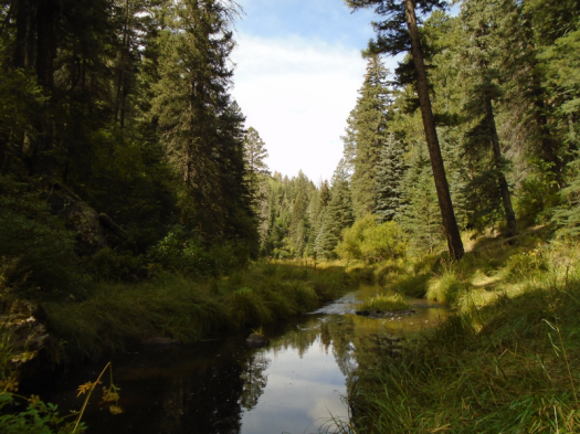
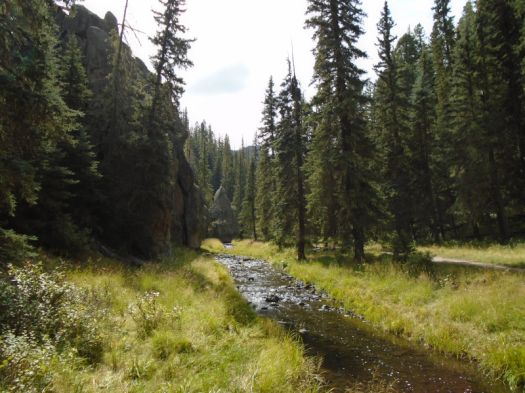
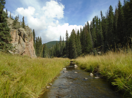
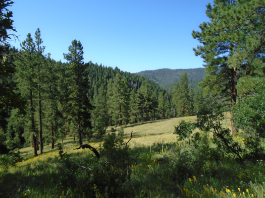
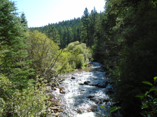
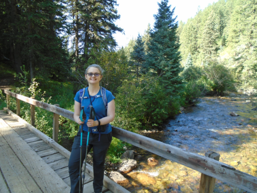
This shallow section of the East Fork Box of the Jemez River doesn’t boast any 20-foot cascades. But the water I walk through gurgles with power over the rocks.
Don’t go chasin’ waterfalls? Too late.
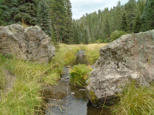
The river’s motion has sculpted canyon walls, arches, hollows and caves. Moss, grasses and trees wrap around rock.
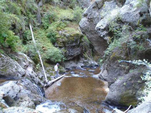
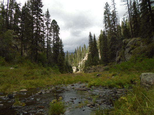
The first real waterfall has only a couple feet drop, but it’s enough to stop my forward progress. My husband, part gazelle, scrambles and glissades between rock and water until he nearly disappears around a bend. Then he, too, reaches a point where he can’t go further without going under.
We reverse direction and reach the point where we left the bank in minutes, though we spent nearly half an hour in the water.
Birds and blue dragonflies swoop over the river. American dippers seem to hop for joy in the water, which I can understand.
Thunder booms as we reach the end of the box. It’s a steep scramble back to the trail. The water in my boots sloshes as I heave myself up the slope.
The first time we hiked this beautiful trail, we reached a fence, turned around and hiked back, not realizing a gate led into the box canyon.
The trail alone could inspire one to burst into song.
The East Fork here babbles small and sinuous through high mountain meadows, through spruce and ponderosa, between 50-foot walls of black and orange rock. The river leashes its power; at times you can step across in one stride.
Rock climbers belay, fishermen angle, kids giggle, dogs pant.
And, oh yeah, thunder rumbles.
After driving 60 miles to our chosen hike today, we found the road closed until spring due to a plugged culvert, then drove another hour to the East Fork Trail. Meaning we started hiking an hour later than we intended. And even though it will be fall in six days, it’s thunderstorm o’clock.
The sun blinks off. The wind rises. The temperature falls. The canyon turns green and gray.
Time to clear out.
We’re close enough to the trailhead that we get damp, not soaked. When we reach our car, it’s 55 degrees and pouring.
The rain follows us for most of our drive back through the Jemez. The roads and the river run red with mud in Jemez Springs. Just when I think I’ll have a chance to practice “turn around, don’t drown,” it lets up enough that we can proceed.
I had no intention of spending four hours in the car today, but this hike is worth it.
Hike length: 5 miles
Difficulty: From the Las Conchas Trailhead to the box is easy; the scramble and the box are challenging
Trail traffic: popular
Wildlife spotted: vultures, crow, American dippers, robins, mountain chickadee, blue jay, dragonflies, grasshoppers, butterflies, fish (maybe a longnose dace)
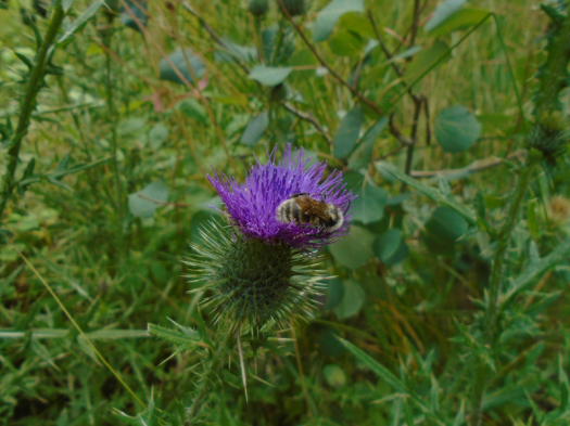
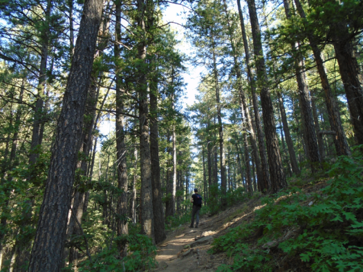
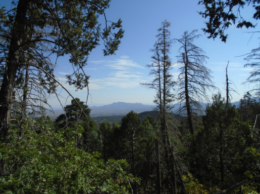
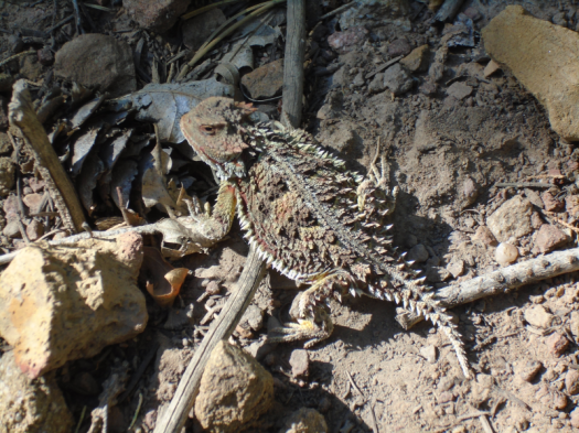
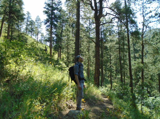
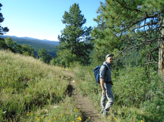
North Mystery Trail has life, lots of it. Red-breasted nuthatches dart through healthy, towering stands of ponderosa. Yellow, orange and black butterflies trail us. A rust-red horny toad comes into and out of focus against the soil beneath.
The universal smell of autumn, dead leaves, greets us too. But it’s midmorning at 8,000 feet in September, and it’s 80 degrees. Everything still living is churning out chlorophyll for all it’s worth.
Below us, in Albuquerque, temperatures climbed above normal virtually every day of August.
The warming of the Southwest is not a blip, one of those unseasonable weather patterns that have happened occasionally since the beginning of time. This is the pattern now.
Under my feet, fossil whorls dot the limestone.
What will remain of this ecosystem in 20 years, or 50, or 100?
The two of us, today, did not get up the back side of the Sandias by public transit or bicycle. So yes. We are part of the problem. We are the problem.
I hope we can also be part of the solution.
My photos and my words from this day don’t really match. I mostly took the green pictures with the views instead of photographing the dead and withered trees and plants. I didn’t know I would write these words until I wrote them. A lesson for me.
Every few minutes we hear some creature racing away. Glimpses of a deer, chipmunks. But mostly, just the forest floor quivering in their wake.
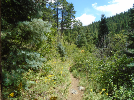
Hamilton Mesa Trail leads us into the Pecos Wilderness through high mountain meadows. Wildflowers pulse yellow and purple. The Pecos River burbles, always within sound if not sight. Then it’s there and we cross it.
From the trailhead, we saw deep into a valley blanketed with rich evergreens, rustling aspens.
No matter how far I go, or what I see, just to be here is enough, I told myself then.
We climb till I’m nearly climbed out. I push on, eager for mesa-top views. We reach a crossing at last and see…cars?! I exclaim in consternation, vow temporarily forgotten.
My research had indicated we’d pop out onto the mesa top, with views everywhere, after three or three and a half miles. We’d hiked three and a quarter miles, all the way to Iron Gate Campground, and we’re still deep in trees.
I plop down on a log. Two squirrels chase each other at high speed. I laugh till I realize one is charging down the log straight at me. It diverts only when I squeal.
Above, the highest and best expression of sky, clear as the peal of a bell.
As we descend back through the trees, ridges high above catch our eye.
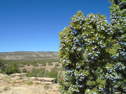
Giant berries surround us. I’d been so focused on gaining the mesa top I hadn’t even noticed the berries before.
My husband touches one. “Feels like leather. Full of fiber and seeds. Probably poison.”
At mile 7.5, we’ll climb the final naked ridge to the trailhead in relentless midday heat, me cursing and praying, mostly in silence.
Every minute, that initial vow will remain true.
Whatever happens is as it should be, for I am in the Pecos.
Hike length: 8 miles
Difficulty: moderate
Trail traffic: just one other human and his two horses
-The proprietress of our cabin painstakingly informed me about the best and worst restrooms on the road to Cowles. This is invaluable information and I am paying it forward. Iron Gate Campground: Just say no. Jack’s Creek Campground: Two thumbs up. I would go so far as to describe the restroom near the horse corral at Jack’s as pristine.
-I didn’t think of it at the time, but if I were climbing back up that ridge to the trailhead on a hot day again, I would stop to soak my feet and maybe my head in the Pecos River to stay cool.