Giving thanks for 8 inches of snow and borrowed waterproof pants

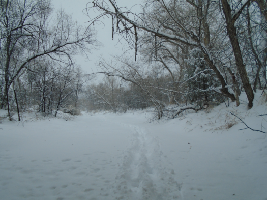
We make the first human tracks in the arroyo just before noon on Thanksgiving.

DSC03028.JPG

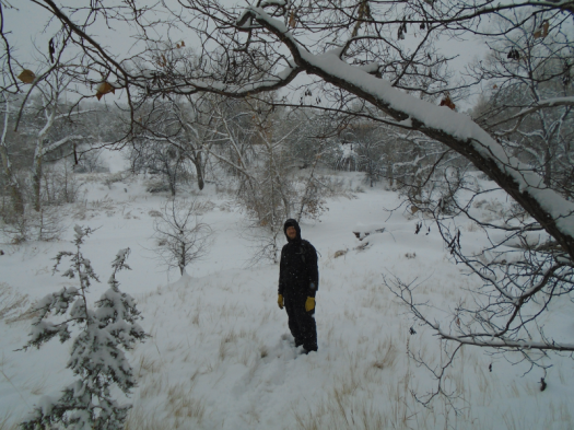
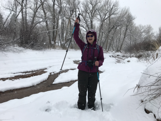
I wear my husband’s waterproof pants, with two pairs of pants under them. My husband wears his dad’s waterproof pants. Combined with his windbreaker, they remind me of an astronaut suit. I guffawed when he put it on – not my smartest move, since this hike in a snowstorm was my idea.

DSC03019.JPGDSC03021.JPG

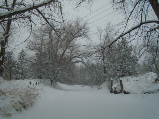
We walk beneath a road overpass. The shift from tromping through eight inches of fresh snow to walking on dry concrete leaves my legs slicing through air.

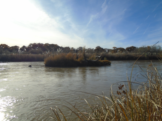
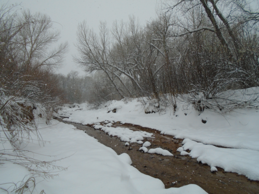
The Rio Tesuque has mostly frozen over. A few channels bubble through the ice.

DSC03023.JPG

IMG_3321.JPG

I’m almost warm when we climb out of the arroyo. Cold air greets our faces.

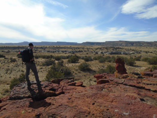
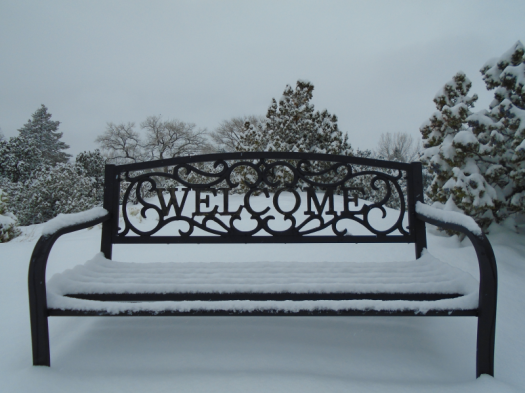
We climb a hill where my in-laws’ neighbors have a bench with a great view. My shins and hip flexors burn from moving through deep snow.

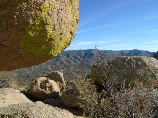
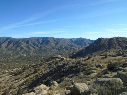
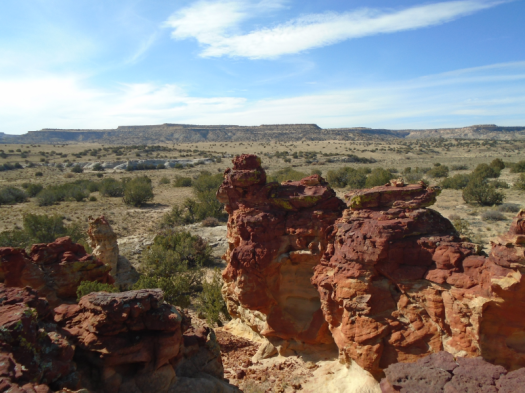
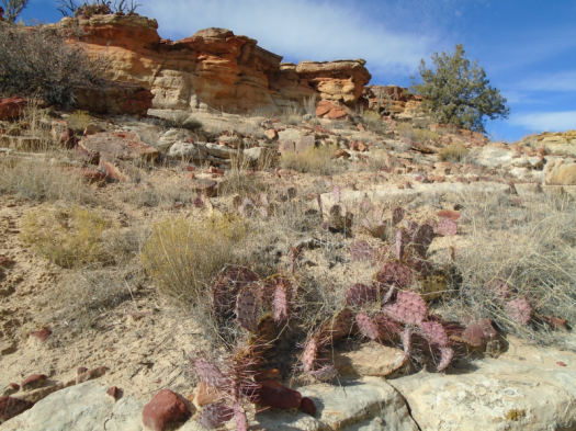
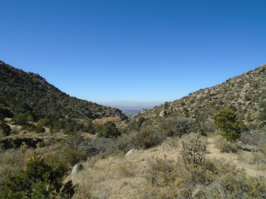
I expect the usual blue and beige and green of these hills, only with white.

Instead we step into a black-and-white photograph.

DSC03033.JPGDSC03035.JPGDSC03039.JPGDSC03043.JPGDSC03045.JPG

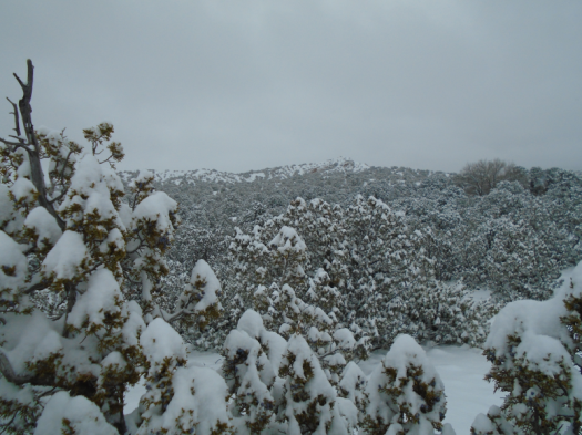
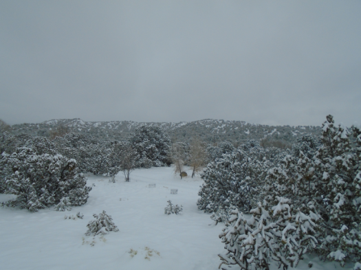
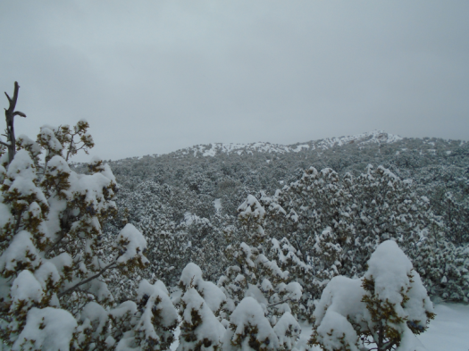
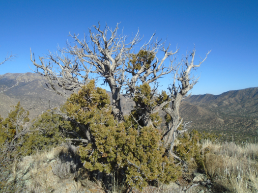
The sky presses low and gray, the junipers almost black under their white blanket. The barest line of beige peeks through the snow on the hills.

I’ve hiked on snow, but never in a snowstorm.

There’s nothing like it.

Hike length: 2 miles

Difficulty: moderate today, easy any other

Trail traffic: none

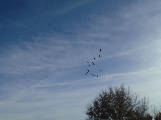
Wildlife spotted/heard: blue jays, towhee

Everything shows its true colors at Manzano Open Space

South Sandia Peak stands rust red, dusted with white.

I’ve stared up at the South Peak so many times, from so many places. I would never have described it as red.

To see that requires being in the right place at the right time.

Early afternoon, late fall, atop an unnamed peak in Manzano Open Space.

DSC02994.JPG
Red ridge on the Sandias at 10 o’clock; snowy San Pedro Mountains on horizon

Rugged paths ramble through Tijeras Canyon, overlapping with Route 66 Open Space. I-40’s white noise rumbles by.

The steep climb up to the peak delivers a 360-degree view: the south Sandias, the rumpled canyon, the high plains rolling south, Mount Taylor with a solid cap of snow on the distant horizon.

DSC02991.JPG
From different vantage points this rock looks like an anvil, a bear, a bike helmet and Trump’s hairdo.

DSC02995.JPGDSC03002.JPG

Wind blows stronger up there. Snow covered the canyon two days ago, but it’s clear and dry below 8,000 feet. I soak up sun on a shielded boulder.

The boulders balance enormous against enormous. We climb down to get a closer look at one, covered with lime-green lichen, that must weigh three tons.

DSC03005.JPG
A mere corner of the boulder that ate Tijeras Canyon

We hike out to a knoll to look over the canyon. Mountain bluebirds spring brilliant from the junipers.

DSC03008.JPGDSC03011.JPG

A wrong turn on the way down dead-ends at a rusted, bullet-riddled truck chassis buried in the sand. Stumps of seatbelt remain.

DSC03014.JPGDSC03016.JPG

Both man and nature have shaped this rugged land on Albuquerque’s eastern flank.

Hike length: 5.5 miles

Difficulty: moderate

Trail traffic: light

Wildlife spotted/heard: blue jays, robins, mountain bluebirds, crows, grasshoppers

TIPS: Like last week’s hike, I recommend this one for November-March. It’s shadeless and looks very rattlesnake-friendly.

People have clearly partied out here; a few trails had quite a bit of broken glass. Watch where you step or ride.

Thanks to the Albuquerque Senior Center for posting a great description of this route!

Cañada del Ojo: An eyeful of hoodoos

We fly as only a wide, smooth dirt road allows a vehicle to do, then stop short.
Before us, more than a dozen horses trot across a junction.
When we park and open the car doors, silence engulfs us. Ravens break it to trade caws across the valley.
We hike to the ruins of two small stone houses. We have to strain our eyes to distinguish the foundations from the rock landscape as we approach.
DSC02918.JPGDSC02921.JPG
We walk a cow path through cholla cactus taller than most humans and sun brighter than most places on earth.
A short, steep track deposits us on a mesa. With the 100-foot elevation gain, wind emerges from the stillness. Juniper replaces cholla.
Rock twists red and rust and burgundy around us. We haven’t reached our destination, but I stop to clamber among the towers and peer through windows in the rock. Herrera Mesa looms tall and flat across the valley.
DSC02929.JPGDSC02931.JPGDSC02938.JPGDSC02941.JPGDSC02945.JPGDSC02946.JPGDSC02952.JPG
DSC02983.JPG
Beyond the red land, the arroyo we seek: sand, rock shelves, juniper branches.
We’re in it before we see it: Cañada del Ojo, a hoodoo garden on BLM-designated land near the To’Hajiilee Navajo Chapter.
The hoodoos rise bulbous, chalky, topped with the rich red we saw earlier. Balanced rocks. Moqui marbles. An arrowhead, chipped and discarded in the arroyo.
The drainage begins to resemble a slot canyon. We climb to a ridge, walk its edge to gaze down on the hoodoos and over the valley.
DSC02959.JPGDSC02961.JPGDSC02962.JPGDSC02964.JPGDSC02973.JPGDSC02980.JPG
The ridge holds numerous tinajas, rock depressions in the desert that can hold water, sometimes for weeks. All are bone-dry. The animals whose scat and sign dots this corridor must seek succor elsewhere.
Rather than retrace our steps, we descend the ridge’s stone shoulder, long and sideways.
Cloud wisps stretch across the sky. The sun’s blast becomes a glow. The ground beneath our feet reveals a chunk of chalcedony, a bobcat print.
We follow a long fenceline through cactus and sky to our car.
The horses run beside us as we drive away.
Hike length: 6 miles
Difficulty: moderate
Wildlife spotted/heard: crows, ravens, cottontail, chipmunk, butterflies, grasshoppers
Trail traffic: none
Tips: This route is from the latest edition of “60 Hikes Within 60 Miles of Albuquerque.” I recommend this hike November-March. There’s no shade and the terrain looks like prime rattlesnake habitat. As noted, the dirt roads to get here are mostly good in dry weather, but the last couple miles could get dicey quick with any rain or snow.

The golden hour lasts for weeks at Valle de Oro

Honk honk honk honk HONK HONK HONK honkhonkhonkhonkhonk.

We hear the ruckus just in time to see what might be 100 geese fly over.

We’re standing on the east bank of the Rio Grande at Valle de Oro National Wildlife Refuge.

DSC02854.JPG
Incoming

Valle de Oro has arguably the best cottonwood fall color show in Albuquerque proper. The cottonwoods peaked at least a week ago. I thought to come here only because a trip to Jemez Springs yesterday reminded me how beautiful cottonwoods are when they turn past peak yellow to gold.

The colors at Valle de Oro today pulse instead of blaze, but they still command attention. So do the gaggles of birds.

DSC02834.JPGDSC02838.JPGDSC02888.JPGDSC02908.JPGDSC02909.JPG

DSC02860.JPGDSC02865.JPGDSC02881.JPG

We hear sandhill cranes’ rusty call from the other side of the river as we wander the east bank. Traffic noise rises. I guess that it’s from NM 47, the highway from Albuquerque to Isleta Pueblo and Bosque Farms.

The bosque path meets an acequia, and we can see the intersection of NM 47 and I-25. Isleta Casino rises up before us, the Manzano Mountains behind it. Between us and the highway, a field full of geese, with a good dozen more arriving every few minutes. A roadrunner darts across the acequia’s dirt track.

DSC02890.JPG
Coming in for a landing
DSC02896.JPG
Looking back over the field of geese toward the Sandias

DSC02897.JPG

We turn around at the NM 47 overpass and walk back south on the acequia. Gold glints from a bosque receding to brown. Birds move over in waves.

The vibrant colors have flamed out, but fall in New Mexico still has more to give.

Hike length: 5.5 miles

Difficulty: easiest

Wildlife spotted/heard: dragonflies, crows, hawks, kestrel, sandhill cranes, geese, ducks, sparrows, downy woodpecker, great blue heron

Trail traffic: light

DSC02912.JPG

The view from the top of Embudo Canyon astounds no matter how you get there

The trail runner leapt onto the rock wall and raced up. His feet met every indentation like magnets.

This is not how I tackle the challenges of Embudo Canyon.

To climb its sloping boulder-shelves, I requested my husband’s assistance from above. To descend them, I scooted down on my butt.


When we got to a black diamond section of very steep switchbacks, I stopped frequently, laboring to push myself up to the next rock. Later, I moved down the switchbacks only slightly faster than a glacier, crouching to keep my center of gravity low, contorting myself into any position that would put a foot in contact with something semi-flat.

I did this even though I’ve been hiking long enough to know that climbing or descending a steep grade slowly taxes your muscles way more than walking briskly down it, planting confident heels into the earth.

Sure enough, after I descended the switchbacks, my legs quaked like aspens and I still had two more miles to hike, including the boulder descent.

But.

I reached my destination, a ridge steeped in sun and wind at nearly 8,000 feet. One mountain range after another rippled blue in the distance: Manzanitas, Manzanos, Los Pinos. I’ve hiked them all and seen them from many vantages. But I would never have guessed you could see them all from so far north and west.

DSC02819.JPG

DSC02820.JPG
Looking west over Albuquerque

DSC02822.JPGDSC02825.JPGDSC02830.JPG

Below us, a sunbaked valley alight with chamisa. A brown stand of cottonwoods’ final show of the year.

DSC02801.JPG

DSC02812.JPGDSC02816.JPG

DSC02808.JPG

I will keep working to build more confidence on steep trails, since many of the best places are at the top of them.

I will also celebrate when I get to the top my own way and at my own pace.

Hike length: 6.2 miles

Difficulty: moderate except for the black diamond section near the top

Trail traffic: moderate

Wildlife spotted: sparrows, blue jays, robins, crows, butterfly, beetles