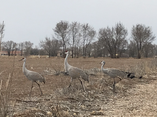
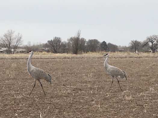
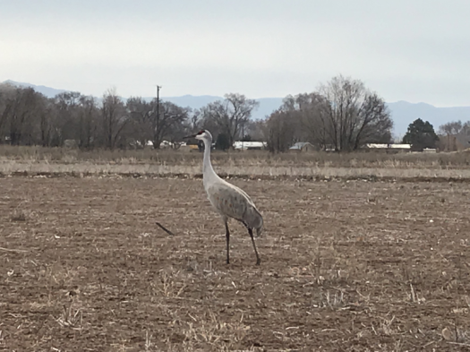
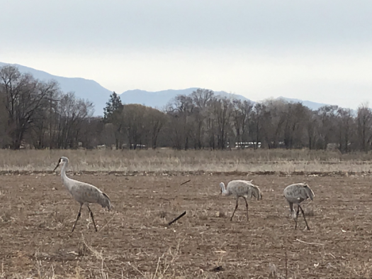
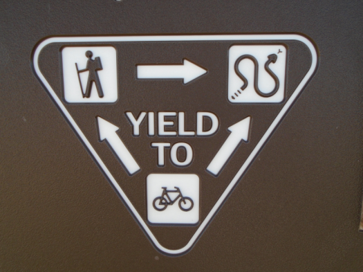
When I approach cranes, they usually sidle away in silence, as if someone had passed gas. These, though, stand their ground. Snacking, squawking, traveling slowly.
We’d heard their rusty call as we walked the Los Poblanos Open Space paths, but couldn’t see them. We figured they were high in the pre-storm atmosphere: cloud-cranes.
As we walk away, a bleat. We wheel. Five more cranes fly over, bank with wings extended for landing. Prehistoric frisbees.
More here than we saw 90 miles south, last week. A tractor traces neat rows on the field’s edge. The crops’ remnants will feed the cranes next year.
We reach the trailhead an hour after we begin our search.
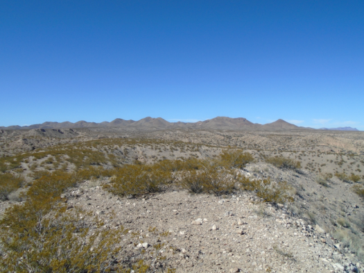
We’ve backtracked by car and foot on the back roads of Elephant Butte Lake State Park.
We hiked nearly half a mile from a campground to a cliff overlooking the Fra Cristobal Mountains. Lovely, but not the trail.
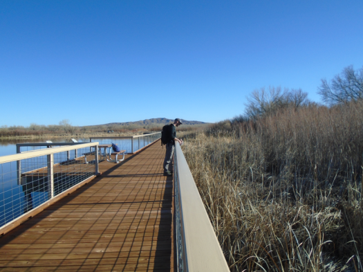
Near the visitors’ centerNope, not the trail
We get back in the car yet again to start looking for a different trailhead. My even-tempered husband’s level of grouchiness is now approaching mine. Then he spots our destination: West Lakeshore Trail’s northern terminus, tucked in the opposite corner of the campground from where we were searching.
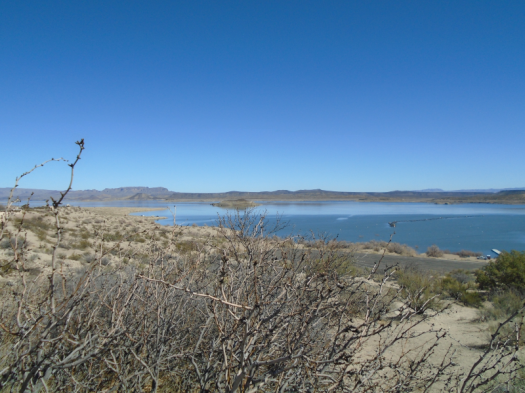
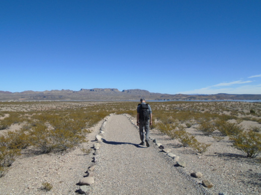
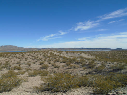
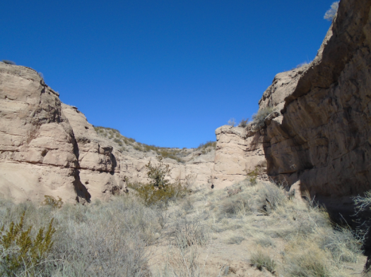
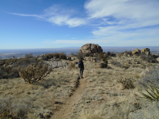
The trail snakes a neat, pristine rock line over mesas bushy with creosote. Except for the footsteps in the sand, it looks like the trail builders just finished yesterday.
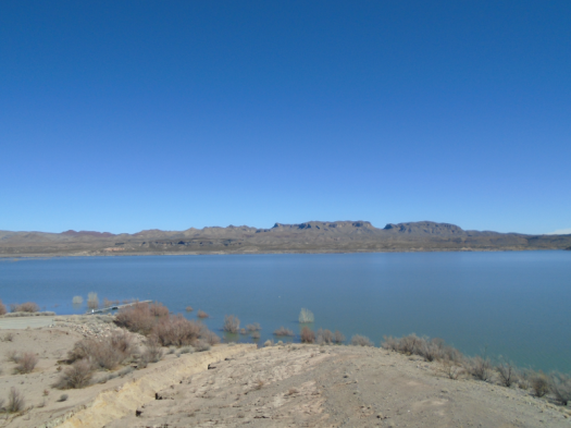
We round a bend. The lake’s turquoise glints through a notch in the cliff. The trail winds over a ridge, then drops us into an arroyo. The creosote stands as tall as we do. Eight-foot yucca stalks loom.
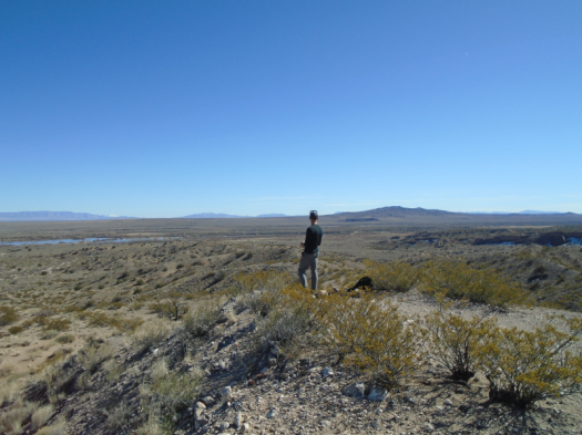
We make the only visible creature movements on this treeless landscape. All others lie burrowed in the cool and dark. Sun rules the land. Occasionally, a lizard scrambles from one bush to another.
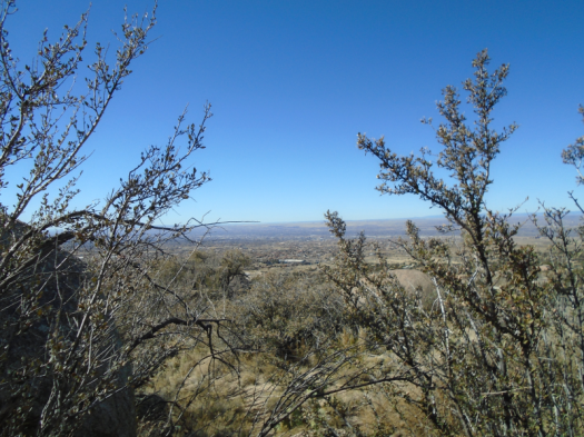
The sky hangs bright and cloudless. The air is so clear I’m sure I could reach out and touch the Fra Cristobals.
As we hike back, the other mountain ranges on the horizon slot themselves into my mental map. The San Mateos with their thumb of rock. The jagged Magdalenas, last week’s snow dusting the peaks.
Back at the trailhead, my husband cools off with a Santa Fe Pale Ale from the trunk.
I take a picture of a sign honoring the unseen occupant who rules this landscape.
Hike length: 3 miles, plus .75 miles out to the cliff
Difficulty: easy
Trail traffic: only one other human
Wildlife spotted/heard: lizards, raven
TIP: The South Monticello campground is gorgeous, quiet and clean and would be a great base for doing this hike at sunrise or sunset when it’s cooler. You could go as far as you wanted – the trail is 12 miles.
Around us, mountains stand in states and shapes of erosion.
The Chupadera Mountains got tired of mountaining and relaxed into rock waves.
The San Andreas Mountains got tired of mountaining and let a giant creature take jagged bites off the top.
Unfamiliar mountains in every direction.
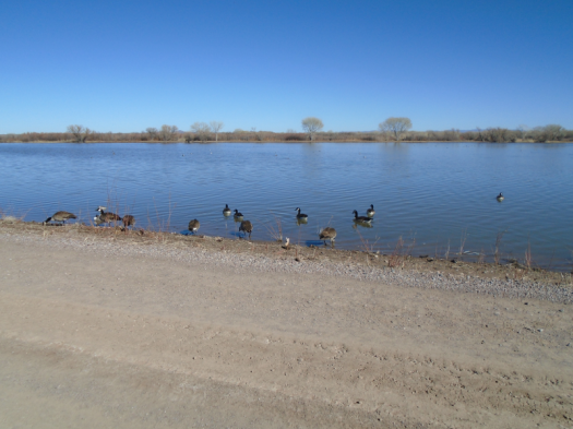
Sage plain pastels. Blue marsh.
360 degrees of stimulation.
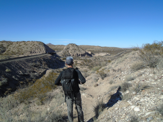
We’re at the highest point of Canyon National Recreation Trail. Creosote and sand stretch back to the Chupaderas.
The Chupadera MountainsThe marsh is at left
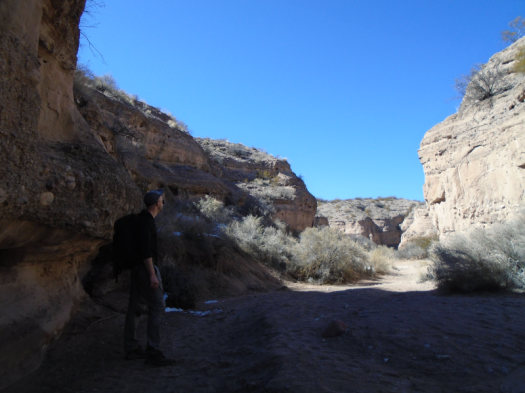
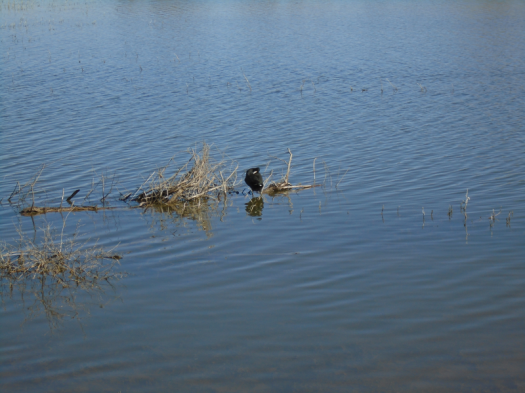
Solitude Canyon brought us here. Nests, burrows, bird droppings lined the ravine’s rocky walls.
It’s a holiday weekend, but the canyon earned its name.
Short, efficient switchbacks lifted us to a panorama that looks like it should have required way more than 30 feet of climbing.
Blue finds new gradients, unbroken by cloud.
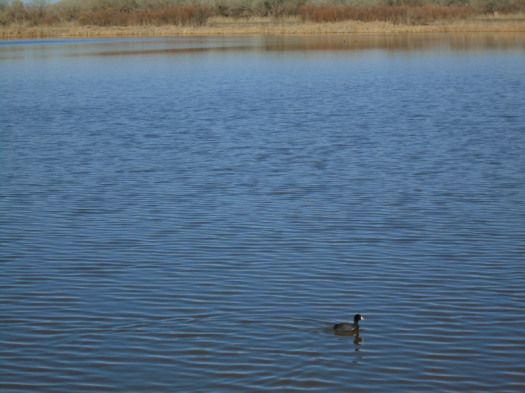
Silence. A few cranes call from the marsh. The end. In November there were thousands.
Later, at the marsh, two harriers wheel higher until we can’t separate them from the blue.
Coming down from the Marsh Overlook Trail; railroad tracks and Highway 1
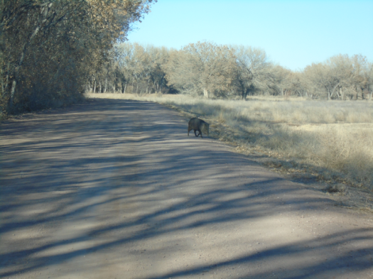
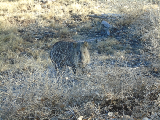
The first javelina we’ve ever seen trundles across the road in front of our car. He munches leaves on the shoulder, stares at us. We hear him snuffle as he walks away.
Why did the javelina cross the road?
The refuge is so vast, the land so open, you forget cities and towns and mountains that are tall. The entire world becomes creosote, rock, water and creatures.
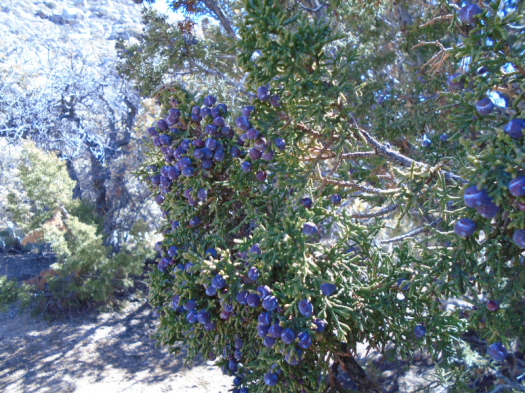
I’m angry about the brisk wind shushing across the hills. The forecast called for zero wind. Being out in the wind is one of the biggest risk factors for me having a giant gusher nosebleed this time of year. Now I’m worried.
I’m angry because I’m tired of worrying about my health. Due to my extreme juniper allergy, I spent six days of January in bed, three with a fever.
I’m also angry at someone. Two people, actually, neither of whom are here.
But I have made it to a trailhead, so we’re going hiking, anger notwithstanding.
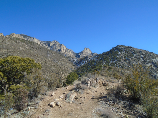
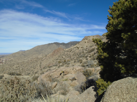
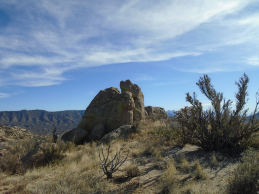
We’re in an open bowl, city on one side, the southwest flank of the Sandias on the other. Our destination is a human-painted eye on a rock reached by a steep climb. As we ascend, we pass a man huddled under a juniper.
We climb to a saddle, then make a long, steep corkscrew up. Tijeras Canyon and the Manzanitas and Manzanos emerge below. Two people in white T-shirts climb a red rock outcropping across the canyon.
The white dot on the red outcropping is a person
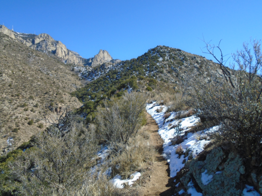
Blue blazes down on us. The sections of the climb surrounded by boulders warm us. The parts on a high ridge huff cold wind in our faces.
I crest another ridge, see a crumpled mass of clothing, and shudder. A sleeping man? A dead man? Just some sweatshirts someone, probably the man under the juniper, left behind.
We reach a high landing. What little vegetation exists here tosses in the wind like we’re on top of Everest.
I gauge the final climb to Eye of the Sandias. It will mean at least half an hour with that wind in my face. That doesn’t seem wise, and I don’t really care about missing the rock. I’m in the most compelling scenery.
Nothing looks the same going down through the warren of social trails. My husband and I argue about the right way back. I think he’s going too far south. We cliff out repeatedly, then descend a path steep enough that I slide down a decent chunk of it on my butt rather than even trying to stay upright. (Today may have been last rites for my five-year-old REI pants.) We emerge north of where we began this morning, indicating that my husband had been headed toward the right trail.
As we get close to the car again, I catch myself smiling. There are worse things than being out here under rock and sky.
That is, if you have someplace sturdier than a juniper to go when it’s time to get out of the wind.