Google’s walking map for this urban hike requires approximately 20 turns.
I take a few street names from it, apply them to what I see around me, and walk toward water.
I’m in St. Petersburg, Florida for a workshop at The Poynter Institute. I have one hour before the heat index passes the mid-80s at 9 a.m.
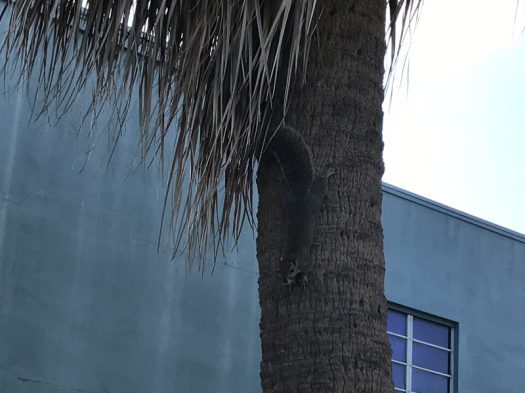
My walk meanders past aggressive squirrels, several parks and historic hotels, and yields one early-morning “Hey baby, why aren’t you smiling?”
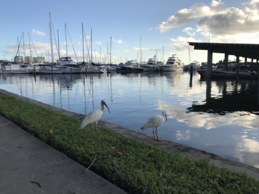
I detour through the St. Pete Yacht Club and meet the North Bay Trail, joining joggers and cyclists. I know I’m near my destination when gulls wing by: black, white, gray.
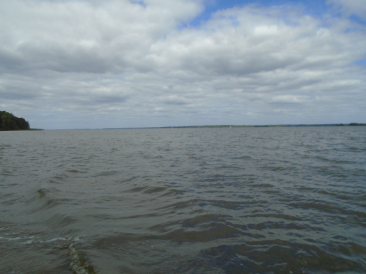
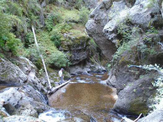
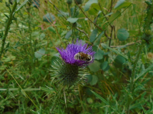
Demens Landing Park yields grass, bay, marina, picnic tables. It’s named for the Russian who named this city after the other St. Petersburg.
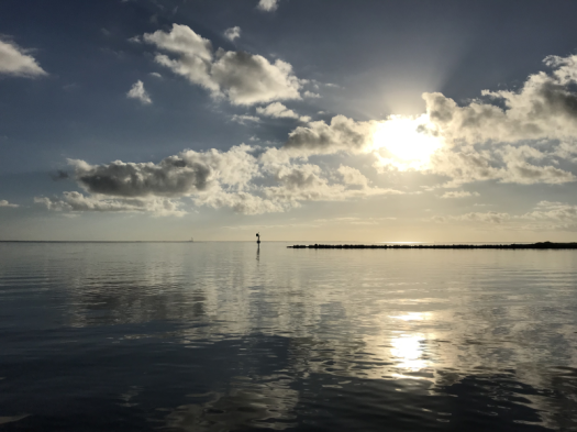
I steer around puddles and mud from the four inches of rain Tropical Storm Nestor dumped yesterday. It’s quiet at the water’s edge this Sunday morning, and bright. At the horizon, sun meets water in a sheet of gold.
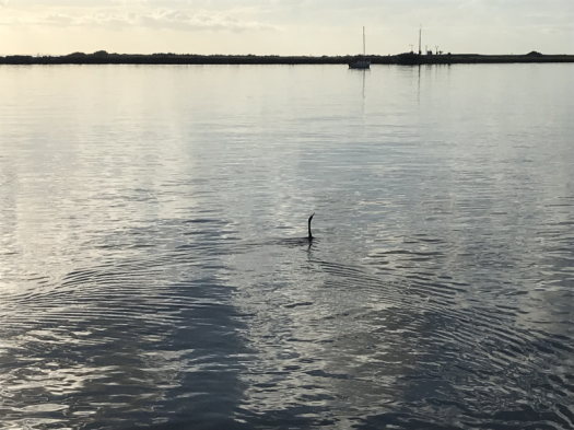
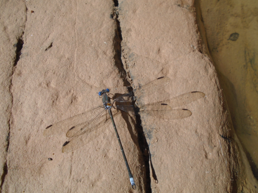
A black bird submarines through the water, only its neck showing. I laugh.
It’s so hot I don’t linger, but that submarine bird alone was worth waking up for.
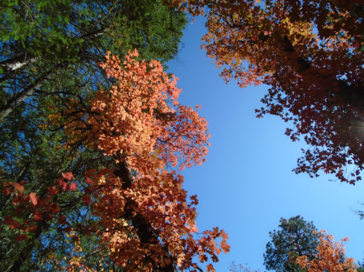
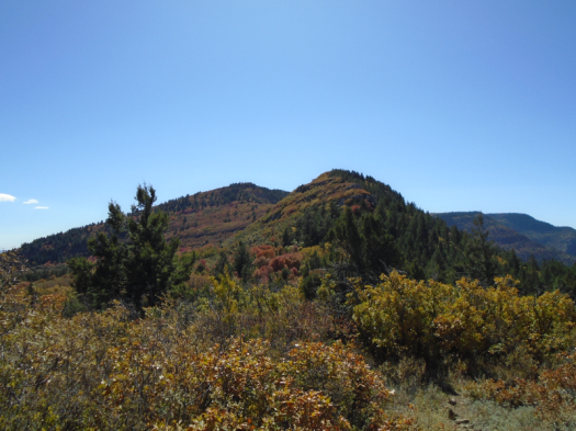
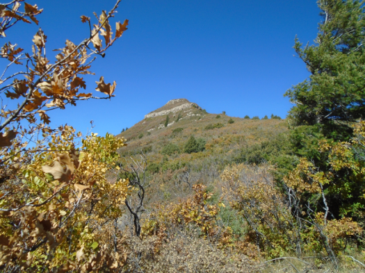
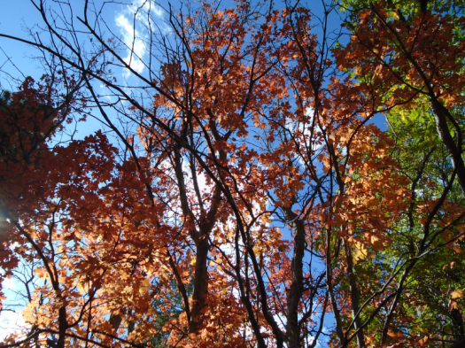
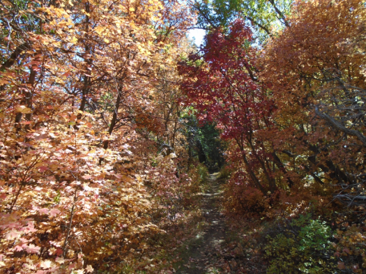
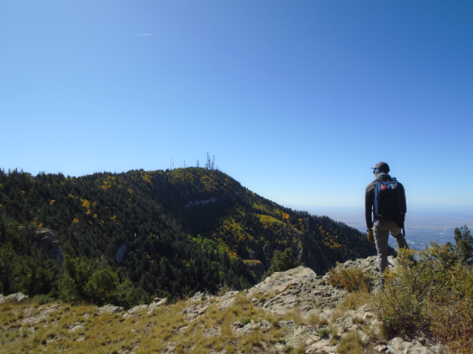
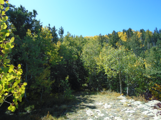
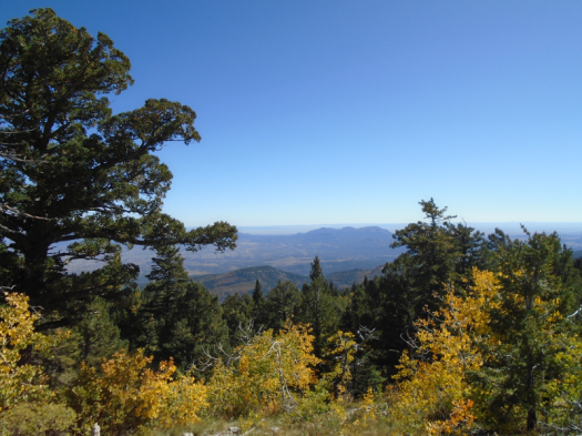
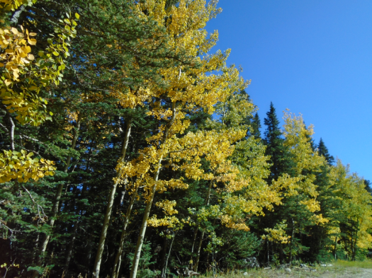
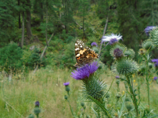
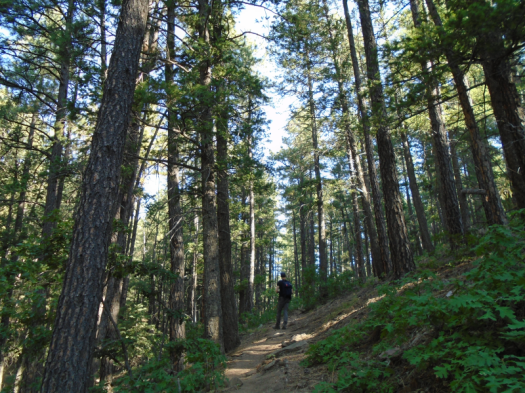
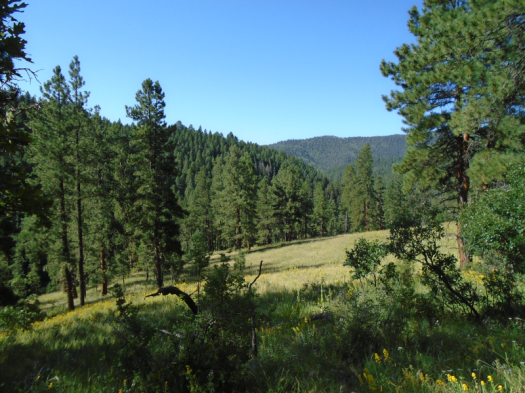
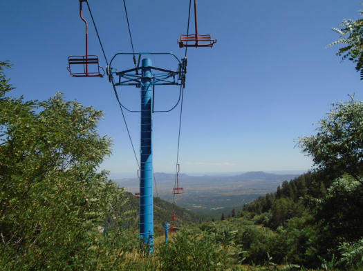
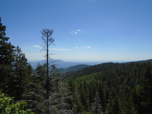
One goes to Fourth of July Canyon in October seeking sensory overload.
What kind you get depends on how far you go.
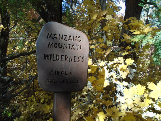
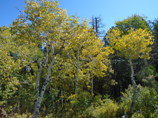
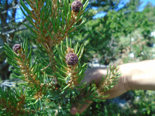
This canyon in the Manzano Mountains boasts a large population of bigtooth maples. In fall they turn orange, yellow, red and pink like it’s New England and not a cleft in the desert.
Along with leaves, the canyon’s main feature this time of year is humans. This can be magic: a bunch of strangers sharing an experience of wonder. Like Balloon Fiesta.
Or, if your backpack’s heavier than usual and groups of eight, 10 and 12 take up the whole canyon, stage lengthy photo shoots, then stand in the middle of the trail and show each other how great their photos are, it can get old fast.
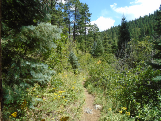
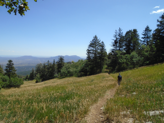
But if you make it to the top of the Fourth of July Trail, the humans thin out and leaf-peeping becomes a different experience.
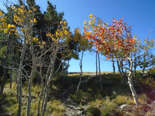
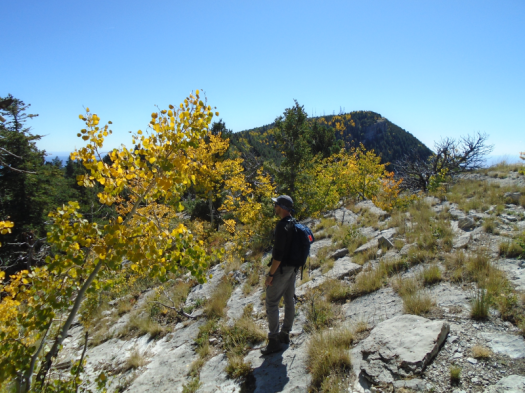
Today the lower canyon still had a lot of green, but the trail exploded in color the higher I went. The sky receded as the trees closed orange and gold around me.
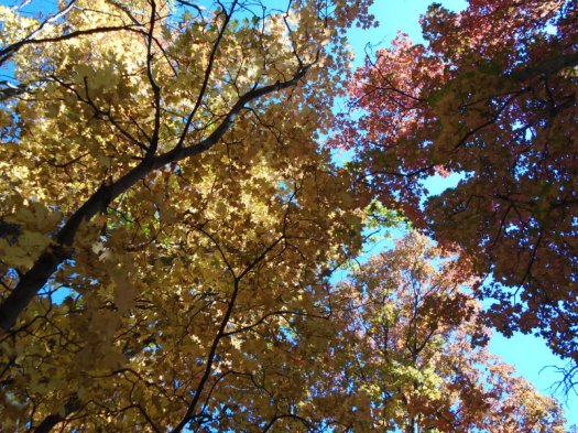
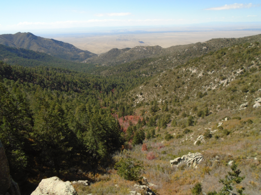
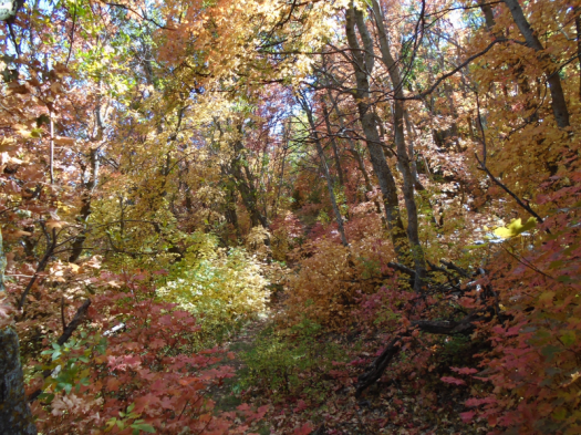
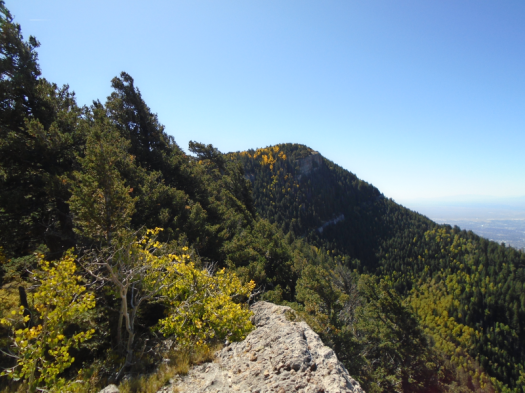
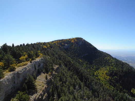
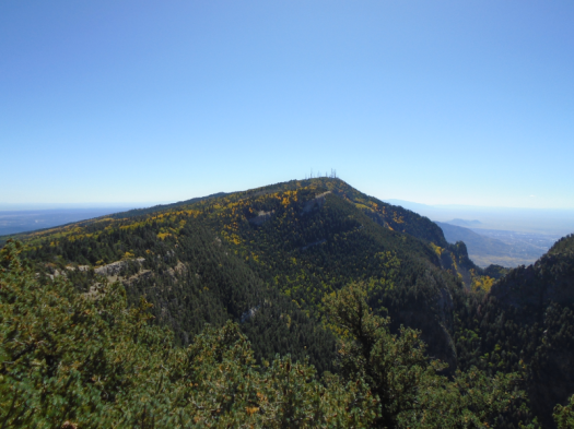
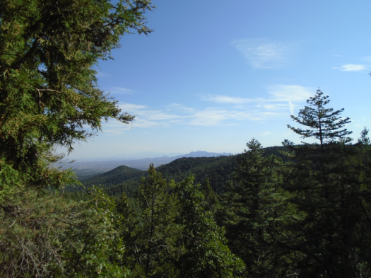
Thinking I’d missed an overlook, I headed into new territory on the Manzano Crest Trail. I realized I was walking away from the ridgeline, turned to head back, and gasped. Ripples of red covered the Manzanos’ eastern slopes in front of me. I’d never been high enough on the trail to see the maples from that perspective.
A gold dragonfly buzzed past gold leaves. An orange and black butterfly danced with orange leaves.
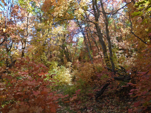
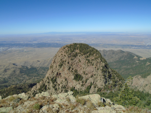
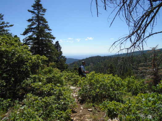
I found the overlook, and then a stone ledge below it that I’d never noticed. As I explored the rocks, I spotted a huge stand of red maples in the center of the canyon below.
Mosca PeakStand of red maples in the heart of the canyon
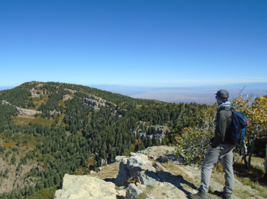
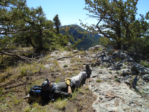
I wandered the overlook in the sun and wind for a good half-hour, completely alone.
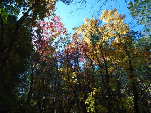
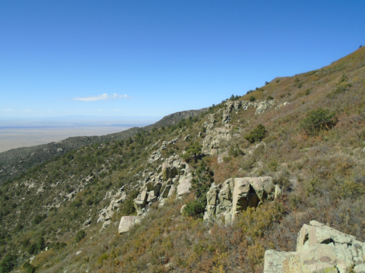
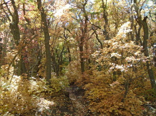
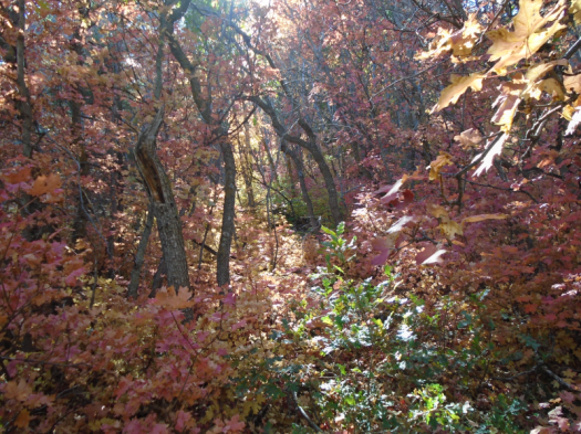
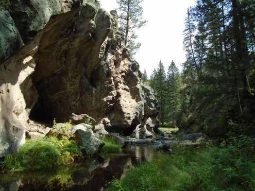
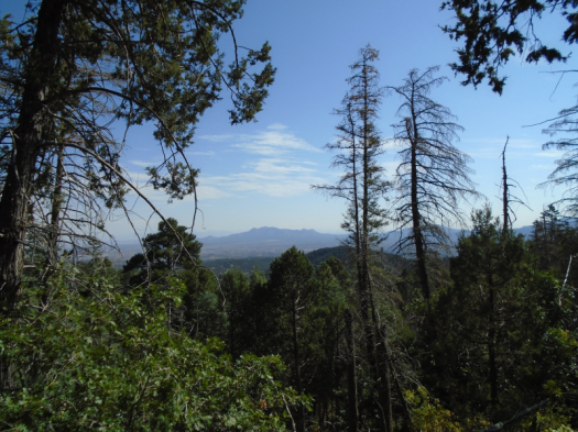
I descended on Cerro Blanco Trail. At times it’s dark, grottolike, colorful leaves forming a snow globe. A few spots open onto sun-drenched ledges with views of the colorful ridges above.
A bend in the trail overlooked a grotto. I sat on a rock. It was 3 p.m. but felt much later in the cool shade. The deep colors and gentle curves reminded me of when I hiked the Appalachian Trail to McAfee Knob in the fall.
Then I looked down, saw a juicy prickly pear cactus on the ledge below me, and laughed.
As I’d approached the peak, I’d passed an older couple on their way down. The man had a wooden walking stick and an open can of beer. I heard the woman say to him, “You can only see so much pretty.”
I understood where she was coming from, but my capacity to see pretty today had only one limitation: how far I could physically hike.
Hike length: 6.5 miles
Difficulty: moderate
Trail traffic: heavy on first mile, moderate thereafter
Wildlife spotted/heard: deer and vultures on forest road, mountain chickadees, crow, bluejays, butterflies, dragonflies
TIPS!
-B.Y.O.T.P. Demand exceeds supply at the trailhead women’s restroom this time of year.
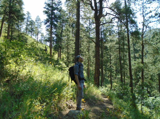
-They say not to hike alone unless you fully understand the risks. I do, and I almost never hike alone. But I took the opportunity to do so today. I knew there would be people all over the place at Fourth of July Canyon, so if I fell and broke something, I wouldn’t lie there for days. (Many places I hike, including Fourth of July Canyon in the summer, that’s a very real risk, as they’re remote and little-traveled.) It was a great chance to experiment with solo hiking.
Mud from Friday’s full-day rain. Cool limestone. Fallen aspen leaves.
A side path takes us to the edge of the world. Colors explode. Deep blue sky, green spruce and fir, yellow aspens glowing in canyons far below. Cold wind steals our breath.
These side paths tangle for miles, lift us away from the North Crest Trail, onto a long limestone ridge. Parallel to The Needle, a giant cave-pocked thumb of rock that, today, looks dusty pink.
We pass a group of mountain climbers on a broad rock ledge. Two miles later, when we look back from high above, they’re still there, tiny, presumably taking turns belaying.
Fall brings such luxury. We soak up sun on a rock outcrop for nearly an hour, unconcerned about outracing thunderstorms or brutal summer afternoon heat. Creatures begin to forget we’re there and return to business. Stellar’s jays hop among low tree branches.
At the highest point we reach, ladybugs swarm the limestone, and deer scat dots it.
When we return on the North Crest Trail, the sun’s higher in the sky, bringing the trail and cliff-edge worlds together. Blue and yellow slice through the tall, dark forest tunnel.
One last peek at a side overlook. Yellow aspens flame against a green mountain.
From a cold, dark morning, a world of color and light.
This is not the rim of a canyon, despite what it looks like.
To the east, volcanic humps everywhere, relentless sun. We head west, intersect trails, follow some with cautious hope.
Then we’re back at the parking lot where we started.
I sit under a rare and precious tree.
Hiking San Ysidro Trials Area can feel like staring down middle age. Your experience ceases to resemble what’s on the map. Things you know how to do, have done before, elude you.
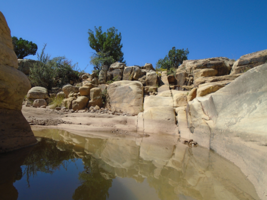
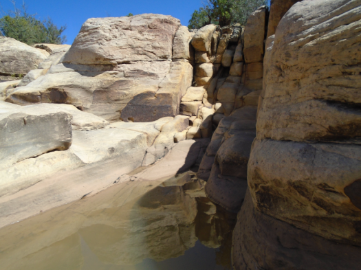
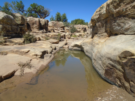
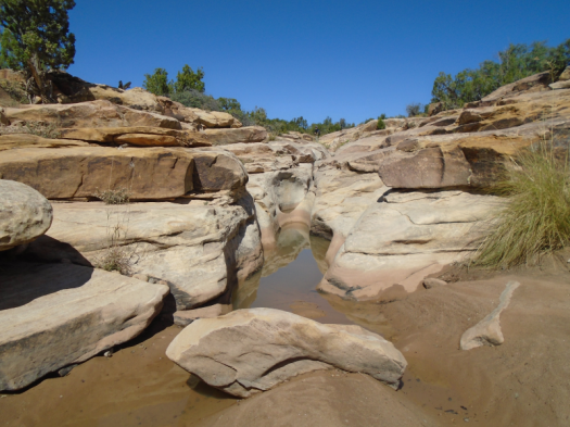
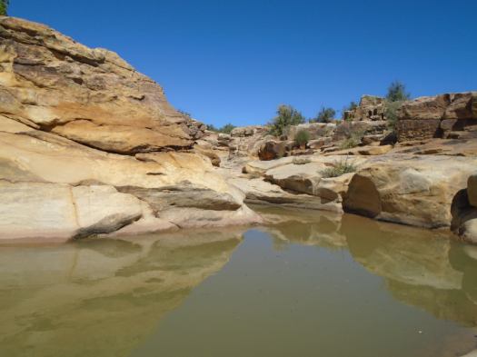
We do know this: Just to the east runs a smaller slot canyon, the one that would have completed our loop, if we’d made it.
We find water there in rock pools, rippling blue-green. Six months ago, the slot canyon pools were deep reddish-brown, silt and clay stirred from snowmelt.
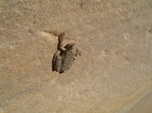
Tadpoles wiggle toward mosquito larvae. A small gray frog catapults himself into the curve of a slot. A blue-eyed dragonfly buzzes the water.
We clamber, photograph, watch creatures, reorient.
A high-pitched tone like a phone alarm, but less annoying, issues from the forest canopy.
Bird? Insect?
I can’t identify it, or much of anything else, in this unfamiliar watery environment.
A sharp call rises above the buzz. Osprey. This I know.
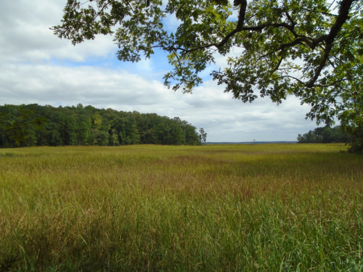
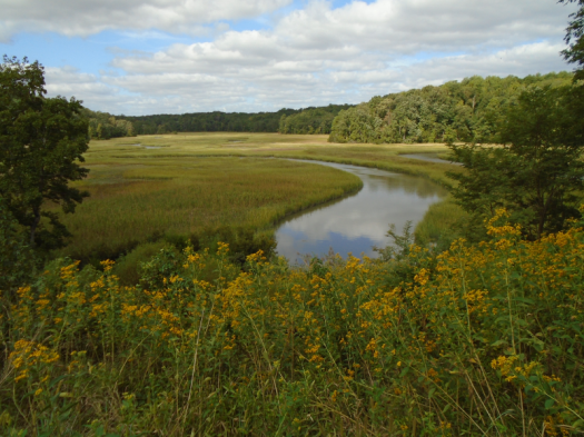
I emerge from the green and brown world at Bald Eagle Overlook. Taskinas Creek curves through marsh grass. A flare of deep brown, wings edged white, soars toward a stand of evergreens. Could it be?
The wingspan’s large, but nowhere near six feet. Must be another osprey.
A jumble of the birds swirls above the trees. Calls echo.
Back into the forest. The path flirts with the marsh. I smell the tang of low tide. Fall nudges in. Red leaves spotted black coat the path like ladybugs.
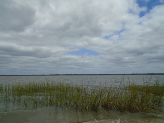
The trail ends and I walk down to the York River, wide enough to be a bay. Wind whips the water at Fossil Beach. The eternal wave sound lulls me. The only fossil I find: an orange and blue crab claw.
This is my first solo hike. If you don’t count the endless days of childhood wandering swampy paths along the Yazoo River. Or the short trail I walked along the Tombigbee River’s old channel at sunset.
I need lunch, and I have work to do before my conference starts.
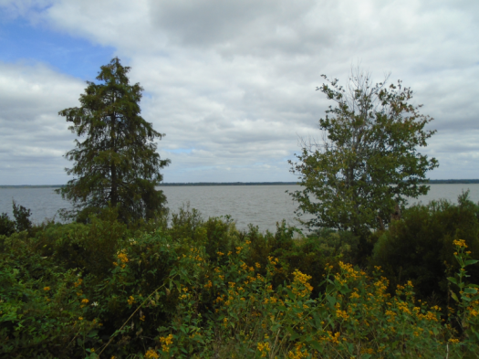
Still, I dawdle at the Taskinas Creek Overlook. A swallowtail butterfly swoops yellow and blue onto a flower. I watch it dine on blooms for several minutes. Maybe I’ll leave when it flies away.
But the butterfly settles in, right where it belongs.
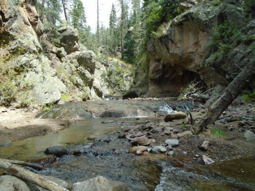
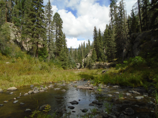
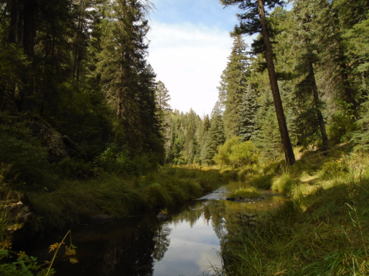
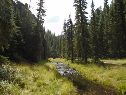
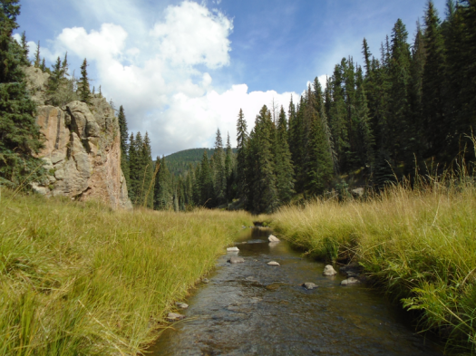
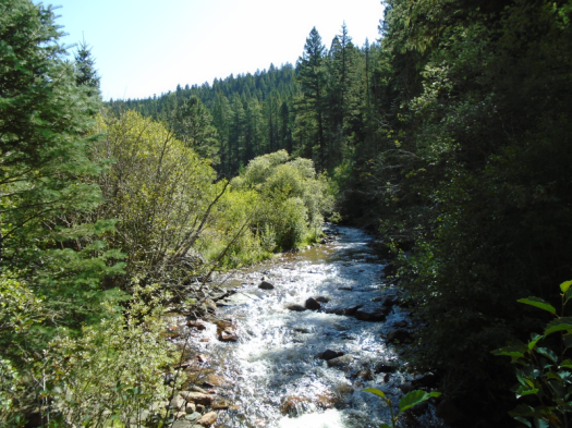
This shallow section of the East Fork Box of the Jemez River doesn’t boast any 20-foot cascades. But the water I walk through gurgles with power over the rocks.
Don’t go chasin’ waterfalls? Too late.
The river’s motion has sculpted canyon walls, arches, hollows and caves. Moss, grasses and trees wrap around rock.
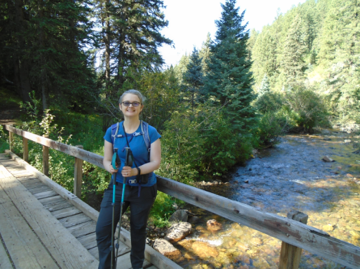
The first real waterfall has only a couple feet drop, but it’s enough to stop my forward progress. My husband, part gazelle, scrambles and glissades between rock and water until he nearly disappears around a bend. Then he, too, reaches a point where he can’t go further without going under.
We reverse direction and reach the point where we left the bank in minutes, though we spent nearly half an hour in the water.
Birds and blue dragonflies swoop over the river. American dippers seem to hop for joy in the water, which I can understand.
Thunder booms as we reach the end of the box. It’s a steep scramble back to the trail. The water in my boots sloshes as I heave myself up the slope.
The first time we hiked this beautiful trail, we reached a fence, turned around and hiked back, not realizing a gate led into the box canyon.
The trail alone could inspire one to burst into song.
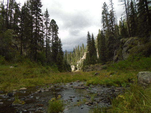
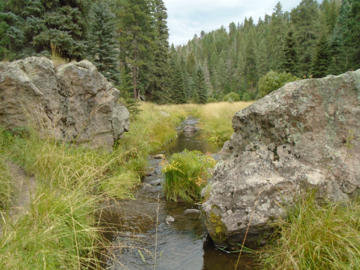
The East Fork here babbles small and sinuous through high mountain meadows, through spruce and ponderosa, between 50-foot walls of black and orange rock. The river leashes its power; at times you can step across in one stride.
Rock climbers belay, fishermen angle, kids giggle, dogs pant.
And, oh yeah, thunder rumbles.
After driving 60 miles to our chosen hike today, we found the road closed until spring due to a plugged culvert, then drove another hour to the East Fork Trail. Meaning we started hiking an hour later than we intended. And even though it will be fall in six days, it’s thunderstorm o’clock.
The sun blinks off. The wind rises. The temperature falls. The canyon turns green and gray.
Time to clear out.
We’re close enough to the trailhead that we get damp, not soaked. When we reach our car, it’s 55 degrees and pouring.
The rain follows us for most of our drive back through the Jemez. The roads and the river run red with mud in Jemez Springs. Just when I think I’ll have a chance to practice “turn around, don’t drown,” it lets up enough that we can proceed.
I had no intention of spending four hours in the car today, but this hike is worth it.
Hike length: 5 miles
Difficulty: From the Las Conchas Trailhead to the box is easy; the scramble and the box are challenging
Trail traffic: popular
Wildlife spotted: vultures, crow, American dippers, robins, mountain chickadee, blue jay, dragonflies, grasshoppers, butterflies, fish (maybe a longnose dace)
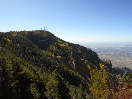
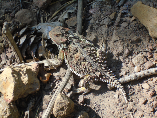
North Mystery Trail has life, lots of it. Red-breasted nuthatches dart through healthy, towering stands of ponderosa. Yellow, orange and black butterflies trail us. A rust-red horny toad comes into and out of focus against the soil beneath.
The universal smell of autumn, dead leaves, greets us too. But it’s midmorning at 8,000 feet in September, and it’s 80 degrees. Everything still living is churning out chlorophyll for all it’s worth.
Below us, in Albuquerque, temperatures climbed above normal virtually every day of August.
The warming of the Southwest is not a blip, one of those unseasonable weather patterns that have happened occasionally since the beginning of time. This is the pattern now.
Under my feet, fossil whorls dot the limestone.
What will remain of this ecosystem in 20 years, or 50, or 100?
The two of us, today, did not get up the back side of the Sandias by public transit or bicycle. So yes. We are part of the problem. We are the problem.
I hope we can also be part of the solution.
My photos and my words from this day don’t really match. I mostly took the green pictures with the views instead of photographing the dead and withered trees and plants. I didn’t know I would write these words until I wrote them. A lesson for me.
Every few minutes we hear some creature racing away. Glimpses of a deer, chipmunks. But mostly, just the forest floor quivering in their wake.
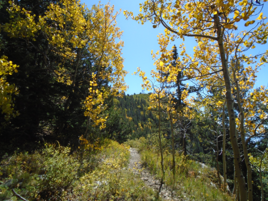
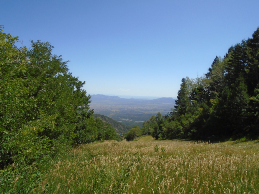
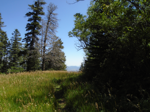
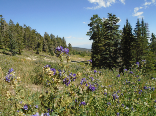
Hamilton Mesa Trail leads us into the Pecos Wilderness through high mountain meadows. Wildflowers pulse yellow and purple. The Pecos River burbles, always within sound if not sight. Then it’s there and we cross it.
From the trailhead, we saw deep into a valley blanketed with rich evergreens, rustling aspens.
No matter how far I go, or what I see, just to be here is enough, I told myself then.
We climb till I’m nearly climbed out. I push on, eager for mesa-top views. We reach a crossing at last and see…cars?! I exclaim in consternation, vow temporarily forgotten.
My research had indicated we’d pop out onto the mesa top, with views everywhere, after three or three and a half miles. We’d hiked three and a quarter miles, all the way to Iron Gate Campground, and we’re still deep in trees.
I plop down on a log. Two squirrels chase each other at high speed. I laugh till I realize one is charging down the log straight at me. It diverts only when I squeal.
Above, the highest and best expression of sky, clear as the peal of a bell.
As we descend back through the trees, ridges high above catch our eye.
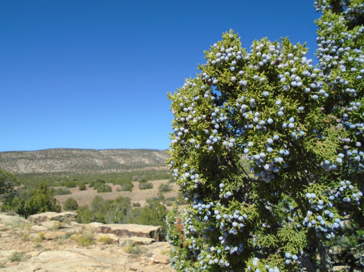
Giant berries surround us. I’d been so focused on gaining the mesa top I hadn’t even noticed the berries before.
My husband touches one. “Feels like leather. Full of fiber and seeds. Probably poison.”
At mile 7.5, we’ll climb the final naked ridge to the trailhead in relentless midday heat, me cursing and praying, mostly in silence.
Every minute, that initial vow will remain true.
Whatever happens is as it should be, for I am in the Pecos.
Hike length: 8 miles
Difficulty: moderate
Trail traffic: just one other human and his two horses
-The proprietress of our cabin painstakingly informed me about the best and worst restrooms on the road to Cowles. This is invaluable information and I am paying it forward. Iron Gate Campground: Just say no. Jack’s Creek Campground: Two thumbs up. I would go so far as to describe the restroom near the horse corral at Jack’s as pristine.
-I didn’t think of it at the time, but if I were climbing back up that ridge to the trailhead on a hot day again, I would stop to soak my feet and maybe my head in the Pecos River to stay cool.
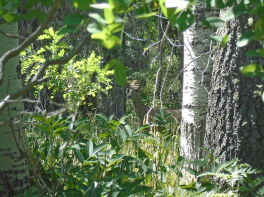
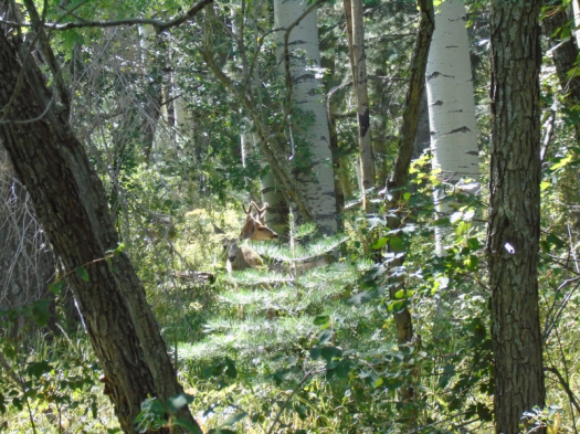
The motion intrigues the three deer staring at us: two does and a buck with fuzzy four-point antlers.
One deer walks away, then another, but one doe doesn’t budge.
As we watch her, the other two come into focus again behind her. Funny how the longer you look, the more you see.
We stand there till my heels throb. Only her ears move.
It’s her home, she’s waited out far more than us, and she’s probably still standing there.
***
In general, I subscribe to the adage that a bad day hiking beats a good day doing most other things.
But this came close to being the first hike ever that I did not enjoy at all.
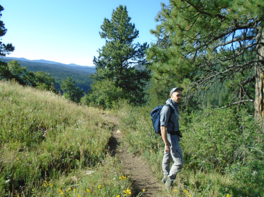
We’d come to explore a shaded trail on a hot day, but couldn’t find the promised trailhead from the Sandia Peak Ski Area parking lot. We figured the path winding up the ski slope would soon lead us there, so we took it.
I grew more and more irked as we zigzagged across the meadow. This would be a fun path to blast down on a mountain bike or shush on skis, but climbing it in blasting sun felt like going nowhere. I got so heated up that it took way too long to realize I hadn’t seen a single one of our trail’s blue blazes.
We kept climbing, thinking we’d intersect another trail and could get down using the trail we’d originally planned to hike. Eventually, though, we realized we still had so far to go to the trail that we were likely to run out of steam. We turned around.
After nearly five miles, my frustration finally began to dissipate. I couldn’t deny, on the way down, that hiking an empty ski slope in high summer brings many delights.
Waist-high grass and sunflowers wave in the wind. Green views plunge far into the valley. Pale aspen trunks shoot into the sky.
My husband suggested a shortcut down a mowed slope to avoid the last of the zigzags, but with the uphill exertion over, being out there felt good.
Two mountain bikers headed uphill paused on a zigzag above us, midday sun blazing down on their climb.
My husband heard one of them say, “I hate this.”
Hike length: 6 miles
Difficulty: moderate
Trail traffic: light
Wildlife spotted/heard: deer, vultures, flycatchers, chipmunk, butterflies, grasshoppers, nuthatch, eagle? (heard only)Abert’s squirrel (in the middle of the Sandia Crest Highway, unconcerned)
Things to know: The ski area is closed and the mountain bike trail we ended up hiking on was unmarked, unpatrolled and unmaintained. It’s in perfectly good condition, but there are some narrow spots where you might have to dive into waist-high grass if a mountain biker came by.
The tune: Robert Palmer’s “I Didn’t Mean To Turn You On.” The setting that kept luring us further: Osha Loop Trail on the east side of the Sandia Mountains.
We’d been out late dancing the night before (still got it, baby!), so we had sore feet and weren’t sure how far we’d get. At a trail junction three miles into our hike, we deemed it better to head back than to try to finish the whole seven-mile-plus jaunt. This meant climbing back up the steep ridge we’d just descended.
My Robert Palmer adaptation played in my head as we neared the top of the ridge. Then we startled a doe, and everything froze. She stared at us, walked a few steps, sniffed the air, repeated the sequence several times, then turned and trotted into the forest.
We’ve had several deer encounters hiking, but never on this side of the mountain. The trails, while not crowded, are popular. Osha Loop, though, is a wilderness trail, less used and less maintained. Wild rose and gambel oak squeeze the rocky path.
What can I say, we’re really sappy
Even on 10K Trail, the popular trail that’s the primary access to Osha Loop, we passed relatively few people. The breeze at 10,000 feet cooled us as the temperature below in Albuquerque approached 100.
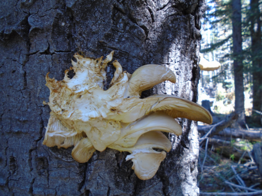
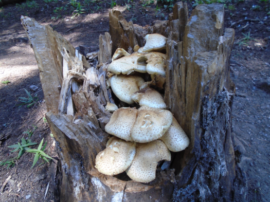
There are some epic shrooms in this spruce-fir forest
The quiet allowed us to see not just the doe, but two sharp-shinned hawks. Who knows what else we could have spotted if we’d done the whole trail.
When I attempt this trail again, I’ll do so on fresh feet.
Hike length: 6 miles
Difficulty: moderate
Trail traffic: light
Wildlife spotted: squirrels, chipmunk, butterflies, grasshoppers, nuthatches, brown creepers, sharp-shinned hawks, doe
Things to know: There are quite a few precariously positioned and hazardous dead trees on the first couple miles of 10K Trail North right now.