If you want to feel all of the feelings, go to Red Canyon

The sounds around me heal: wind rustling aspen leaves, birds chirping.

The sounds in my head tear everything apart.

What the hell is wrong with you today?

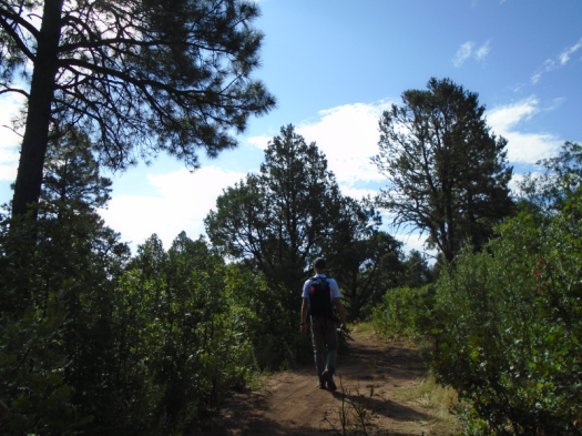
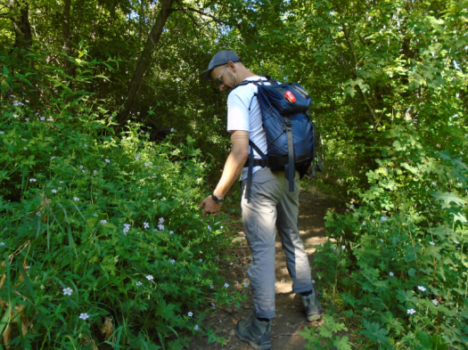
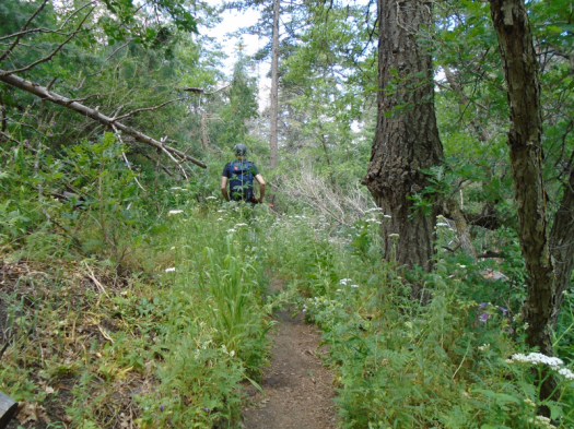
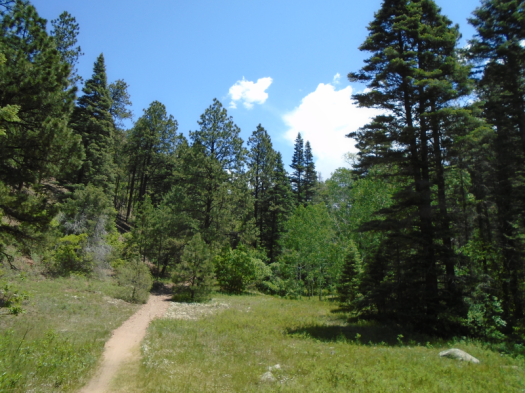
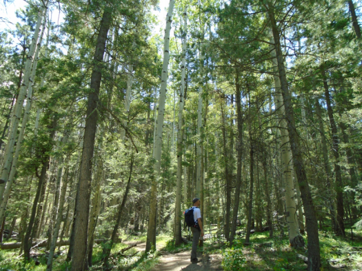
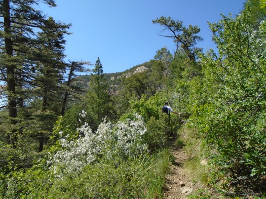
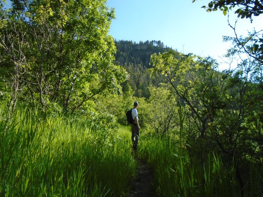
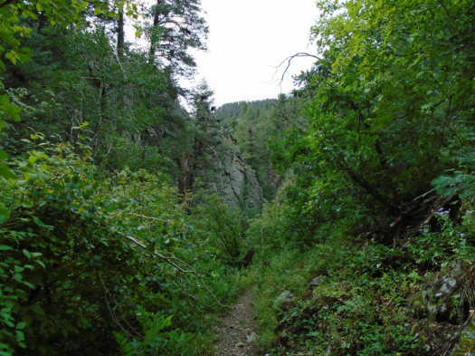
I trudge up the top of Red Canyon Trail in the Manzano Mountains. At least I hope to God it’s the top. Before today I’d only hiked down this trail, as part of a loop, and I now see why my guidebooks prescribe that.

I did a hike with the exact same elevation gain as Red Canyon Trail a month ago, but my legs are ready to give out. My internal monologue of judgment, though, has plenty left to give.

DSC02235.JPG
Leave No Trace it ain’t, but this bear art on an aspen lifted my spirits on that endless final trudge.

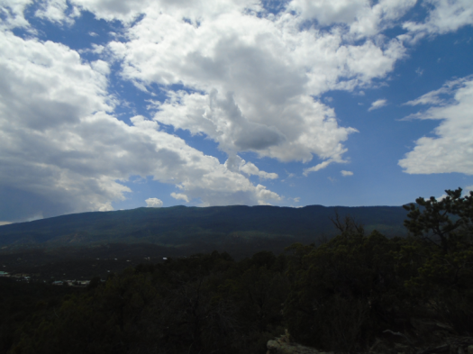
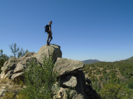
Many steep grades and grunts later, sky and a trail junction sign emerge.

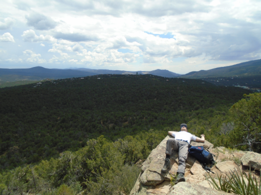
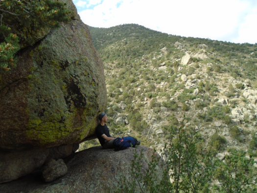
My jelly legs deposit me on a shaded rock, where I meditate. I’ve never done that in nature, but I need to stop the runaway train of my brain.

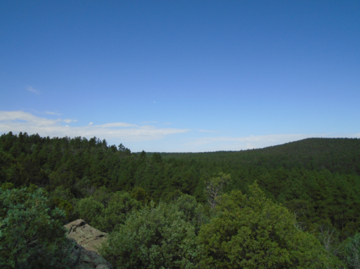
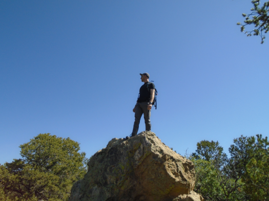
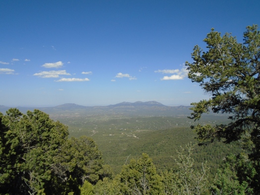
My eyes only stay closed about three minutes, because I have, in fact, reached the Manzano Crest Trail, and I want to see the world around me.

My eyes open to another day than the one in which our hike began.

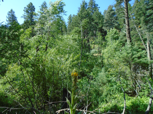
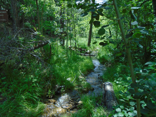
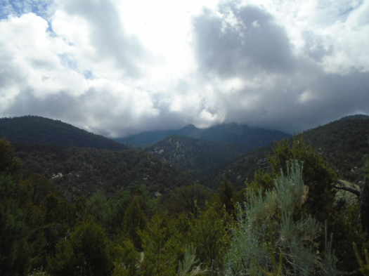
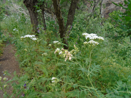
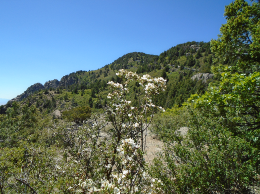
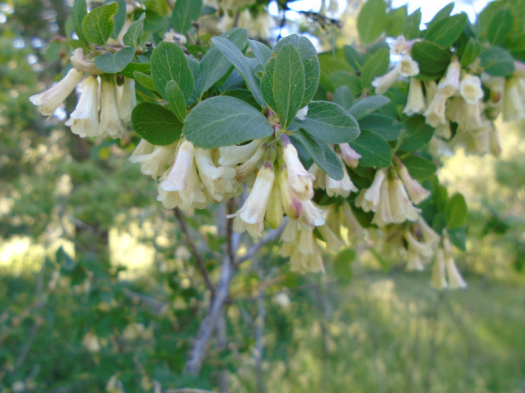
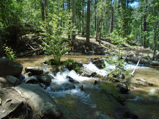
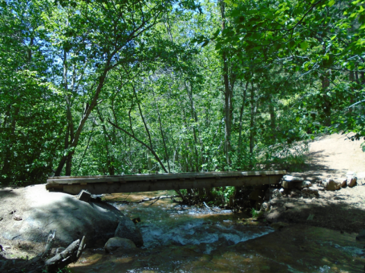
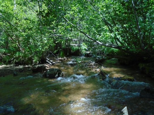
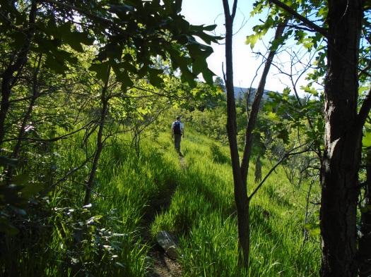
We shivered in a cold wind at the trailhead, breathed water-saturated air. An early-morning rain had bathed the mountain. Water droplets shimmered on spiderwebs and leaves and buds all the way up the dark canyon.

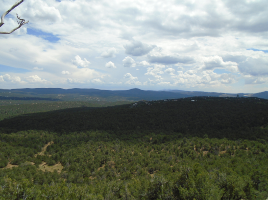
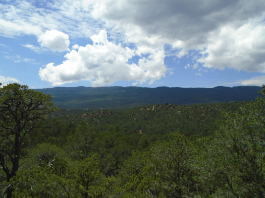
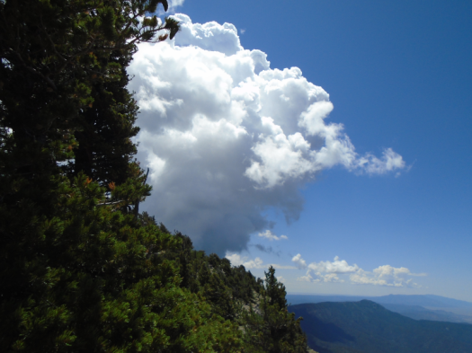
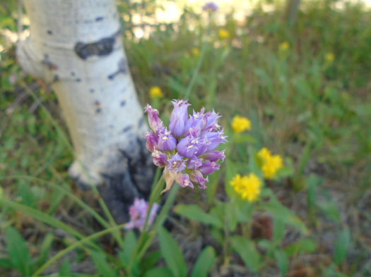
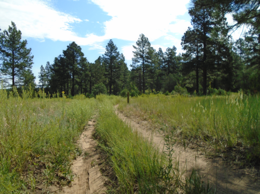
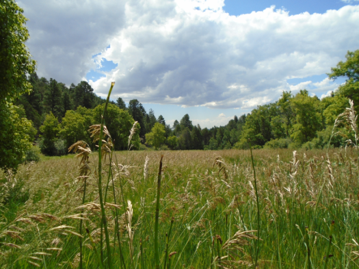
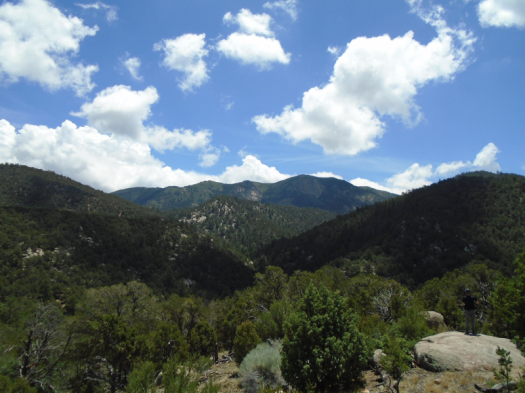
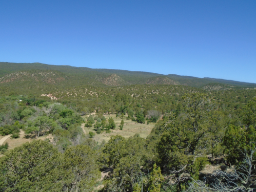
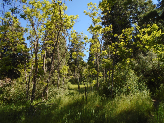
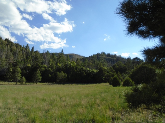
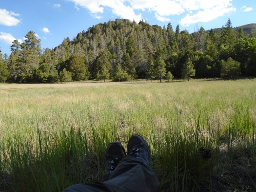
Here, in a Crest Trail meadow, grass glows in the sun, brilliant blue sky above.

DSC02241.JPGDSC02243.JPGDSC02256.JPG

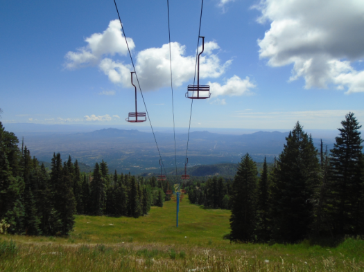
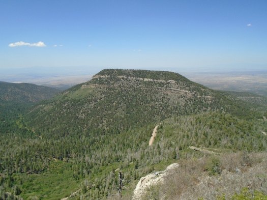
Our original plan called for venturing slightly north to climb Gallo Peak. Climbing any peak is now a ludicrous thought.

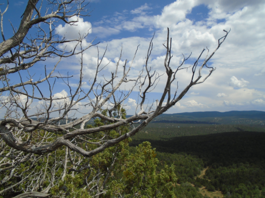
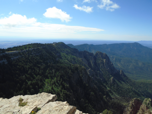
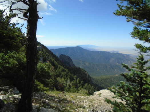
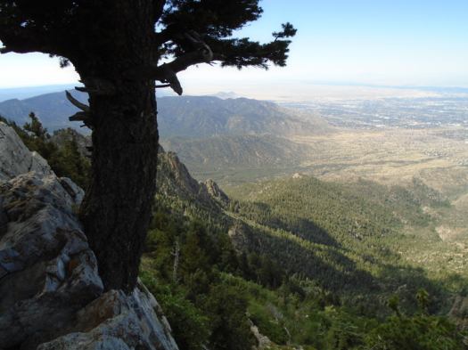
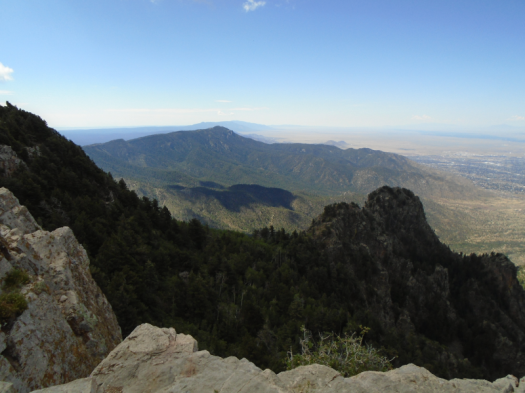
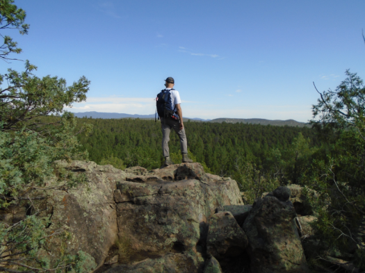
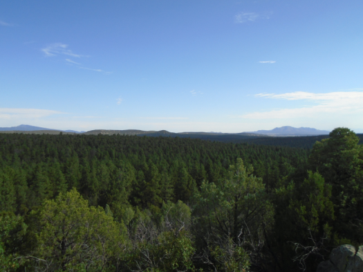
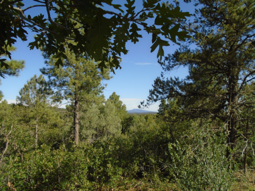
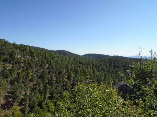
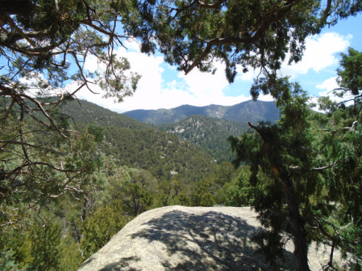
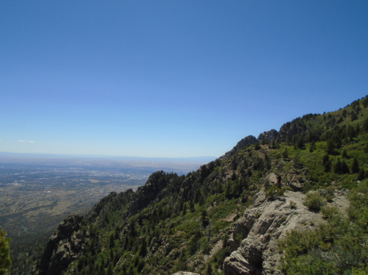
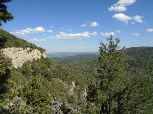
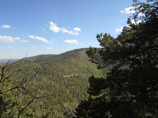
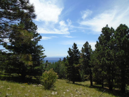
All around us rise ridges that promise views of the valleys far below. We start up one, but the top’s not as close as it looks (it never is) and up is no longer a direction my legs will consistently travel in.

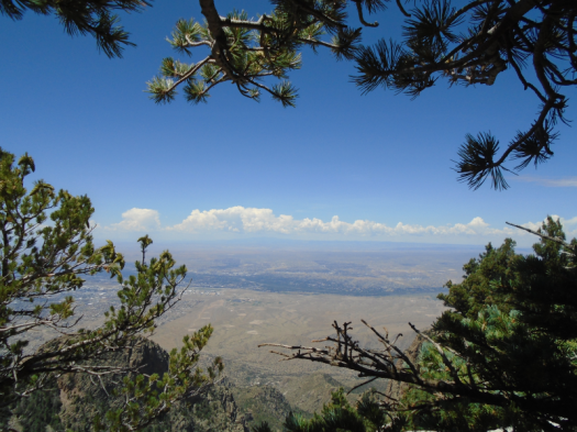
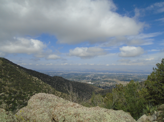
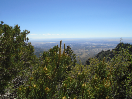
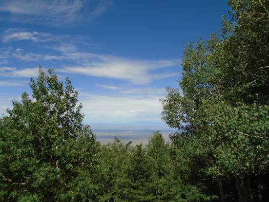
We settle into the meadow for lunch, looking into the distant Estancia Valley. When we came up here a year ago, the clouds were so thick we couldn’t see it

It’s not the first time this part of the Manzanos has touched off an emotional cascade in my brain, then brought me back to reality with its beauty.

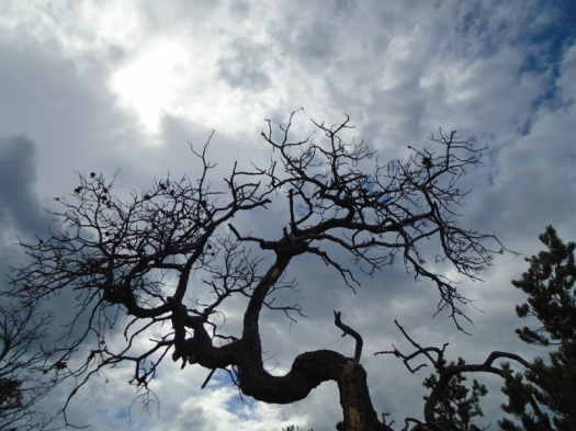
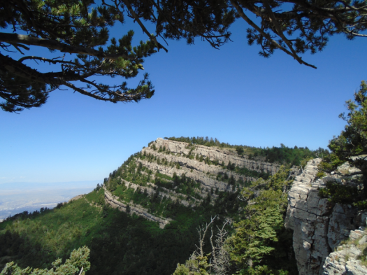
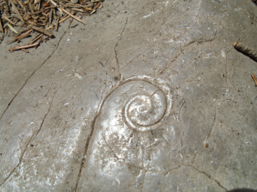
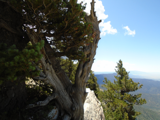
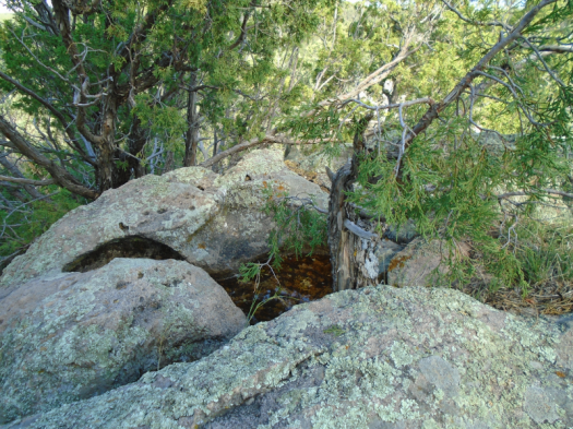
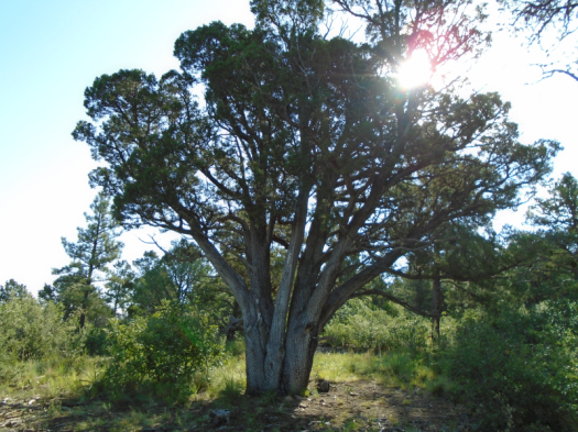
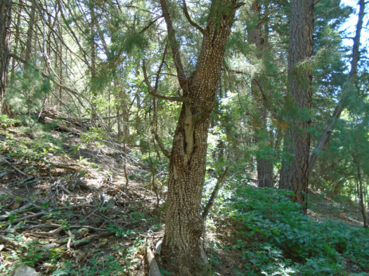
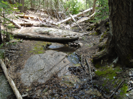
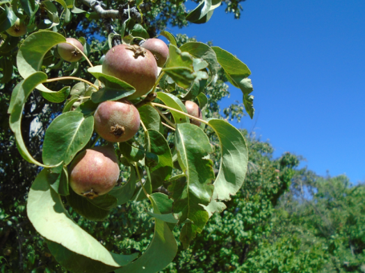
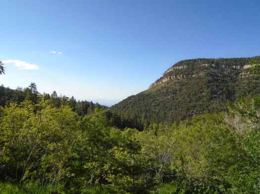
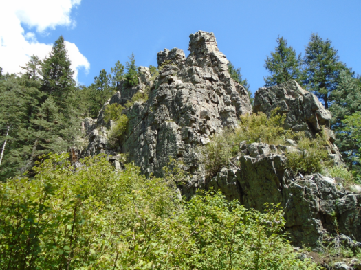
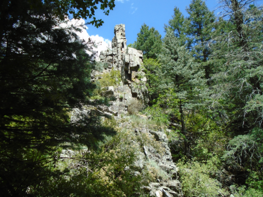
I don’t know what it is about Red Canyon. I have hiked in many special canyons in New Mexico. This one stands out. It’s dark, walls rising high, a lush microclimate within. It’s steep, obviously. Its rock formations tower like ziggurats, dark gray stone shading to pink and purple on a wet day.

DSC02215.JPGDSC02220.JPG

DSC02230.JPGDSC02232.JPG

DSC02273.JPGDSC02275.JPG

It’s something you should experience for yourself.

Prepare for some feelings.

Hike length: 6 miles

Difficulty: The official ranking is moderate. That’s fair, but you know where I stand.

Trail traffic: moderate today, typically light

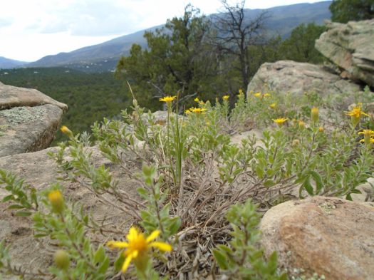
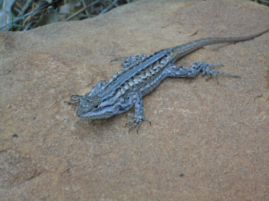
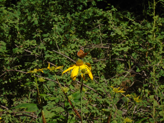
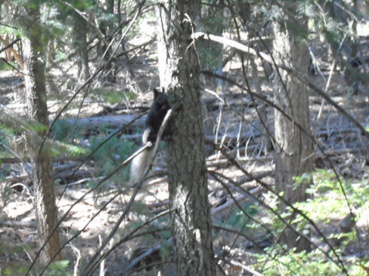
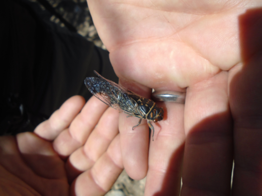
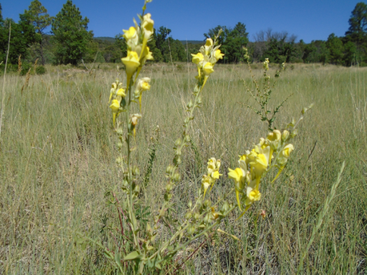
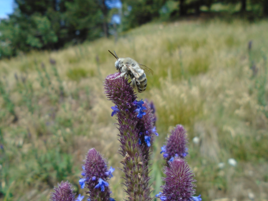
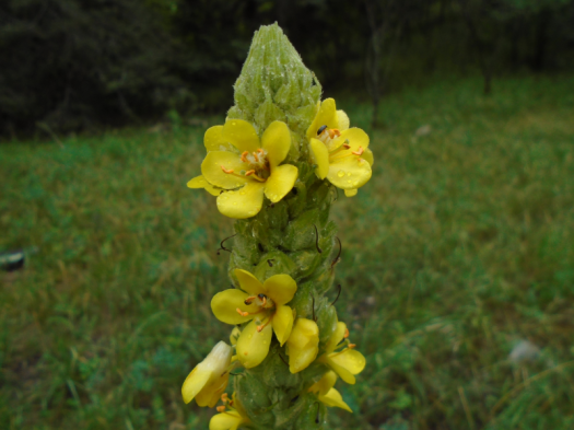
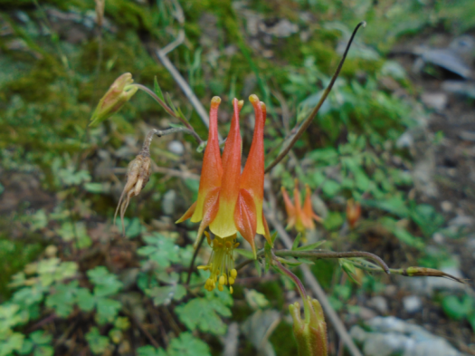
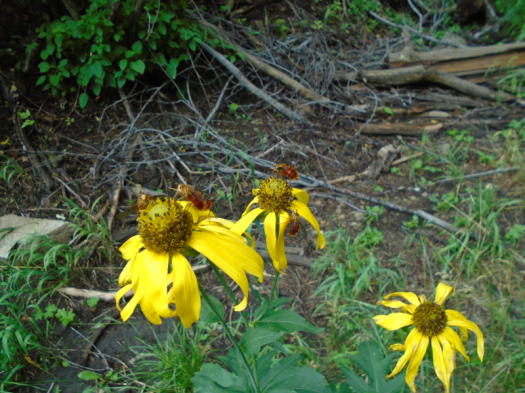
Wildlife spotted/heard: hummingbird, nuthatch, butterflies galore, hawk, beetle, caterpillar, cicadas

DSC02284.JPG

Life and death at Gutierrez Canyon Open Space

Shadow plays down the ridge. We await its transformation.

The Gutierrez Canyon Open Space overlook bakes in the afternoon sun. My husband lies on the rock. I tell him he looks like he’s on a funeral pyre.

DSC02181.JPG

Shade. One could nap on the pyre now. I recline on rock, monsoon breeze cooling me, and consider it. Huge puzzle piece clouds slide over, lock into each other.

DSC02202.JPG

Guadalupe and Mosca Peaks stand bruise-blue on the horizon. The hue communicates the rain we can’t see.

DSC02175.JPGDSC02162.JPGDSC02179.JPG

DSC02205.JPG

DSC02190.JPGDSC02189.JPG

DSC02206.JPGDSC02208.JPGDSC02211.JPG

Narrow trails twist through pinon and juniper spiked with moss and lichen. A handful of crows bleat furiously as we pass. My husband suspects a predator nearby, maybe a bobcat. When we pass back by, the crows crank a new symphony. Maybe it’s us they’re protesting.

Something’s been about, though. A rabbit, recently bloodied, lies dead on the trail, a warning.

We pass no one, see nothing but life and death.

Hike length: 5 miles

Difficulty: moderate

Trail traffic: none

Wildlife spotted/heard: beetles, butterflies, hummingbirds, crows, hawk, nuthatch, sparrows, striped and spotted lizards, dead rabbit

Watching the eagles soar at Sandia Crest

The unmajestic sound – a squirrel-like chittering – tells us that’s a majestic eagle swooping above the Crest Trail. Two, actually.

We’ve claimed one of the finest snack spots within driving distance of Albuquerque, a limestone shelf under a tree. Behind us, the historic stone Kiwanis Cabin commands the tip of a promontory. North of us, the Kiwanis Meadow glows green. In front of us, the Crest Trail flirts with the cliff’s edge. The San Pedro and Ortiz mountains slope beyond. Two nights of rain washed the sky clear as a bell.

It’s no wonder everybody and their dog – literally – is out here.

The 1.5-mile stretch of the Crest Trail from the Crest House to the Sandia Peak Tram’s upper terminal gets the most traffic of any trail on the mountain, according to Mike Coltrin’s Sandia Mountain Hiking Guide.

Steps from your car, or the tram, you’ll find a jaw-dropping cliffside view above 10,000 feet where the mountain just plunges away.

DSC02121.JPGDSC02126.JPG

DSC02129.JPG

DSC02137.JPG

DSC02141.JPG
WHAT ON EARTH IS THIS PIPE DOING HERE

DSC02142.JPG

Or you’ll walk into Albuquerque’s little slice of cathedral forest and breathe in wet fir, the greatest scent on the tree menu.

DSC02114.JPG

My husband could have hiked this trail twice in the time I took checking out every overlook. Slick limestone, muddy tree roots and making way for other humans kept us alert. The accents and languages we heard were nearly as diverse as the scenery.

DSC02136.JPG
Most excellent fossil I’ve seen in the Sandias

Somehow we ended up hiking a forest road most of the way back from the tram terminal. Fewer people, fewer views, more butterflies. I aimed my camera at five or six fritillaries, but wasn’t fast enough to capture a single one.

DSC02147.JPGDSC02148.JPG

One more pass through the deep dark forest, uphill this time, and city and mountains and sky open before us again.

DSC02151.JPGDSC02153.JPGDSC02154.JPGDSC02161.JPG

You don’t have to go far to get far.

Hike length: 5 miles

Difficulty: moderate

Wildlife spotted/heard: golden eagles, crow, violet-green swallows, swifts, nuthatches, least chipmunk, butterflies, horny toad, deer and fawn (on the Sandia Crest Highway)

Trail traffic: plenty


New views open up at Juan Tomas Open Space

This overlook wasn’t here before. A halo of stumps circles the promontory. Forest thinning must have revealed it.

We climb lavender granite, just behind a chipmunk. A Western bluebird swoops into pine. Waves of forest break below us, all the way to South Sandia Peak.

DSC02095.JPGDSC02098.JPGDSC02099.JPG

DSC02093.JPG
A sapling grows from a water hole in the rock

This is Juan Tomas Open Space, a city-owned property south of Tijeras. We’ll see no other hikers, but probably a dozen mountain bikers. The rolling hills offer plenty of room to move over.

Ponderosas hover above, their enormity granting needed shade. In meadows, green competes with green, grass and wildflowers waist-high. Smooth logs rest in a trail rut, washed there by the most recent rain.

DSC02090.JPG

DSC02091.JPG
Alligator juniper

DSC02100.JPGDSC02101.JPG

We disagree at the same junction as always on which trail leads back. As always, we find our way.

Driving down Oak Flat Road, I think I see my first Western diamondback, but it’s just a gopher snake. A four-foot gopher snake. My husband is compelled to rescue all road snakes, living or dead, so I put on my hazards while he jumps out, finds a branch to pick up the snake with, and relocates him (or her).

It’s my first live snake sighting in the West.

Even the most familiar locations in the forest have so many surprises.

Hike length: 4 miles

Difficulty: easy-moderate

Trail traffic: moderate

Wildlife spotted/heard: nuthatch, flycatchers, Western bluebird, sparrows, lizard, beetles, chipmunk, gopher snake, butterflies


Cienega-Armijo loop: an eyeful of birds, butterflies and Abert’s squirrels

An hour in, we can finally see.

Many days in the forest, birds blur at the edge of our peripheral vision, nothing discernible except “small,” maybe “brown.”

Now, sitting in a grove of ponderosa pines on Armijo Trail, nuthatches resolve into focus. Once they do, we see them everywhere: sailing from tree to tree, corkscrewing up and down trunks. We identify their testy chirps.

“Small” will resolve itself at other points today into woodpeckers, two sparrows in a spindly pinon, a flicker brushing a ponderosa’s crown.

Butterflies emerge, too: the orange and pink of painted ladies, swallowtails highlighted blue and black. Tassel-tailed Abert’s squirrels wrap around tree trunks, gallop up the trail like dogs.

DSC02067.JPG

DSC02080.JPG
Abe, the blurry Abert’s squirrel
DSC02070.JPG
Alligator juniper

DSC02075.JPG

When we began this hike, along Cienega Trail’s spring, a riot of wildflowers attracted so many butterflies it was tough to zero in on any one.

DSC02061.JPG

DSC02085.JPG

Before I could see anything, I had to hear. How a grumpy person’s heavy footfalls on a rocky trail sound just like grumbling.

DSC02069.JPG

I’ve had a low-grade grouch on all week – exactly the amount of time since our last soaking rain. Exactly the amount of time since the humidity rose and some of this year’s epic grass pollen washed away.

Building above the ponderosas: the kind of towering cloud that could make something happen. Ten, 20, 30 percent chance – these numbers mean little in monsoon season. It will rain when it will rain.

DSC02087.JPG

Until then, the abundance of this year’s growing things burn my eyes – but I can see.

Hike length: 5 miles

Difficulty: moderate

Wildlife spotted/heard: woodpeckers, nuthatches, flicker, sparrows, lizard, butterflies, cicadas, Abert’s squirrels

Trail traffic: busy at trailhead, none for the first half of the hike


Embudito Canyon’s funky, tingly, flowery forest

We try to talk each other out of it.

That huge creature soaring high above the canyon probably isn’t an eagle.

I can’t be sure what I’m seeing, with sweat in my eyes and watercolor Albuquerque levitating below us.

DSC02036.JPG

We’re on Embudito Trail, one of the most beautiful hikes close to the city – one I’d normally never do in summer. Its stunning first two-plus miles scale steep canyon walls with no trees to speak of. In full summer sun, hiking it feels like roasting on a griddle.

DSC02034.JPG
Want shade on the first section of this trail? Better find a boulder.

Thankfully, it’s unusually cool this morning, thanks to last night’s monsoon rain. It’s also unusually humid.

We lose the not-eagle in the cloud smudges. We round a corner and realize we’d taken our break just short of an outstanding overlook, forested peaks and ridges on all sides.

DSC02038.JPG

DSC02051.JPGDSC02053.JPG

Then we climb into them for the first time.

Two hours into our hike, everything that came before evaporates. Ponderosas coalesce into a canopy. The temperature drops 15 degrees. Aspens shoot up from mossy two-ton boulders. Yarrow and penstemon narrow the trail from both sides.

DSC02045.JPGDSC02047.JPG

DSC02048.JPG

Forest funk fills the air. My arms tingle from the cool breeze and the phytochemicals.

I have never felt a sensation like it. I tell my husband.

“Is it just your left arm?”

“No, it’s both. Why?”

“Because that would be a heart attack.”

This is not that. I don’t know what this forest is manufacturing, but I just finished “The Overstory” and I know my blood pressure is probably improving every time I inhale.

The grade of the trail lessens through the forest, but then the switchbacks begin again. The entire trail is rated difficult. It’s midday and the forecast cloud cover is nowhere to be seen (I knew I was rolling the dice with that and I might lose.)

It’s time to haul my tired legs back down the griddle.

Good thing I have a lungful of mysterious forest compounds to propel me.

Hike length: 7 miles

Difficulty: difficult

Trail traffic: lots until you reach the forest

Wildlife spotted/heard: quail, curve-billed thrasher, hawk, butterflies, cicadas, bluejays, horny toad, lizards, velvet ant, crows. And after consulting the bird book on what an eagle looks like from below (I’ve only seen one once for sure), I think there’s a good chance that was a golden eagle.

Ojito de San Antonio: small but mighty (plus, fruit)

The whine intensifies, as if someone were drilling nearby.

It’s a cicada, half a note higher than the drone of his brothers and sisters all around us.

It’s a hot morning at Ojito de San Antonio, a small Bernalillo County open space near the East Mountains. The trail begins in a meadow where a historic acequia feeds an orchard, and the orchard feeds birds. Then the trail climbs through rocky juniper, and, this time of year, cicadas.

DSC02001.JPG
This lovely fellow was lying on the trail, recently deceased.

At the top, stacks of boulders look down on the meadow tucked into evergreen hills, and down on Highway 14 (conveniently located is, well, conveniently located). A single violet-green swallow swoops above us.

DSC02004.JPG

DSC02005.JPG

DSC02006.JPG

We emerge back into the meadow, counting wildflowers, butterflies and fruits. We spot apples, pears, apricots and mulberries.

DSC02017.JPG

DSC01994.JPG

DSC02022.JPG

DSC02023.JPG

Those who want to see the bounty this year have exactly one month to do so. Ojito de San Antonio reportedly closes from August to November so the East Mountains’ bears can have the fruit all to themselves before hibernation.

Hike length: 2 miles

Difficulty: easy

Trail traffic: very light

Wildlife spotted/heard: sparrows, bluejays, bluebird, violet-green swallows, nuthatches, butterflies, beetles, cicadas

DSC02025.JPG

Tree Springs Trail: the coolest place around (if you can stay upright)

We step into gale force wind.

The first time I stood on this spot, I understood every bumpy plane ride I’d had over the Sandias on a clear day.

The overlook at the top of Tree Springs Trail provides one of the best panoramas you’ll find of Albuquerque. And, like many a bare rock ledge at 9,500 feet elevation, it gets a daily whipping from the wind.

DSC01968.JPGDSC01972.JPGDSC01975.JPG

Tucked under a tree, we found enough stillness to eat a snack and soak up the sun. My husband explored a rocky promontory we often check out, but the footing’s a little precarious, so I didn’t chance it. Gusts had me listing even when taking a photo well back from the ledge.

Tree Springs Trail traverses high-elevation meadows and ridges, mostly in the shade of fir and spruce, with an occasional sunny climb. It’s a haven for wildflowers, hikers and dogs. Today we witnessed a first: four guys on fat-tire unicycles.

DSC01983.JPG
Fossil in the limestone

We usually flee to Tree Springs when the mercury nears 100 in the valley. Today, unseasonably cool in Albuquerque, felt even more spectacular up here: the temperature on the trail never climbed above 70, and a cool breeze bathed the trail. A brief windstorm had blown away two nights of heavy smoke from Arizona’s Woodbury Fire, leaving fierce blue skies behind.

We capped off our hike with a detour on a side path of Oso Corredor Trail to check out more wildflowers.

DSC01990.JPG

DSC01991.JPG

I don’t know how the Duke City managed to steal this day from early May, but I sure am glad it did.

And, as always, grateful that we didn’t blow away up there.

Hike length: 4 miles, plus side trip

Difficulty: moderate

Trail traffic: popular

Wildlife spotted/heard: vulture, flicker, butterflies, caterpillar, cicadas


Borrego Trail: the power of the creek

“Is that the wind or the creek?”

“It’s the creek,” my husband said.

Sure enough, as we descended, the roar grew louder. A switchback, and the water appeared: wide, deep, fast-flowing. Froth built and dissipated around rocks. Butterflies darted.

DSC01939.JPG

One electric lavender butterfly swooped, landed on a rock and promptly disappeared, camouflaged by the mottled gray on the backs of its wings.

We turned from Borrego Trail onto Winsor Trail, which forms the spine of many a hike or bike ride from Tesuque to the Pecos Wilderness. We walked the Winsor for less than a mile, most of that in sight of the rushing creek, and all in earshot of it.

We emerged from a meadow at Winsor’s junction with our return trail, Bear Wallow. The relatively short distance and the creek make this a very popular loop hike, but we managed to snag a shaded log above the creek for our lunch spot.

DSC01943.JPG

DSC01957.JPGDSC01960.JPG

A hiker and his dog approached the creek, the dog curious but hesitant. He lapped water, dipped his paws in, then retreated up the bank before returning to try it again.

Suddenly, he galloped away and leapt on us, desperate to sniff and share his wet paws. His owner apologized profusely. All we could do was laugh.

We hiked downhill to reach the creek, so there was no escaping the fact that the hike back to the trailhead was all uphill.

The temperature was in the low 70s, a good 15 degrees cooler than Albuquerque.

The landscape changed from the ponderosas around the creek to cool, lanky aspens as we climbed.

DSC01934.JPG

Still, I sweated my way up the many sunny ridges.

I find it harder to motivate for a climb when there’s a hot car waiting at the top instead of an overlook, but it was more than worth it to see and hear the creek’s power.

Hike length: 4 miles

Difficulty: moderate

Trail traffic: plenty

Wildlife spotted/heard: butterflies, hawk, cicadas


The rugged Sandias where few travel: Palomas Peak

I. Capulin Peak

We step onto the overlook and into a bird ballet.

Vultures and hawks soar above us, riding the cool breeze that whips at the overlook.

The Estancia Valley rolls away to the east. Veins of red soil ripple the green plains between us and the San Pedro and Ortiz mountains.

We stare out at a giant obelisk, a Titanic of rock, pale cliffs rising from forested slopes.

DSC01906

Between us and the obelisk, a wooded valley. A dirt road plunges into the valley, rolls around it, then climbs out the other side.

I want to go there, I think.

Then I realize that’s the place we already planned to go next.

II. Palomas Peak

My knees scream.

Something screams louder.

“Is that a mountain screamer?” I ask my husband, trying to make light of the sound. I’d learned from a dialect quiz that in some places in the U.S., people call mountain lions “mountain screamers.”

He laughs.

Some kind of bird we can’t see is making the sound, an eerie one I’ve never heard, and it doesn’t let up. I wonder if it’s in distress, or distressing something else.

I wonder if it’s at the edge of its capabilities.

I’m pretty sure I am.

The Palomas Peak ridgeline twists and bumps along, tight against the bands of limestone we’d seen earlier.

DSC01922

DSC01918

DSC01917

Splintered and fallen rock litters the trail. Just a couple of steps beyond us, the slope plunges into the canyon.

My husband spots climbing pitons in the rock wall above us. I don’t see any of them. I’m mostly watching my feet.

But from our spot near the ridgeline’s end, we can look back at the cliffs we just walked under, the endless green ridges.

We navigate the rugged ridgeline back to the steep trail that brought us here.

At a junction, we visit Lagunita Seca meadow, which we bypassed on the way up.

DSC01926

DSC01927

We sit under a tree, eat a snack and look out at all the shades of green.

We head back to our car on a path that’s nearly swallowed by waist-high grass and wild rose and head-high Gambel oak.

DSC01915

DSC01929

Palomas Peak’s rock bands and evergreens, now high above us again, peek through the growth.

DSC01931

DSC01930

We saw many things on the Palomas Peak Trail. They did not include footprints. It’s the wildest place we’ve seen in five years of hiking the Sandias.

Hike length: Capulin Peak Trail 1.6 miles, Palomas Peak Trail 2.5+ miles

Difficulty: Capulin Peak Trail – easy; Palomas Peak Trail – moderate (the ridgeline is strenuous)

Wildlife spotted/heard: grasshoppers, cicadas, crows, vultures, hawks, jays, butterflies

Trail traffic: none on either trail

Things to know:

-Palomas Peak Trail is unmaintained; the ridgeline is rough, as noted above; and about a quarter mile from the trailhead, multiple partially fallen dead trees present a serious hazard. Hike at your own risk.

-I’ll save you a half-hour of wandering around parking lots and roads by telling you that Capulin Peak Trail begins at the snow play area, not the picnic area.

-Capulin Peak Trail would be an outstanding hike for small children, but keep them very close at the end of the trail. The dropoffs from the overlook are steep.

-The dirt valley road noted above is Highway 165 West to Placitas. It is stunning, especially this summer with the creek running. If you have a truck, take it. If you don’t have a truck, you can still drive this road, but take it very slowly.

-Both of these hikes are from the Sandia Mountain Hiking Guide.