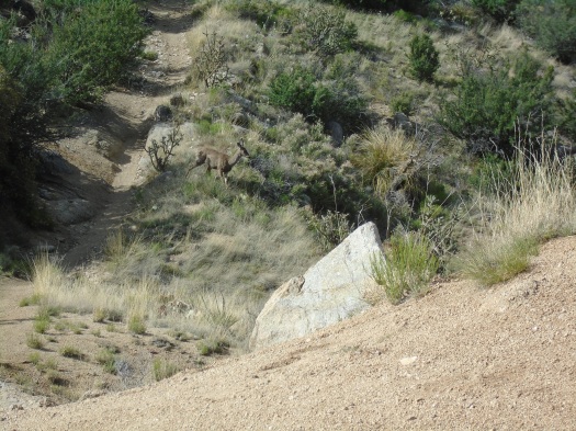
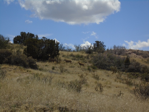
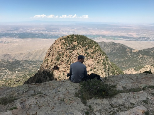
The deer paused on its way down the slope and looked around. It glanced at us; lifted a hind leg, still perfectly balanced; and – was it? Yes. Yes, it was peeing.
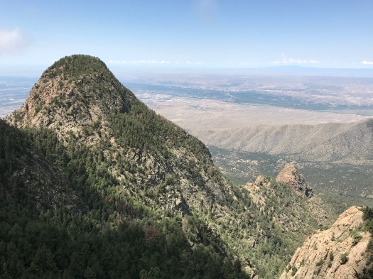
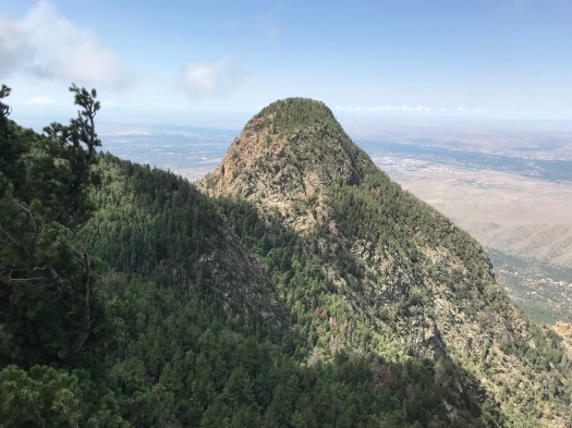
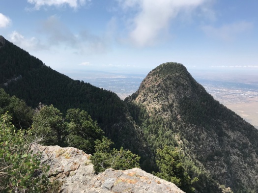
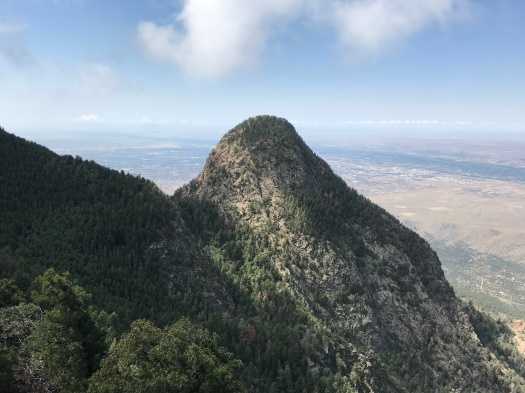
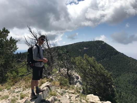
The relieved-looking deer and its companion navigated a hillside, leapt a fence, glissaded another hillside and jumped an arroyo.
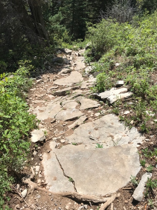
We did not have such grace as we clambered up the rough, rocky and steep trail – but then, the deer didn’t have to deal with backpacks.
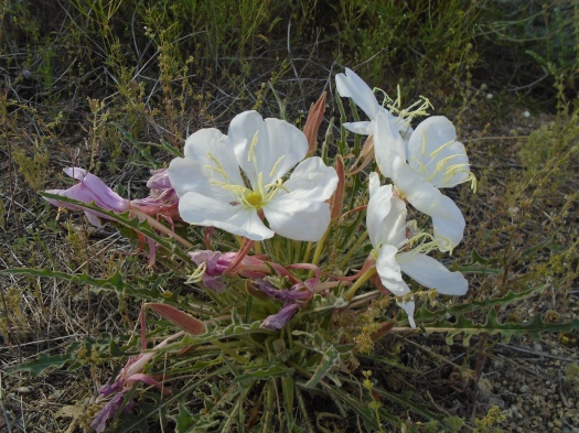
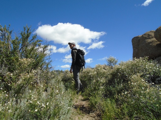
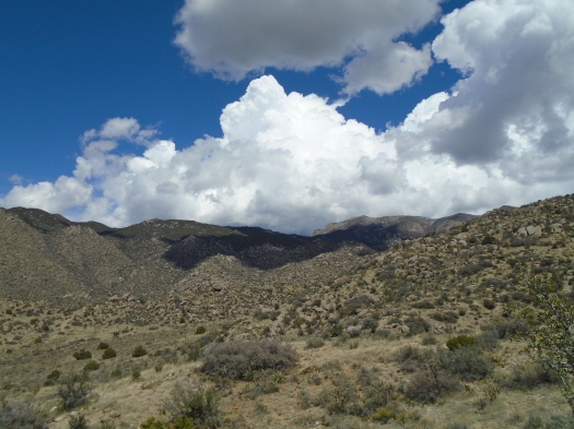
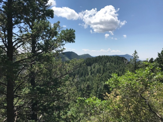
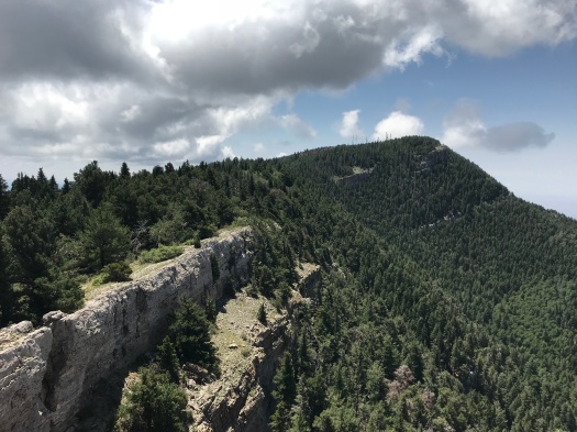
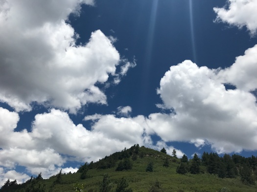
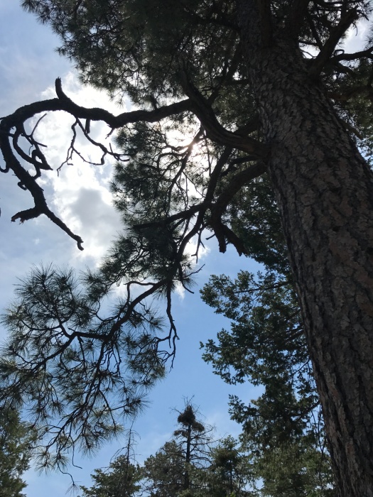
The Mano Route’s northern half sprouts boulders and rock gardens, which truly were gardens today. Apache plume tossed in the wind. Asters danced. Orange, yellow and white butterflies flirted with flowers. Giant black beetles reproduced. (We saw not one but two pairs of these beetles getting it on today.)
I would not normally recommend the Mano Route in late spring. There’s no shade. But while this time a year ago it was 100 degrees, last night’s canyon winds blew in a cooler day. It was about 65 in these rocky hills at noon.
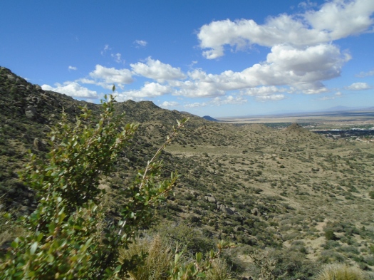
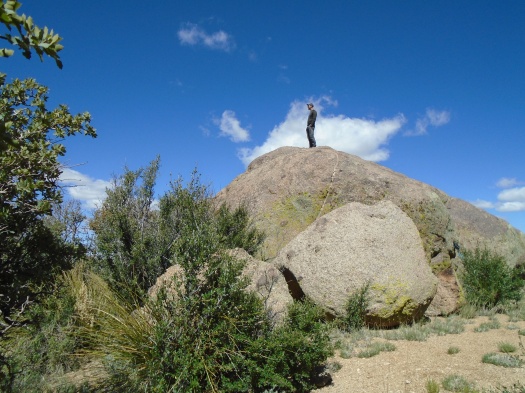
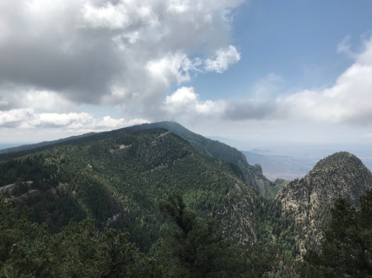
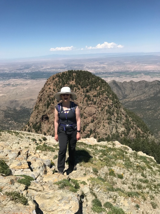
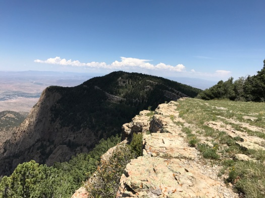
With such inviting conditions, when we reached the meadow at the top of our climb, we kept exploring. Then we clattered down the southern half of the Mano Route. It’s even steeper and rockier than the northern section, and slow going, but it overlooks Echo Canyon, El Cerro de Los Lunas and the Sierra Ladrones.
Though this trail runs at times just steps from busy streets and residential neighborhoods, it’s rugged, secluded and, this year, a wildflower wonderland.
As we made our way back to the car, my husband and I disagreed on which of many paths would get us there quicker. We were both wrong. A flock of violet-green swallows darted overhead as we consulted the map yet again.
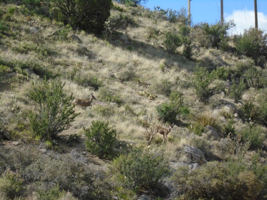
Something moved on the hillside ahead.
A deer. Then two. The same two we’d seen earlier.
The sight reminded me: I needed to pee.
Hike length: 6.2 miles
Difficulty: moderate, with some strenuous climbs and descents
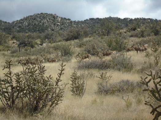
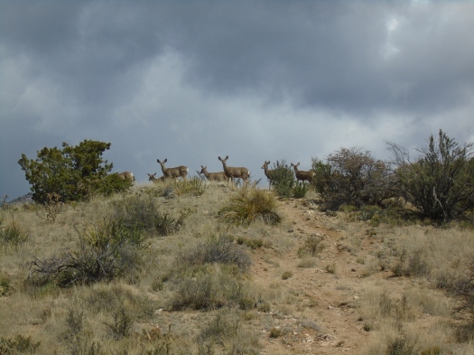
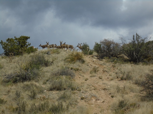
The mule deer glided along the steep hillside. She froze when she reached the dirt trail, as if someone had pressed pause. Then she stepped over the trail and kept trotting. At least 14 companions followed her.
I heard a noise and turned to see a trail runner and his dog. The runner couldn’t see over the ridge, but he’d figured out what was happening from our stillness. We invited him to pass us. He broke into a wide grin when he caught sight of the deer.
“Awesome!” he said as he ran up the hill.
We kept watching the deer as they leapt one by one over a fence, crested a ridge and stood looking at us before heading down the back side.
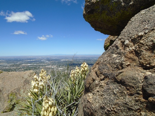
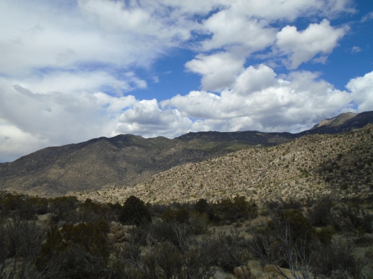
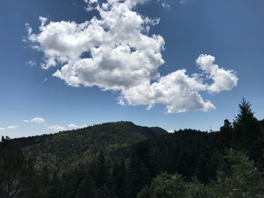
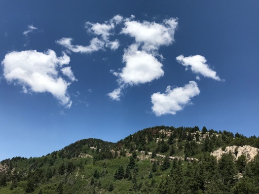
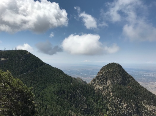
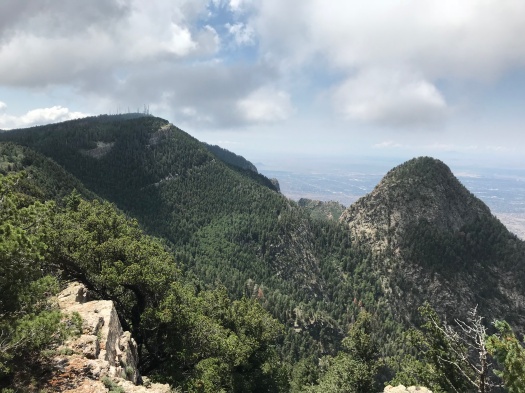
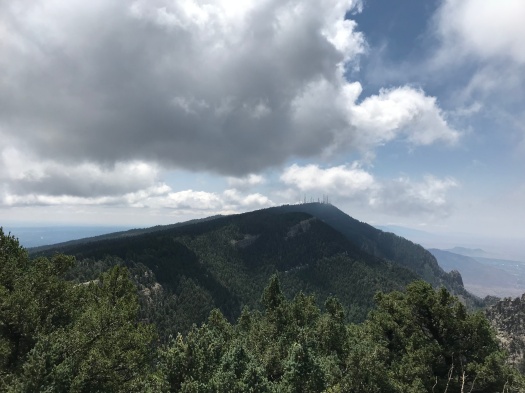
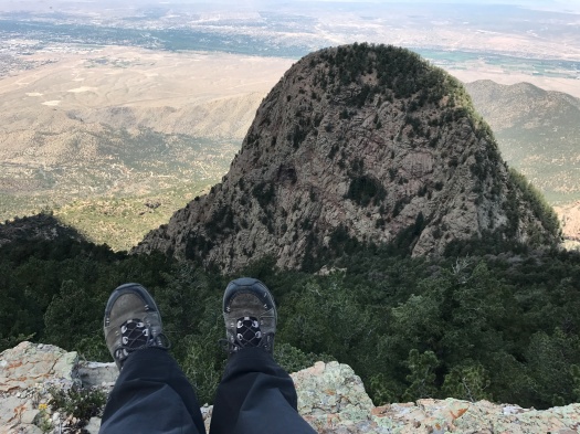
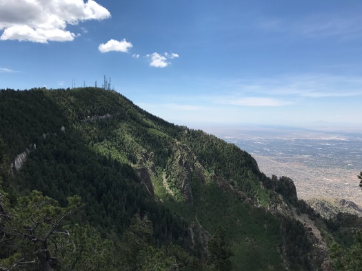
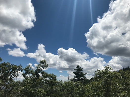
We were on the North Mano Trail, less than a mile from the Embudo Trailhead parking lot. Butterflies darted along the trail, and the sun beat down intensely on the lower slopes. But as the trail twisted through a steep landscape of boulders and cacti, the wind picked up and clouds left from an overnight rain began to coalesce.
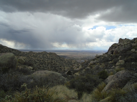
Shadow played on the walls of Embudo Canyon. Watercolor curtains of rain hovered between us and the Sierra Ladrones to the south, Cabezon Peak to the northeast.
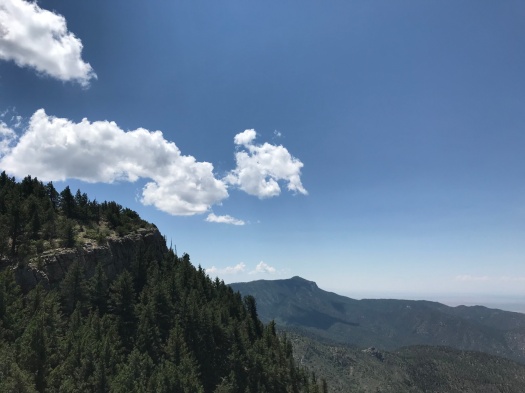
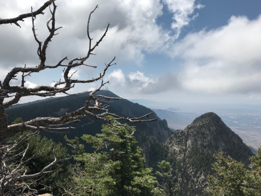
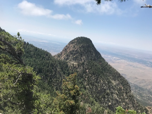
After an intense ankle workout, the trail leveled off and curved around a ridge to offer a peek at the airport and El Cerro de Los Lunas to the south.
There were multiple paths back there and it was so tempting to keep exploring. But I’d forgotten my Sandias topographical map, the clouds were threatening and that steep granite would not be fun to navigate when wet.
I’d been nervous about descending that steep trail, but I stayed upright by moving slowly, using my hiking poles and being deliberate about where I placed my center of gravity.
As we rounded a huge boulder stack, snow flurries began to fall and thunder rumbled. But the cool, wet flakes lasted only a moment.
We reached the bottom of the steep climb just as a man and his corgi Pretzel began to tackle it. Pretzel’s tiny legs scrambled mightily on the 45-degree slope, but he looked like he’d found heaven.
The trail widened, the sun found us again, and I began to sweat in my hoodie once more.
April in Albuquerque has plenty of surprises this year.
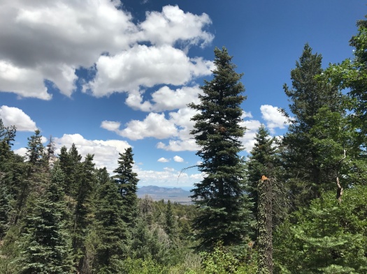
The tang of evergreen needles fills my nostrils, mixed with a hint of dampness, the packed trail below redolent of mud from a monsoon storm now forgotten. As we climb, the evergreens get taller and fatter, and copses of aspen appear.
I knew as soon as I got out here, I’d want to go all the way to the upper tram terminal, a more than 7-mile roundtrip hike with 2,000 feet elevation gain. I also knew we’d started too late, it was too hot and too humid.
I make it about a mile up the Crest Trail – let’s just see how far I can get! – before assenting to the conditions, to my thigh and ankle muscles, and heading back.
On the return, we take a side trail to revisit the overlook, seeking a promontory that was occupied by lunchers earlier. The trail’s so thick with Gambel oak that I hold my hiking poles in front of my face to keep branches at bay.
My husband tells me later that as I crashed through the undergrowth, a small white butterfly with black-pepper spots danced circles behind me.
Some things are graceful, even when others are not.
Hike length: 6 miles
Difficulty: moderate
Traffic: moderate
Wildlife spotted or heard: Abert’s squirrel darting across the Crest Highway, woodpecker, butterflies, blue dragonflies, dove, chickadee, coyotes (heard in the distance), horny toad
Two nights of thunderstorms that meant business have left their mark. The air’s heavy and cool, the trail oozing smells of soil and pine.
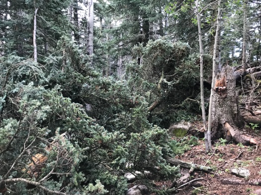
We descend carefully over muddy tree roots. A big evergreen, blown down by one of the storms, blocks our path; we climb around it.
We bypass Del Agua Overlook, the world’s greatest overlook, which we discovered here last week, and spent our lunch hour watching the light and shadow play across the top of the Needle.
As spectacular as it was, we know there’s more, and we want to see it.
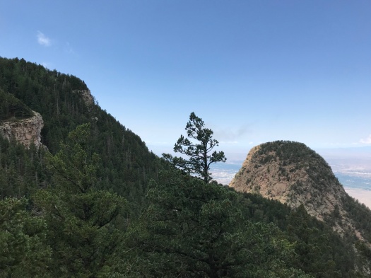
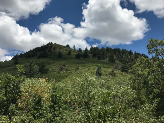
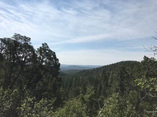
Mini-overlooks abound. The Needle’s shoulder comes into view.
We see more and more of the limestone ridge stretching back to the crest.
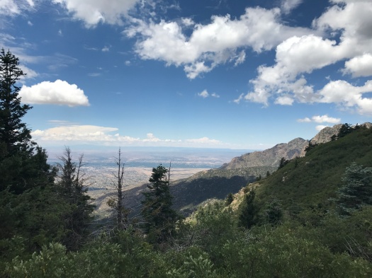
The Del Agua Overlook is the green spot just below the highest point visible in this image.
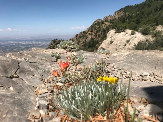
The trail begins ascending, fossil-rich limestone poking more frequently into the path. The sun ascends, too, and when we emerge from dense stands of aspen and spruce, it quickly warms us.
We turn. We’re now headed for a ridge higher than everything around it, one we’d spotted from last week’s overlook. The vantage point from there will be one we’ve never seen.
But first, a clamber over steep limestone. I stop to eat lunch on a ledge before the last push.
Before we even reach the top, I look back and see the Del Agua Overlook, its limestone shelf carpeted in golf-course green.
Gray wisps coalesce in front of us. My husband thinks a building far below must be on fire. It’s a good guess – everything’s on fire right now – but what we’re seeing are wisps of cloud playing across the green slope we’ve just traveled.
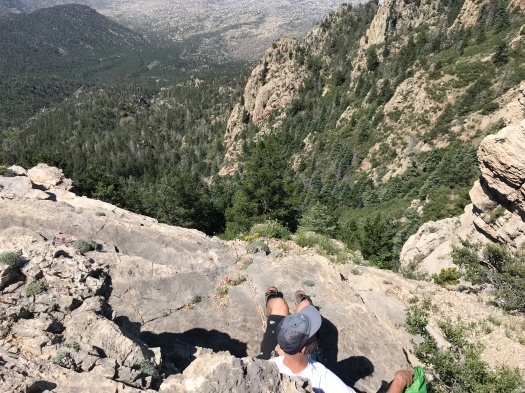
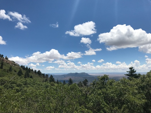
At the top of the ridge, a commanding view of Juan Tabo Canyon, glimpses of the San Pedro Mountains and Ortiz Mountains in the valley behind us.
For just a second, I think about the next ridge, and the next, and the next.
But we’ve gone nearly three miles, and my ankles and knees are talking to me from all the clambering. The return route is a 700-foot elevation gain.
I snap a sideways view of the top and clavicle of the Needle as we return.
This is the Sandia Crest I know, a place where you’re always one ridge away from seeing something you’ve never seen before.
Hike length: 5.6 miles
Difficulty: moderate
Trail traffic: moderate
Wildlife spotted or heard: swifts, brown creepers, chipmunk, butterflies, vulture, crow, squirrel, mule deer on the Crest Highway
I can stop taking pictures of the top of the Needle anytime I want to. Really…OH MY GOD, I CAN’T STOP
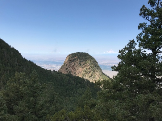
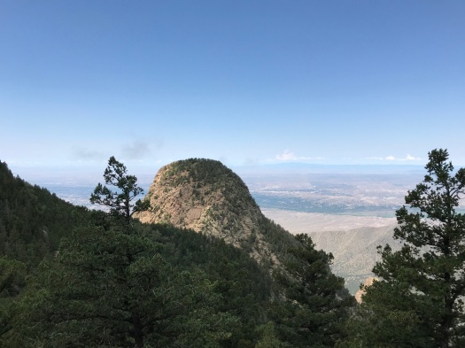
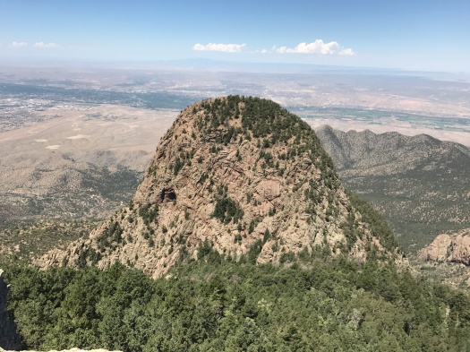
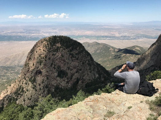
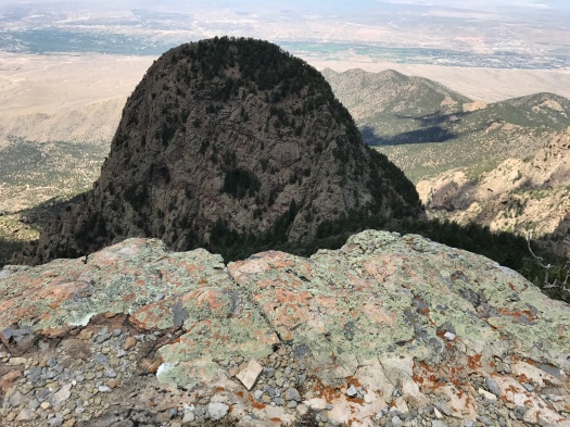
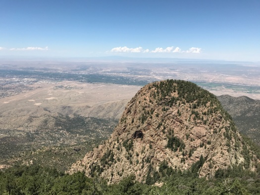
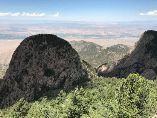
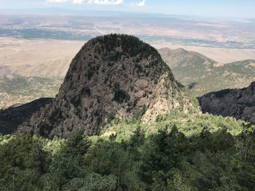
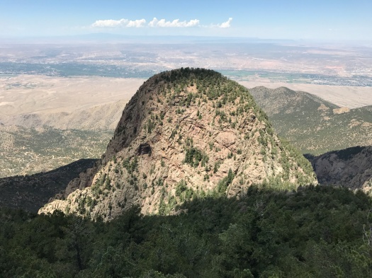
The structure rose thumblike, enormous, in front of us. It looked like it topped out nearly as high as our trail – 10,000 feet. Evergreens dotted the dome. We spotted a cave in it, then another partly obscured behind trees.
We took one of many narrow paths pulling us off the Crest Trail, closer to the mountain’s edge. A broad limestone shelf, the Del Agua Overlook, opened up. From it, an unobstructed view of the dome.
We must have sat there for half an hour, watching light and shadow play across the dome as clouds scuttled across the sun.
I thought I saw a person standing very precariously on the dome’s pitched face, a person with a white hat and black clothing. My husband busted out the binoculars and observed that the white item was a giant bird shit.
“What shat that?! A pterodactyl?”
“Maybe an eagle,” he said. “Or a vulture.”
There was plenty more to look at – swifts hurtling by us, butterflies alighting on limestone, shadows on the mountain’s green peaks. We could see other things we’d never seen from the top of the Sandias, too: the water in the Rio Grande caught my naked eye. Through the binoculars, my husband saw the Los Poblanos Fields open space.
But no matter where I looked, the dome always lured my gaze back.
I couldn’t believe after nine years of living in Albuquerque and three years of hiking here, I had never seen this incredible sight.
Just 90 minutes earlier, I’d thought the day was a wash. The Ellis Trail, where we’d started out, was in full sun. Even at 10,000 feet, it was unbearable, and I quickly turned back. I’d had no idea what direct midsummer sunlight felt like at that altitude; most of my trips to 10,000 feet, even in summer, had been cold enough to need a hoodie.
I was irked that I’d burned time and energy there before switching to the shade of the Crest Trail. I thought I’d be lucky to see anything new today.
Little did I know a magical mystery dome awaited.
After looking it up, I think the dome has to be the top of the Sandias’ famous Needle rock formation – if so, seeing its giant base from below is a completely different experience from seeing the top of it from above.
Hike length: 5 miles
Difficulty: moderate
Trail traffic: moderate
Wildlife spotted: swifts, vulture, many kinds of butterflies, brown creepers, a mule deer on the Crest Highway
If it weren’t for the illusion that you were almost at the top, many of us would probably never make it to the top.
I’d been under that illusion for the past hour. Every time I swung my left foot into the 45-degree angle needed for the next step, my ankle, aching from that action, protested. I’d sent my husband ahead twice to get a sense of how much further it was to the top. At least a quarter mile, he said.
I thought hard about turning back.
But dude, the forest had just reopened after more than a month, and I knew a spectacular view awaited, and it would suck so hard to turn back so close to the top.
At last the jungle of the Cienega Trail disgorged us onto an overlook at the junction with the Crest Trail, the mark that we’d gained 2,000 feet in elevation. It was the hike we intended to take weeks ago, but took a wrong turn.
A brilliant green peak towered over us. The blue-gray San Pedro Mountains loomed on the horizon. Puffy clouds floated above.
Loud conversations and crunching greeted us. Two groups of lunchers who’d come up the Pino Trail had commandeered the spot. The Pino Trail is even harder, so they’d earned it. One of them talked about the wreckage of a plane crash nearby (not the famous one.) Two hikers on the way up had offered to show us the crash site, too. It was the first I’d ever heard of it. It sounded incredible, but I knew if I took any detour I would not reach the top, so we’d kept going.
I ate my peanut butter and honey sandwich under a shady ledge, waiting there till the friendly lunch groups moved on. Stepping into their spot, I could see the jagged ridge of the Sandias stretching away and clouds above Mount Taylor 80 miles west.
I’d seen very little of the scenery coming up, focused on keeping my footing on the steep trail beneath me and navigating the wild rose and other vegetation that pressed in on both sides of the trail. On the way down I noticed the towering aspens and spruces, the spots where glimpses of the mountain peeked through, the wildflowers.
Down took less exertion than up, but was almost as slow going, because it was so steep. The arrival of the monsoon season had increased the humidity, so the afternoon was very warm.
At last we reached the Cienega trailhead and walked back to our car along the campground road. I was glad we’d explored the nature trail and marshy meadow on the way in, because I was spent.
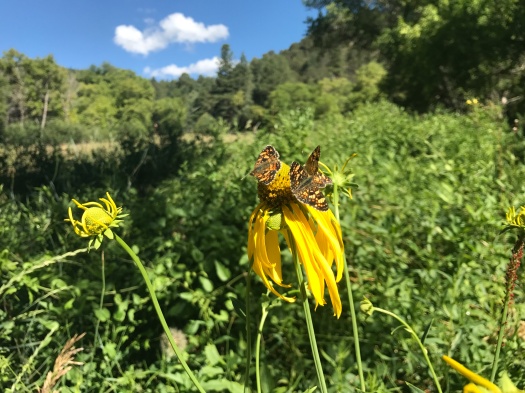
Three-butterfly pileup on the nature trail.
As we approached the nature trailhead, I noticed a black dog galloping along the trail.
“That dog is really bounding,” I said.
“That’s a bear,” my husband said.
My brain had registered it just as he said it: the stocky but fast creature leaping over the nature trail fence and running across the road in front of us was a black bear. Drought summer notwithstanding, it looked spectacularly robust and healthy. Its coat shone.
Though the animal had to be 200 pounds, my startled brain misidentified it as a cub. I looked around frantically for a mother, knowing it was imperative not to be between the two. I asked my husband to take the bear spray, which he’d recently stowed, out of his backpack.
He did as he looked to see where the bear had gone. In seemingly no time, it had bounded up to a ridgetop high above us. It paused near the top and looked back, making eye contact with us. My husband waved, which is actually one of the things you’re supposed to do if you encounter a bear.
The Cienega picnic area has had its share of bear sightings; it was closed all of last fall for bear activity. But we had no expectation of seeing a bear in the middle of a summer afternoon with hikers and campers all about.
But all of us were in his house, not the other way around.
I’m grateful that I got to see him, and even more grateful that he didn’t take offense.
I have no photos of the encounter; I was focused on staying alert to his actions, rather than taking his picture.
Hike length: 7 miles
Difficulty: on the high side of moderate
Trail traffic: moderate
Wildlife spotted/heard: Western kingbird, green-tailed towhee, northern mockingbird, lizards, nuthatches, grasshoppers, Abert’s squirrel, chipmunk, many kinds of butterflies, many broad-tailed hummingbirds, BEAR!!!
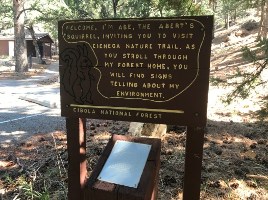
Abe the Abert’s squirrel welcomes you. (Sign below Abe is in Braille.)
I see a glimpse of clear, open blue through the trees, and I just know there’s a vista spreading out in all directions a few steps ahead. No matter how tired I am, I push on.
A quarter-mile later, I’m still in the trees. My body’s more than ready to turn around and head back. My mind? Please. I see another glimpse of blue, seemingly just ahead, and the cycle repeats itself.
Today this game played out in the delicious-smelling spruce-fir forest at the top of Oso Corredor Trail (that really is an “e” in “corredor,” believe it or not.) I finally gave out at a semi-clearing, right where brilliant green trees crowded close against the trail.
I would have liked to explore that, but the partial view from where I sat was pretty darn good. The grass-green, limestone-capped, rounded peaks that remind me of castles were in view. The birds were singing, a giant ponderosa offered tons of shade, and none of the other hikers and bikers out today had made it this far up this side trail.
As we walked back, we saw two tanagers, brilliant in orange, yellow, black and white, flitting from branch to branch. A fat Abert’s squirrel hustled down the trail in front of us, brandishing its bushy tail.
From Oso Corredor we headed back toward our car on Faulty Trail, which runs practically from I-40 to the Sandia Crest Byway. This stretch of Faulty boasts views of the San Pedro Mountains, Ortiz Mountains and the Estancia Valley below.
We hadn’t meant to wander around this bend in the Sandias today. I had in mind a 2,000-foot climb straight up Cienega Trail to the Crest Trail. But at the junction at the trailhead, we never located Cienega. We couldn’t figure out our mistake, even with the map, but perusing the map later, I think we just should have gone left on Faulty instead of right.
But our mistake was serendipitous. As we walked the last half-mile to our car, I ran into an old friend with her family. We hadn’t seen each other in years, and they told us all about raising two little kids in the East Mountains.
We wondered how many other people we knew were scattered around the Sandias’ 140 miles of trails on a Saturday morning.
You’d probably have to get lost to find out.
Hike length: 6 miles
Difficulty: moderate
Trail traffic: moderate
Wildlife spotted: caterpillar, butterflies, Western tanagers, crow, vulture, dark-eyed junco, Abert’s squirrels, carpenter ants at work