Gulls await at the bosque trail’s end

DSC01316

The trail deposited us at the Rio Grande’s edge, the channel to our south too wide to cross.

Gulls wheeled overhead, glints in the blue.

Gulls at 5,000 feet elevation in the high desert? Why not?

They’d come a lot further than we had to be here.

DSC01313

DSC01312

DSC01314
Robust ducks

We’d planned to hike on a mesa west of town. But when we got up there, high and exposed, I could barely open the car door against the fierce west wind.

Back down into the valley we went, into the bosque. The cottonwoods stood brown and gray and naked, but they provided some shelter from the wind. A few last dead leaves trickled to the ground.

We wandered two miles south of the Montano bridge on the river’s west bank. Trails  braided toward, then away from the river. An enormous flood control spillway stood empty and sunbaked, begging for skateboarders.

DSC01325
Alternate entrance/exit from the spillway.

Not far beyond it came the dead end at the river.

DSC01317

On our return, we walked out onto the Montano bridge. The river’s surface rippled in the wind. Miles away, clouds dripped a light rain onto the northern half of the Sandias.

May that riverbed fill, and fill, and fill.

Hike length: 4.6 miles

Difficulty: easy

Wildlife spotted: ducks, geese, ring-billed gulls, sparrows, sharp-shinned hawk

Trail traffic: moderate

Winter comes to Embudito Canyon

DSC01304

I peer through filigree.

Snow balances, fluffy and gleaming, on a tree branch just above the spring.

DSC01296

Silence and white reign, 24 hours after a dust storm that, at nightfall, transformed to drop five inches of snow in the Sandia foothills.

Embudito Canyon casts wonders even when it’s not covered in snow, like this spring that trickles between boulders. I want to climb more of the layers of rock, see what’s tucked under the snow up there. Snow-bewitched, I begin to try, but I know it’s unsafe, and I stop. Ice and slush don’t mix with the boulders’ smooth, sloping surfaces. I forgot to bring my microspikes today, which puts the rest of the canyon out of reach.

DSC01291

DSC01292

We arrived at the spring much sooner than I expected.

DSC01290

We both could have sworn there were  two miles of open canyon before the bouldering began. It just feels that way on a warm day in full sun.

We retrace our steps and decide to take the actual trail.

Yep, on our previous visits to Embudito, we mistook the throat of the canyon for the trail (judging from the footsteps, we’re not alone.) Somehow the little brown “trail” sign caught our attention today.

DSC01286

The path climbs the rocky canyon wall and somehow maintains a manageable angle (much more so than the nearby trail where I fell on cactus and mooned our great city). The sun warms this path and lots of feet travel it, so it’s mostly clear of ice. We gain altitude. Below, the well-trod path into the canyon’s mouth gleams like a road. Snow blankets boulders and cacti.

DSC01302

DSC01298
As a native of the Mississippi Delta, I can say with authority: this looks like cotton.

We climb until the path ahead turns steep and snowy enough that I don’t feel descending it would be safe. Damn forgotten microspikes. I’m sure that around that steep bend, I could peer down into that nook of canyon we didn’t quite reach. But not today.

Back at the bottom, we explore the wildland-urban interface, clusters of homes on one side, snowy, rocky wilderness on the other.

DSC01307

Everything, natural and unnatural, looks different, transformed by this winter’s abundance.

Hike length: 4.8 miles

Difficulty: moderate

Wildlife spotted: canyon wrens

Trail traffic: moderate

DSC01288

Sunlight and snow play tricks on Tram Trail

DSC01249

Watercolor-blue thumbs smudge the sky. Weather surrounds us.

Cool wind puffs as we ascend the boulder garden that is the Tram Trail.

DSC01241

DSC01255
Looks like he’s flipping me off, doesn’t it? But it’s not that finger.

DSC01256

DSC01261

Battle-gray clouds tuck into the crevasses of the Sandia peaks. Flurries dust us, then disappear. Sunlight washes the plains and the city below.

I’d forgotten you could see houses (ah, the wildland-urban interface) for almost this entire hike. It’s easy to forget that and remember only boulders nearly as large as those houses.

Under cloud, chill sets in. Sun emerges to bake a long climb.

One more ridge and I’m sure we’ll reach the high, rocky meadow I wanted to explore last time.

We gain the ridge. The cloud show dances on the Shield and the Needle. Late-afternoon rays warm the walls of Juan Tabo Canyon.

DSC01271

DSC01268

The meadow is nowhere. I spot a hill of rock two ridges away. I think the meadow must be near there. My husband doesn’t.*

Despite the ridge’s loveliness, it’s wind-whipped and cold in shadow. We can’t linger.

DSC01277

DSC01280

On our way down, something coalesces from the weather-smudges on the horizon. Wisps of white levitate between us and the volcanoes on the West Mesa.

Rain? Snow? Virga (precipitation that evaporates before it hits the ground)? Sun rays pulling a fast one?

DSC01283
WHAT IS IT

I watch it nearly all the way down the mountain, but I can’t identify it.

As soon as we get in our car and pull onto Tramway, it’s gone.

Or is it?

Hike length: 5.5 miles

Difficulty: moderate

Wildlife spotted: jays, crows, chickadees

Trail traffic: light

*My husband was right. The meadow was on the Foothills Trail, not the Tram Trail.

DSC01234
The Sandia Peak Tram heads down the mountain.

Sunlight and glitter at the Ojo Caliente mica mine

DSC01220

Glitter shimmers in the dark.
It’s flakes of mica, sparkling in the stillness of a cave.

DSC01221
Miners once hewed mica out of this rock. Its jagged crystalline edges still poke from the ceiling.
These three caves once comprised part of Joseph’s Mine in the hills outside Ojo Caliente. We’ve reached it on an old two-mile dirt track from the Ojo resort.
We knew we were close when the rocks started to shimmer. The caves appeared high on a hillside, the slopes around them seeming to glitter.

DSC01229

Mica flakes litter the floor of the hollow beneath the caves. Rose quartz, mica, shale and more mingle.

DSC01218

DSC01215

DSC01224

From the caves, we clamber back to the two-track. A steep trail from it leads to an overlook above the caves. Mountains on the horizon show off their fresh topcoat of snow.

DSC01227

DSC01228
A bigger hill beckons. But the resort doesn’t recommend going further; the footing’s precarious, the topography confusing.
We head back, leaving the overlook’s chill behind. It’s below freezing and we can see our breath, but the sun-soaked hills insulate us.
Bobcat and elk tracks mark the road.
This is just a glimpse of what those long-ago miners must have seen out here.

Hike length: 4 miles, plus one for detours and exploring
Difficulty: moderate
Trail traffic: none
Wildlife spotted: blue jays, raven
TIP: This is the most sunbaked hike I have ever taken. It was 25 degrees when we started, but I was very warm almost the entire time. Even under my giant hat, the sun was an intense presence. I recommend this hike in winter. You could go really early if you want to avoid the most intense midday rays, but be prepared: Ojo winter mornings are extremely cold.

The Rio Ojo Caliente and the midwinter desert

DSC01175

The hills above fill my vision. Fast breath fills my body as I climb the steep slope.
I turn and the land below falls away, opens a panorama, brown and green, white and blue. Snow-dusted hills stretch to mesa walls. Frosted mountain peaks tower on the horizon.
We’re wandering a cluster of hills above the spa at Ojo Caliente. As we climb, the hills  block the cold wind. Western bluebirds surprise us, darting among the junipers on the high sage plain.

DSC01178

DSC01181

DSC01186
The trail dumps us into an arroyo. Rivulets of snowmelt have sculpted the sand under our feet into marble. Red clay fingers poke from the arroyo walls. Small springs trickle beneath us, hardening to ice at the arroyo wall’s dark base.

DSC01189
The hills across the valley gleam in the last of the sun. Three structures glisten atop a hill. Those are the places to live, we decide, then realize at least one is a water tower.
Winter-bare trees alert us to water before we hear it. The Rio Ojo Caliente flows just a few steps from the arroyo’s end, at a truly heartening rate for a desert midwinter.

DSC01190

DSC01192

DSC01203

We follow the Rio to a historic barn, locked, and a labyrinth, which we pace in full.

DSC01201
We chose this hike solely because we could complete it by sunset from a late-afternoon arrival. In this one circuit of the landscape, the desert showed us so much.

Hike length: 3 miles
Difficulty: easy
Trail traffic: very light
Wildlife spotted: Western bluebirds, Steller’s jays, coyote tracks and burrows

Chalk dust and fool’s gold in the Placitas hills

DSC01160

We top a rise, and the path sloping down it transforms: red and white, beige and purple. We’ve chosen the Chalk Dust Trail, and it’s aptly named.

The trail twists us up and down the hills of Placitas. Snow-dusted peaks tower beyond. I’ve been off the trail for a month with various ailments. The hot sun and the cool wind pulse life back into me.

DSC01164

We see almost no wildlife, just a few small birds at the trailhead. But the rocks! Quartz and mica. Pyrite (fool’s gold). Fossilized seashells, embedded in rock and not. We even find potsherds for only the second time (the first was in these hills, too.)

DSC01149

Every time I stop to take a picture or a rest, a rock examination ensues.

DSC01151

I long to go all the way up to the snow zone, but my feet already throb. We retrace our chalk-dusty steps. My husband thumps a rock onto the ground. It makes a hollow sound, like the ground at White Mesa.

Clouds puff and stretch across the sky, bathing ridges in shadow.

DSC01154

We spot a doubletrack that leads toward a sweeping view of the snowy ridges.

DSC01170

DSC01174

My feet will just have to keep throbbing.

Hike length: 5.3 miles

Difficulty: moderate

Trail traffic: moderate, mostly mountain bikes

DSC01148

Change comes on the wind at Los Poblanos Fields

img_2037

I step onto the dirt path under a gray sky, cold wind chilling my bare fingertips.

I reach the other side of the field 20 minutes later under a warm sun, heating up quickly in my fleece.

I have a narrow window before the wind whips into 40-mile-an-hour gusts, a common occurrence in central New Mexico from January to April.

When I walk east, the wind feels like it’s out of the north-northeast. When I walk west, it bumps up against my face as if it’s out of the west.

I’m no scientist. And though I’ve lived here a decade, that’s the blink of an eye in the West. But my gut tells me the spigot that’s blessed Albuquerque with snow and rain for weeks is turning off, though hopefully new snowfalls will continue to blanket the mountains.

That the spigot even turned on is all too rare as the Southwest warms.

A brown lump across the field catches my eye. It’s sizable. A deer? I wonder, though I’ve never seen one in the middle of the city.

It unfolds itself, begins a lope across the field. Coyote. Another coyote-lump unfurls itself and follows the first one’s lead.

Coyotes have adapted fiercely, establishing themselves ever more fully in lands more and more choked with humans.

How much further will we push them?

Hike length: 1.8 miles

Difficulty: easiest

Trail traffic: moderate

Wildlife spotted: coyotes, cranes, geese, grackles

img_2038

Elena Gallegos, tucked under a blanket of snow

dsc01132
The gate beckoned us into the wilderness on a snowcapped ridge.
Just a few steps in, my husband plunged up to his knees in snow.
dsc01127
OK. Not that route, at least not without snowshoes.
We’d still spend the afternoon wandering in and out of the wilderness, traipsing through snow that at times was up to our ankles, with occasional drifts to our knees.
dsc01130
Another winter storm smacked Albuquerque since we traversed Embudo Canyon in snow a week ago. This storm dropped a rare two inches at our house in the center of town on New Year’s Day, so we knew the area around Elena Gallegos Open Space in the Sandia Foothills would have plenty of snow to explore.
dsc01125
dsc01121
Despite the similar geography, this was a very different hike than last week’s. The temperature didn’t climb past 25 in Embudo Canyon last weekend, and the wind chill hovered closer to 15. Today we had almost no wind – the forecast around noon read “calm,” the first time I’ve seen that word in a New Mexico forecast. Before I knew it, I was down to a single sweater, warm hat and gloves stashed in my backpack.
dsc01119
dsc01118
dsc01117
A wan sun wavered above the mountains. Moisture and chimney smoke mixed in the valley below us until Mount Taylor and the Sierra Ladrones appeared to levitate on a dusty plain.
We saw fewer people than we’d ever encountered on these popular trails, especially in the wilderness. We thought it was a prime day for another multi-deer sighting, but we saw only birds this day, along with bobcat, mouse and deer tracks in the snow.
Even with a good four to six inches of snow underfoot, the still air and the light blanket of cloud insulated the foothills, the world keeping us warm on one of our most wintry hikes ever.
Hike length: 6.2 miles
Difficulty: moderate
Trail traffic: light-moderate
Wildlife spotted: jays, towhees

Embudo Canyon, blue and white, after the blizzard

DSC01083

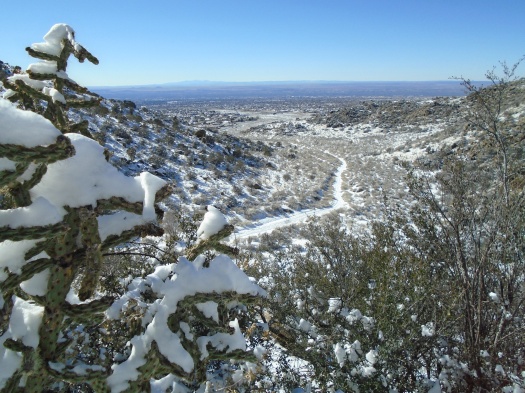
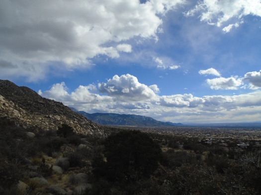
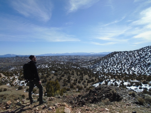
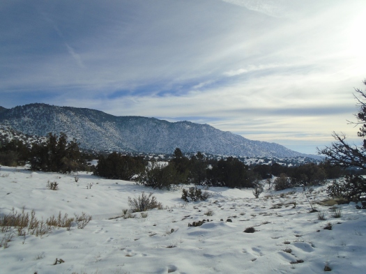
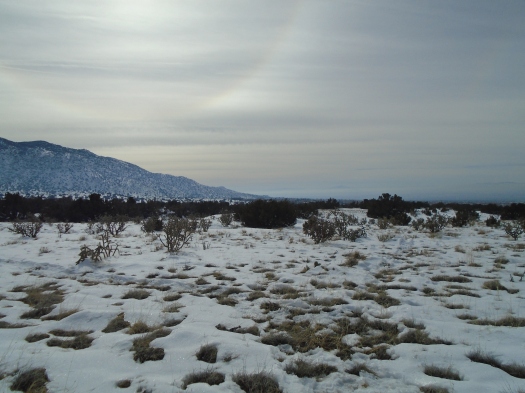
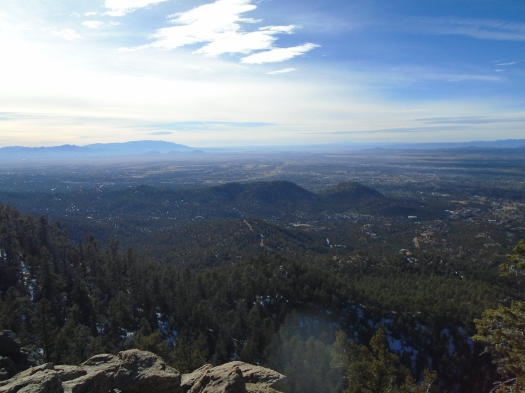
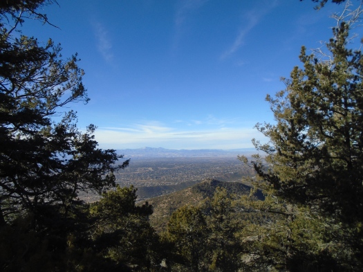
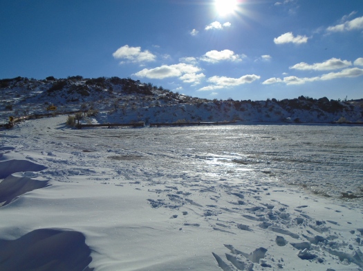
I longed to see blue and white today, and my wish came true.

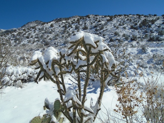
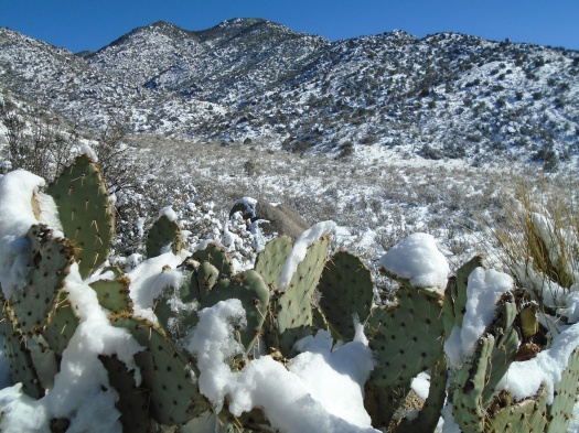
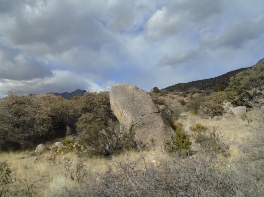
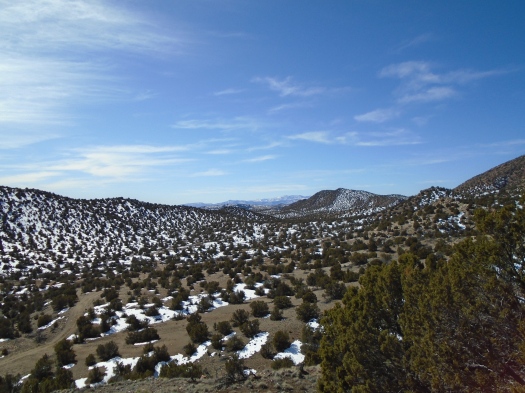
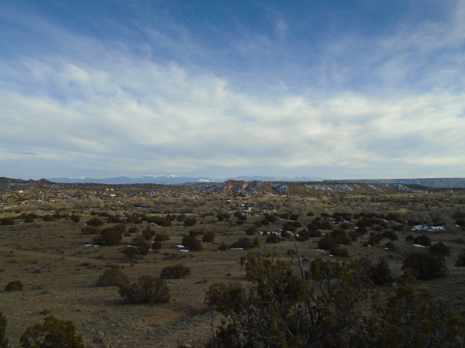
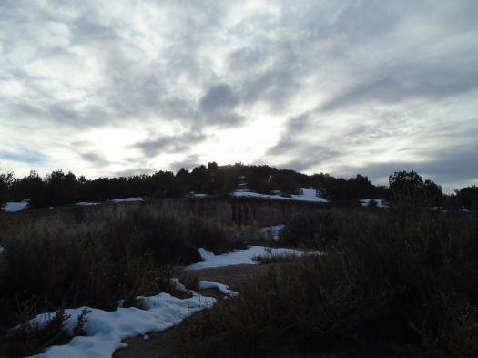
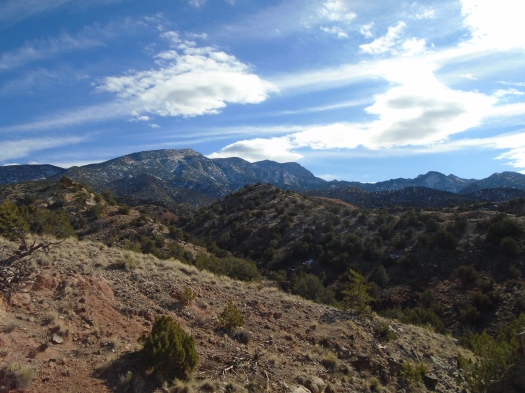
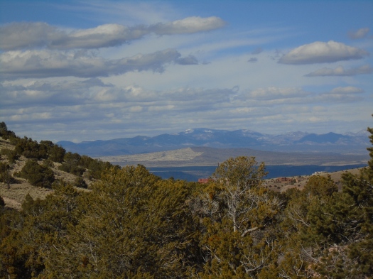
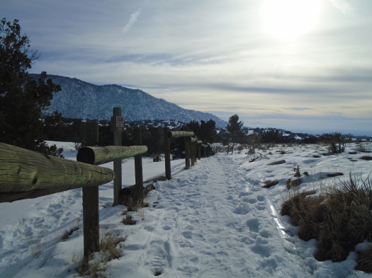
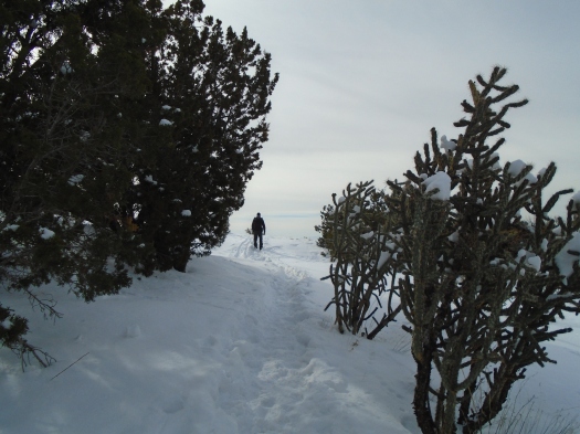
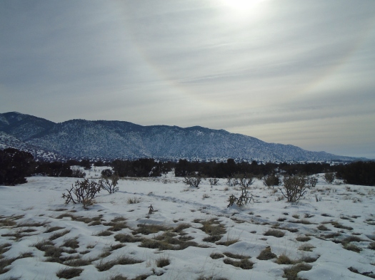
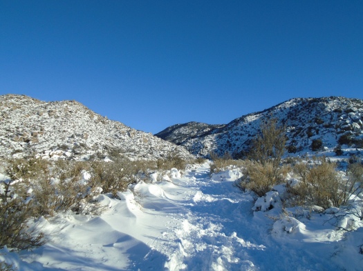
The non-color of the winter Embudo Canyon desert lay buried under a blanket of snow. White below, blue above. Cacti the only interruption, sage green in the slant light, some bedecked with a slab of snow or sheaf of ice.

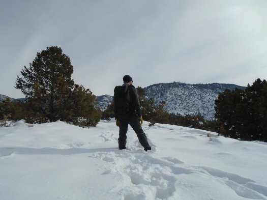
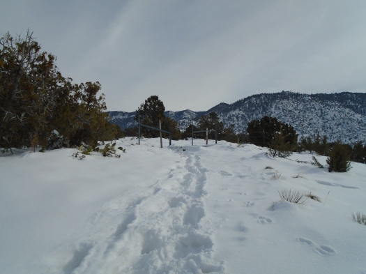
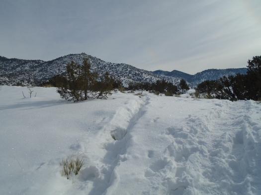
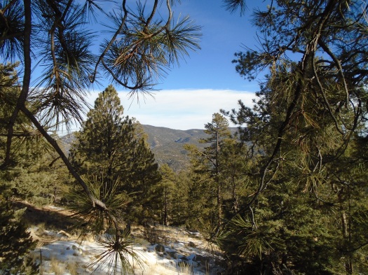
We stumbled on ice – I went down hard on a knee – and postholed where others had clearly postholed before us. The snow lay four to six inches deep in places, squeaking under our boots. Calf muscles I’d never felt powered me up slopes piled deep with snow.

DSC01081

DSC01080

DSC01074

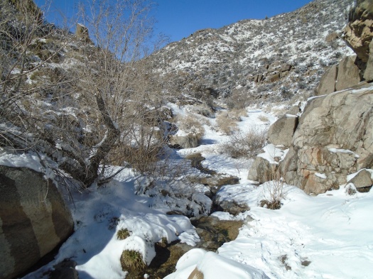
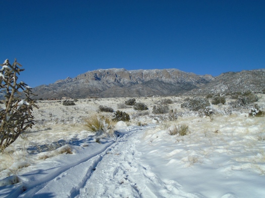
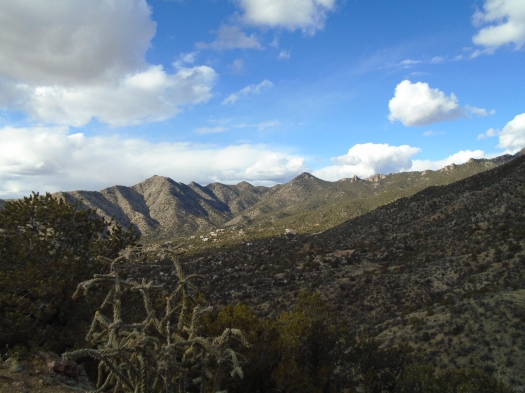
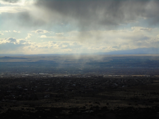
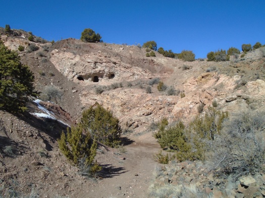
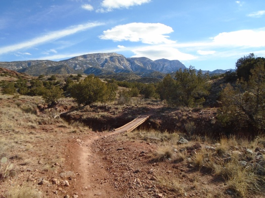
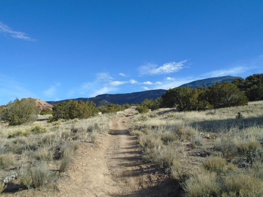
The mouth of the canyon stretched wide, sun on white waves of snowdrifts. We’d reached the lower Embudo parking lot easily, but when we passed the upper parking lot and its access road, we saw a sheet of ice.

DSC01071

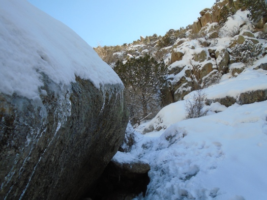
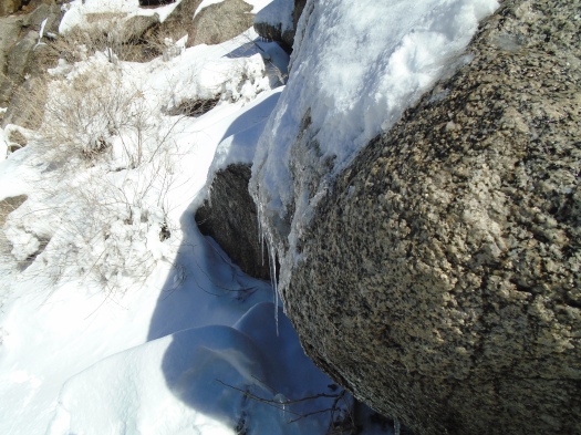
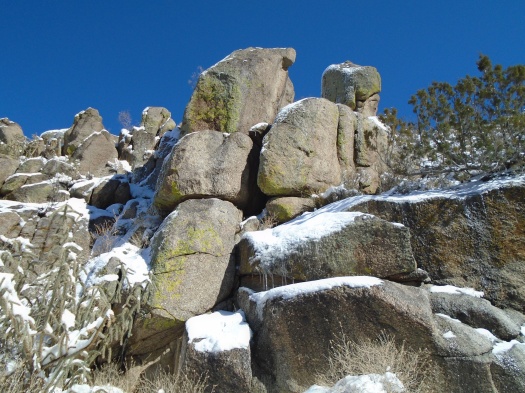
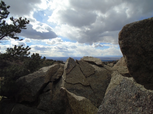
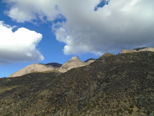
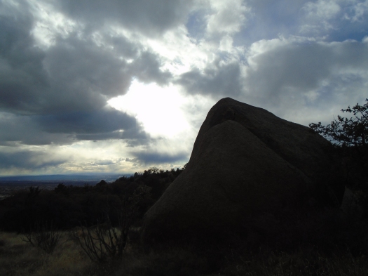
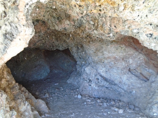
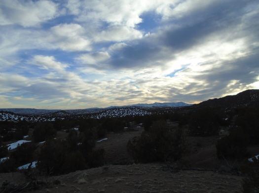
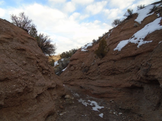
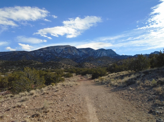
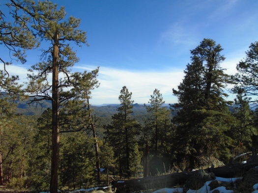
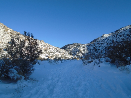
We climbed further, stacked rock of canyon walls narrowing, shadow falling across the trail. We stopped where the canyon became an obstacle course of boulders. Not in the snow.

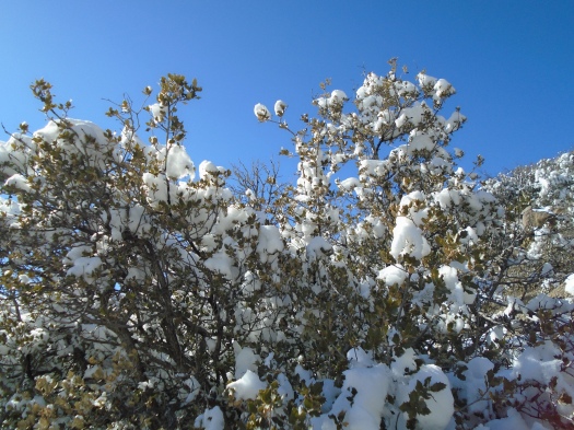
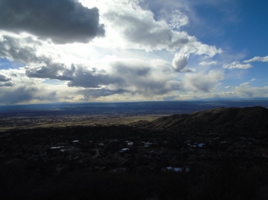
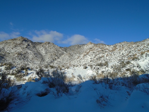
The sun dropped just below the canyon wall as we walked back, backlighting a filigree of ice-covered juniper high above.

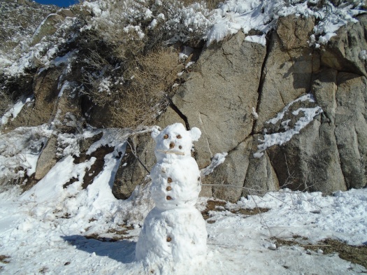
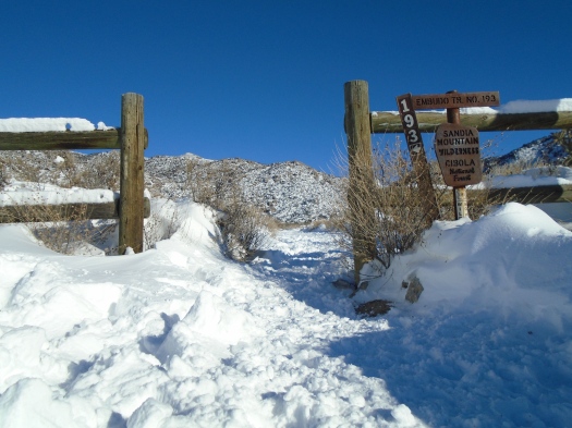
At a junction in the trail, a penguin sculpted of snow served the purpose of a cairn. We spotted more penguins ahead. I was charmed, until we reached a pass where the young men who’d made the penguins stood on either side of the trail.

One mentioned that the steep section of path right behind us was really slippery. I immediately turned around and started walking back to the previous junction. It felt like they were taking up all the space on the trail and I’d be damned if I let them see me slip and slide down that chute.

The alternate route brought new levels of postholing. At some points we scooted through hip-high craters in the snow.

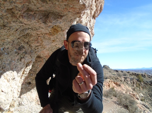
I groused about the penguin-makers. My husband didn’t understand my irritation. He’d stopped to talk with them and thought they were nice.

I realized I was the only one who cared whether those dudes saw me slip on the ice. I was worried they would see me as someone who didn’t belong on the trail.

I realized I had my fair share of trail credibility, having been on trails 52 times already this year, including some tough ones.

But trail credibility is a fairly useless manmade (or womanmade) notion.

There is no one who doesn’t belong on a trail. There is nothing we need to prove to the natural world.

There is only blue and white, and blue and white, and blue and white.

Hike length: 4.5 miles

Difficulty: moderate

Trail traffic: moderate

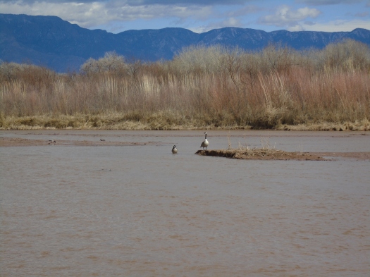
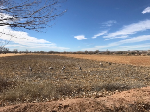
Wildlife spotted: curve-billed thrasher, dove


How the winter solstice looks from Atalaya Mountain

DSC01058

Fifty feet makes such a difference.

At the overlook, a brisk, chill wind whips your face.

But we’re lounging on a rock higher up the hill, protected from the wind, soaking up the sun.

The sun brought me here today.

I’d realized a week ago that I’d be off work on the winter solstice, the shortest day of the year. I made it my mission to do a full-sun hike that day.

DSC01051

DSC01052

DSC01054

I’m looking at the place where we’d planned to hike, Tetilla Peak, miles away and 2,000 feet below where we sit. Our truck wouldn’t start this morning and the rough road to Tetilla demands high clearance, so we needed a destination reachable by car.

My husband suggested Atalaya Mountain in Santa Fe, a trail that tops out above 9,000 feet. I worried it would be too snowy. But Atalaya’s notorious sunshine keeps most of the mountain basking in the rays. Snow blanketed north-facing slopes around us, but much of the Atalaya trail was totally clear, save for a steep, icy section I dubbed “the chute.”

DSC01055

DSC01056

Early on, a well-marked fork in the trail presented a stark choice: “Easier Route” and “Steeper Route.” My husband charged for the steeper route, but I insisted we do the easier route, concerned about ice and my calf capacity. Even the easier route was tough; I was glad we’d done a comparably steep hike a week earlier.

At the top, mountain ranges melted into clouds in the distance. Crows traveling in pairs and threes floated in blue overhead. My husband cawed at them and they cawed back.

We stopped at a viewpoint on the way down just after 3 p.m. With the sun already falling, it looked more like 5 p.m.

DSC01067

Luckily, we’d gotten ample sun worship in already.

Hike length: 7 miles

Difficulty: difficult

Trail traffic: moderate

Wildlife spotted: crows, dark-eyed juncos, bluejays, a fleeting glimpse that might have been a coyote on the way down

With this hike, I completed the #52HikeChallenge in 11 months and 1 week!