There’s a boulder wonderland beneath one of ABQ’s biggest tourist attractions

This hike began with the hum of gears turning.

It’s the sound of the Sandia Peak Tram moving up or down the mountain on its pulley. The sound is equally audible whether there’s a tram car in sight or not.

We were on the Tramway Trail, and while there are many excellent places in the Sandias to see boulders, this one may take the cake.

Gray granite boulders. Lichen-covered boulders. Boulders ribbed with stripes or veins of quartz. Boulders stacked atop one another. Boulders leaning against other boulders. Boulder-edged meadows. Boulders separated by slick granite faces like the one that stymied me on the Whitewash Trail.

IMG_9624
Nature’s Earthship, boulder edition.
IMG_9626
Boulders with barrel cactus.
IMG_9628
Stairway to boulders.

IMG_9630IMG_9634

IMG_9640

IMG_9650
Shot while standing on a boulder

IMG_9652

IMG_9660

In some places, the boulders were the trail.

This is the trail you take if the line for the tram is too long. (So I’m told; I’ve never ridden the tram – I prefer to traverse mountains with my feet on the ground.) This trail connects to the La Luz Trail, with its legendary 3,800-foot elevation gain to the top of the mountain.

One day.

Today, we were just there to soak up sun and sky, to climb high enough to feel sore but not so much that we can’t move tomorrow.

As we returned to the trailhead, we explored the empty space between two giant boulders, the sound of the tram humming in our ears.

Hike 1 of the #52HikeChallenge

Length: 5 miles

Difficulty: moderate

Trail traffic: moderate

Wildlife spotted: bluebird, jay, crow

We still haven’t found what we’re looking for

For C.Z.

My husband pours a few drops of water into a small burrow next to two intact dead tarantulas and a few more dismembered ones.

“What the heck is IN there?!”

Tarantula hawk?” I suggest. “Do they burrow?”*

He sticks a blade of grass into the hole.

We don’t know where we are, but we can see the road and know how to get back to it. So we aren’t lost, navigationally.

But we are a bit adrift.

We’re in the San Ysidro Trials Area, a chunk of public land with amazing sandstone canyons that’s mostly used by motorcyclists doing stunts. Today, there’s not another soul here.

We’re here to hike an amazing loop found in Stephen Ausherman’s “60 Hikes Within 60 Miles of Albuquerque.” It traverses a sandstone canyon full of natural pools, squeaks through a wild section of land where the soil is red and purple, and brings you back over more trippy rocks.

But even though we’ve done this hike before, we cannot find that loop. We can’t even find a single one of the three sections that make it up.

We find a natural rock mini-amphitheater.

IMG_9592

We wander through a wash and find a side canyon of brick-red soil that narrows to a slot too small to walk in.

IMG_9601

We scramble up to the rim in search of our route, but while we see lots of volcanic-looking mini-domes and the hometown Sandia Mountains beyond, nothing looks familiar.

IMG_9602

IMG_9603

IMG_9605

We climb back down and head up a rocky canyon. This looks familiar. The spots that look like they could hold natural pools are dry, but that could just be because it hasn’t rained in Albuquerque in nearly 100 days.

But when the canyon ends, we’re facing a fence that we know marks the Jemez Reservation boundary, as far as we can see. We turn around and head back.

Even without the desired route, there’s plenty to see and feel; warm sun, crisp breeze, the play of colors in the slanting light.

We’ll have hiked five miles by the end. We’ll have spotted petrified wood. Our feet will hurt, our shoulders will be sore from backpack straps.

But something’s off today.

We’re out here two days after the death of a family member, which came just a week after he unexpectedly went into the hospital.

We’re out here looking, but not quite finding.

It’s not the first time I’ve gone on a hike in response to the death of a loved one and it won’t be the last. I have a Big Birthday this year. The number of people I love who will die does not get smaller from here.

As we walk the road back to our car and look across the valley, a wash of red and purple soil comes into view. The canyon. We were so close to it, but we couldn’t quite get there.

IMG_9612
Our shadows are unintentionally in this photo.

It’s sad to look back at it.

But we have to keep going.

*Turns out tarantula hawks do burrow.

Hike length: 5 miles

Difficulty: moderate

Trail traffic: none

Wildlife spotted: dozens of bluebirds in trees along the road, two dead tarantulas

Hoodoos, hoodoos, hoodoos, hoodoos, hoodoos, hoodoos, hoodoos

There’s a famous episode of “The Wire” where Detectives Bunk and McNulty say only variations on one word – the F-word – for an entire scene, in many different ways.

I thought about doing something like that with the word “hoodoo” for my post about hiking Hoodoo Pines in the Ojito Wilderness. But it doesn’t work without intonation.

So, instead, here are the many faces of the Ojito hoodoos, in pictures. (For the uninitiated, Merriam-Webster defines a hoodoo as “a natural column of rock in Western North America often in fantastic form.” Word.)

IMG_9501IMG_9504IMG_9507IMG_9509IMG_9521IMG_9527IMG_9532IMG_9551IMG_9558IMG_9561IMG_9564IMG_9575

Hike length: 2.6 miles

Difficulty: easy-moderate

Trail traffic: moderate

Wildlife spotted: red-tailed hawk, crow, cow


I don’t know what they mined here, but it’s precious

We stepped off the trail just in time for two mountain bikers to whiz past.

“Just out enjoying a beautiful spring day!” one called to us, laughing.

It’s Dec. 28. One minuscule patch of snow graces the Sandia foothills in Placitas. I was hiking in short sleeves.

We were soaking up the sun and the breeze on the Strip Mine Trail.

IMG_9459

What they mined there, I can’t say. The Sandia Mountain Hiking Guide promised an abandoned mine. We never saw one. But we soon saw, amid the pinon-juniper hills, veins of deep red and purple earth winding through the arroyos.

IMG_9463

IMG_9490

At points the rocks underfoot were black and hollow.

An unmarked side trail took us higher, a minefield of loose rock all the way.

As we climbed, Cabezon Peak quickly came into view on the horizon, then White Mesa, the Jemez Mountains, the Sangre de Cristo Mountains, Mount Taylor and the green mesa tops on Santa Ana Pueblo.

IMG_9468

IMG_9474

We reached a clearing where the trail led deeper into the evergreen-dotted hills.

IMG_9480

A bird of prey swooped over a canyon, wings fully extended, intricate patterns on display. We watched it until it flew behind a ridge. My husband pulled out the binoculars and waited for it to reappear, but it never did.

We climbed higher, nearing 7,000 feet, the wind picking up and growing cooler. Still, the sun kept me comfortable.

IMG_9483IMG_9487

On our way back, we explored part of a side trail, trying to figure out how all the pieces of the trail network fit together.

IMG_9491

This hike was an unexpected gift, a Thursday afternoon in the last week of the year alight with sun and wind, coolness and warmth, blue and green and red and purple.

The real gift – the blanket of snow that will keep the cycle going – has yet to arrive.

Hike length: 4.5 miles

Difficulty: moderate

Trail traffic: moderate

Wildlife spotted: bluejays, mystery hawk or falcon, crows

The devil made me do this hike (on Christmas Day, no less)

I started and ended this hike dizzy.

There is no lengthy climb to a dramatic viewpoint in Diablo Canyon, no delayed gratification. You’re face-to-face with some of the most eyeball-stretching sights nature has to offer the second you get out of the car.

IMG_9393IMG_9396

IMG_9412

Columnar basalt towers hundreds of feet into the sky on both sides of a narrow canyon. I tilted my head back as far as it could go, seeking the best possible view of the formations. (Luckily, the canyon is basically flat, an excellent attribute in a place where a hiker will be focused on what’s above her instead of what’s under her feet.)

The last time my in-laws hiked in this canyon, the movie “Cowboys and Aliens” was being shot there, and men portraying bandits climbed all over the walls.

There were no bandits on Christmas Day, but as we examined the walls around us, we spotted climbers scaling the rock. Several were still going when we left the canyon two and a half hours later.

When we finally managed to take our eyes off what was above us and focus on what was in front of us, we realized we were hiking among some of the biggest, smoothest basalt boulders we’d ever seen.

IMG_9398
Alternate headline for this post: Basalt with a Deadly Pepa.

A natural spring trickled through the sandy canyon bottom, ending in a patch of ice.

IMG_9406

It was the only piece of ice or snow we encountered in two days in Santa Fe at the end of December.

Even in a snowy year, this would be a killer winter hike. Once you’re through the throat of the canyon, it widens, becoming a massive arroyo that leads you toward the Rio Grande. The sun pours onto that arroyo at midday.

IMG_9420

IMG_9416

The ecosystem of the canyon creates 20-degree temperature differentials. As we came out the neck of the canyon, a wave of warmth washed over us. It was coming from a rock and sand wall that had been soaking up sun all day. And while the flat arroyo was in full sun, when we came back through the narrow canyon at 4 pm, all but the tops of the walls were in shadow, and it felt more like 40 degrees than the high-50s air temperature.

Though it was flat, hiking a sandy arroyo is always more work than it looks like. We turned around about two and a half miles in, knowing daylight and warmth were growing short. Later, we realized we’d only been about half a mile from the river.

The steady flow of families and groups of friends we’d seen as we started our hike slowed to a trickle. The falling sun cast a shrinking slice of light on the top of the canyon walls, shading them deep red.

IMG_9432IMG_9434IMG_9438IMG_9439IMG_9447

By the time we returned through the chilly canyon, our only companions were a few climbers and a black-capped chickadee drinking from the spring.

IMG_9450

Hike length: 5 miles

Difficulty: moderate

Trail traffic: moderate

Wildlife spotted: crows, ravens, black-capped chickadees, canyon wrens

Getting there: The price you pay for enjoying a free visit to this fabulous public land just outside Santa Fe: You have to drive on Old Buckman Road. We have been on a lot of rough unpaved roads in search of remote hiking spots. This is the worst road I have ever driven on – not the most dangerous, but the most uncomfortable. “Washboarded” is an understatement. When we drove to the end of this road in my husband’s little truck to hike along the Rio Grande, my Fitbit measured my time rattling around the cab as an “outdoor bike ride.” Beg or borrow the biggest, most heavy-duty vehicle you can. We borrowed my father-in-law’s Toyota Tacoma this time and it made a world of difference.

This spot in the Sandias is familiar, yet unknown

The forest road we finished our hike on yesterday was probably the most dangerous thing we traversed. It was narrow Forest Road 333, with trucks coasting up and down from higher trails in the Sandias, no shoulder or room to get over. Luckily, we were only on it for a few hundred feet.

We’d come off the Boundary Loop Trail in the foothills north of Sandia Casino. Completing our loop, we stumbled into the wrong canyon. It was fabulous, with swirling humps of stone like those we’d encountered on last week’s hike. Luckily, this time the stone was stepped, with some purchase for feet.

IMG_9370IMG_9371

We were confident we could find our way back down this canyon. But then we came to a barbed-wire fence. Rather than trespass on Sandia Pueblo land, we backtracked up the canyon.

We’d made the right turn when it counted earlier. From the highest point of the hike, we picked the correct fork of four to lead us down a dirt trail to the arroyo we’d entered when we began.

Before that, we chilled out for a while atop a ridge. Juan Tabo Canyon yawned before us, a mesa’s flat top on the other side.

IMG_9368IMG_9360

Haze filled the valley below; we could barely see the Albuquerque skyline. But up here, the sky was blue and clear, the warm sun offset by the cool wind.

The first arroyo we navigated corkscrewed through high-desert hills. Jays squawked and wrens called as we passed. The sand kept our pace to a steady beat.

A quick, steep climb from the road to a ridge had brought us into quiet Jaral Canyon. A steep trail perched on the edge of the canyon wall led us into the arroyo.

This hike feels different than any other I’ve done in the Sandias. The terrain is less mountainous than classic high desert, not unlike Cerrillos Hills.

IMG_9355

And the deep, wide canyons tucked into the hills take you by surprise. Yet the Sandias’ famous Shield, Prow and Needle formations frequently appear beyond ridges.

IMG_9353IMG_9365

There is the familiar stacked form of the casino as you top the first ridge.

IMG_9343

There is hazy downtown Albuquerque.

It’s familiar and unfamiliar all at once.

Hike length: 4 miles

Difficulty: moderate (the classic Sandia Mountain Hiking Guide rates it “easiest;” I respectfully disagree)

Trail traffic: little

Wildlife spotted: jays, chickadees, wrens

I can’t whitewash it: This trail got the best of me

Some of the best hiking on the west face of the Sandias can be found in Embudo and Embudito Canyon.

Both involve climbing lots of slick Sandia granite, making your way from one rock to another.

I usually need a boost or a hand, but I’ve tackled some of the most challenging parts of those trails (and Waterfall Canyon, too, where the rock is not only slick in nature, it’s frequently wet.)

But today, in a canyon that looked deceptively similar, I met an obstacle I wasn’t ready to field: slick Sandia stone stretching upward at a 45-degree angle.

IMG_9318

We were on the Whitewash Trail, an undesignated trail leading to a ridge. We’d climbed familiar terrain to get there, but the sand and stepped rock came to an end, and only smooth stone remained.

We could see our destination ridge silhouetted against the blue sky, so close. We began heading up, my husband leading the way and pulling me up the hill. It was working. But he wouldn’t be able to give me the same kind of assist down the steep, slippery incline, and I didn’t know how I would make it down.

After a short distance, I gave up and slid back down on my butt. It was surprisingly easy, but not a feasible means of getting all the way back down from the ridge.

I sat on a rock while my husband climbed to the ridge. He’s much more comfortable on boulders and steep slopes than I am, but he slipped and gashed his hand on the way down. While we doctored his wound from the first aid kit, he told me about the meadow he’d seen on the ridge. I wanted to see it and I’d been thinking of trying again, but when the descent tripped even him up, I reluctantly accepted that I wouldn’t see the meadow today.

The path back down the steep, stepped rocks seemed easy by comparison. We explored boulders and game paths on the way down and took side trails.

IMG_9314IMG_9327IMG_9332IMG_9335

As we exited the canyon, we could see clouds surrounding the arrowhead ridge of the Sierra Ladrones 70 miles away. It appeared to be levitating.

IMG_9322

We could even see the cloud-wreathed Magdalena Mountains south of the Ladrones, a rare sight that had me questioning my geographic awareness.

What goes up generally must come down. But if one had the stamina and daylight for a 9.5-mile hike, one could go up the Whitewash, then return via much easier Embudo Canyon.

Stay tuned.

Hike length: 3 miles

Difficulty: difficult

Trail traffic: lots in the foothills, none in the canyon

Wildlife spotted: butterfly, chickadees, one really irritated jay

The stories bones tell in the hills of Cerrillos

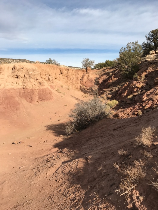
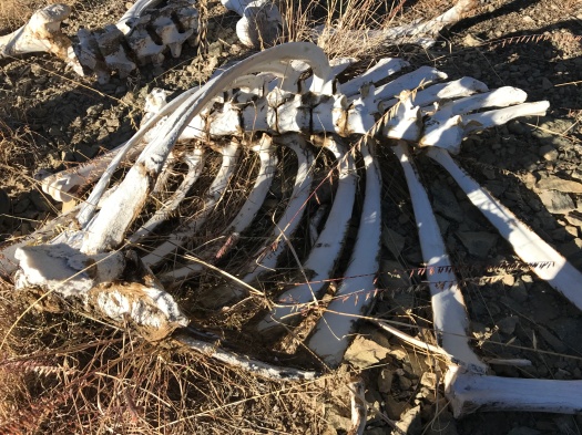
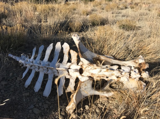
First, a few vertebrae scattered at the edge of the sandy arroyo.

My husband and I climbed the bank. There, a jawbone, more scattered bones and, nearby, a pelvis with several vertebrae still attached.

IMG_9264

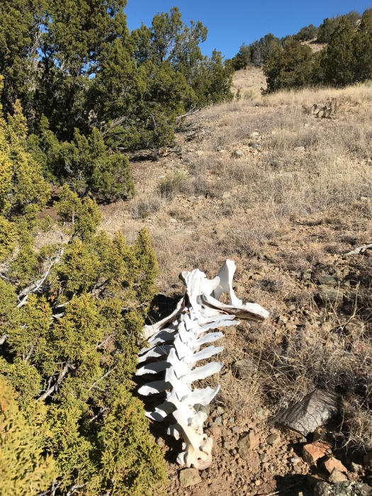
It must have been an elk. It had to have been there a long time; its bones were bleached a pure, eternal white.

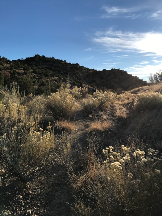
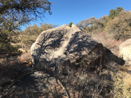
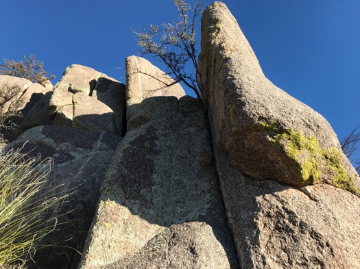
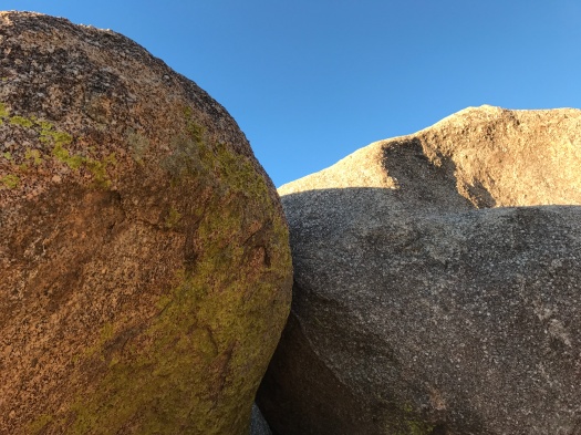
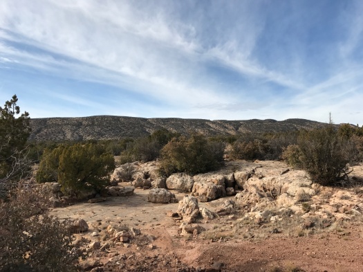
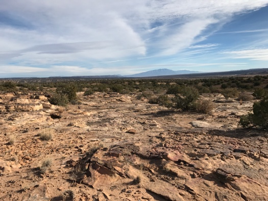
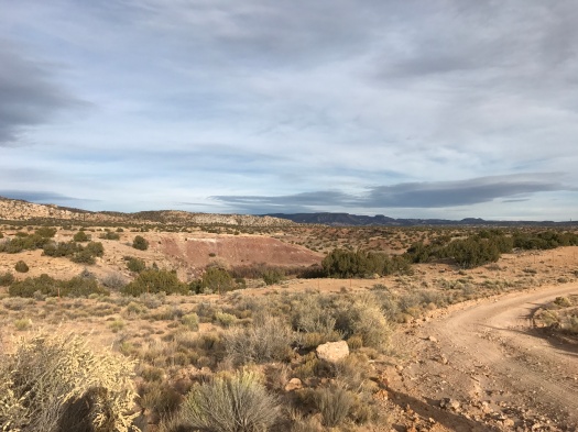
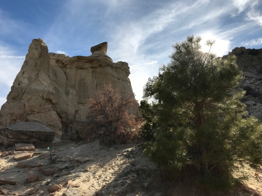
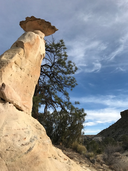
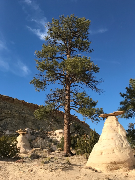
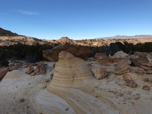
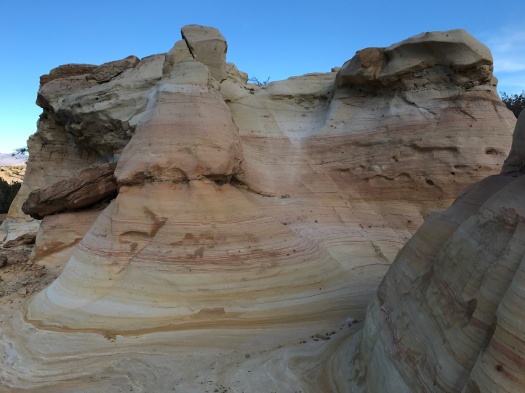
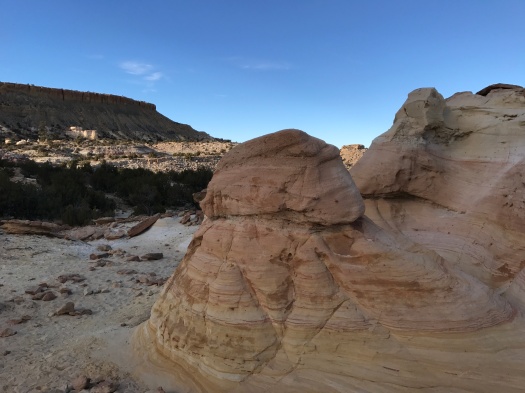
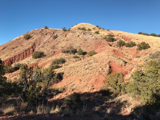
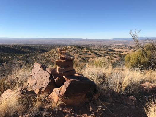
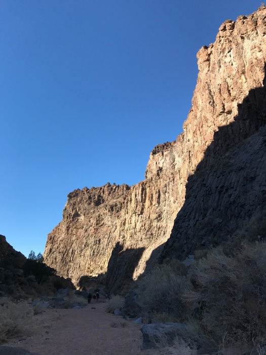
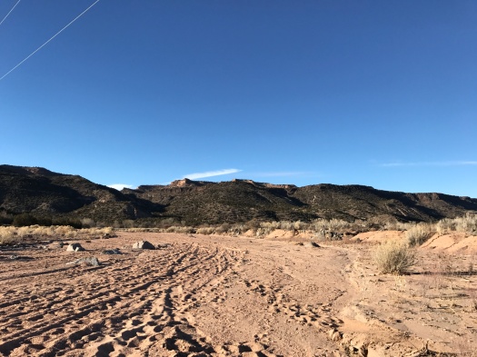
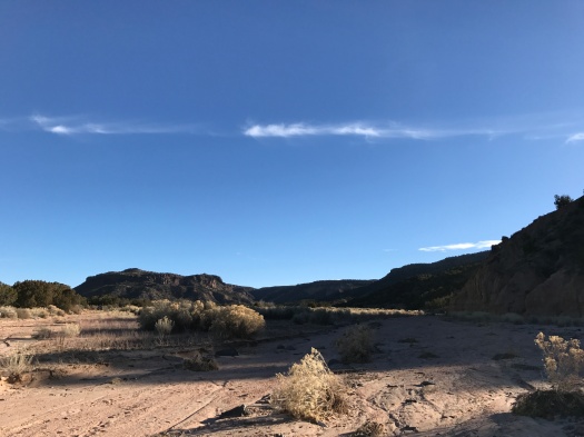
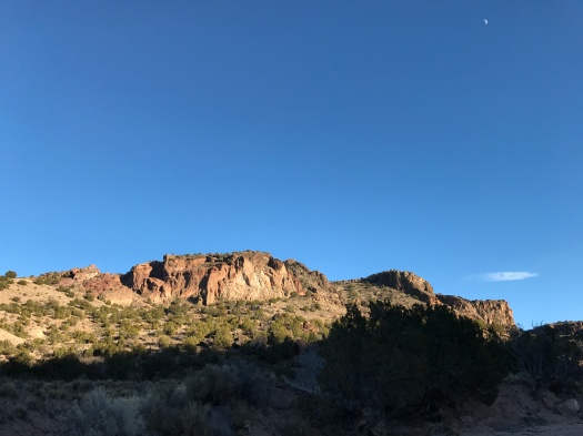
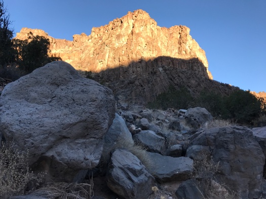
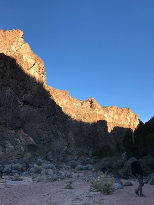
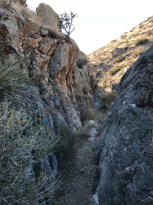
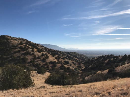
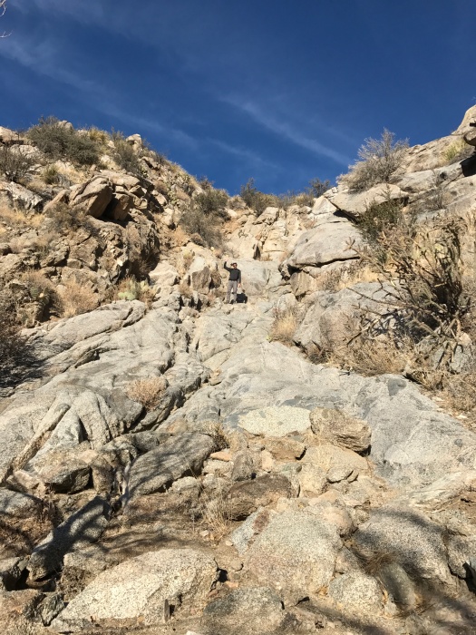
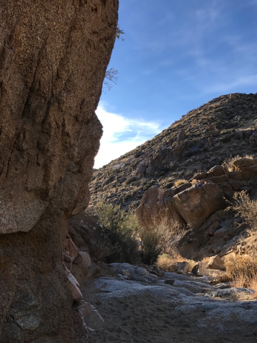
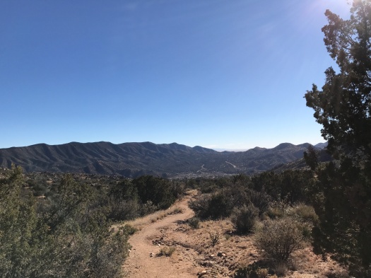
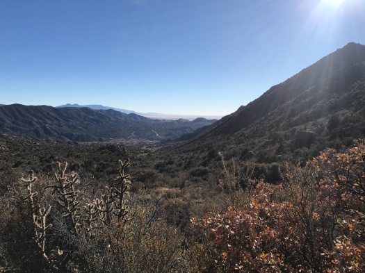
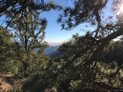
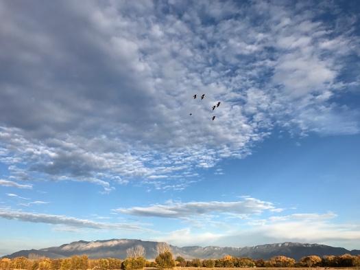
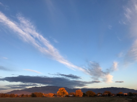
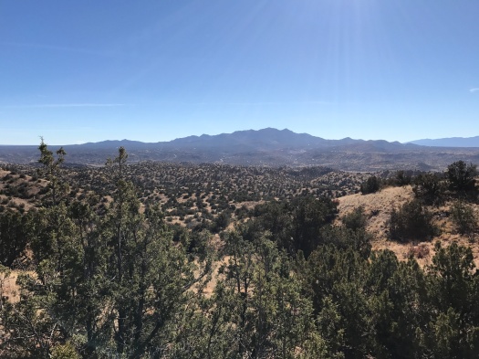
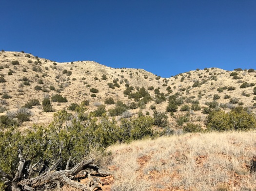
From the arroyo, a steep climb up old jeep trails to the base of Grand Central Mountain and a sweeping view of the Ortiz Mountains.

IMG_9268

IMG_9270

IMG_9272

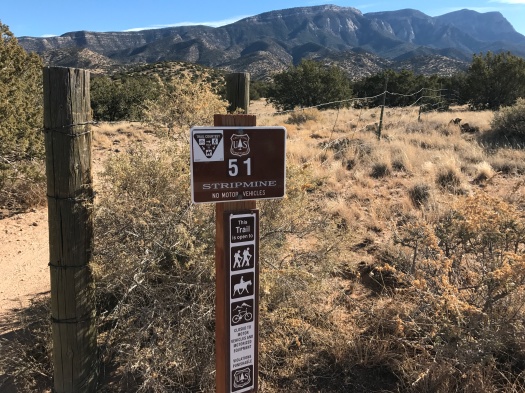
We didn’t see another soul on our hike, even though it took place at Cerrillos Hills State Park on the day of the “Stuffing Strut,” when the park welcomes folks to its trails to walk off some turkey on the day after Thanksgiving.

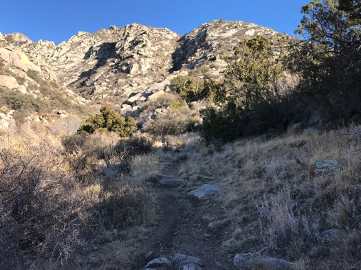
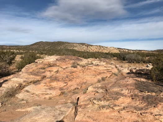
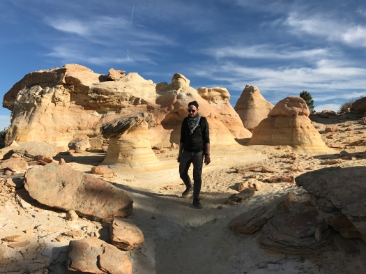
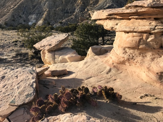
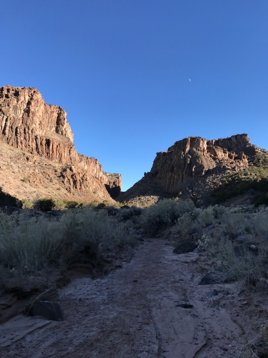
Admission to all state parks was free the day after Thanksgiving this year. The parking lot of Cerrillos Hills was full. While others flocked to the marked trails with interpretive signs, we dove into a hike from “60 Hikes Within 60 Miles of Albuquerque.” It uses a complex chain of arroyos, old roads and mining trails that weave between the state park and Bureau of Land Management property to build a killer hike.

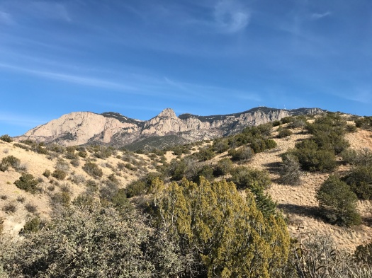
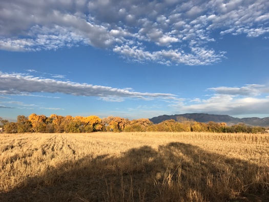
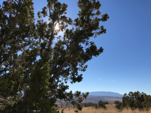
It was warm when we did this hike 365 days earlier and warmer this time. The temperature climbed quickly to 70 degrees, and the only shade to be found is in the arroyo at certain times of day or if you tuck yourself carefully under a juniper.

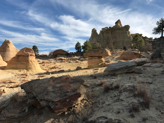
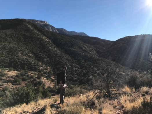
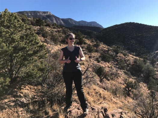
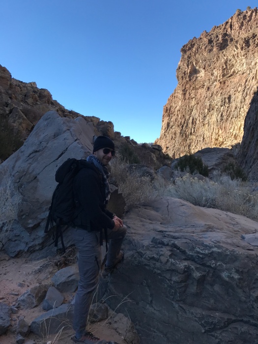
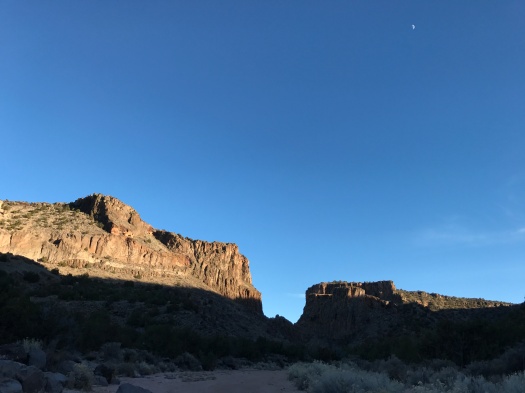
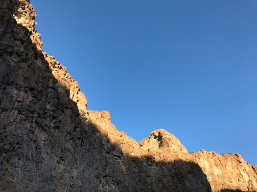
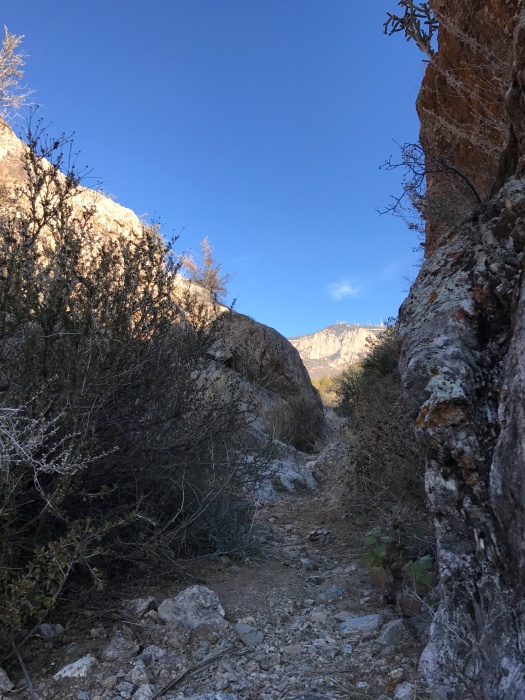
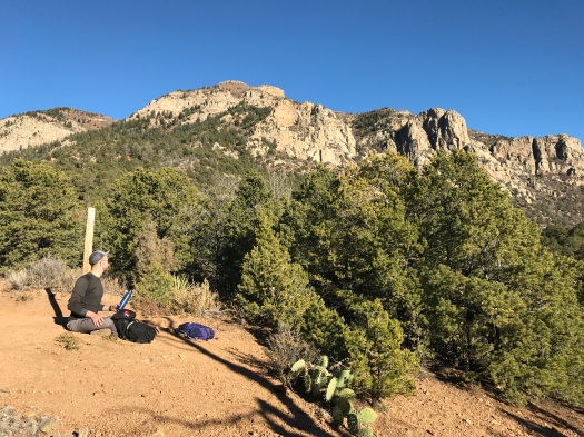
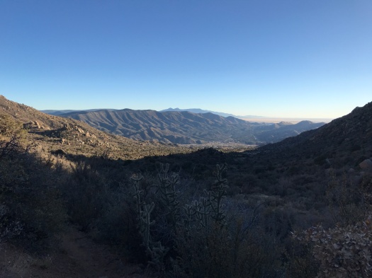
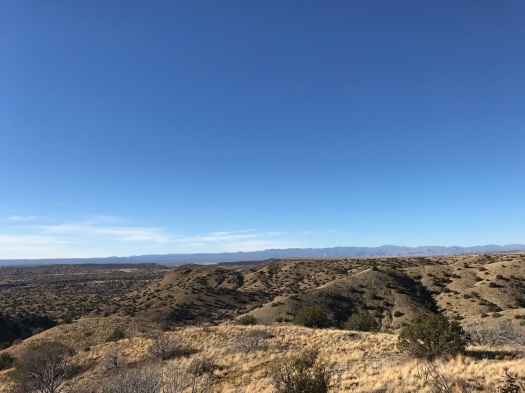
After a rest, we tackled the problem of trying to follow the book’s directions to a “spectacular overlook.” We’d gotten so turned around at this point last year we gave up. My husband and I disagreed about the best way to get there. He’s been finding his way out of arroyos since he was a child. He was right this time, and he’d be right when we disagreed later about the best way to get back to the trailhead.

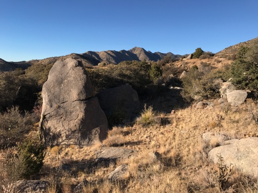
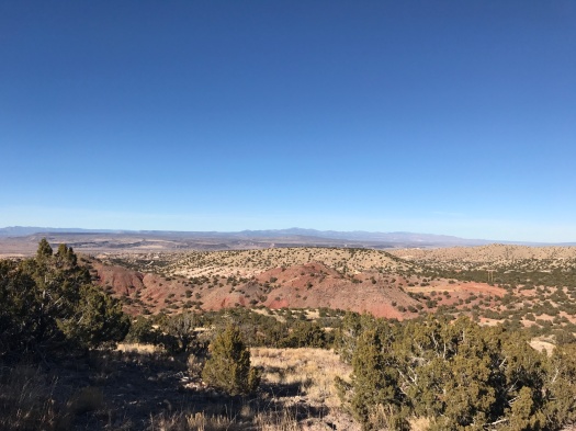
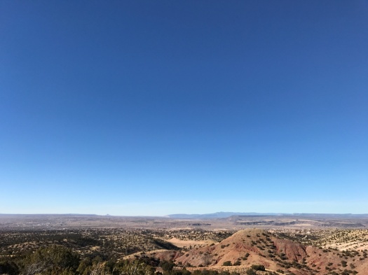
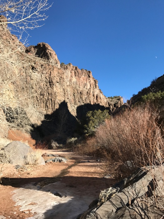
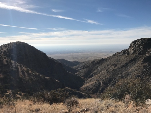
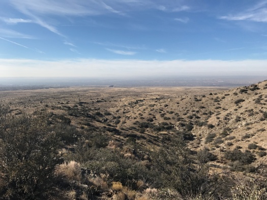
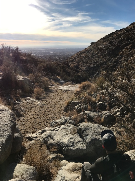
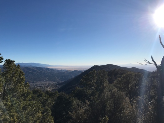
At the spectacular overlook, we’d be able to see the top of La Bajada, the massive volcanic escarpment, and the glint of sunlight off cars on I-25.

IMG_9274

But first, as we navigated a faint, narrow, rocky path to the overlook: we rounded a bend and saw, ahead, the remains of another elk. Ribcage on one side of the trail, pelvis with a few attached vertebrae on the other.

IMG_9287

IMG_9282

Even a few months earlier, we would have probably have picked up one of the scattered vertebrae we saw Friday in a backpack to take home as a memory of the place.

I’ve walked out of a hike with many a rock, even a few bones. It was the one Leave No Trace practice I fudged. A rock or bone isn’t alive; I didn’t see how taking it with me changed anything, and I loved having a physical reminder of the incredible places I’d been.

But after reading 5280 Magazine’s comprehensive look at how Colorado’s wild places are being loved to death, I saw things differently. The logic I was using to carry home a rock was presumably the same logic people are using when they defecate in the Weminuche Wilderness without bothering to dig a cathole. I don’t condone doing that to the wild world, so I quit doing anything in the wild world that would change it, even in a small way.

What I was seeking by bringing home a rock couldn’t be found, anyway. The experience of being in nature becomes part of you, but as far as what you find there, you literally can’t take it with you. The rock’s meaning only truly exists in its place.

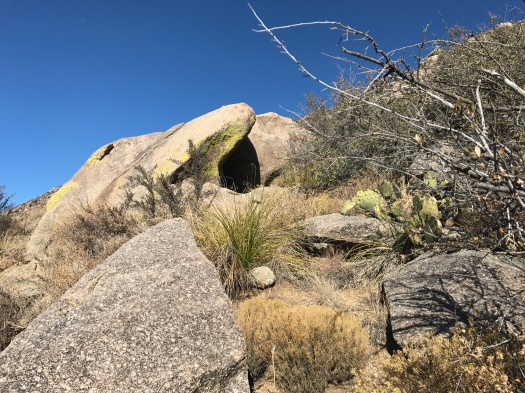
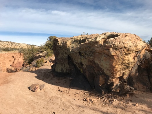
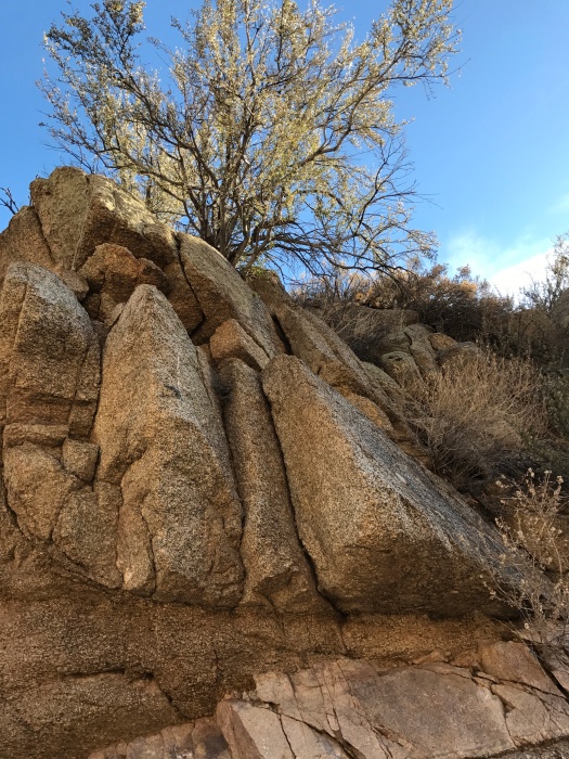
The bones are part of the story of Cerrillos Hills – what’s been and what is still unfolding. Both animals and humans play a role in its story, from the deer tracks at a small spring bubbling up in the arroyo to the capped and abandoned mines in the hills to the train whistle from a nearby railroad.

However those two elk met their end, their bones provide a message to the many other creatures traversing these hills and arroyos daily: Be watchful. Take nothing for granted.

I’m grateful for the chance to read that sentence of the story.

Hike length: 7 miles

Difficulty: moderate

Trail traffic: nope

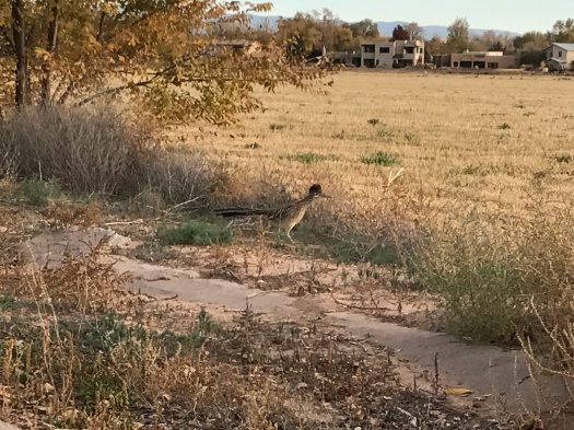
Wildlife spotted: canyon wrens, crows, butterflies, chipmunk

IMG_9288


Burque, here is your ultimate winter hike

There’s always that moment when what you fear becomes what you love.

Hey, don’t leave. I’m not psychoanalyzing you. I’m talking about hiking, man.

I’m talking about that moment – right around the time of the first freeze (anticipated tonight in Albuquerque) – when I go from avoiding the sun to seeking it.

There are some people (my husband included) who would do a full-sun high-desert hike 365 days a year. I am not one of them. From April to October, you will find me at as high elevation as possible, under tree cover.

But at some point in November, when Daylight Savings Time ends and the darkness descends and the cold finally arrives, and my cells crave light, everything changes.

This is the time to go to Three Gun Springs.

This trail tucked into the East Mountain foothills climbs from a residential neighborhood through steep, rugged rock to a saddle with views of a good five mountain ranges. It faces south, so it’s heavenly in the winter (and probably hellish all summer, save for dawn and dusk).

The rock formations – slabs piled high, some covered with lichen – hit me first. Then my eyes drank in the views.

IMG_9204

IMG_9209

IMG_9224

The day was cloudless; the higher we climbed, the bluer the sky. At the saddle it was so intense I almost felt like I was doing something wrong by looking at it.

The sandy arroyo trail rises steadily, lined by cactus, juniper, deep blue berries underfoot. Chunks of Sandia granite glitter gray and pink beneath my feet.

The switchbacks begin. The temperature’s in the 40s, but the entire trail is in the sun. A single layer is plenty. I soak in the light my body’s craving. The grade steepens; my pace slows. I enter that zone where my body’s sole focus is moving legs and poles a little further, where my mind repeats, “If it’s not around the next bend, I’m done.”

This trail was the first long climb I did. The Forest Service measures Three Gun Spring as eight miles round-trip. The first time I did this hike I was so sore I was positive I’d done all eight. It was only recently that I realized there’s significantly more trail after the saddle.

We reached the saddle 90 minutes after leaving the trailhead, enjoyed snacks and views of mountain ranges.

IMG_9229
On horizon at left, front to back: Sandia, Manzanita, Manzano, Los Pinos mountains. On horizon at right: Sierra Ladrones.

IMG_9232

IMG_9236IMG_9243

We could feel that the sun’s heat was already ebbing, so we headed down, keeping a brisk pace, chasing the warmth. About 60 percent of the way down, the sun dropped behind canyon walls, outpacing us.

IMG_9247IMG_9248

We moved even quicker to stay warm.

Jays and robins darted among the junipers. A man walked three dogs in the open space beyond the trail. The dogs engaged coyotes, which we couldn’t see, but their yips echoed through the canyon. We could hear the dogs’ owner warning them away. Finally, they trotted off, and they – and we – left the coyotes to enjoy their warm winter canyon.

Hike length: 5.5 miles

Difficulty: moderate

Trail traffic: moderate

Wildlife spotted: jays, robins, coyotes (heard only)

TIP! For maximum sunlight this time of year, if you’re going to the saddle, leave by 12:30. If you’re going further, leave earlier.

Things birds taught you at Los Poblanos Open Space

You’ve been hearing sandhill cranes fly over your house for three weeks, burbling all the way. All day they flew overhead in Vs.

You need to see them up close again.

You head straight for the Los Poblanos Open Space, near your old house. Your first year in New Mexico you were there every day at dawn and dusk, just to hear the cranes, see them springing up from the field into flight, see them extend to their full wingspan and glide in for a landing.

You remember waves of them launching and landing, their sound, their wings filling the sky.

When you arrive, there are dozens of geese in the field, occasionally squawking, rising and resettling. You count maybe 10 sandhill cranes.

Even with so few among so many, they stand out. They’re big, tall, a prehistoric-looking sand-gray. Something sets a few off, and they talk loudly to each other. The sound is like if a kid really got going on a porch swing whose chains hadn’t been oiled in a while. It’s a strangely comforting sound.

You never give up on a crane-photo fest somehow materializing, but with so few cranes, there are times on your walk when you notice other things instead.

You turn down a side path where you’ve had serious dusk cranespotting luck. The first thing you see: a fat roadrunner, feathers slightly disarrayed, hustling toward you, then realizing your presence and changing course.

IMG_9130

You spot several kestrels, seeing the flash of their patterned underside and burnt orange back as they settle into trees high above you, hearing their insistent klee-klee-klee-klee-klee.

You wander until the sun sets, unable to let go of the 1 percent chance of crane liftoff. You see the Sandia Mountains turn the watermelon of their name, fade out, then turn watermelon again.

IMG_9159

You see the golden cottonwoods glow when the light hits them just right, fade out, then glow again.

IMG_9132

IMG_9136

IMG_9167

IMG_9185

You see a flash of fading sunlight over the West Mesa that looks like it’s 10 seconds from becoming a rainbow, watch it till it fades.

You recall the bald eagle you saw there years ago, circling hundreds of feet overhead. And the spring day you walked out there after a soul-crushing two-week period of work, seeking a little respite that would help you continue. Two pheasants did a five-minute leaping faceoff in the field that you could only surmise was related to a lady pheasant.

Maybe the cranes aren’t all in Albuquerque for the winter yet. Maybe it will be another light year for cranes. Or maybe it just wasn’t your day to hang out with them.

But anytime you come here, you will be blessed by something you were not looking for, something that was also not looking for you.

Hike length: 2.5 miles

Difficulty: easy

Trail traffic: moderate

Wildlife spotted: sandhill cranes, geese, kestrels, roadrunner, crows, sparrows, flicker