I didn’t plan to get Gnasty on this hike, but I don’t regret it

On some maps of the Manzanita Mountain trails, it just appears as “Gnasty.” Which is eye-catching enough.

On others, its moniker is even more in-your-face: “Gnasty with a G.”

I hadn’t thought I would ever end up there. It’s a mountain bike path, and part of the warren of Manzanita trails where we tend to get lost.

But I was destined for Gnasty today, though I didn’t know it.

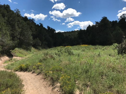
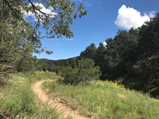
Our hike began at Otero Canyon, the second pulloff where you can hike on Highway 337 south of Tijeras. I’d seen a friend post a beautiful picture of it and was intrigued.

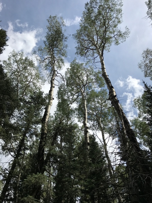
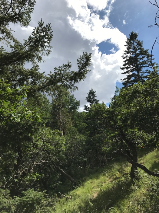
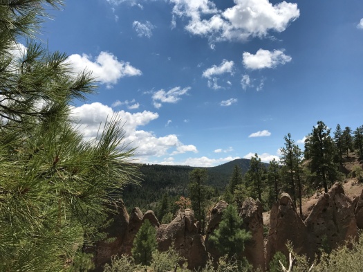
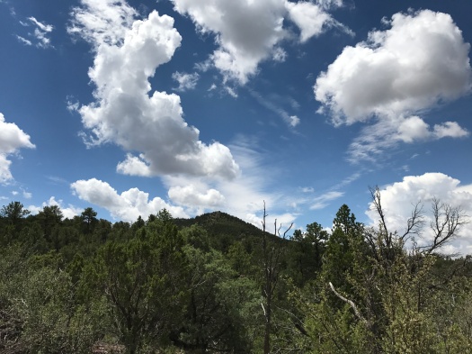
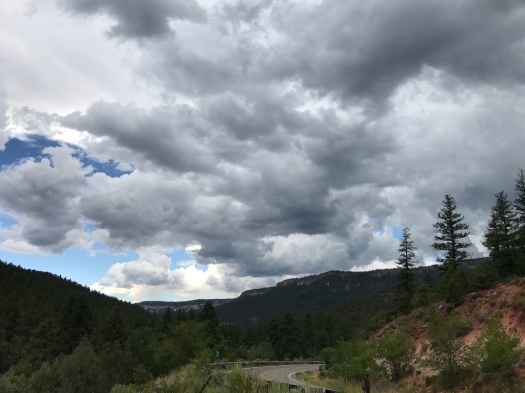
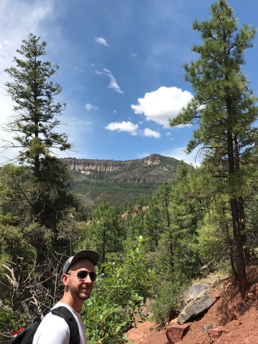
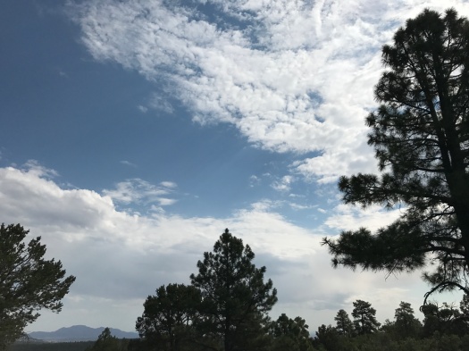
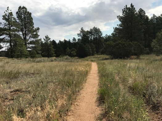
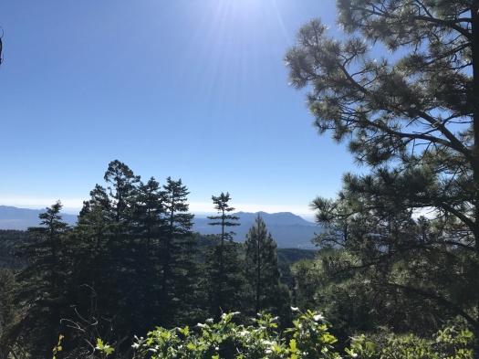
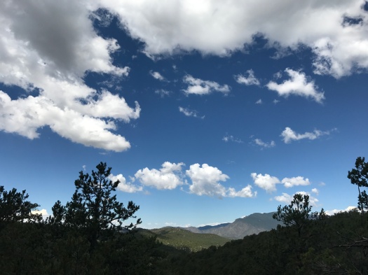
I’d slept late, and by the time we dawdled to the trail, it was nearly 11 a.m. We had three cool, cloudy days in Albuquerque this week, and the sky was that punch-me-in-the-face blue you get in fall.

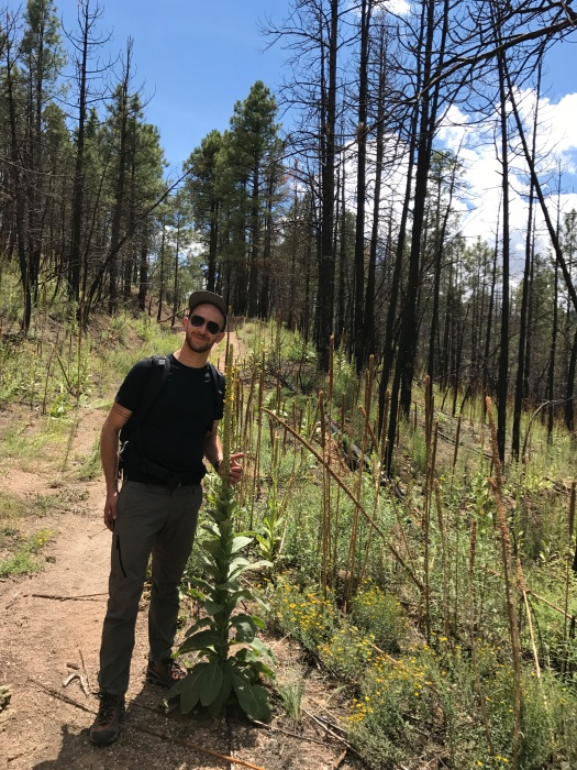
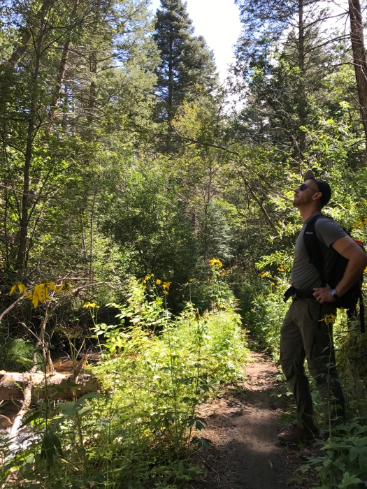
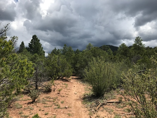
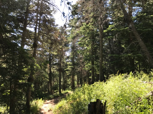
But within our first steps onto the trail, it was obvious that it was still summer. There are many unshaded sections of this hike and the sun was absolutely blazing.

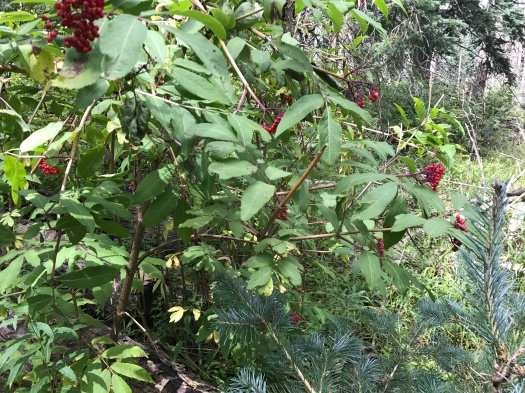
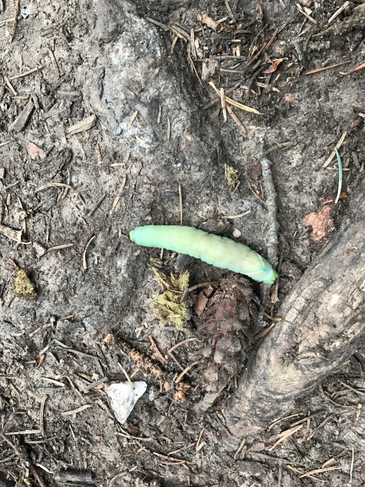
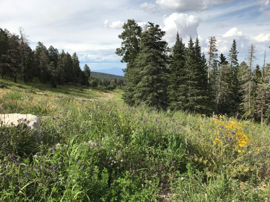
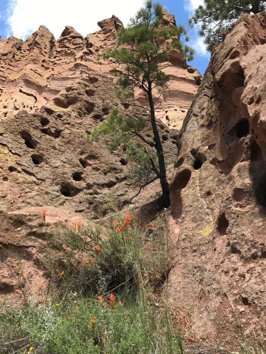
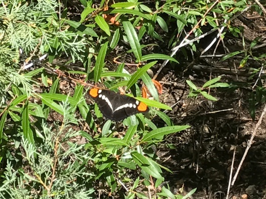
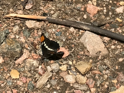
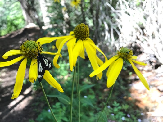
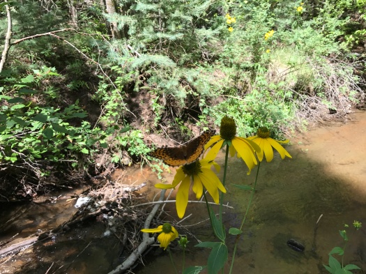
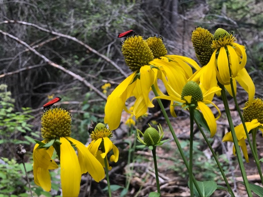
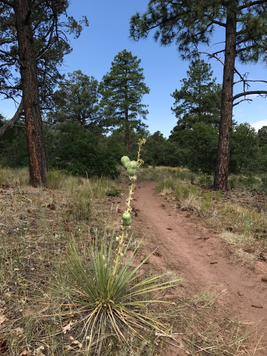
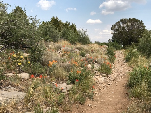
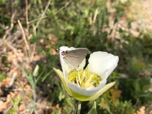
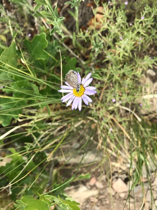
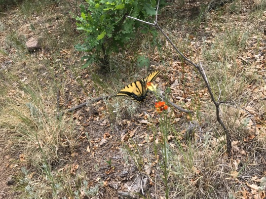
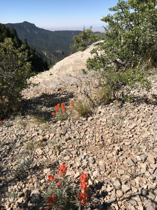
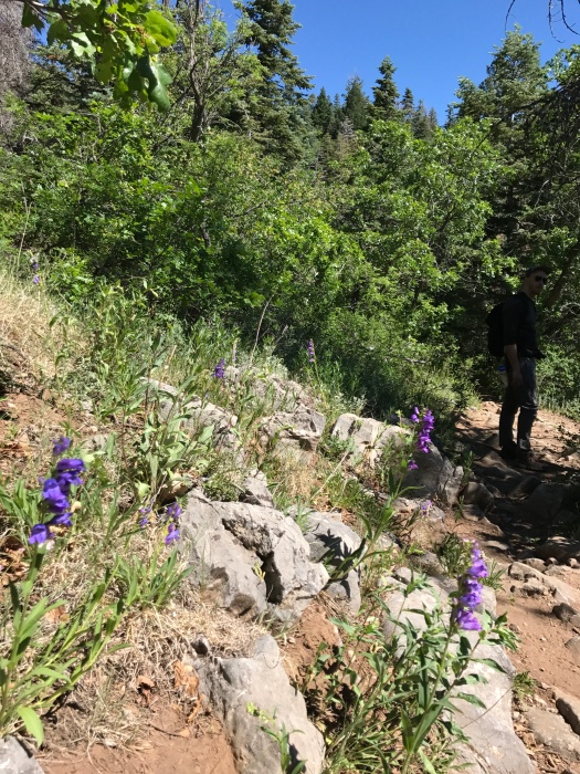
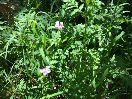
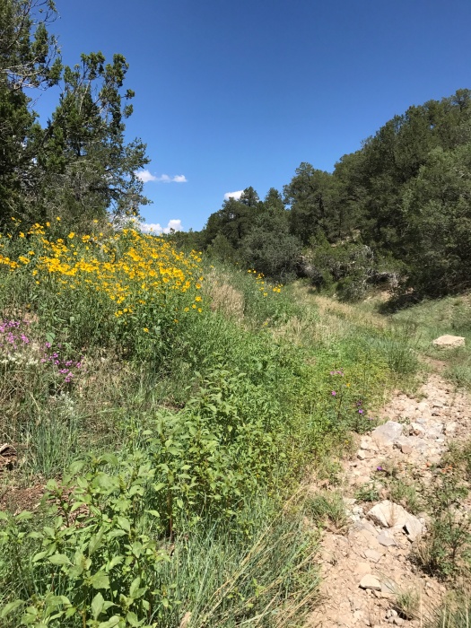
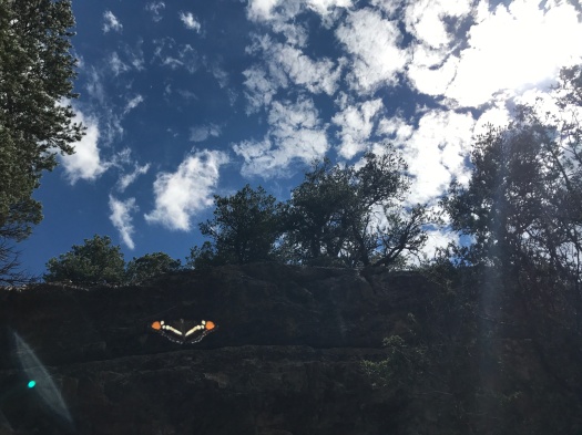
So were the wildflowers. If there is a better place within 20 miles of Albuquerque to see wildflowers right now, I don’t know of it. Sunflowers and yellow daisies danced in the wind, while red Indian paintbrush, lavender asters and tiny white flowers we couldn’t identify carpeted the ground. We saw every color of the rainbow and then some in wildflowers along the trail. All sizes and colors of butterflies danced around the canyon. The most plentiful were black, orange and white.

IMG_8469IMG_8511IMG_8518

IMG_8478
One of the canyon’s abundant butterflies photobombed me.

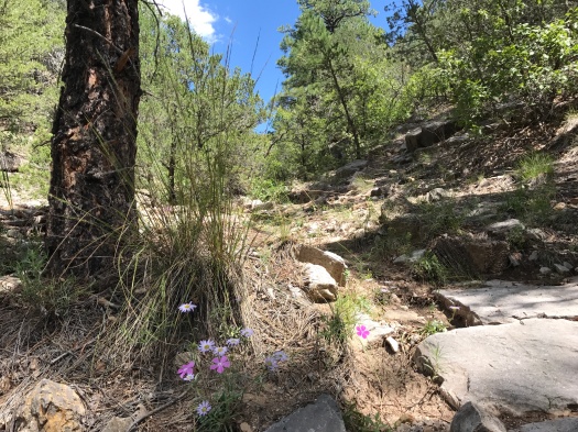
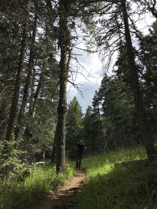
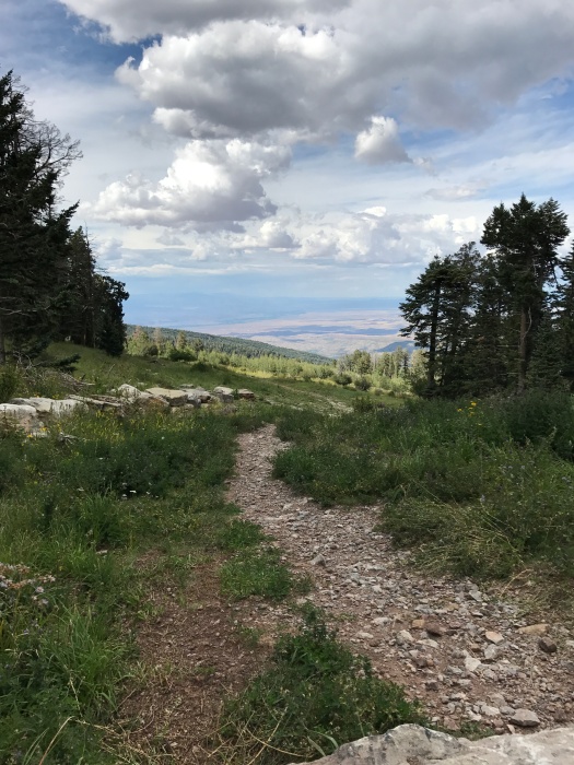
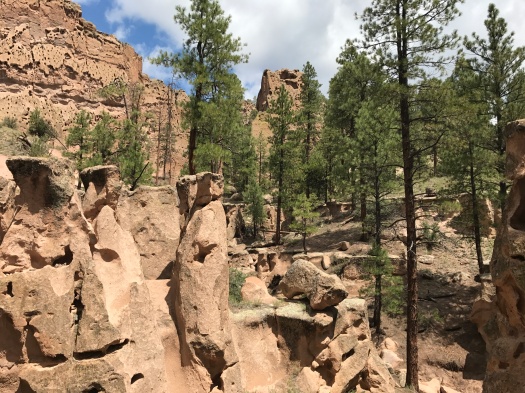
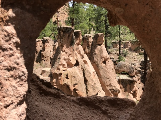
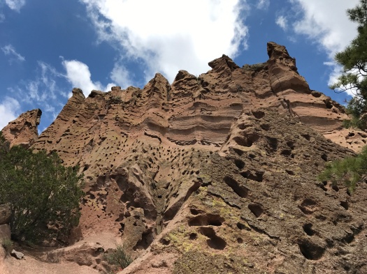
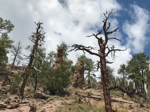
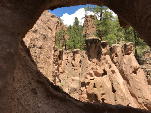
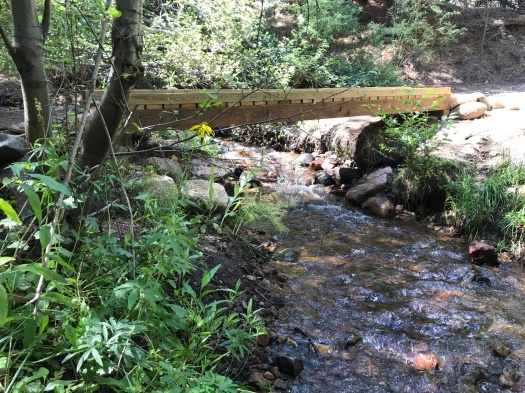
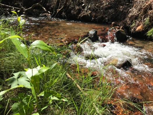
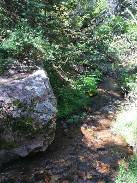
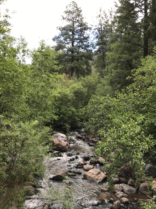
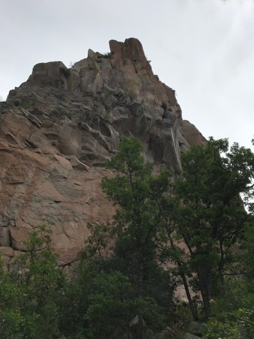
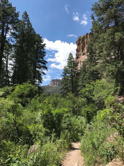
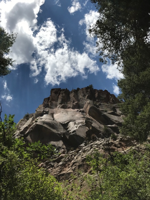
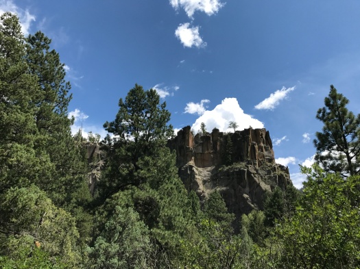
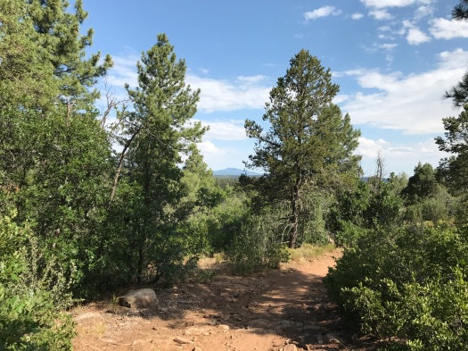
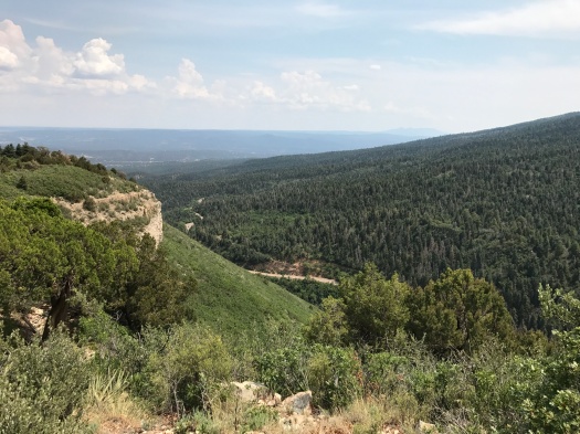
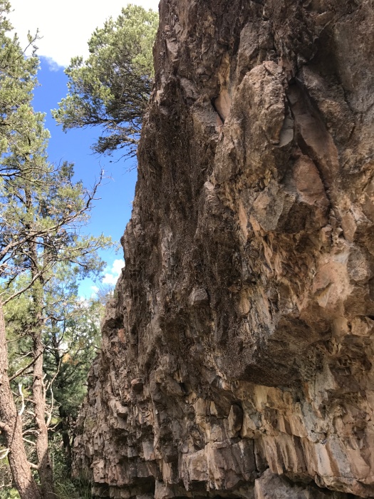
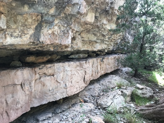
The Otero Canyon trail winds through stacked limestone formations. We saw no other hikers, but tons of mountain bikes and a few motorbikes. Luckily, there was pretty much always an arroyo when we needed to scoot off the trail.

IMG_8480IMG_8482

IMG_8485
How could you not climb on this, then sit and eat a snack?

We watched two Abert’s squirrels chase each other up and down a tree, and later, we saw a Cooper’s or sharp-shinned hawk chase another along a ridge. I knew I was anthropomorphizing them, but it was hard not to. There was no obvious evolutionary benefit to what they were doing; it seemed it had to be play.

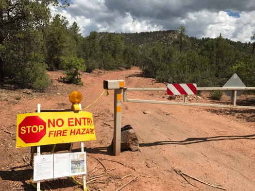
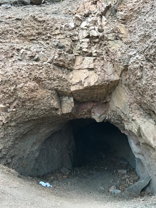
The maps showed the Otero Canyon trail extending nearly four miles. But two miles in, we came to a blatant Department of Defense stay-away-from-our-unexploded-bombs sign.IMG_8493

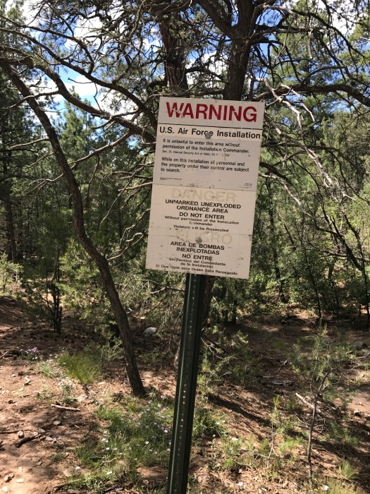
Plenty of bikes were whizzing in and out of that area, but I didn’t want to get arrested or exploded today.

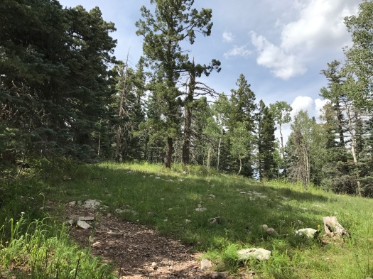
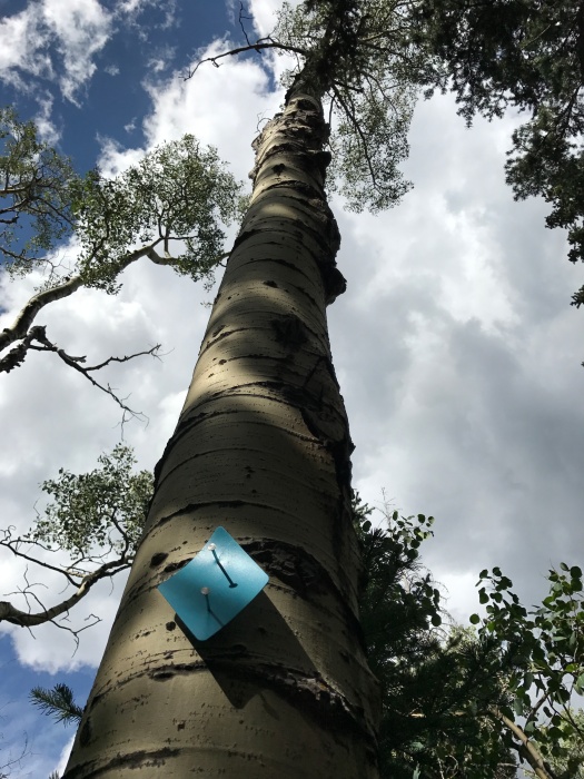
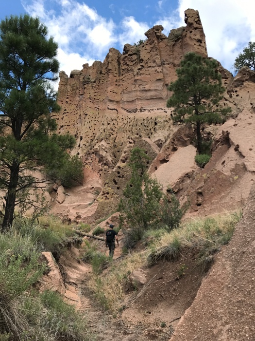
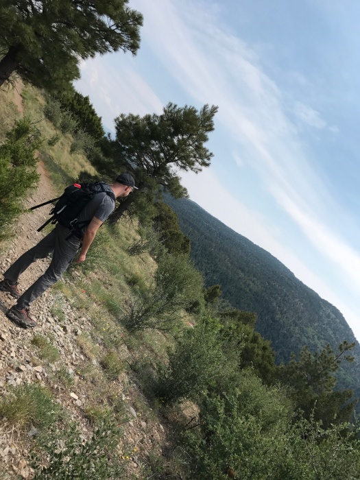
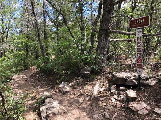
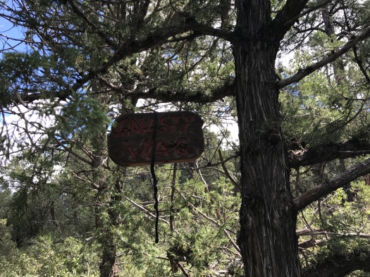
However, the trail climbing up a ridge just north of the unexploded-ordnance area was – you guessed it – Gnasty. Trail signage confirmed it, and there was even a hand-carved wooden sign, the kind you’d see on someone’s front porch, hanging from a tree: Gnasty with a G.

IMG_8492IMG_8494

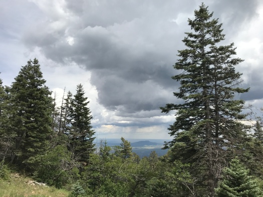
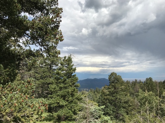
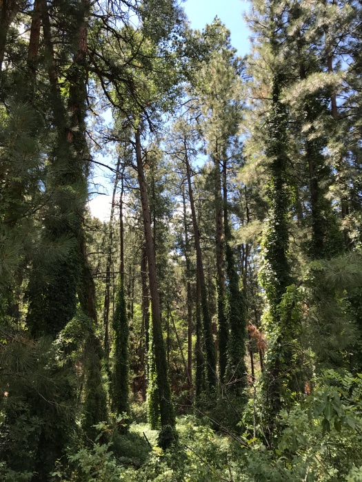
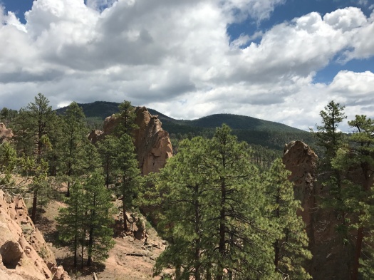
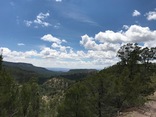
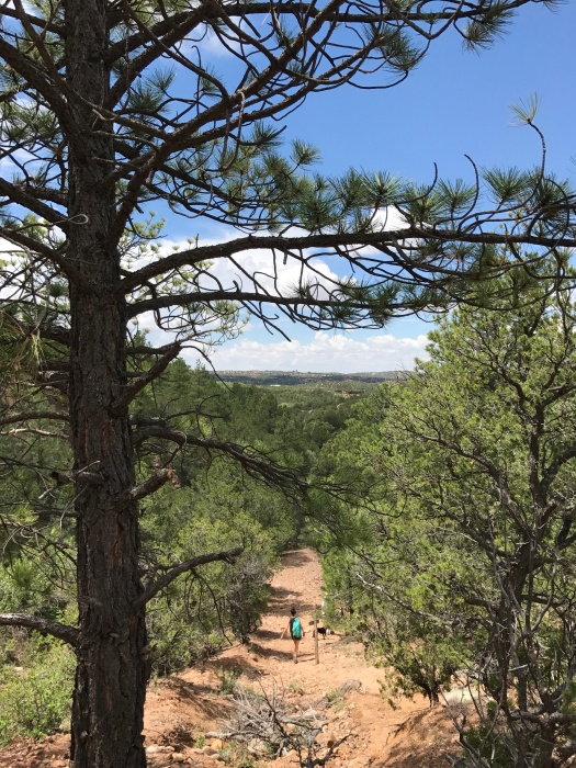
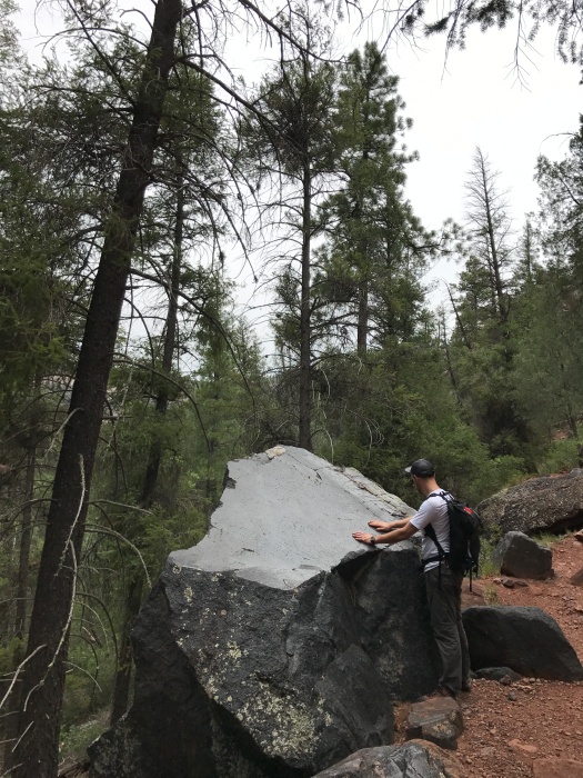
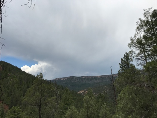
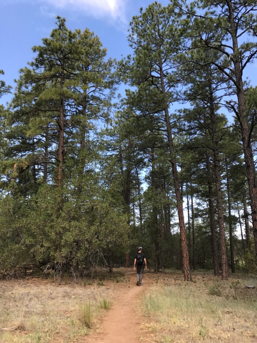
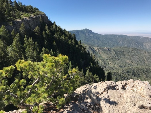
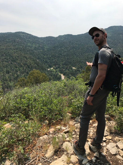
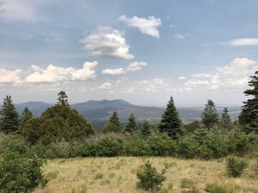
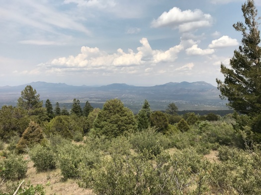
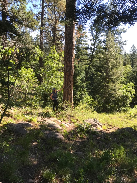
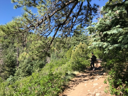
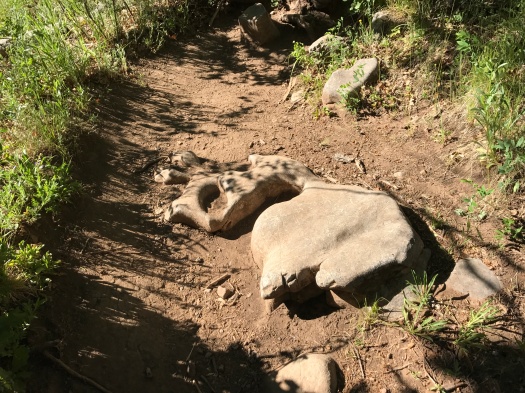
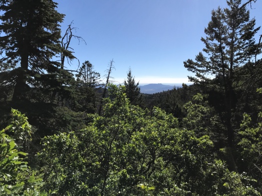
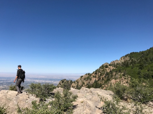
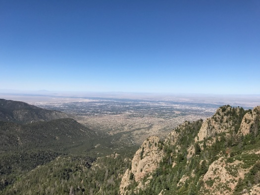
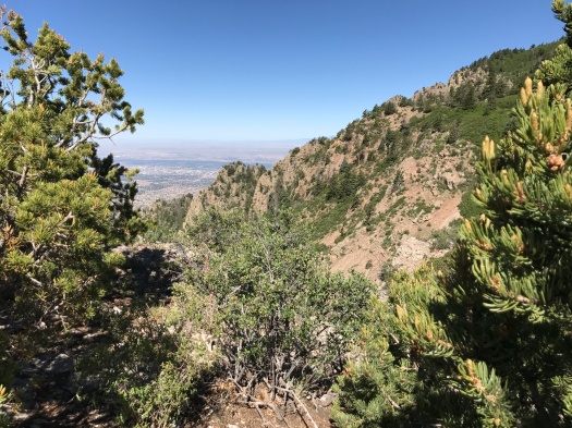
Gnasty is lovely, though challenging. It’s steep, rocky and narrow, with Gambel oak squeezing in on both sides. Ridgeline vistas quickly come into view through the trees.

IMG_8498

As we ascended, a couple of folks on mountain bikes were descending. We watched a ripped 70-year-old man steer his bike rapidly and with complete control down a stepped hairpin turn.

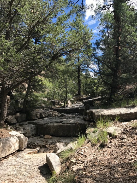
We went about a half-mile up Gnasty, then reversed course. When we got back to Otero Canyon, we stopped at the first limestone arroyo for a snack.

IMG_8505IMG_8509

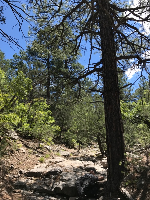
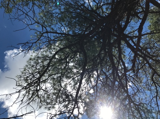
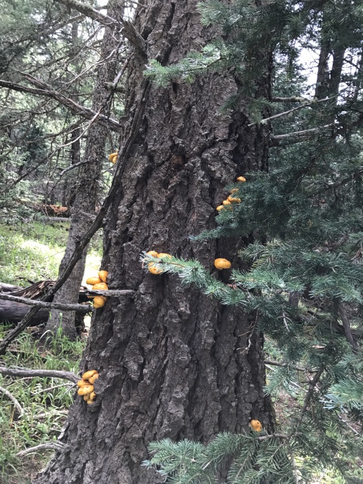
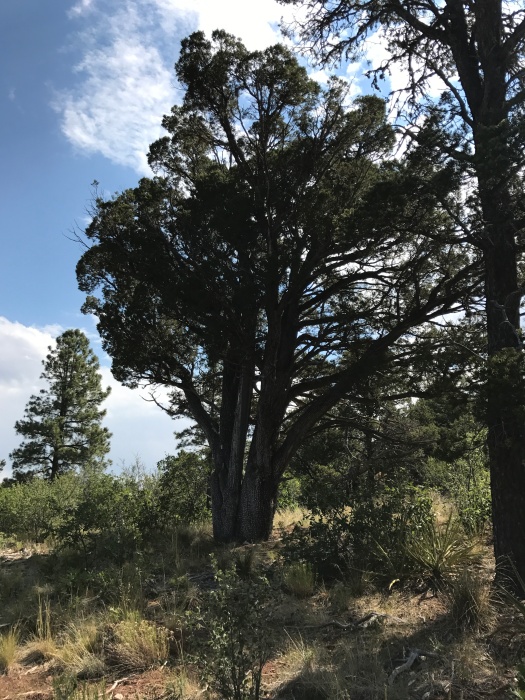
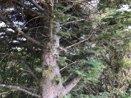
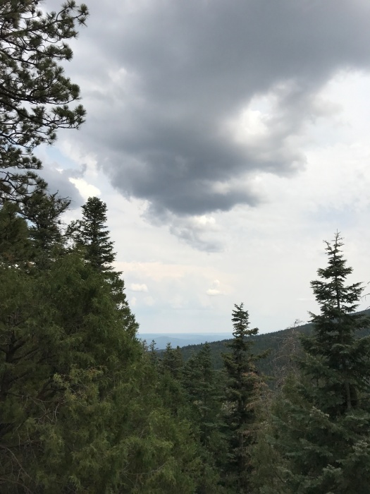
We lay on the cool rock beneath a giant ponderosa, watching clouds scuttle across the sky, listening to silence until the buzzing of flies overtook it.

That’s when it hit me: I could get used to Gnasty living.

Hike length: 5 miles

Difficulty: moderate

Trail traffic: moderate

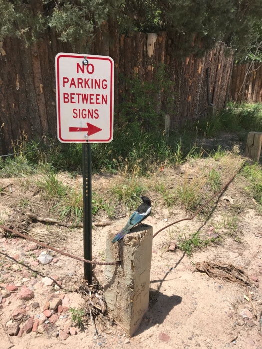
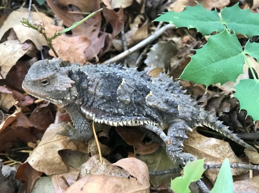
Wildlife spotted: jays, crows, hawks (Cooper’s or sharp-shinned), butterflies, canyon towhees (we think), Abert’s squirrels

IMG_8526

There are 10,000 reasons to hike this trail, but I only needed one

The 10K trail got its name because it follows a ridge along the 10,000 foot elevation line in the Sandia Mountains.

I was here because I’d put the word out on social media for a hike I’d never done before. I’ve spent the past two summers chasing shade, and there are fewer and fewer cool, shady hikes close to Albuquerque that I haven’t done.

When a friend suggested the 10K trail, I knew we had a contender.

The trail gains a total of just 600 feet in elevation over its five-mile one-way length. Piece of cake, right?

Heh.

There’s plenty of up-and-down within that 600-foot range, but what really makes this trail challenging is 1) the high elevation (huff, puff) and 2) the ankle workout from the tree root networks poking out of the path.

This is spruce-fir-aspen wonderland, complete with carpets of wildflowers and many kinds of mushrooms. The sweet-sharp smell of fir was our constant companion. Neither my husband nor I could resist poking a finger in a drip of fir sap. At some points the trail was mostly deadfall, mushrooms growing out of giant dead spruce trunks.

As we reached a beautiful overlook just a quarter-mile in, thunder rumbled. We debated turning back, but neither of us wanted to and both our instincts told us no storm was close enough to present danger, so we kept going.

There was plenty of traffic on this hike, but the folks who were just out there to gossip turned around after about a mile. The silence was even more welcome because we’d craved it.

I got into the rhythm of the hike, the trail leveled out more, and breathing became easier. We turned around after two and a half miles, and I realized why that last part of the trip out had felt so easy – it was all downhill. I huffed and puffed again.

Once we were close enough to the trailhead that I knew I’d get back under my own power, I had another problem; I did not want to leave.

Chickadees and nuthatches twittered above, squirrels and chipmunks darted along fallen logs, and sunlight filtered in through the trees. It was a cool 75 degrees with a refreshing breeze – even with rain nearby, the elevation kept it from being humid.

We heard thunder rumbling again on the last mile of the hike. But I couldn’t say no to stopping for a snack at the overlook, or walking down into a meadow to get a better view of the San Pedro Mountains.

The fields of wildflowers that had begun our hike greeted us again at the trailhead. Another side trail called to me, but the thunder grew more persistent and the dark clouds were rolling our way.

We climbed in the truck and drove the 11 miles back down the mountain. We caught the flint-smell of rain about halfway down. We drove through puddles. Mist rolled off the road’s surface. The temperature dropped another 10 degrees. Then, real rain, a steady beat against our windows that kept up all the way through Tijeras Canyon.

We passed the lovely trail that’s closed for three months due to heavy bear activity.

We passed the sign telling us we were leaving the Cibola National Forest, “Land of Many Uses.”

Hiker and motorcyclist and bear and caterpillar and chipmunk, all using the mountain in different ways.

I gave thanks for it and took my leave until I am lucky enough to be at 10,000 feet again.

Hike length: 5 miles

Difficulty: Moderate

Trail traffic: Moderate

Wildlife spotted: chickadees, nuthatches, caterpillar, butterflies, chipmunk, squirrel

IMG_8425
Chokecherries (right?) and fir
IMG_8428
San Pedro Mountains getting rained on
IMG_8433
So many mushrooms, so little time…

IMG_8435IMG_8437IMG_8439

IMG_8442
That is one hefty caterpillar.

IMG_8446IMG_8449

IMG_8453
SNACKTIME…jk
IMG_8454
10K Trail blaze on an aspen
IMG_8455
You can tell that the hills are alive with the sound of music down there, right? But the thunder was rolling and the sky behind us was black, so we kept going.
IMG_8458
Parting shot

There will be goblins: The most delightfully weird hike in the Jemez

“Hey!” my husband yelled. “There’s a bunch of Swiss cheese penises!”

I’d already done more climbing and scrambling than I expected, and was ready to head back down.

But how do you not look at Swiss cheese penises?

I dug in my poles and pushed up the steep slope.

***

In fall 2015, my sister gave me the gift that started it all: Stephen Ausherman’s “60 Hikes Within 60 Miles of Albuquerque.”

When I opened it, the first thing I saw was a place called Paliza Canyon Goblin Colony.

Sold.

Upon our arrival there in November, a ginormous tarantula greeted us.

It’s my only hiking encounter with a tarantula. So far.

That day it was around 40 degrees, with a cold wind. We were eager to see the canyon in summer, and when we reached it today, the morning after an hours-long soaking rain, we were not disappointed.

Paliza Canyon is seven miles up a narrow forest road from Ponderosa Winery. The hike is on another old forest road that winds along little Vallecito Creek. Brick-red dragonflies, a good 10 kinds of butterflies and little striped lizards darted across the road. Small electric-blue butterflies swarmed around what appeared to be elk scat. Ponderosa pines swayed in the wind above; thick vines wrapped around the trunks of the ones near the creek.

There are two gorgeous campsites tucked into the pines, right next to the gurgling creek. We didn’t see a soul there or anywhere on this hike, despite the full campground just a couple of miles away.

The road climbed gradually. Rock formations appeared. Then, a mile and a half up, the goblins. Acres of hoodoos, tombstones, fingers point into the sky. Your challenge: navigating the steep canyon for a closer look at them.

Bonus: As you climb, the view of the forested ridges around you just gets better and better.

Indian paintbrush and other wildflowers lit up the base of some of the goblins. Tangles of vegetation grew out of shaded spots in the rock in the big formations.

After a good hour of tramping around the goblins, we hiked further up the road. We passed through a small section of burned trees where new growth of wildflowers and vegetation carpeted the ground. A mullein plant stood as tall as my husband. We rounded a bend and views of mountain ranges and mesas opened before us.

So did a threatening bank of dark-gray clouds. We were running out of road. It was time to head back.

As we neared the creek again, I spotted an even smaller pocket of burned trees.

What kind of fire burns a few trees here and there? I asked my husband.

One that gets rained out, he said. The canyon serves as a natural firebreak too. (The area had been closed for remediation from the Cajete Fire when we tried to hike here three weeks ago.)

I stopped to take a picture of a butterfly on a bush, and thunder boomed in the black sky behind us. I abandoned picture-taking and hustled. Ahead, the sky was brilliant blue. There was no sign or sound of the storm when we reached our car.

As we drove back down through the valley, we admired a soaring ridge full of the same Swiss-cheese holes we’d seen on our hike.

No penises, though.

The goblin colony’s the only place I know of where you can see that.

Hike length: 5 miles

Difficulty: The hike’s easy; clambering around in the goblins is not

Trail traffic: none today

Wildlife spotted: bluebird, chipmunk, dragonflies, butterflies, nuthatches, jays, squirrels

Tip: This is a beautiful hike in the summer, but go early in the morning. While some sections are well-shaded, the sun really beats down on that first mile and the ridge.

IMG_8338

IMG_8343
Vallecito Creek
IMG_8344
Vine-covered ponderosas by the creek
IMG_8347
THEY’RE EVERYWHERE

IMG_8348IMG_8352IMG_8358IMG_8360

IMG_8367
Welcome to Stonehenge.

IMG_8368

IMG_8397
Ladies and gentlemen, I give you…Swiss cheese penises.

IMG_8401IMG_8403

IMG_8409
New life in the burn zone: husband-sized mullein.


This hike ended at just the right time

Until today, I had only seen the Winsor Trail along Tesuque Creek buried in snow.
Today, Tesuque Creek was flowing fast along the Winsor, surrounded by lush foliage and wildflowers. A sign on the approach to the trail noted that about 100 dogs travel on it with their owners each day. We didn’t see all 100 – maybe a fifth of that.
When we began the hike, it was a perfect 71 degrees. It’s actually been raining in Santa Fe, so the humidity quickly worked us into a swelter when we were in the sun, and sometimes when we weren’t. The sky was vivid blue; fluffy, towering monsoon-season clouds built in the distance.
The hike begins along the creek, climbs above it, then meets it anew further up the trail.
We began to see sunflowers as we climbed, first a couple at a time, then in clusters along the creek. We passed through a section of the trail with rows of sunflowers on each side. Several kinds of butterflies fluttered among them, along with some bee-like red insects we couldn’t identify.
The Winsor Trail goes all the way from Tesuque to Ski Santa Fe. You can use it to get up to Lake Katherine, one of the hardest hikes in New Mexico.
We weren’t going to get anywhere near that far this day.
We’d hoped to see more of the higher section of the trail, but after two and a half to three miles, we reluctantly decided to head back. I’ve been having some high desert summer nosebleeds and my allergies were starting to kick up, so I decided not to push my luck.
The sky above was inviting, beckoning us higher, just one single dark cloud among the fluffy white ones.
But we turned and headed back. Somehow, on the way down, my husband managed to spot a tiny horny toad, not much bigger than the tip of a finger, camouflaged perfectly among the beige and pink rocks.
We stopped at a ridgeline to take one last look behind us – and the entire sky was grayish-black. That one cloud had managed, before noon, to bloom into something much bigger.
As we walked out of the Winsor and into the surrounding neighborhood, thunder began to crackle.
I’ve seen my fair share of New Mexico monsoons, and my husband has seen them all his life. Neither of us would have turned back solely for that one cloud.
I’d like to thank my nose for perfect timing.
And perfect performance. It didn’t even bleed.
Hike length: 5.5 miles
Difficulty: moderate
Trail traffic: busy, though less so the higher you climb
Wildlife spotted: butterflies, Abert’s squirrel, dragonflies, tiny horny toad, magpies, crows
IMG_8246IMG_8227IMG_8236IMG_8237IMG_8243

IMG_8244
Perfect lunch-eating boulder above the creek.

IMG_8250IMG_8255

IMG_8263
We saw several insects we couldn’t identify, including these red and black butterflylet-esque things.
IMG_8264
That escalated quickly.
IMG_8265
Meanwhile, on this ridgeline, all is fluffy.

IMG_8267

IMG_8272
Magpie looking out for the neighborhood where you park at the base of the Winsor Trail

The Jemez is beautiful this summer – even minus the parts you can’t get to

I was really looking forward to hiking at Paliza Canyon Goblin Colony this weekend.
It’s a crazy conglomeration of hoodoos tucked into a beautiful canyon near Ponderosa Valley Vineyards. It’s cool and shaded – perfect for summer.
As our truck dipped through a fertile valley and climbed the forest road into Paliza Canyon, a chipmunk skittered across the road, and birds and butterflies darted by.
But when we got to the trail, just a few hundred feet down the path, we met a locked gate and caution tape. The area was closed until July 31 due to fire hazards. The posted sign said it was because of the Cajete Fire earlier in the summer, which puzzled me greatly, since that fire was a good 30 miles away.
We weighed our other options. Stable Mesa, about 20 miles away, was another well-shaded summer hike. But when we’d stopped in the Walatowa Visitor Center at Jemez Pueblo, we’d seen a notice that the road to Stable Mesa was closed for rockfall mitigation. And our favorite hike in the Jemez, the Las Conchas Trail, was right next to the Cajete Fire site, so we thought it was probably closed.
We decided to drive further into the Jemez and pull over at the first campground we could be sure had a hiking trail.
That turned out to be Battleship Rock, a few miles past Jemez Springs. We’d seen that rock formation towering over Highway 4 many times but never stopped.
The campground was mobbed, as we’d known it would be on a summer Saturday. The East Fork of the Jemez River was flowing well. I’d forgotten to bring my hiking poles and I was nervous about fording without them, but we crossed at a narrow, shallow spot and made it across without incident. Then we thought about the gray clouds threatening overhead and about being cut off if a downpour made the river too dangerous to ford. So we crossed back over and found a path along the base of Battleship Rock.
It was gray and humid and smelled like campfires and pit toilets. The trees and vines pushing in on both sides of the trail felt oppressive. We saw a trail heading upward and took it, thinking it was a back approach to Battleship Rock.
It wasn’t, at least not in the direction we headed. But it took us away from the crowds and up a ridge strewn with the shiniest black boulders we’d ever seen – probably basalt, although there are other lava forms in the area.
Incredible views of mesas edged with fingers of rock, deeply forested slopes and Highway 4 below came into view. The dark clouds slowly lifted and the sun came out – just as I’d hoped – and it was instantly really, really hot. Lizards scampered over the boulders as they heated up in the sun.
The climb was challenging without my poles, and the descent more so.
The way down brought even more amazing views, now that the clouds had cleared. When we came within earshot of the East Fork again, it was a welcome sound. And with the sun shining down on the riverbank, the plants and flowers at the base of looming Battleship Rock seemed to glow.
The sun was still beating down when we left, but more storm clouds were gathering.
I would love to hike up Battleship Rock itself one day.
Maybe that day will come soon, if everything else is closed.
Hike length: 3 miles
Difficulty: Moderate
Trail traffic: lots along the East Fork, less on the climb
Wildlife spotted: lizards, vultures, crows
IMG_8176
Paliza Canyon wasn’t happening this day.
IMG_8179
Arrival at Battleship Rock under threatening skies.
IMG_8180
The East Fork of the Jemez River, looking good.
IMG_8184
Battleship Rock
IMG_8189
Respect the boulder.

IMG_8192IMG_8195

IMG_8212
Battleship Rock in foreground

IMG_8218

IMG_8221
Our final glimpse of Battleship Rock

One summer night in the Mississippi Delta

When my sister asked, “You gonna hike?” I was like, “Are you crazy?”
We were home visiting my parents in the Mississippi Delta, where I grew up. Just walking from the house to the car in the heat of summer in the Delta is enough to give you the vapors. Most days, with the heat index, it feels like at least 100.
But on our third night home, a rainstorm washed everything clean and wiped the temperature down to 76.
The Delta is flat. I did not hike in it growing up. No one did.
I was also too busy hating it to really look at it. I saw and heard so many racist things growing up. I defined myself in opposition to a place where so much ugliness had happened and was still happening.
So when I went up in a hot-air balloon at age 13, I was shocked to love what I saw: a tapestry of green in shades I’d never seen outside a Crayola box, ribbons of rivers snaking through black soil.
In summer, in full-on primordial swamp mode, the Delta is freaking gorgeous.
This night in July, the light was soft, the air almost totally saturated with moisture, the neighborhood a tangle of trees and vines, flowers and grass.
My husband, my sister and I walked up Grand Boulevard and crossed the Tallahatchie Bridge (yes, that one) onto Money Road.
Yes, that Money, Mississippi. The place where 14-year-old Emmitt Till was brutally murdered in 1955 in an act of racial hate.
The historical marker of Till’s death was vandalized just last month. Again.
Money Road is not a place to travel on foot, so we immediately turned onto a dirt road that parallels the Tallahatchie River. Cotton and soybean fields stretched away into the unseeable distance. Despite all the cotton fields I’d seen in my life, it was the first time I’d actually seen cotton plants flowering.
We passed a parked tractor, the glowing sun behind it. A deer bounded along the riverbank, leaping over tangles of brush.
We rounded a bend in the road, tried to remember where it led, and headed back so as not to be wandering around Money Road after dark.
That walk through fields in a Delta pulsing with life and light was one of the highlights of our visit home.
There are many myths about the Delta. Inevitably, they all ignore one of two things.
All of the hate and injustice and poverty and ugliness here was – and is – real.
So is the beauty.
Hike length: 1.6 miles
Difficulty: easy
Traffic: some in neighborhoods, none on the bridge or dirt road
Wildlife spotted: deer, red-headed woodpecker, squirrels
IMG_8127IMG_8129IMG_8137IMG_8139IMG_8143IMG_8145

Some who wander in the Manzanitas are lost

“If they don’t have to send out search and rescue, you weren’t lost.” -my husband
Mmm-hmm.
After our latest hike in the Manzanita Mountains just south of Tijeras, I took score.
Of the six hikes we’ve taken in the area, two were completed without any wrong turns. One required retracing our steps back to the car when we couldn’t find the trail that was supposed to lead us out. And one took us on an unintended three-and-a-half-mile detour.
It’s a lovely landscape to hike in – deeply forested, a couple thousand feet above Albuquerque, with winding rock-lined canyons. But the trail system is primarily used by mountain bikers, and it’s a tangle, with informal trails cut between the official paths. It’s also a foothills area, with fewer distinctive landmarks visible from a distance than higher in the mountains.
Hence, directional challenges.
We were there for a short loop hike at Juan Tomas Open Space, which is City of Albuquerque property. We were the only hikers on Juan Tomas this morning, with plenty of mountain bikers, some of whom we saw multiple times as they made a circuit.
The area’s gently rolling terrain allows you a better grasp of just how towering ponderosa pines are than you get high in the mountains. This spot has some sweet alligator junipers, too.
Most of this hike is trees and meadows, but there’s a vista of Sandia Peak near the beginning of this loop. We could see the smoke from a small fire burning on the Sandia crest.
This is a beautiful hike during the period when the monsoon season is flirting but not committing. Clouds frequently slid by above, and when they did, a breeze rose that was just humid enough, without making you sweat buckets. The downside of summer hiking here: in some spots, there are lots of flies.
A black-and-white Abert’s squirrel darted across the path, then scampered up a massive ponderosa and looked down at us from high above. Birds chirped and called all around us.
Our guidebook refers to a spot toward the end of the loop where the trail splits four ways. We found two places where the trail split three ways, but never found the four-way split (something similar happened on our first hike here, a year and a half ago.) We took our best guess, but it quickly became clear it wasn’t leading us back to where we started.
We could see the road we drove in on through the trees, so we headed toward that and, about a third of a mile up the road, we found our car. (Oddly, the part of this hike that had the most flies was the part we hiked on the road.)
Our first hike here was in winter, with snow on the ground. Our second was in sweltering pre-monsoon summer. Both were worth taking.
But I’m beginning to think no matter how many times we hike this loop, we’ll never find the end.
Hike length: 3.2 miles
Difficulty: On the easy side of moderate
Trail traffic: A healthy dose o’mountain bikes
Wildlife spotted: coyote (on the drive in), crow, vulture, nuthatches (heard but not seen), Abert’s squirrel, lizard, juniper titmouse (I think) and many flies

IMG_8103IMG_8108

IMG_8106
Alligator juniper
IMG_8109
Yucca gone to seed

IMG_8111IMG_8112

The mountain does not care about you

IMG_7958

You’re getting close to 40. Things hurt that never hurt before, in your body and in your heart. You worry.

You worry when you’re on the mountain: is whatever body part’s talking to you today up to the task? Do you have enough strength and balance and patience for what’s in front of you, which often feels different from what your reference material described?

The mountain does not care.

The mountain never had a guidebook, nor needed one.

For millennia, the mountain has been whatever it had to be.

When there was water everywhere, the mountain was a ridge at the bottom of the sea.

When the ocean receded, the mountain was an arrowhead sticking up from the desert.

When the rock couldn’t hold it together anymore, it fell. It didn’t care who or what was under it.

The mountain doesn’t care who got hurt, or who died.

The mountain doesn’t care how much being there means to you.

That is why it means everything.

Of all the hikes, this one smells the best

As soon as I stepped out of the car at the Tecolote Trail in the Sandia Mountains, I recognized the scent. It smelled like the Christmas tree farm where my family got our trees when I was growing up.
Unlike many New Mexico mountain hikes where the vanilla-tinged smell of ponderosa pine hits you periodically, this trail smells like straight-up pine and fir pretty much the whole time. Like Christmas, in other words.
Besides the smell, the other thing I noticed right away was the breeze. A heat wave of endless 100-degree days had broken and the temperature was in the low 80s, with 40 percent humidity. That meant more sweating on the trail, but also more coolness in the wind.
Then we heard a clear, musical bird call neither my husband nor I could identify. We later spotted a Western tanager high in a tree, and suspected the call was theirs.
We had two hours before a hefty chance of thunderstorms, so we’d chosen the less-than-three-mile Tecolote Trail, at 8,200 feet in the Sandias. It was just half a mile up the road from the hike we did last weekend, but significantly less difficult, and with views of  different mountain ranges. This hike’s accessible enough that everyone from the young to the old can enjoy it, and we saw multiple generations of families tackling it together.
The trail is much gentler than nearby Tree Springs, ascending steadily but gradually. One of the first things you spot is an old mine shaft carved into the rock. Along the trail grow both mountain wildflowers and cacti with chartreuse flowers. It doesn’t take long to reach killer views, including one of a rock dome with a huge grassy slope rolling away from it – the biggest area I’ve seen in the Sandias covered with something other than evergreens.
At the top, a quarter-mile loop leads to fantastic views of the Ortiz and San Pedro Mountains. We did some serious butterfly chasing, and even spotted – a first for me – two butterflies mating on a flower.
When we started the hike, I thought the soft, blurry quality to the air might be a heat haze. But it was clear right away, given how fragrant and moist the air was, it had to be water vapor – the most humidity we’ve encountered on a New Mexico hike in a long time.
The clouds began to close in just as we headed back down. When the sky turned gray, all the shades of green along the trail began to look really saturated.
It was the best-smelling 90 minutes I’ve spent in a long time – and there was plenty to see, too.
Length: 2.8 miles
Trail traffic: moderate
Difficulty: easy
Wildlife spotted: butterflies (including swallowtail, and some caterpillars), tanager, enormous vulture, grasshoppers, rabbit
IMG_7975
Jesus is real, but these restrooms are not. They are permanently closed for “unsafe conditions.” Husband’s theory: black widow farm.
IMG_7983
Mine shaft

IMG_7993IMG_7996

IMG_8002
Indian paintbrush and cacti
IMG_8003
Lizard chillaxin

IMG_8006

IMG_8014
Below, the Sandia Crest Highway and the trailhead for last week’s hike

IMG_8016IMG_8025IMG_8030

IMG_8037
Annnnnd that is what two butterflies getting it on looks like.

IMG_8044IMG_8047

IMG_8050
That’s our cue!

If you can’t take the heat, get on Tree Springs Trail

I’ve only been on Tree Springs Trail when it’s 100 degrees in Albuquerque. The trailhead is at 8,500 feet elevation. You step out of your car and instantly you’re in a mountain forest: evergreens soaring overhead, wildflowers at your feet, chipmunks scampering, sky an eye-popping blue. The elevation change alone is good for 10-15 degrees lower temperature than in the valley.
The first time we came out here, the mountain was shrouded in mist and fog. I needed extra layers. We hiked all the way to the Sandia Peak Tram terminal, over seven miles roundtrip.
I was hoping for that same cool mist today, but the only clouds to be seen appeared to be far-off smoke from a fire in the Jemez Mountains. No moisture there.
A thing I cannot overstate about hiking in New Mexico: it’s usually solitary, rarely crowded, and never, ever really crowded. It was a prime, if hot, summer Saturday on a popular trail 30 minutes from downtown, but after saying hello to a few folks at the trailhead, we didn’t see anyone but black-and-white Abert’s squirrels for most of the first hour of our hike.
Much of Tree Springs Trail is deeply shaded. The sections on mountain bends in the sun were already baking at 8 a.m. The trail is a gradual but constant 1,000-foot climb over two miles. Much of the trail is limestone rock, and as you ascend, more and more fossils from when this trail was at the bottom of an ocean appear in the rocks. My husband kept seeing animal shapes in the limestone rock formations, and after he pointed them out, I did too.
Amid the canopy of massive evergreens and sprinklings of wildflowers, some great views over the surrounding mountains and small-town valleys appear. We followed a couple of huge yellow and blue swallowtail butterflies, hoping they’d settle on a flower long enough for us to snap a photo, but couldn’t quite catch them.
It’s been many months since I did a real mountain climb. My calves and ankles felt it, and the low humidity had me guzzling twice as much water as usual (and usual is a lot). As the morning kept warming up, I began to wonder if they’d moved the spectacular overlook at the top of Tree Springs Trail further away. Finally, we passed the wilderness boundary sign and took the path to the overlook. We waited in a shaded glen while a loud couple took overlook selfies. I spotted something moving on the ground. It was the biggest horny toad I’d ever seen, gray and black. We watched him, snapping a few photos, until he disappeared in the brush.
Then we climbed around the enormous overlook, with its panoramic view of dusty, hazy Albuquerque below, faraway mesas and the arrowhead-shaped Sierra Ladrones range 60 miles to the south.
On my previous two visits to this overlook, the winds were so strong it was hard to stand. I understood for the first time why it’s always so bumpy when you’re flying over the Sandias. Today, a cool, gentle breeze offset the baking sun.
There would be no trip up the Crest Trail to the tram today; after the hot climb to the overlook, I had enough energy to make it back down the trail, and that was all. We enjoyed that breeze on the way down, passing panting but happy dogs and their owners as the trail came to life for the day.
Will we have the good fortune of hiking this trail in a gentle mist on a blazing day again? Stay tuned. The current forecast for next Saturday: 103 degrees.
Length: 4 miles
Difficulty: moderate
Trail traffic: moderate
Wildlife spotted: many kinds of butterflies, chipmunks, rabbits, Abert’s squirrels, bluebird, towhees, ginormous horny toad
IMG_7927
Pondering bigly.
IMG_7930
Husband pondering bigly.
IMG_7933
That rock looks like a rabbit! Right?

IMG_7936IMG_7938IMG_7940

IMG_7947
I SAID NO PAPARRAZI, DAMMIT

IMG_7955IMG_7958

IMG_7959
Hot, hazy ABQ below. Sierra Ladrones range at 10 o’clock.
IMG_7960
Indian paintbrush at overlook

IMG_7961

IMG_7966
Husband patiently waiting out wildflower photo-taking

IMG_7969