Go to the top of Piedra Lisa Trail. Turn right. Commence scramble.

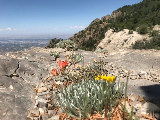
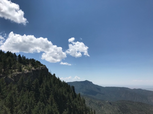
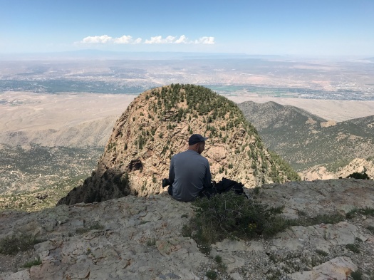
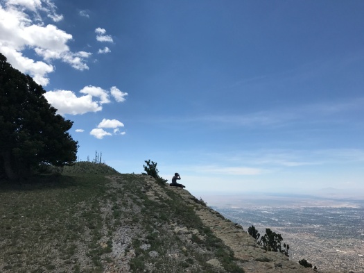
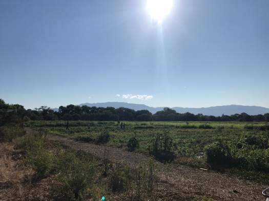
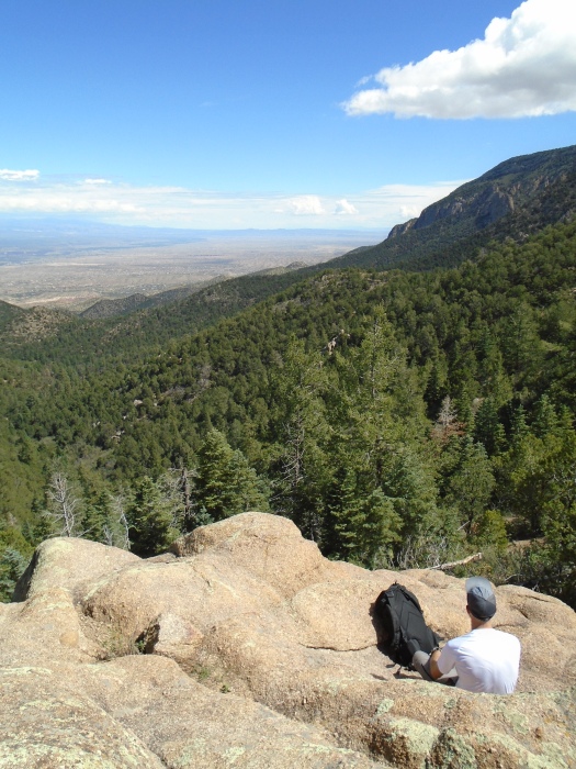
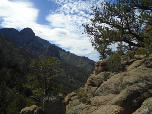
I stopped on Rincon Ridge to eat my sandwich. But the real feast was in front of me.

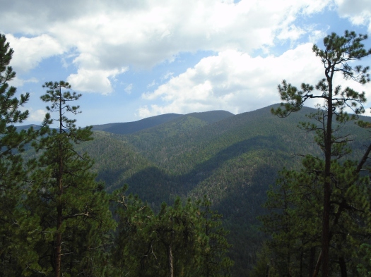
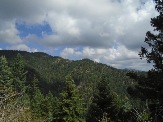
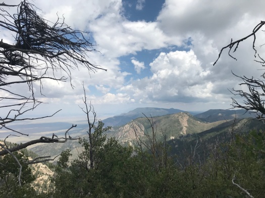
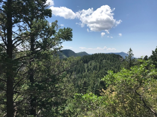
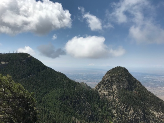
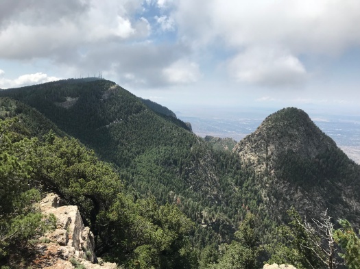
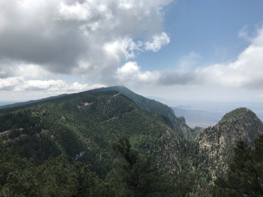
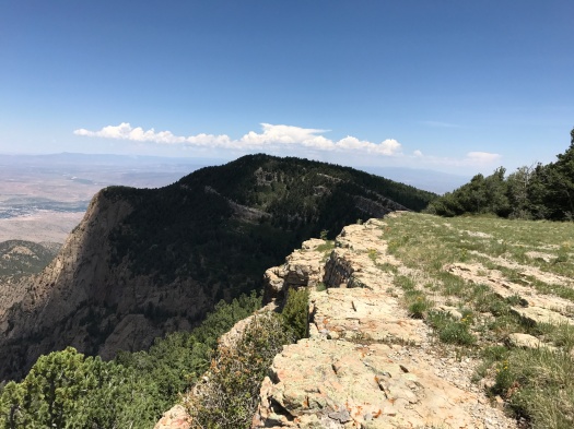
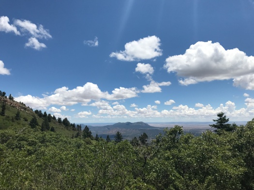
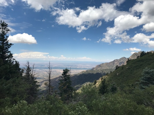
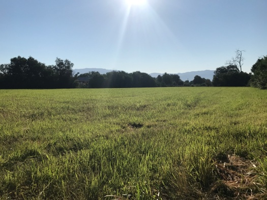
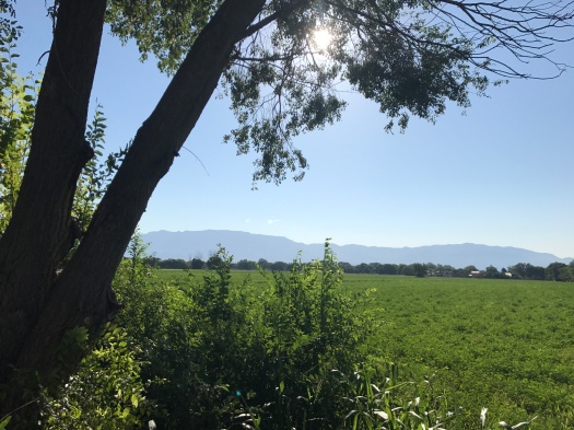
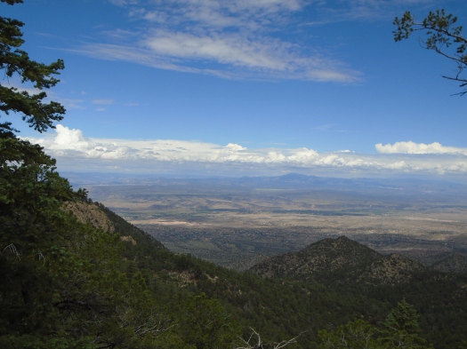
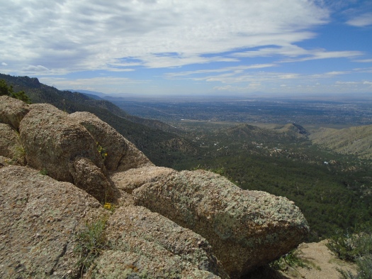
I could see deep into the Jemez, all the way to Redondo Peak. Between me and it, the Jemez’s drainages cut deep clefts through the Santa Ana Pueblo, the tops of its mesas glowing green.

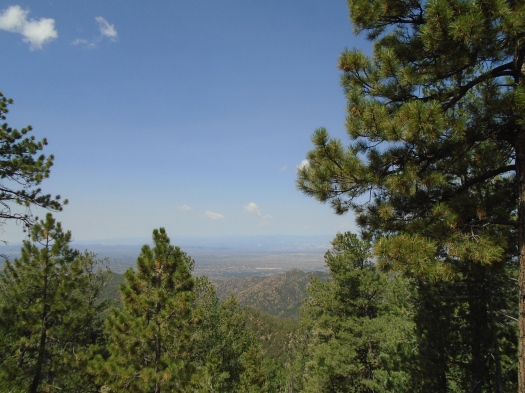
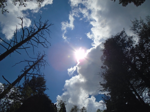
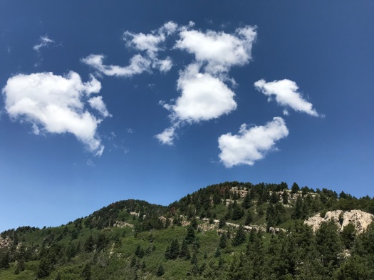
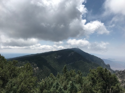
A glimmer of the Rio Grande on Santa Ana came into view as clouds, then sun, then clouds bathed the valley.

DSC00188

DSC00180

DSC00189

DSC00145

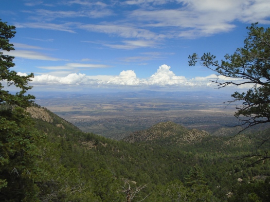
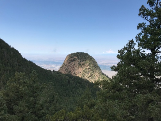
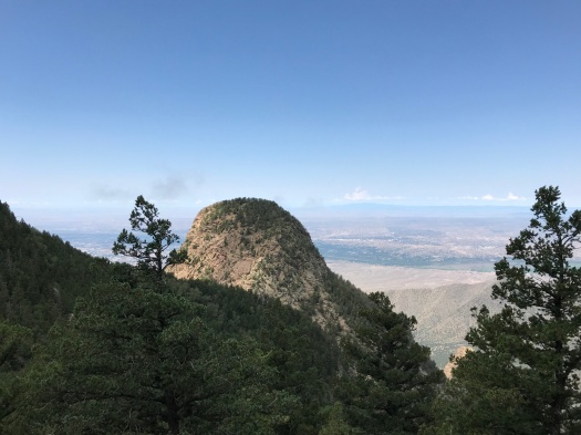
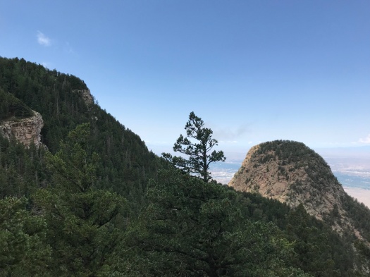
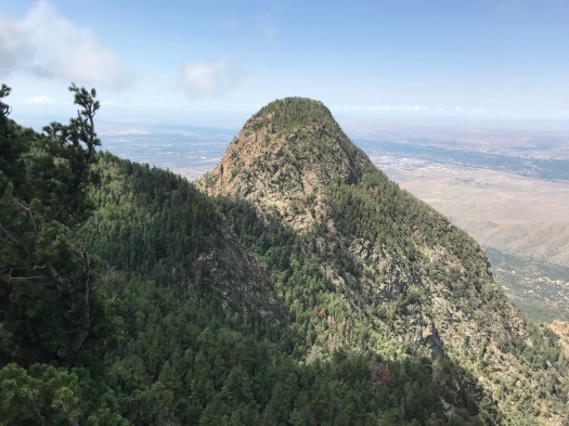
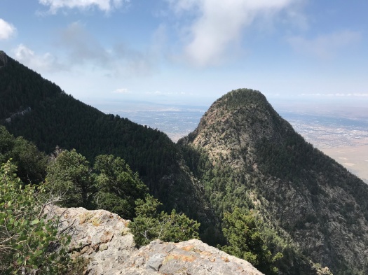
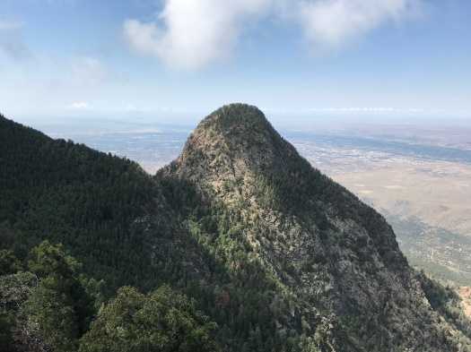
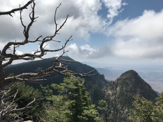
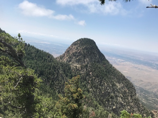
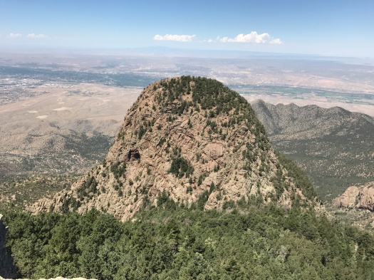
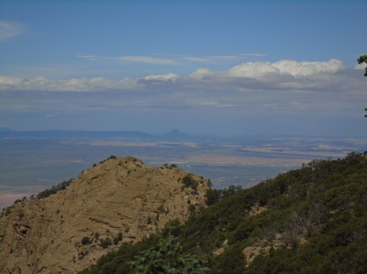
A couple of steps to my left, and the volcanic neck of Cabezon Peak came into view.

DSC00152

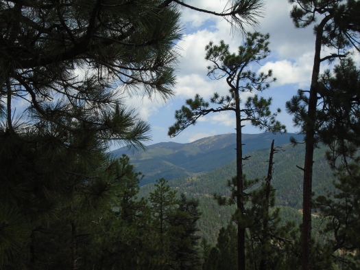
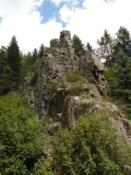
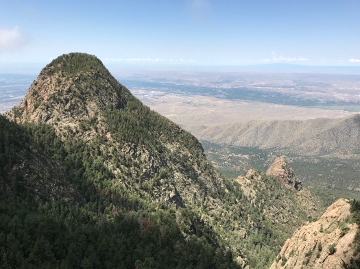
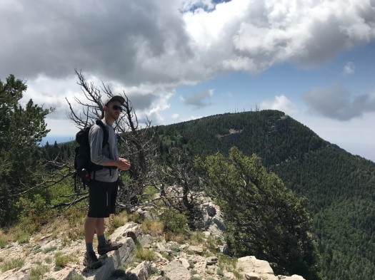
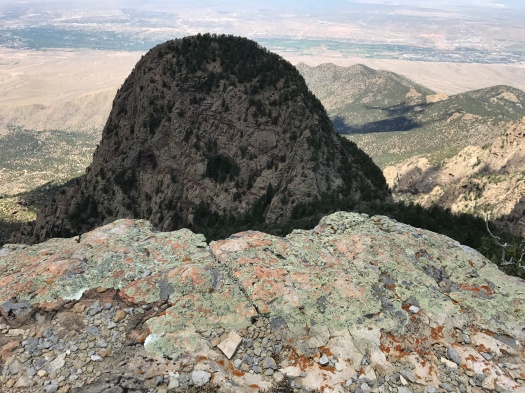
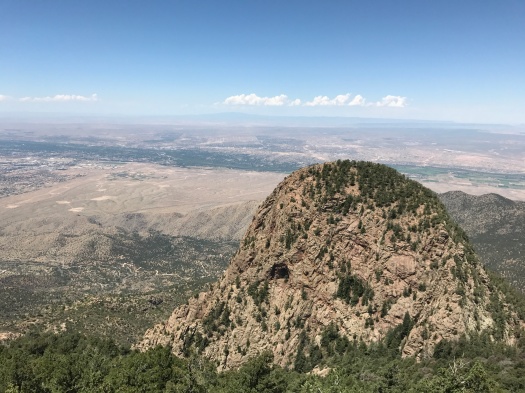
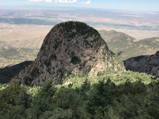
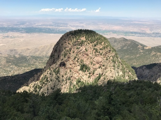
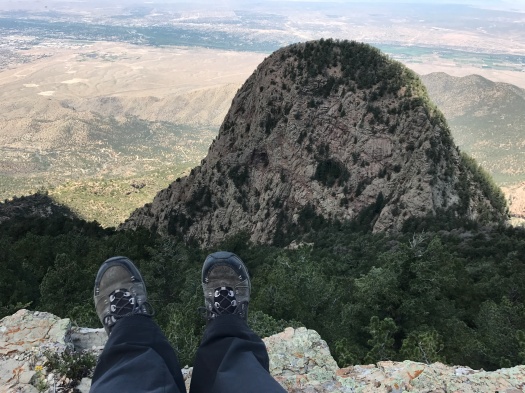
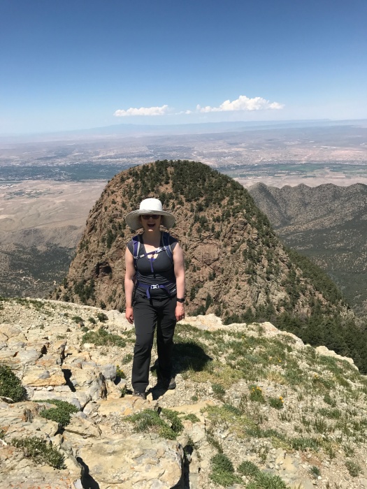
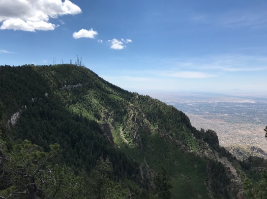
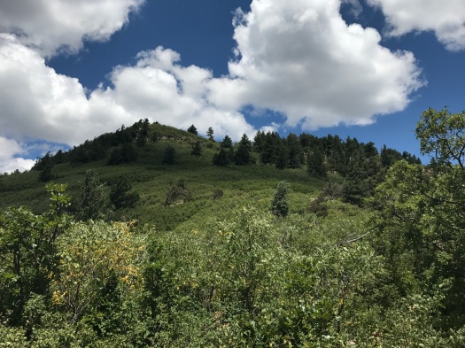
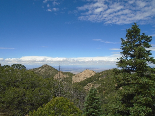
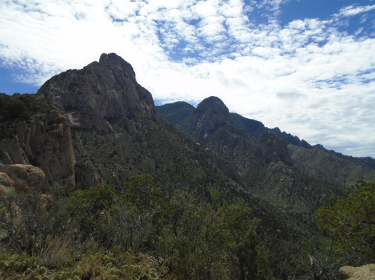
Over my right shoulder, the Knife Edge of the Shield, one of the Sandias’ most famous rock formations. And, yes, the Needle – the rock dome I’d become smitten with at the top of the mountain earlier this summer.

DSC00159

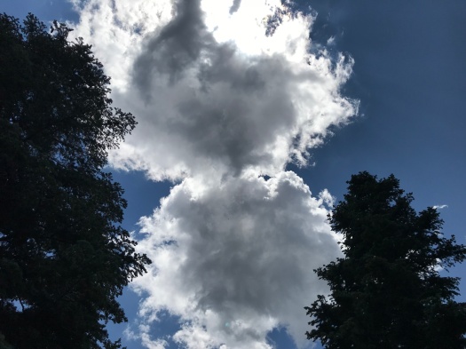
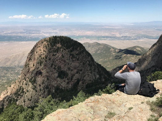
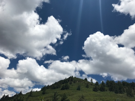
We watched a raptor soar impossibly high above, so high we couldn’t be sure what we were looking at even with binoculars, but guessed a red-tailed hawk or golden eagle.

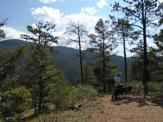
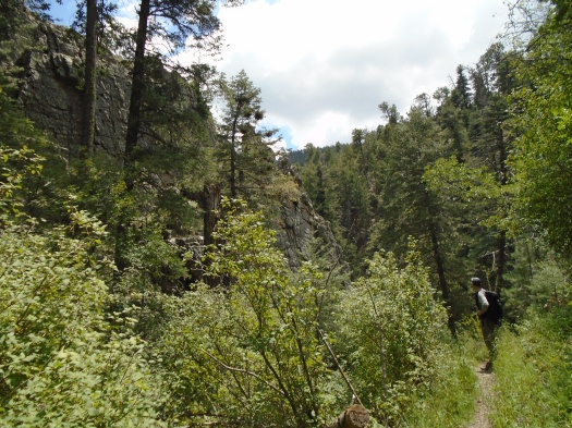
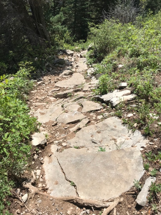
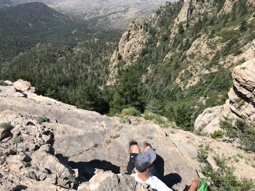
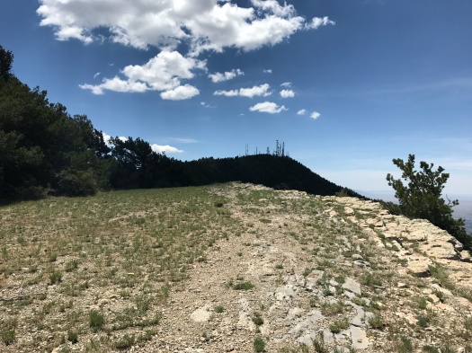
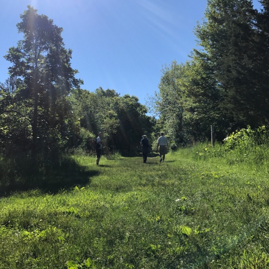
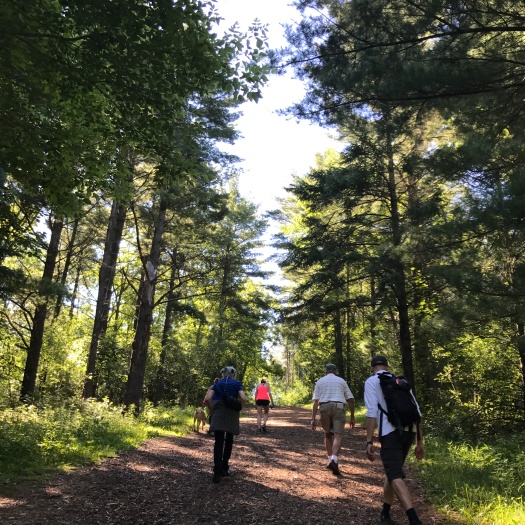
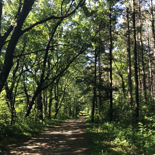
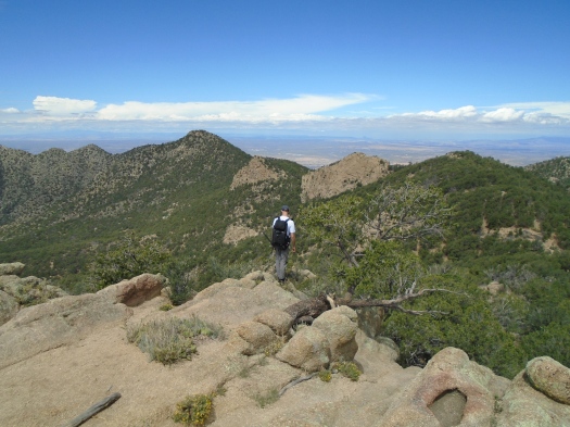
We’d reached this spot with a 1,500-foot climb up Piedra Lisa Trail, one of the most popular in the Sandias. But we’d had the ridge to ourselves since another pair of lunchers left half an hour earlier.

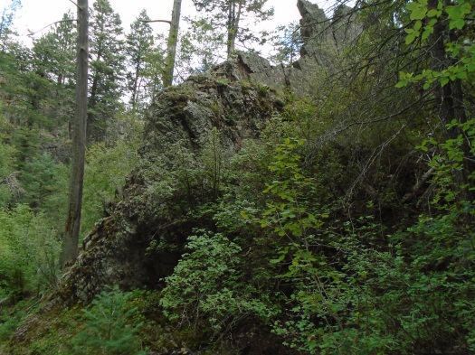
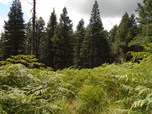
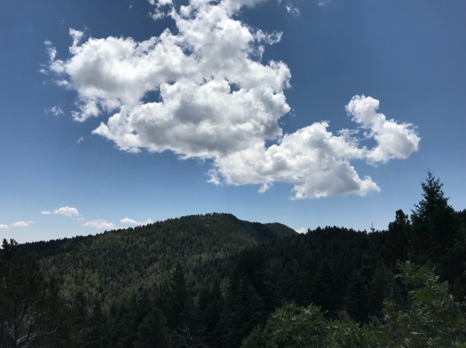
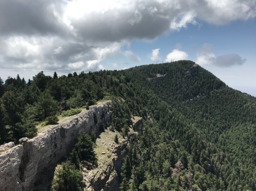
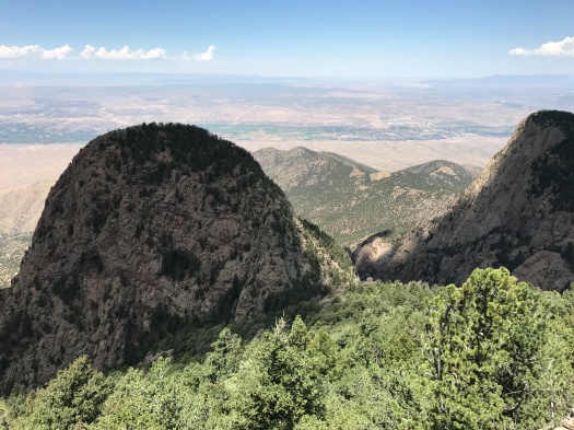
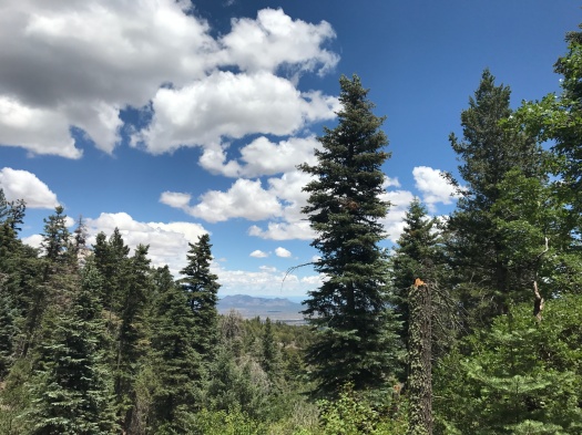
A short, faint trail and a little scrambling had brought us here. I warily eyed the steep, trailless slope between us and the highest rocks on the ridge. A brief stalemate ensued in which I repeated that I knew I could get up, but I didn’t know how I would get down. But ultimately I couldn’t resist checking out the top, and I did, after all, know how I could get down (I’ll scoot down a short slope on my butt if I think it’s too steep for me to stay upright on.) The green slopes of Juan Tabo Canyon came into view.

DSC00169

DSC00174

DSC00166

DSC00154

DSC00143

My husband found us a more challenging but less steep way down, and within minutes, we were back at the busy Piedra Lisa juncture.

When we last hiked Piedra Lisa, two years ago, we skipped this ridge. We were doing the whole six-mile trail with a car at each end, and I didn’t think I had the leg power for a side trip. I was probably right; the back side of the mountain is even steeper than the front, and I slipped and gashed my leg on the way down.

But I missed the best part.

Hike length: 6 miles

Difficulty: moderate

Traffic: popular on Piedra Lisa, light on Rincon Spur

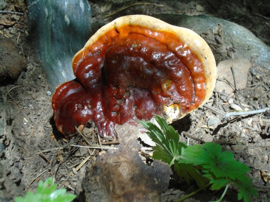
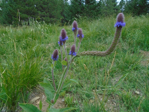
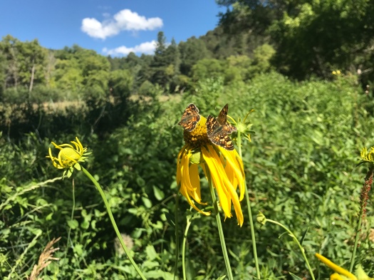
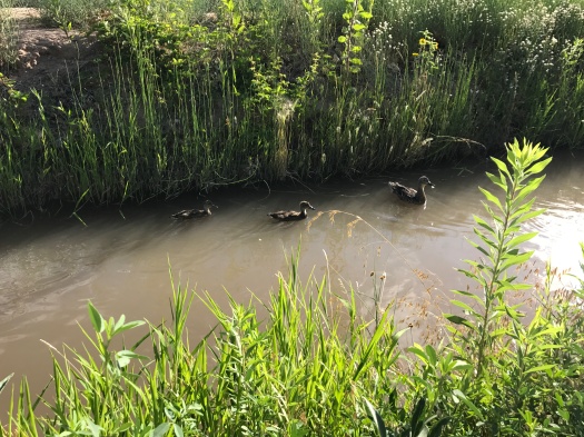
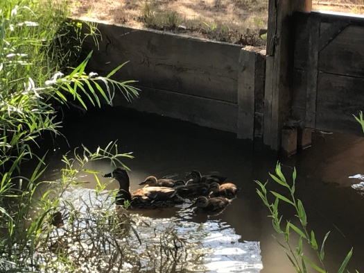
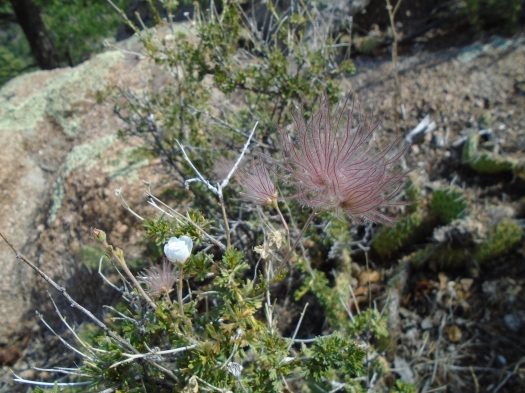
Wildlife spotted: dragonflies, butterflies, lizard, blue jays, black-capped chickadee, raptor, swifts

Hyde Park’s ridges look so gentle, but its switchbacks don’t feel that way

This is torture. With really great scenery.

I was navigating a mile-plus of extremely steep switchbacks up West Circle Trail in Hyde Memorial State Park.

There are strategically placed benches at a quarter-mile up the trail and a quarter-mile from the top. I took advantage of both, plus a rest on the ground.

As I pushed and pulled myself up the trail, yellow and purple wildflowers flashed by. Rolling green ridges stretched above and below. Glimpses of Santa Fe and the Rio Grande Valley began to appear.

My husband spotted nine horny toads. One was the big-fellow-in-shades-of-gray type we’ve seen so often around Albuquerque. The rest were thumb-sized, rust-red, barely distinguishable from the mica-flecked rocks around them.

The switchbacks mellowed slightly as we got closer to the top. A sign marked the 9,440-foot high point of the trail. A little further, two picnic tables and a jaw-dropping view into the Jemez Mountains, complete with its drainage network of ridges and canyons. We could see the Santa Fe Opera, Los Alamos and the brown snake of the Rio Grande. A raven ripped through the air just above us, cawing, wind whistling through its talons.

DSC00115DSC00102

DSC00093
White structure at center of photo is the Santa Fe Opera.

DSC00089DSC00087

My husband broke out the binoculars, sure he’d be able to spot his parents’ house, but a ridge blocked the view.

The steep descent took us past two yurts, a recent camping upgrade at Hyde Park.

We headed for a spur trail to a waterfall, hoping to catch it flowing, but red caution tape blocked the trailhead.

So we watched a Stellar’s jay and wound past campsites and over the world’s smallest creek.

The circle was complete.

Hike length: 4 miles

Difficulty: moderate

Trail traffic: light on West Circle Trail, moderate on rest of loop

Wildlife spotted: horny toad bonanza, Stellar’s jay, ravens

TIP FOR CAMPERS! Whether you get on the yurt train or not, Hyde Park has the prettiest, most well-kept campsites I’ve ever seen.

Red Canyon is purple on a rainy day. Or is it pink?

It’s raining on us.

It’s been two years since we got rained on during a hike, and that one wasn’t even in New Mexico. This is momentous.

It’s a light, steady rain, stirring the smells of fir and pine from the forest floor.

And it pisses me off.

Where the hell is Red Canyon, anyway? It’s been at least a mile since the junction and everything looks just like it did before.

And no overlook on the last part of the Crest Trail? After climbing 2000 feet, I want a damn 50-mile view.

I want to cry. I want to chuck my hiking poles into the canyon below us.

It’s not about the hike, of course. It’s this godforsaken year that just keeps knocking me on my ass and there’s nowhere to hide from your feelings in the damn Manzanos and –

Suddenly the rock under my feet, soaring above me is purple. Or is it pink?

I had remembered this stretch of the Manzanos as one of the most beautiful places I’d ever hiked. But I didn’t know why it was called Red Canyon. I remembered the grottolike stone as a deep, rich gray, and my old photos back me up.

But the sun peeking in and out from layers of clouds, the moisture in the air, show the rock’s true colors – for the moment, at least.

The scale of the rock towering above can’t be conveyed. I even brought a real camera, albeit small. I lie down, cool stone under me, and aim skyward. What I capture looks tiny.

We slowly make our way down the trail, a steep chute of pink rock. A cornucopia of things grow in the rock – moss, ferns, many kinds of wildflowers; it’s the Hanging Gardens of Babylon up there. Sometimes the rocks stack neatly, cubes on cubes, sometimes jagged fingertips jut into the sky.


DSC00058

DSC00080

DSC00068

DSC00050

DSC00030

Before we reached the rock, there was only forest. Bright spruce and aspen commingled, sunlight pouring through. Ponderosa so thick on the north side of a ridge the temperature dropped 10 degrees and it began to look like dusk. Deadfall, giant trunks to climb over and under and around. Mushrooms making homes among the living and dead. And, as we emerged at the top of Spruce Spring Trail, a grove of ferns as tall as my shoulder.

DSC00038

DSC00054

DSC00025

DSC00020

DSC00017
Land of the Ferns

And yes, truth be told, there were views. Through trees and of trees. The Estancia Basin’s salt lakes glimmering in the distance. The pyramid of Mosca Peak. Ridges saturated with multiple shades of green.

DSC00015

IMG_1464

The Manzanos demand commitment. You want to summit by noon starting from Albuquerque, you will get up very early. You will drive winding roads, many of them unpaved. You will hike a long way; trailheads are few and far apart. You will be self-sufficient, as you rarely pass other hikers on the trail.

And when the experience gets emotional, you will be grateful for it, even if you didn’t start out that way.

Hike: Spruce Spring-Red Canyon loop, Manzano Mountains

Length: 7 miles

Difficulty: moderate

Trail traffic: none

Wildlife spotted/heard: nuthatches, finches, mountain bluebird, butterflies, black-capped chickadees


That moment on a familiar trail when everything around you starts to look alike (in a good way)

What’s above me and what’s under my feet have begun to look the same.

I crane my neck to see two giant clouds melting together, gray and white, light beaming through the space where they meet.

Their pattern echoes the patches of limestone embedded in the trail.

IMG_1421

IMG_1418

We take the gorgeous Tree Springs Trail from 8,500 feet through spruce and fir to an overlook of rugged rock.

IMG_1409

IMG_1374IMG_1381IMG_1398IMG_1399IMG_1402

Then we head north on the Crest Trail, about 1,000 feet lower in elevation and several miles from where we hiked the past two weeks.

The tang of evergreen needles fills my nostrils, mixed with a hint of dampness, the packed trail below redolent of mud from a monsoon storm now forgotten. As we climb, the evergreens get taller and fatter, and copses of aspen appear.

I knew as soon as I got out here, I’d want to go all the way to the upper tram terminal, a more than 7-mile roundtrip hike with 2,000 feet elevation gain. I also knew we’d started too late, it was too hot and too humid.

I make it about a mile up the Crest Trail – let’s just see how far I can get! – before assenting to the conditions, to my thigh and ankle muscles, and heading back.

On the return, we take a side trail to revisit the overlook, seeking a promontory that was occupied by lunchers earlier. The trail’s so thick with Gambel oak that I hold my hiking poles in front of my face to keep branches at bay.

My husband tells me later that as I crashed through the undergrowth, a small white butterfly with black-pepper spots danced circles behind me.

Some things are graceful, even when others are not.

Hike length: 6 miles

Difficulty: moderate

Traffic: moderate

Wildlife spotted or heard: Abert’s squirrel darting across the Crest Highway, woodpecker, butterflies, blue dragonflies, dove, chickadee, coyotes (heard in the distance), horny toad

The Sandia Crest I know never looks the same twice

Now, this is the Sandia Crest I know.

The place where the air is as clear and crisp as the first day of the world.

The place where the sun and the wind feel right on your skin, a mile above the valley’s dry blaze. You might even need a jacket.

The Sandia Crest of last week, nearly as hot and bright as the valley, fades into a not-quite-believable memory.

Two nights of thunderstorms that meant business have left their mark. The air’s heavy and cool, the trail oozing smells of soil and pine.

IMG_1241

We descend carefully over muddy tree roots. A big evergreen, blown down by one of the storms, blocks our path; we climb around it.

IMG_1242

We bypass Del Agua Overlook, the world’s greatest overlook, which we discovered here last week, and spent our lunch hour watching the light and shadow play across the top of the Needle.

As spectacular as it was, we know there’s more, and we want to see it.

Mini-overlooks abound. The Needle’s shoulder comes into view.

IMG_1244IMG_1252IMG_1257IMG_1264IMG_1268IMG_1275IMG_1281

We see more and more of the limestone ridge stretching back to the crest.

IMG_1288
The Del Agua Overlook is the green spot just below the highest point visible in this image.

IMG_1290IMG_1294IMG_1298IMG_1303IMG_1314IMG_1323

The trail begins ascending, fossil-rich limestone poking more frequently into the path. The sun ascends, too, and when we emerge from dense stands of aspen and spruce, it quickly warms us.

We turn. We’re now headed for a ridge higher than everything around it, one we’d spotted from last week’s overlook. The vantage point from there will be one we’ve never seen.

But first, a clamber over steep limestone. I stop to eat lunch on a ledge before the last push.

Before we even reach the top, I look back and see the Del Agua Overlook, its limestone shelf carpeted in golf-course green.

Gray wisps coalesce in front of us. My husband thinks a building far below must be on fire. It’s a good guess – everything’s on fire right now – but what we’re seeing are wisps of cloud playing across the green slope we’ve just traveled.

At the top of the ridge, a commanding view of Juan Tabo Canyon, glimpses of the San Pedro Mountains and Ortiz Mountains in the valley behind us.

For just a second, I think about the next ridge, and the next, and the next.

But we’ve gone nearly three miles, and my ankles and knees are talking to me from all the clambering. The return route is a 700-foot elevation gain.

I snap a sideways view of the top and clavicle of the Needle as we return.

This is the Sandia Crest I know, a place where you’re always one ridge away from seeing something you’ve never seen before.

Hike length: 5.6 miles

Difficulty: moderate

Trail traffic: moderate

Wildlife spotted or heard: swifts, brown creepers, chipmunk, butterflies, vulture, crow, squirrel, mule deer on the Crest Highway

IMG_1351
I can stop taking pictures of the top of the Needle anytime I want to. Really…OH MY GOD, I CAN’T STOP


Atop the Sandias, a mysterious dome comes into view. With caves in it.

I know the vista from the top of the Sandias pretty well by now, the jagged ridges sloping away on either side.

Today, that view opened to reveal something I’d never seen, and I couldn’t take my eyes off it.

We were skirting the edge of the mountain a couple miles north of the Sandia Crest House.

We saw the ridges. We saw rugged Juan Tabo Canyon far below. But in front of Juan Tabo Canyon, just coming into view, was a giant stone dome.

The structure rose thumblike, enormous, in front of us. It looked like it topped out nearly as high as our trail – 10,000 feet. Evergreens dotted the dome. We spotted a cave in it, then another partly obscured behind trees.

We took one of many narrow paths pulling us off the Crest Trail, closer to the mountain’s edge. A broad limestone shelf, the Del Agua Overlook, opened up. From it, an unobstructed view of the dome.

IMG_1117IMG_1130IMG_1161IMG_1190IMG_1198IMG_1202IMG_1203IMG_1212IMG_1200

IMG_1111

We must have sat there for half an hour, watching light and shadow play across the dome as clouds scuttled across the sun.

I thought I saw a person standing very precariously on the dome’s pitched face, a person with a white hat and black clothing. My husband busted out the binoculars and observed that the white item was a giant bird shit.

“What shat that?! A pterodactyl?”

“Maybe an eagle,” he said. “Or a vulture.”

There was plenty more to look at – swifts hurtling by us, butterflies alighting on limestone, shadows on the mountain’s green peaks. We could see other things we’d never seen from the top of the Sandias, too: the water in the Rio Grande caught my naked eye. Through the binoculars, my husband saw the Los Poblanos Fields open space.

IMG_1176IMG_1191IMG_1201IMG_1223

But no matter where I looked, the dome always lured my gaze back.

I couldn’t believe after nine years of living in Albuquerque and three years of hiking here, I had never seen this incredible sight.

Just 90 minutes earlier, I’d thought the day was a wash. The Ellis Trail, where we’d started out, was in full sun. Even at 10,000 feet, it was unbearable, and I quickly turned back. I’d had no idea what direct midsummer sunlight felt like at that altitude; most of my trips to 10,000 feet, even in summer, had been cold enough to need a hoodie.

I was irked that I’d burned time and energy there before switching to the shade of the Crest Trail. I thought I’d be lucky to see anything new today.

Little did I know a magical mystery dome awaited.

After looking it up, I think the dome has to be the top of the Sandias’ famous Needle rock formation – if so, seeing its giant base from below is a completely different experience from seeing the top of it from above.

Hike length: 5 miles

Difficulty: moderate

Trail traffic: moderate

Wildlife spotted: swifts, vulture, many kinds of butterflies, brown creepers, a mule deer on the Crest Highway

High in the Sandias, my first bear sighting

If it weren’t for the illusion that you were almost at the top, many of us would probably never make it to the top.

I’d been under that illusion for the past hour. Every time I swung my left foot into the 45-degree angle needed for the next step, my ankle, aching from that action, protested. I’d sent my husband ahead twice to get a sense of how much further it was to the top. At least a quarter mile, he said.

I thought hard about turning back.

But dude, the forest had just reopened after more than a month, and I knew a spectacular view awaited, and it would suck so hard to turn back so close to the top.

At last the jungle of the Cienega Trail disgorged us onto an overlook at the junction with the Crest Trail, the mark that we’d gained 2,000 feet in elevation. It was the hike we intended to take weeks ago, but took a wrong turn.

IMG_1037IMG_1055IMG_1061IMG_1063IMG_1078

A brilliant green peak towered over us. The blue-gray San Pedro Mountains loomed on the horizon. Puffy clouds floated above.

Loud conversations and crunching greeted us. Two groups of lunchers who’d come up the Pino Trail had commandeered the spot. The Pino Trail is even harder, so they’d earned it. One of them talked about the wreckage of a plane crash nearby (not the famous one.) Two hikers on the way up had offered to show us the crash site, too. It was the first I’d ever heard of it. It sounded incredible, but I knew if I took any detour I would not reach the top, so we’d kept going.

I ate my peanut butter and honey sandwich under a shady ledge, waiting there till the friendly lunch groups moved on. Stepping into their spot, I could see the jagged ridge of the Sandias stretching away and clouds above Mount Taylor 80 miles west.

I’d seen very little of the scenery coming up, focused on keeping my footing on the steep trail beneath me and navigating the wild rose and other vegetation that pressed in on both sides of the trail. On the way down I noticed the towering aspens and spruces, the spots where glimpses of the mountain peeked through, the wildflowers.

IMG_1082

Down took less exertion than up, but was almost as slow going, because it was so steep. The arrival of the monsoon season had increased the humidity, so the afternoon was very warm.

At last we reached the Cienega trailhead and walked back to our car along the campground road. I was glad we’d explored the nature trail and marshy meadow on the way in, because I was spent.

IMG_1029
Three-butterfly pileup on the nature trail.

As we approached the nature trailhead, I noticed a black dog galloping along the trail.

“That dog is really bounding,” I said.

“That’s a bear,” my husband said.

My brain had registered it just as he said it: the stocky but fast creature leaping over the nature trail fence and running across the road in front of us was a black bear. Drought summer notwithstanding, it looked spectacularly robust and healthy. Its coat shone.

Though the animal had to be 200 pounds, my startled brain misidentified it as a cub. I looked around frantically for a mother, knowing it was imperative not to be between the two. I asked my husband to take the bear spray, which he’d recently stowed, out of his backpack.

He did as he looked to see where the bear had gone. In seemingly no time, it had bounded up to a ridgetop high above us. It paused near the top and looked back, making eye contact with us. My husband waved, which is actually one of the things you’re supposed to do if you encounter a bear.

The Cienega picnic area has had its share of bear sightings; it was closed all of last fall for bear activity. But we had no expectation of seeing a bear in the middle of a summer afternoon with hikers and campers all about.

But all of us were in his house, not the other way around.

I’m grateful that I got to see him, and even more grateful that he didn’t take offense.

I have no photos of the encounter; I was focused on staying alert to his actions, rather than taking his picture.

Hike length: 7 miles

Difficulty: on the high side of moderate

Trail traffic: moderate

Wildlife spotted/heard: Western kingbird, green-tailed towhee, northern mockingbird, lizards, nuthatches, grasshoppers, Abert’s squirrel, chipmunk, many kinds of butterflies, many broad-tailed hummingbirds, BEAR!!!

IMG_1036
Abe the Abert’s squirrel welcomes you. (Sign below Abe is in Braille.)

Just us and a 5K on the second-most enticing ditch in the North Valley

The first surprise came when we pulled up to the parking lot at the Los Poblanos Fields Open Space.

The usually quiet lot overflowed with hundreds of cars. It was serving as overflow parking for the Los Ranchos Lavender Festival today.

The festival is fantastic. But it’s hot, crowded and costs money, and we had a shaded, free and wide-open plan in mind: using the open space to get to the North Valley’s second-most enticing ditch.

As we embarked on that goal, Western kingbirds chattering on power lines above us, the second surprise: a 5K run, part of the Lavender Festival, coming right for us, and sharing much of our route.

We had to step aside a few times to let crowds of runners pass, but there was room for all of us.

We lived near the Los Poblanos Fields for two years, and I was there almost daily. In  winter, it’s sandhill crane migration central. In spring, ring-necked pheasants cavort in the clover. In summer, the fields used to dance with sunflowers.

I saw no sign of those today, but the open space is still hard to beat. It has killer views of both mountains and mesas, which few flat plots of land in the city can boast.

IMG_0969

IMG_0970

IMG_0978

IMG_0977
Here they come!
IMG_0979
One corner of the open space houses the Rio Grande Community Farm.

As we turned onto the ditch, the crowd thinned and the water just kept widening.

IMG_0981
Squash growing right on the ditch.
IMG_0982
And apples.

IMG_0989

By the time we came near the back side of the Los Poblanos Inn, the 5K route had diverged from ours, and all was quiet but the water and the birds. Tangles of wildflowers and foliage engulfed the ditch. A red flash soared by overhead, leaving us wondering if it was a cardinal or pyrrhuloxia.

IMG_0991

IMG_0993

IMG_1001

IMG_1003

Our route took us near the crossroads with the North Valley’s most-enticing ditch, which we explored earlier this week.

How many more ditches throughout Albuquerque have just as much to offer?

Depending how long the forests stay closed, we might find out this summer.

Hike length: 2.9 miles

Difficulty: easy

Trail traffic: busy at the open space, moderate to light on the ditch

Wildlife spotted: hawk, pyrrhuloxia/cardinal (?), dragonflies, butterflies, velvet ant, goat, ducks

IMG_1005

This is the most enticing ditch in the North Valley (and that’s saying something)

This ditch’s siren song has called to me for years.

I first noticed the ditch along Guadalupe Trail when we were buying a house. We looked at a home nearby. All these years later, I have no memory of the house, but I never forgot that ditch.

Forest closures have reduced our hiking options to the bosque and the ditches, and after reading David Ryan’s book “The Gentle Art of Wandering,” I was inspired to make the Guadalupe Trail ditch’s acquaintance.

When we stepped onto the ditch at its crossing with Griegos, only one side offered a narrow path.

IMG_0897

As the ditch widened, it wound by funky old houses and soaring modernist cathedrals of light.

IMG_0902

Irrigated fields opened up, offering glimpses of the mesa and mountains.

IMG_0913

This ditch boasts one of the biggest cottonwoods I have ever encountered. Its trunk had to be 15 feet in diameter.

IMG_0907

This ditch also boasts the most ducklings I have ever encountered. We saw three duck families. One family huddled together on the ditch’s concrete lip; the two bravest  ducklings tiptoed down the slope into the water, and the rest followed.

IMG_0915

IMG_0951

We came to a crossroads behind the Unser Museum, only to discover that the magical mystery ditch ran smack into a large ditch we’d used weekly for years to access the Flying Star Cafe from our old house.

We crossed the familiar ditch and kept going. The chatter of ducks and the breeze gave way to the sounds of traffic. Our new ditch route was as wide and tree-lined as the main boulevard in my Southern hometown, running right next to Montano.

The path led us right to the river. A roaring ditch gave the illusion of abundant water.

IMG_0952

We walked out to the overlooks on the Montano Bridge, which I’d never crossed on foot. Swallows swarmed overhead.

As we walked back east on the bridge, we saw that no more than a few inches of water covered the sandbar below. The Rio Grande could run dry through the city as soon as this month.

IMG_0966

In the bosque, we spotted a mountain bluebird at 5,000 feet.

Maybe the dry conditions on the mountain exiled her, too.

Hike length: 3.2 miles

Difficulty: easy

Trail traffic: heavy at the bridge, light to moderate elsewhere

Wildlife spotted and/or heard: starling, mountain bluebird, ducks, violet-green swallows, barn swallows, cows, roosters, chickens, butterflies, dragonflies, nuthatches, spotted towhee

IMG_0964IMG_0962IMG_0968

These are the days when Wisconsin can only give you everything

Sometimes it’s too much.

As beautiful as southern Wisconsin is, I remember a visit when the trees pressed in on me too closely, the sliver of sky frustratingly small. I knew how much bigger the sky was, and it troubled me not to see it.

But on this day, when we stepped onto the trail at Lapham Peak, a trail whose primary material is grass – grass! – I was ready to be swallowed by green.

IMG_0815IMG_0819IMG_0821

At home it was 102 degrees, forests closed for fire danger, all living things parched.

We arrived at Lapham Peak, part of the Kettle Moraine State Forest, on a brilliant, sun-drenched morning after days on end of rain. The wide green trails gleamed in the morning light. Waist-high grasses and wildflowers surrounded us, and the tree canopy overhead sheltered us.

Our destination was the Butterfly Garden, a riot of wildflowers that 12 of Wisconsin’s butterfly species call home. We spotted five of those species, from the small cabbage white to the great spangled fritillary.

IMG_0827IMG_0831IMG_0836

IMG_0840
Found a familiar sight at an unexpected latitude!
IMG_0841
Don’t know this one, but seems like it could come in handy back home.

We dawdled there, my husband watching a garter snake slither through the flowers, plants and butterflies dancing on the breeze.

A narrower trail through what appeared to be fields of wild spinach and rhubarb led us to an observation tower, our original primary destination. The tower was founded as a National Weather Service station that transmitted data from the weather station on Pikes Peak to Chicago, and it boasts views of many surrounding lakes. But it’s closed indefinitely for repairs.

IMG_0850IMG_0851IMG_0852

We walked back to our car on a path sprinkled with some of the wildflowers we’d seen labeled in the butterfly garden, allowing us to name them. An Eastern bluebird darted from tree to tree as we returned to the trailhead.

You could wander the extensive network of trails at Lapham Peak all day. We spent 90 minutes there before a busy day of family activities began. Even that short time in the forest’s embrace made a difference.

Wisconsin bestowed abundance on us all weekend: its sparkling waters, its lake breezes, the land and its growth pulsing green and blue and fuchsia.

Family and food washed over us in waves, too, as we gathered to mourn one we lost suddenly in January.

At one point, a long-lost relative kayaked up to my husband’s aunt’s house, strode into the back door and was embraced as if it had been days instead of decades.

All weekend, people said this was what they lived for, why they called Wisconsin home, what carried them through the darkness: these short weeks into which nature pours all its riches at once.

It’s a shock to the eyes, and the heart, what land and love can deliver.

Hike length: 2 miles

Trail traffic: moderate

Difficulty: easy

Wildlife spotted: butterflies, dragonflies, Eastern bluebird, chipmunk, squirrels, garter snake